
You might hear a geologist say: "We can't predict earthquakes."
Well, WHY NOT???
1/n
🧵⬇️⬇️⬇️
#earthquake #earthquakeprediction
Well, WHY NOT???
1/n
🧵⬇️⬇️⬇️
#earthquake #earthquakeprediction
First, let's define "prediction". A useful #earthquakeprediction will tell you where, when, and how big a significant #earthquake will be, with a reasonably high success rate.
That's different from #forecasting, #earlywarning, and #aftershocks. 2/n
That's different from #forecasting, #earlywarning, and #aftershocks. 2/n
https://twitter.com/JudithGeology/status/1409313593334501378
To date NO ONE has developed an effective way to predict significant earthquakes.
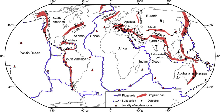
Issue #1: Faults are fractal.
"But we know where the tectonic plates are!"
Yes, mostly, but plate boundaries are complicated - see the maps below comparing plates vs. faults. 3/n
#tectoplot
Issue #1: Faults are fractal.
"But we know where the tectonic plates are!"
Yes, mostly, but plate boundaries are complicated - see the maps below comparing plates vs. faults. 3/n
#tectoplot


And it's far more complex than that! The fractal nature of faults extends from scales of 10 km all the way down to 0.01 mm.
doi.org/10.1029/GM037p…
Here are images of faults in hand samples and under a microscope. These faults are pervasive! 4/n
doi.org/10.1029/GM037p…
Here are images of faults in hand samples and under a microscope. These faults are pervasive! 4/n


If that didn't impress you, maybe this will: a computer model of a fracture network in rock - notice the scale! 🤯5/n
Source: en.wikipedia.org/wiki/Fracture_…
Source: en.wikipedia.org/wiki/Fracture_…

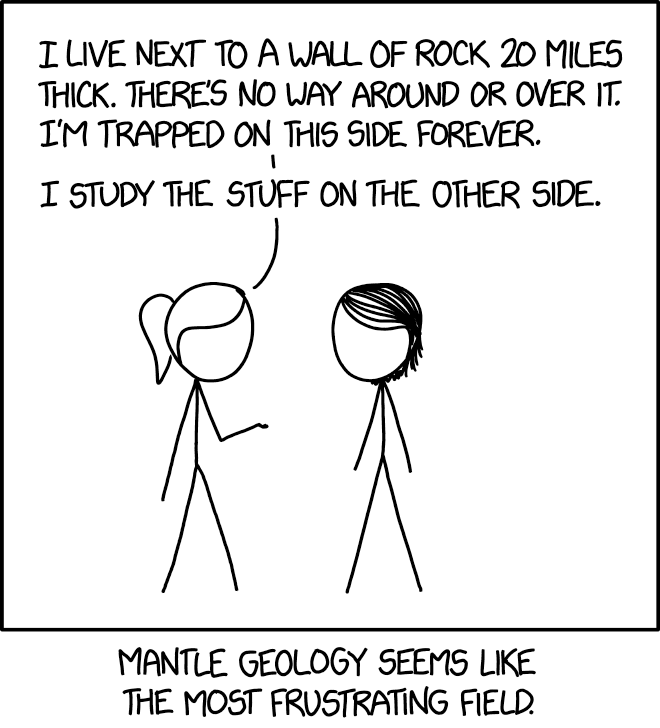
We can map the larger faults, but earthquakes often occur on faults we didn't map.
Why? Well, most of the fault is below our feet, and in some cases faults are "blind" - they don't reach the surface.
Like this, but we're studying the wall itself. 6/n
xkcd.com/2058/
Why? Well, most of the fault is below our feet, and in some cases faults are "blind" - they don't reach the surface.
Like this, but we're studying the wall itself. 6/n
xkcd.com/2058/
And that's just the start. The crust is made of lots of different rocks. Sandstone, schist, basalt, siltstone, granite... the list goes on and on.
Mapping these rocks at the surface is painstaking work. Interpreting the subsurface geology is an art. 7/n
researchgate.net/figure/A-3D-ge…
Mapping these rocks at the surface is painstaking work. Interpreting the subsurface geology is an art. 7/n
researchgate.net/figure/A-3D-ge…

Surprisingly, the specific rock type is actually not that critical to understanding whether the rock will break - experiments show that most rocks break under the same stress conditions. So at least there's that. #ByerleesLaw 8/n

Another issue: temperature. Whether or not a rock *breaks* vs. *squishes* is almost entirely temp dependent.
Rocks get hotter with depth, but how fast? We're often just guessing. And different kinds of rocks transition from squish to break at different temps. 9/n
Rocks get hotter with depth, but how fast? We're often just guessing. And different kinds of rocks transition from squish to break at different temps. 9/n
Making the situation worse: water. Water completely changes rock behavior - not just its presence, but its pressure. This water is hiding within the pore spaces between rock grains. The pressure can change dramatically between layers. 10/n
So, to understand earthquake behavior at a predictive level, we would need to know the 3D distribution of rock types, water pressures, temperatures, and fracture networks, throughout the Earth's crust, where we can't see anything. But that's not all... 11/n
Rocks break when a particular plane in the rock experiences stresses that exceed its strength. So, to know whether a break will occur we need to know the stresses and the strength. 12/n
What are the stresses in the crust? We really don't know. We have a few ways to coarsely measure stress orientations, but magnitudes are almost impossible.
And we would need to know this in 3D throughout the crust too. 13/n
And we would need to know this in 3D throughout the crust too. 13/n
https://twitter.com/JudithGeology/status/1485050979125198848
But even that isn't enough! Because an earthquake isn't just one thing, it's a whole process.
An #earthquake starts at one point - one tiny location where the stress exceeds the strength. 14/n
An #earthquake starts at one point - one tiny location where the stress exceeds the strength. 14/n
That initial break changes the stresses around that point, and sometimes that can cause a runaway effect where more fault slips, causing more stress change, causing more fault to slip, until a large fault has slipped a lot. 15/n
By "large fault" and "a lot" I mean a fault 10s to 100s of km long, and meters.
This process of fault rupture involves dynamic stresses and changing friction values and generation of heat and fluids. It's messy! It's exciting! It's dangerous. 16/n
This process of fault rupture involves dynamic stresses and changing friction values and generation of heat and fluids. It's messy! It's exciting! It's dangerous. 16/n
We have guesses about how friction might evolve in an earthquake - based on how fast the slip is - but there are a lot of unknown parameters, and when we try to apply these friction laws across long time periods they often produce implausible results. 17/n
#rateandstatefriction
#rateandstatefriction
People have tried to study if there's something different about early ruptures that allows them to go big, compared to the ones that stop while they are small.
So far, the answer is NO - they are indistinguishable. 18/n
earthmagazine.org/article/initia…
So far, the answer is NO - they are indistinguishable. 18/n
earthmagazine.org/article/initia…
So to predict earthquakes, we would need to know the 3D distribution of rock types, fractures, stresses, fluids, and temp, PLUS how friction, temp, fluids and stresses evolve during an earthquake.
Oh, and then there's TIME. 19/n
Oh, and then there's TIME. 19/n
Because the stresses are changing all the time, due to plate tectonics and earthquakes and volcanoes and erosion. So we need to know that too. 20/n
Now, it's possible that in 10k-100k years, when we have data that stretches across a bunch of earthquake cycles, we'll be able to discover patterns of behavior that will let us predict earthquakes without knowing all of the nitty-gritty. 21/n
Why so long? Well, many large faults only slip in large earthquakes every 1000 years or so. And since faults interact with each other we'd need to see a range of different earthquake behaviors to understand patterns. 22/n
So, for the foreseeable future, the answer to "can we predict earthquakes"? is a resounding NO, and don't let anyone tell you otherwise.
And maybe the length of this thread explains why geologists don't usually explain why. 23/end
And maybe the length of this thread explains why geologists don't usually explain why. 23/end
• • •
Missing some Tweet in this thread? You can try to
force a refresh


#/media/File:Three-dimensional_Computer_Model_of_a_Fracture_and_Fault_Network.jpg)