#ExtremeWeather Alert Thread
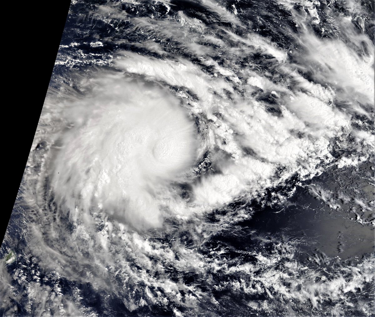
Cyclone Batsirai is heading towards Madagascar, hot on the heels of Storm Ana which has brought fatal flooding and massive damage to both Madagascar and SE Africa, Mozambique - Malawi & Zimbabwe.
6 hour animation of the storm this morning.
Cyclone Batsirai is heading towards Madagascar, hot on the heels of Storm Ana which has brought fatal flooding and massive damage to both Madagascar and SE Africa, Mozambique - Malawi & Zimbabwe.
6 hour animation of the storm this morning.
Cyclone #Batsirai is a much more intense storm than Storm Ana, and at present nearly all simulation runs from both the European and US models show a landfall on the East Coast of Madagascar in 4-5 days. 


The @USNavy's #JTWC website (metoc.navy.mil/jtwc/jtwc.html) is currently inaccessible from what I can see (possibly due to certificate errors) but this graphic from France Meteo appears to be the current official forecast for #Batsirai. 

It is more than unfortunate that the usual
@USNavy's @USNRL forecast materials are not currently accessible - and haven't been for some time.
It is perhaps something that the @WMO should look into as these forecasts are needed for public safety.

@USNavy's @USNRL forecast materials are not currently accessible - and haven't been for some time.
It is perhaps something that the @WMO should look into as these forecasts are needed for public safety.


This is the current rainfall forecast for #CycloneBatsirai #Batsirai for Madagascar - and is quite alarming. Especially given that the formerly drought stricken nation is already dealing with the aftermath of #StormAna.
Like #StormAna #IntenseCycloneBatsirai is expected to weaken while over land, but intensify once over the Mozambique Channel before making landfall - in the current forecast - in North East South Africa.
The path of cyclones beyond three days is highly unpredictable. And models do not currently agree.
Here's the latest complete ECMWF PWAT (Atmospheric Water/Energy) forecast which indicates does not show a landfall by the core of #Batsirai in South Africa.
Here's the latest complete ECMWF PWAT (Atmospheric Water/Energy) forecast which indicates does not show a landfall by the core of #Batsirai in South Africa.
Another view of the latest GFS model (16 day forecast) shows the cyclone strengthening and running down the East Coast from Feb 9-11, and bringing significant rains across lost of southern Africa.
Here is a corresponding rainfall forecast, same model - preceding run.
As noted #Batsirai is subject to significant levels of change, but in all scenarios, this storm on its current trajectory, carrying as much water as it is, is likely to do a lot of damage.
As noted #Batsirai is subject to significant levels of change, but in all scenarios, this storm on its current trajectory, carrying as much water as it is, is likely to do a lot of damage.
Here's a 24 hour satellite animation of #CycloneBatsirai which shows a burst of spectacular strengthening over night (the speckles are lightning bursts).
The weakening appears to be a consequence of the cyclone pausing to integrate all the new water it has spun up for itself.
The weakening appears to be a consequence of the cyclone pausing to integrate all the new water it has spun up for itself.
The current forecast [available here >> nrlmry.navy.mil/tc-bin/tc_home…] shows the storm peaking at 105 knots - equivalent to a Cat 3 Major Hurricane on the 3rd and 4th of February, and then weakening before landfall. 


This is definitely a storm that needs to be watched closely.
/ENDS
@Threadreaderapp Unroll
/ENDS
@Threadreaderapp Unroll
• • •
Missing some Tweet in this thread? You can try to
force a refresh


