
Unseasonal rains to impact pan #India 15th March onwards.
• Abnormal dip in the westerly jet stream up to the southern peninsula to trigger back to back WDs.
• A lot of wind instability on lower levels with (CC/LPA/LWD) to form up with moisture aid from BOB & Arabian sea.
1/n
• Abnormal dip in the westerly jet stream up to the southern peninsula to trigger back to back WDs.
• A lot of wind instability on lower levels with (CC/LPA/LWD) to form up with moisture aid from BOB & Arabian sea.
1/n


Impact (13-14th March)
Under the influence of weak WD isolated thunderstorms to form up over #Punjab, #Haryana #Chandigarh #Delhi NCR, #HimachalPradesh, #Uttarakhand in the late afternoon - night hours on 13th & 14th march, coverage will be highly localised (25% areas)
2/n
Under the influence of weak WD isolated thunderstorms to form up over #Punjab, #Haryana #Chandigarh #Delhi NCR, #HimachalPradesh, #Uttarakhand in the late afternoon - night hours on 13th & 14th march, coverage will be highly localised (25% areas)
2/n

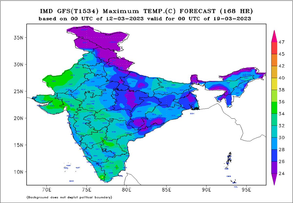
After 15th March the key weather features will develop and lead to a sudden change in weather conditions across #India.
Intense #Thunderstorm, #Rains, #Hailstorm and strong winds to affect most parts of south, east, central and north India with peak intensity during 16-20th.
3/n
Intense #Thunderstorm, #Rains, #Hailstorm and strong winds to affect most parts of south, east, central and north India with peak intensity during 16-20th.
3/n

After a historically warm #February and #March first half it will be a major cool down in the country with maximum temperature anomalies might dip 5-12°c below normal in the second half of the March with no likelihood of #Heatwave for the remaining days of March .
4/n
4/n
An early start of #summer lead to quick growth of the rabi, now a very strong spell of unseasonal rains possess a risk of crop damage to standing ready to harvest crops as this is the time of the year(March) when atmosphere throws #Hailstorms.
#Farmers remain vulnerable.
5/5
#Farmers remain vulnerable.
5/5
• • •
Missing some Tweet in this thread? You can try to
force a refresh


