,
27 tweets,
13 min read
Read on Twitter
flickr.com/photos/ugborou… Interested to see that the old name for Oxcars rock in the Forth was Ocksters (Scots; armpit) 

a few years later it's down as Oxscares in Adair's map. I wonder if either of these was a simple phonetic spelling mistake.
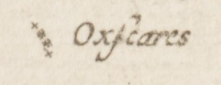
Aha, wonder no more. The root is "Ox Scaris", as in Ox Skerries, as in Ox Rocks. Ocksters is a mis-spelling.
It's likely this animal theme lent its name to the neighbouring rock of Cow & Calf, which was traditionally "Muckriestone" (as it lies off the north of Inchmickry)
It's likely this animal theme lent its name to the neighbouring rock of Cow & Calf, which was traditionally "Muckriestone" (as it lies off the north of Inchmickry)
(thanks to the Fife Place Name Data website for clearing this up) fife-placenames.glasgow.ac.uk/placename/?id=…
The Fife Place Name Data website is braw, been working my way down the Forth exploring the toponymy. The Isle of May at the eastern extreme is likely old norse, Má ey or "gull island". Stands to obvious reason. The Gaelic Magh, an open field, is less likely

The Bass rock of course isn't off Fife, but off East Lothian. The origin of its name has been lost to history, Milne suggests "death", from the Gaelic "bàs", as it was long a place of banishment and execution, but he's often pure dead wrong.

But we do know that the Bass gives the scientific species name to the Northern Gannet - Morus bassanus - for which it is long kent as its largest colony. Described as far back as the 16th century as Anser bassanus later in the 18th by Linnaeus as Sula bassana.
moving west, the next island is Craigleith. Milne suggests the Gaelic "Creag Liath" - the grey-blue rock. The stains of guano on the dark volcanic rocks do look a bit that way if you squint, but I know enough Gaelic to know liath does not have the soft "th" ending of Leith...

Next up is The Lamb, Milne goes for the easy Gaelic "Làmh" for an arm or handle, one assumes for the shape. Or there might be a Norse origin, or it's simply named after the animal (see also Oxcars, Cow & Calve). It is after all flanked by the N & S dog rocks

The Lamb was bought by Uri Geller (yes, *that* Uri Geller) in 2009 so he could dowse for Egyptian treasure on it. Yes, I'm being serious, he described that it's an analogue for the layout of the Egyptian pyramids and holds the buried treasure of Princess Scota.
Milne gives a fanciful Gaelic derivation for Fidra, but it's now believed to be Old Norse, from Fiðrey or "Feather Island" as a result of all the seabirds; Eider feathers would have been gathered here in yore. Robert Louis Stevenson based his plan for Treasure Island on Fidra.

Next along is Eyebrough, "Ibris" in Grenville-Collins chart. Now Milne gives a Gaelic from Chuith Bruchan "fold of a small hill", but the Old Norse Ey for island seems an obvious root also.

Inch Keith, which looms large in the centre of the Forth. It's etymology gets a whole chapter on its Wikipedia page, but the logical explanation may be Innse Coit, a hybrid of old Gaelic (Island) and Welsh (wooded) for a wooded island.

But as the Place Names of Fife points out, its an unlikely candidate to be known for being wooded, so once again we probably just don't know. It was used to quarantine victims of syphilis from Leith and Edinburgh in the 15th century, of that we do know
The Grandgore (syphilis) Act of 1497, saw Inchkeith made a place of "Compulsory Retirement" for sufferers. They were obliged to board a ship at Leith and to remain on their island "till God provide for their health". 👻
Interestingly, Roy left Inchkeith off his "great map" of both the Lowlands and Highlands of Scotland (the Forth is the eastern boundary of his geographical division) , but there's a square that looks like a repair where it *should* be... @natlibscotmaps

@natlibscotmaps Oxcars we covered earlier, but just to the south is Inchmickery and Mickrystone, now Cow & Calve. Mickery may be from the Gaelic Innis nam Biocaire, "Island of Vicars", as like most of the Forth's islands it was a religious retreat at one time.

@natlibscotmaps Inchmickery was fortified during both World Wars, and it's not without good reason that there's a legend its outline was deliberately made to look like an anchored battleship. If you know your Royal Navy, it's a pretty good likeness to HMSs Nelson and Rodney.


@natlibscotmaps The logic is that any U-boat commander who made it into the Forth would pop up his periscope, be taken in by the cunningly disguise and would have fired his torpedoes and legged it before realising he'd wasted them on a rock
@natlibscotmaps Inchcolm (hi @davehPars !) is probably the best known of the Forth Islands and is named obviously from its eponymous saint, Columba (Colum), from the Gaelic "Innis Choluim". The old joke goes "how many inches are there in the Forth" and you're meant to count the islands.

@natlibscotmaps @davehPars Just off Inchcolm lies Inchgnome, but the jury of the best minds in Scottish placenames is still out on where that one might come from. Probably from some obscure Gaelic saint.
@natlibscotmaps @davehPars Cramond Island is obviously from the village of Cramond off which it lies. It's from Caer Amond, Caer being old British for a fortification referring to Roman fort on the site, and Amond to the river of that name, which like Esk, Avon and others simply means "river"

@natlibscotmaps @davehPars Inchgarvie, that convenient stopping off point for the Forth Bridge, is likely from the Gaelic Innse Garbh, or "rough island", on account of its rugged appearance.

@natlibscotmaps @davehPars An island in the Firth that many folk are less familiar with is "Preston Island", which was only an island for about 150 years. Named after Robert Preston, an industrialist who had it built out on the mudflats off the Craigmore Rocks (big rock rocks) at the turn of the 19th c.

@natlibscotmaps @davehPars Preston was something of the visionary, and his artificial island was a coal mine, with shafts tapping good coal at an easily reach depth, and surrounded by water where ships could take it away. The coal was also used to heat the pans to make salt.

@natlibscotmaps @davehPars A firedamp (methane) explosion less than a decade after it was built put an end to mining, but it remained a useful place to produce salt. It was later swallowed up by the land reclamation in Torry Bay from the ash from Kincardine and later Longannet power stations

@natlibscotmaps @davehPars Enjoy some thread, you'll sleep much better looking at this than looking at Threads in HD; threadreaderapp.com/thread/1176464…