PSA: Relatively low-latitude, even sub-tropical, locations in central & eastern portions (but less frequently western portions) of continents can occasionally experience severe winter cold spells--like Texas is currently enduring. But how, & why this longitudinal asymmetry?(1/17)
Well, water has a tremendous ability to buffer against thermal extremes. This is because H20 has high heat capacity--around 4x that of land! This means that it takes around 4 times as much energy to raise the temperature of a given mass of water the same amount as land. (2/17)
An intuitive consequence is that regions near large bodies of water are usually milder than landlocked areas at a similar latitude. This is also why dry places have much larger diurnal temperature ranges than humid places. (3/17)
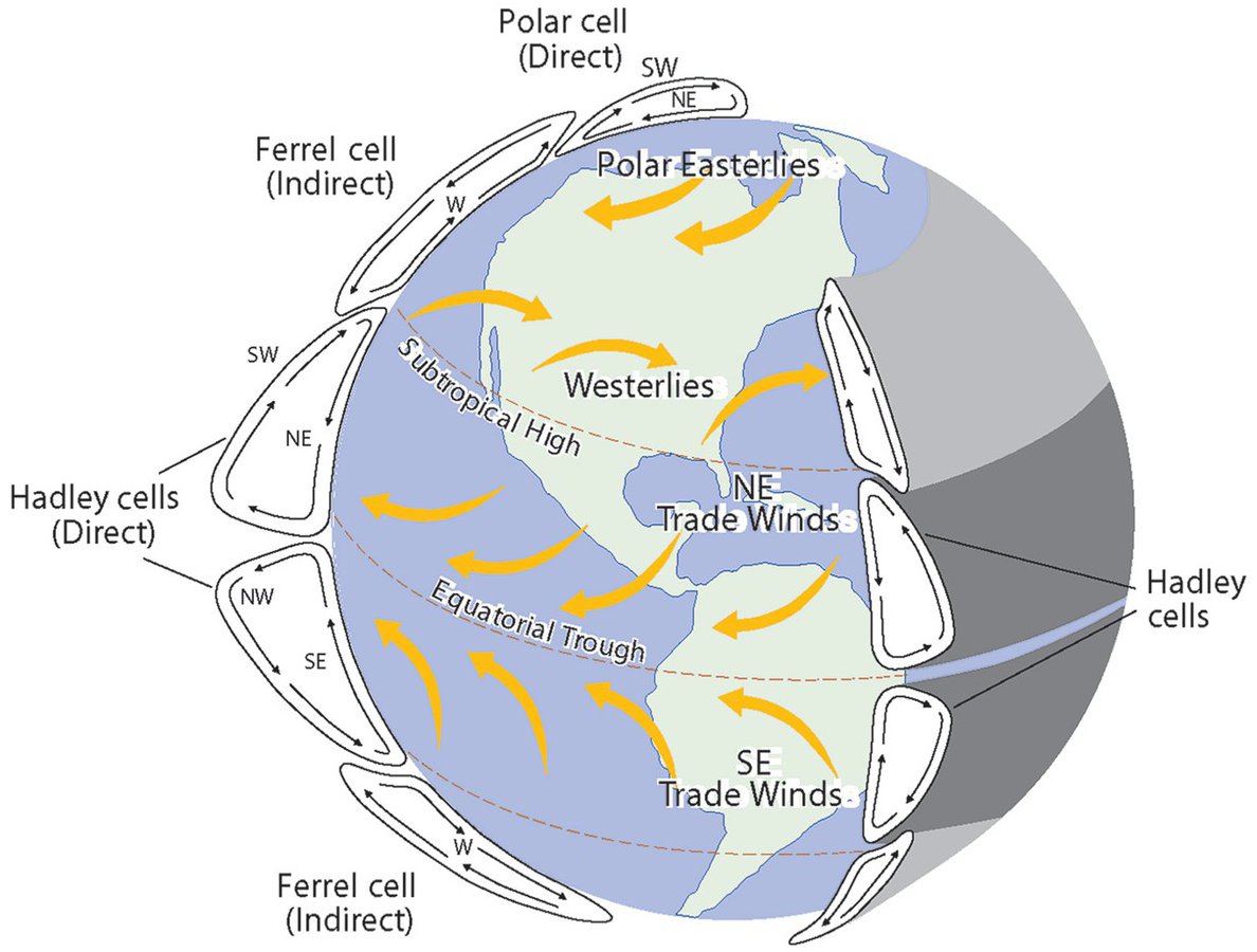
But that's not the whole story! The rest boils down to several basic tenets of physical climatology. First, winds in mid-latitude regions generally blow from west to east (the "prevailing westerlies"). This brings relatively moist & mild "maritime" climates to west coasts. (4/17)
Second, and less intuitively, these prevailing west to east winds do an especially good job protecting west coasts from outbreaks of extremely cold winter air. This is because the ultimate source region of extremely cold air in the northern hemisphere is...the Arctic. (5/17)
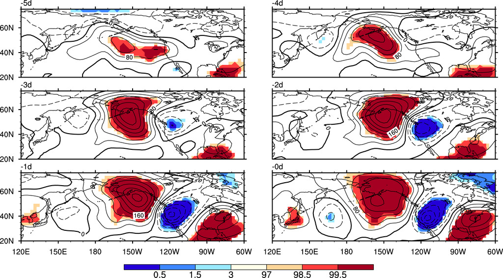
This is where the #PolarVortex comes in. The PV is actually a semi-permanent climate feature, and is not new: for most of the winter, this ring of westerly winds keeps frigid Arctic air largely "fenced in" across the high latitudes. (6/17)
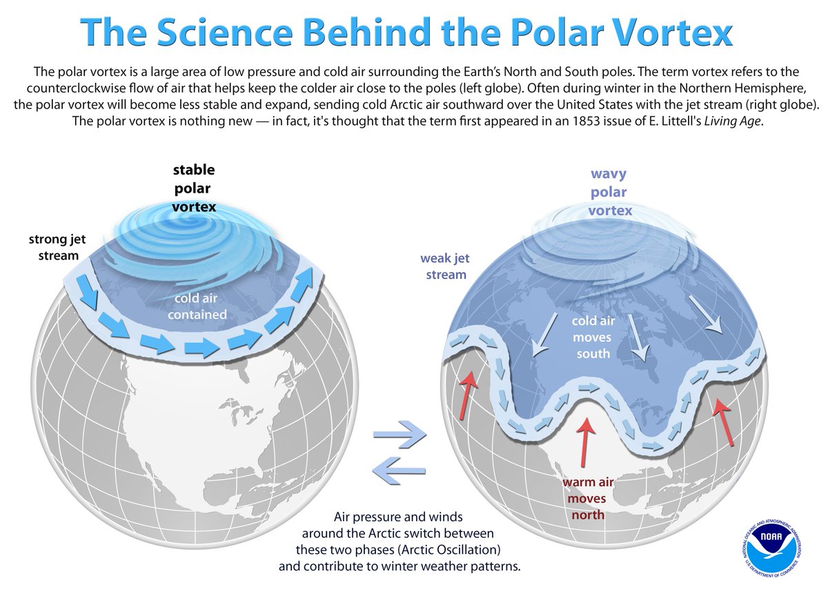
But occasionally, the #PolarVortex vortex becomes temporarily destabilized--allowing westerly winds to become more latitudinally oriented & resulting in a "wavy" jet stream pattern. Pockets of extremely cold Arctic air can escape & reach very low latitudes. (7/17)
An especially extreme iteration of this process, in fact, exactly what's happening right now--leading to chaos and dangerous societal disruptions in Texas. #TXwx (8/17)
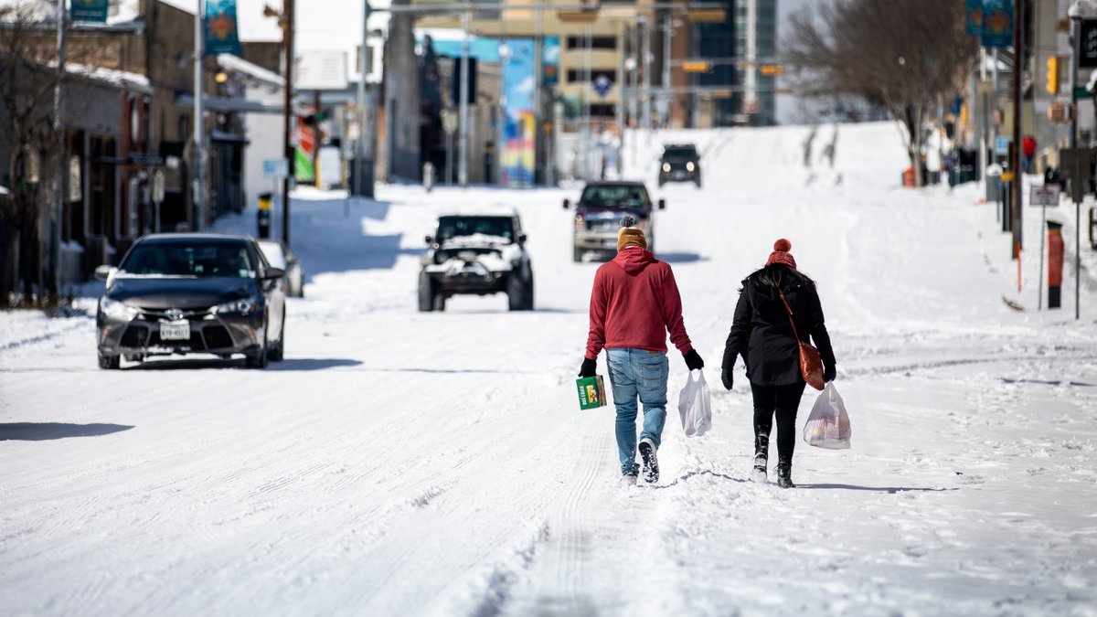
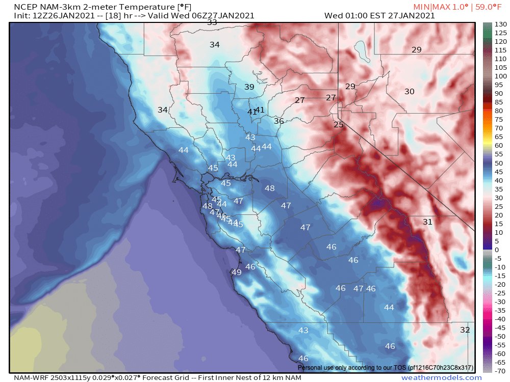
But why does, say, California, never experience such dramatic cold extremes? Houston is south of San Diego, after all! Well, it all has to do with those westerly prevailing winds I mentioned above. #CAwx (9/17)
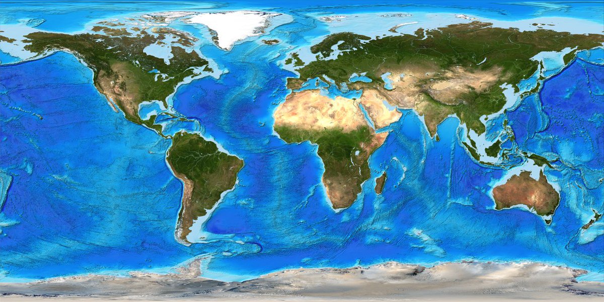
Arctic air destined for California (and most west coast continental areas) usually has to cross over a substantial expanse of the ocean before arriving from the northwest--and the high heat capacity of that ocean water greatly moderates the cold air long before arrival. (10/17)
Over the continental interiors, however, there is no such protection--frigid Arctic air can flow directly from north
to south without passing over any large bodies of water--arriving largely unmoderated by its overland trajectory. (11/17)
Because prevailing winds are from the west, this means that
even *coastal* areas on continental eastern or even southern sides of continents can occasionally experience severe cold outbreaks (think U.S. Gulf Coast, southern/eastern Mediterranean, & SE China/Japan). (12/17)
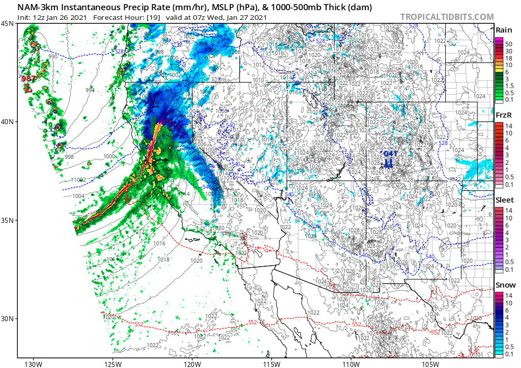
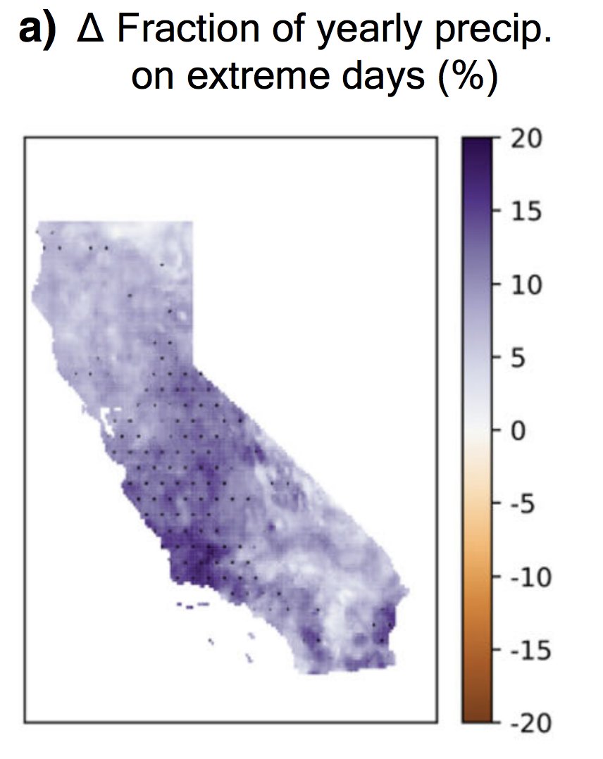
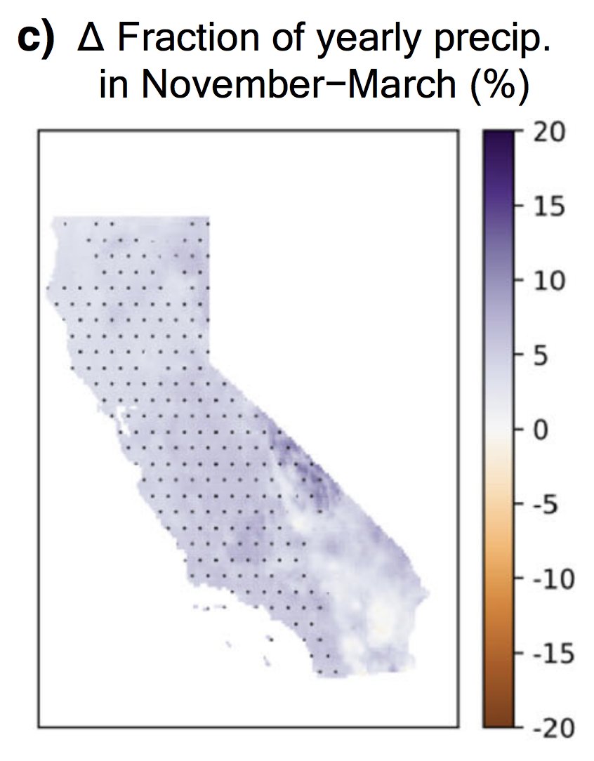
What does it take to get an extreme cold outbreak in California? A complete breakdown of westerly flow--& even a *reversal* to weak easterly flow (caused by upstream blocking high pressure) that allows cold continental air to spill westward. This occurs very rarely. #CAwx (13/17)
Finally, since this claim is showing up a lot in news stories right now: Is #ClimateChange increasing the likelihood of extreme winter cold air outbreaks across the northern hemisphere continental interiors? The short answer: we don't know yet, but we're working on it. (14/17)
This specific question has been the subject of intense study over past decade, & answers thus far have been...conflicting, and dependent on specific tools & metrics used. Right now, there is some evidence in favor of a link, but also substantial evidence against. (15/17)
There are certain extreme weather processes that now have very clear links to climate change, as my colleagues and I have discussed extensively in the past. I would argue that the Arctic/mid-latitude question is not yet once of them. (17/x)
For a much more comprehensive discussion on the climate change question, I think this @CarbonBrief article from 2019 remains an excellent primer on the topic, & includes perspectives from many scientists directly involved in underlying research. (17/17) carbonbrief.org/qa-how-is-arct…

• • •

Missing some Tweet in this thread? You can try to force a refresh
 

Keep Current with Daniel Swain

Daniel Swain Profile picture

Stay in touch and get notified when new unrolls are available from this author!

Read all threads

This Thread may be Removed Anytime!

PDF

Twitter may remove this content at anytime! Save it as PDF for later use!

Try unrolling a thread yourself!

how to unroll video
  1. Follow @ThreadReaderApp to mention us!

  2. From a Twitter thread mention us with a keyword "unroll"
@threadreaderapp unroll

Practice here first or read more on our help page!

More from @Weather_West

26 Jan
Thread on very strong inbound CA storm. A cold & clear morning will quickly give way to increasing clouds, NorCal valley rain & snow down to 1,500-2,000 ft (locally lower) later this PM. Current satellite imagery shows this strengthening system off the coast. (1/10) #CAwx
Tonight, a rapidly intensifying cold front will sweep across NorCal. This front will be unusually well defined, for a CA winter storm, and will replace an already cold airmass with...another cold airmass! (2/10) #CAwx
The cold frontal passage is expected to be quite dramatic across NorCal in the overnight hours. A convective "narrow cold frontal rainband" (NCFR) will likely develop, which could bring a period of torrential rain or snow to many areas, as well as possible lightning. (3/10) #CAwx
Read 11 tweets
22 Dec 20
In case you missed it: a "thread of threads" highlighting some of our collaborative research from 2020. How are wildfires, atmospheric rivers, floods, and other extreme events changing in a warming #climate (and in California specifically)? Read on for details: (1/8) #CAwater
A general-audience primer on the rapidly advancing science of "extreme event attribution." How do scientists approach question of whether #ClimateChange is affecting likelihood and/or severity of extreme weather events? (2/8) @ClimateChirper @danielletouma
Our deep dive into extreme #AtmosphericRiver storms in California and how they are likely to warm & intensify considerably due to #ClimateChange. (3/8) @xingyhuang @ProfAlexHall
Read 8 tweets
26 Oct 20
First, some good news: NorCal seems to have made through initial (extreme wind) phase of this critical fire weather event relatively unscathed. Few new small fires, but nothing unmanageable. A few thoughts as to why this was the case: #CAwx #CAfire
Very strong to extreme winds and exceptionally low humidity did materialize, despite an initial delay. A peak Bay Area gust of 89mph (with fairly widespread gusts above 50-60 mph), and peak Sierra Nevada gusts well over 100mph, were recorded. #CAwx #CAfire
In some spots, extreme winds did indeed mix down to low elevations (interior North Bay Valleys; Oakland Airport; San Francisco; Half Moon Bay). But some locations closer to sea level saw little wind,so sea level gusts were somewhat less widespread than initially anticipated.#CAwx
Read 6 tweets
25 Oct 20
Folks: major wind/extreme low humidity/fire weather event is still coming--it just might be slightly delayed (by a couple hours or so in SF Bay Area). Very surprised to hear that PG&E is cancelling some of the planned PSPS with strong winds still inbound?? #CAwx #CAfire
Are @NWSBayArea or @NWSSacramento aware of any major forecast changes that would explain why PG&E is claiming that conditions will no longer justify a PSPS (at least in portions of East Bay Hills and Sierra foothills)? I certainly am not...
cc @RobMayeda @psuweatherman I am genuinely baffled here.
Read 4 tweets
22 Oct 20
This is the fire weather forecast I was hoping wouldn't come to pass, given all that has already transpired in 2020: Very strong offshore winds, coupled w/exceptionally low humidity & record-dry vegetation, will bring extremely critical wildfire risk Sun/Mon. 1/3 #CAwx #CAfire Image
This will likely be strongest & most widespread offshore wind event of season, & is reminiscent of extreme events in 2019 & 2017. Hardest-hit areas appear to be west slopes of Sierra Nevada (gusts of 70+mph) & SF Bay Area (widespread gusts 40-50mph; higher in hills). #CAwx Image
Exceptionally low atmospheric humidity (relative humidity of 5% or less and dewpoints below zero F) will accompany these strong winds. This will be a *cold* offshore wind event, and temperatures will drop precipitously (especially in mountains). #CAwx ImageImage
Read 4 tweets
7 Oct 20
New research led by @ggpersad & featuring @PabloWater. Using downscaled climate model simulations, we show that there is unexpectedly high inter-model agreement re: increasing extremity of California hydroclimate due to #ClimateChange. (1/n) link.springer.com/article/10.100… #CAwater
In general, climate models agree than an increasing fraction of California's overall precipitation will become concentrated into the most intense events--and that the most extreme precip events will themselves be substantially more intense. (2/n) link.springer.com/article/10.100… #CAwater
There is also agreement that CA's already pronounced precipitation seasonality will become even sharper--with more rain concentrated into winter months at expense of the autumn & spring. Consider the wildfire season implications... (3/n) link.springer.com/article/10.100… #CAwater #CAfire
Read 8 tweets

Did Thread Reader help you today?

Support us! We are indie developers!


This site is made by just two indie developers on a laptop doing marketing, support and development! Read more about the story.

Become a Premium Member ($3/month or $30/year) and get exclusive features!

Become Premium

Too expensive? Make a small donation by buying us coffee ($5) or help with server cost ($10)

Donate via Paypal Become our Patreon

Thank you for your support!

Follow Us on Twitter!