#India to experience a very wet phase of weather, usually cool temperatures in the next 10 days with no seasonal #Heatwave which usually strengthen around this time.
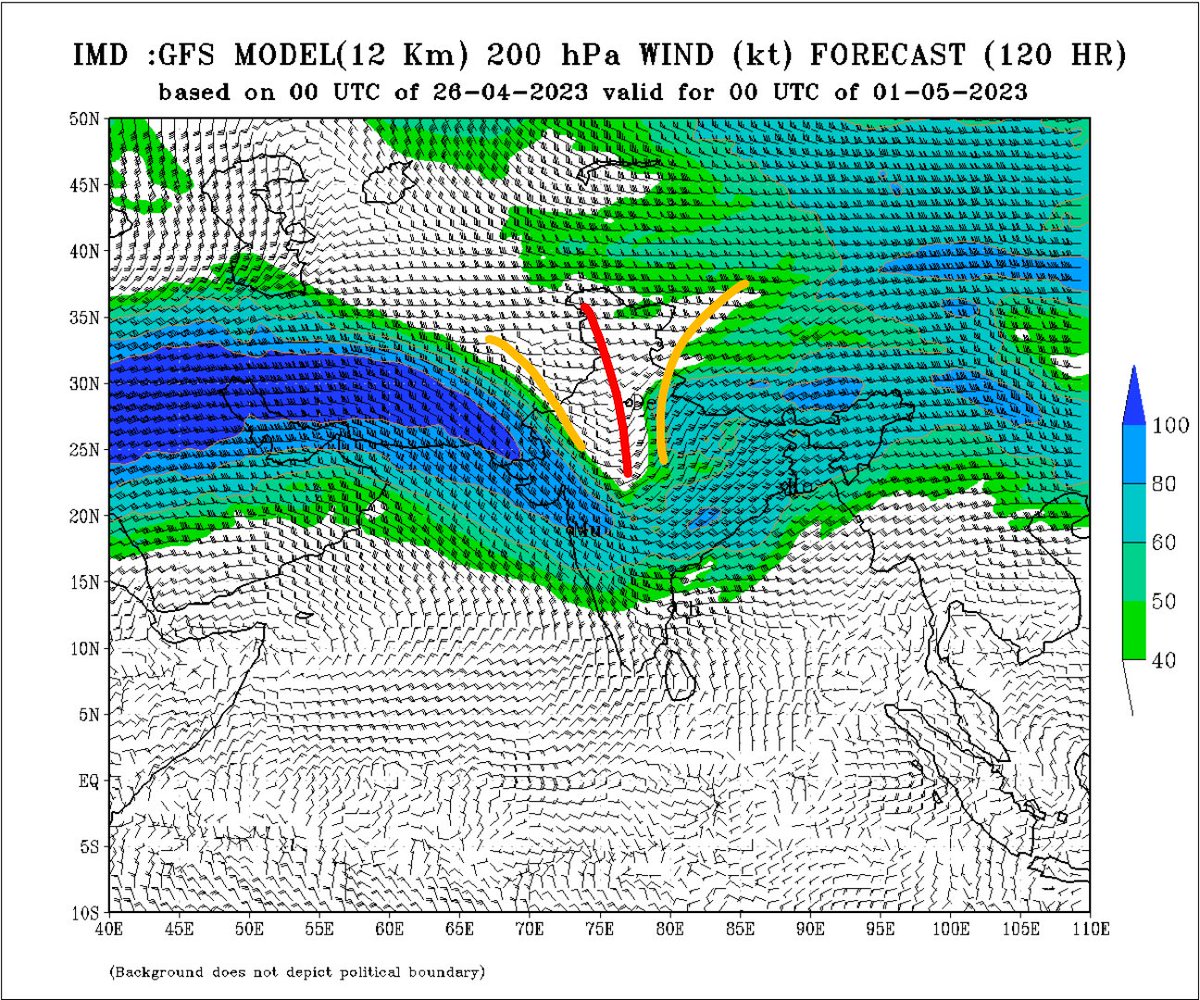
A Typical Jan/Feb standard WD is approaching (200 hpa Jet streams dipping too south + CC developing)
1/n

A Typical Jan/Feb standard WD is approaching (200 hpa Jet streams dipping too south + CC developing)
1/n


Dipping Jet/WD approaching North India + Lower level Cyclonic circulation developing in the plains, Wind discontinuity over central India along with moisture incursion from the seas.
- Scattered #Duststorm and rains to pick up in North #India from 27th April i.e tomorrow
2/n
- Scattered #Duststorm and rains to pick up in North #India from 27th April i.e tomorrow
2/n

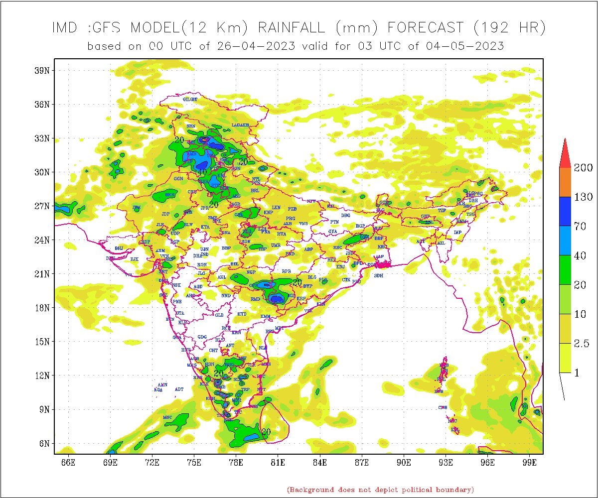
As the Wx systems strengthen, this will result in widespread #Duststorm, intense spells of #rains, #Hailstorm, strong winds across western #Himalayas #Punjab #Haryana #Delhi #Rajasthan #UttarPradesh #Gujarat #MadhyaPradesh #Chhattisgarh this weekend into first week of May.
3/n
3/n

The prolonged rains will have a major impact on temperature.
These are the days when it usually get as hot as 45°c with #Heatwave but the maximum temperature in first week of May is expected in the range of 24 to 28°c, atleast 10 to 18°c below normal.
Interesting days ahead.
4/4
These are the days when it usually get as hot as 45°c with #Heatwave but the maximum temperature in first week of May is expected in the range of 24 to 28°c, atleast 10 to 18°c below normal.
Interesting days ahead.
4/4

• • •
Missing some Tweet in this thread? You can try to
force a refresh

 Read on Twitter


