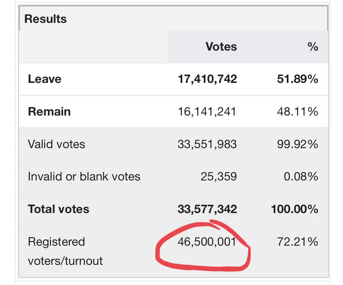
This @nytimes cartogram is getting a lot of deserved praise, but I wanna talk about one particular design choice that is simply genius:
Separating the states from one another.
Why is this such a brilliant decision? A very brief thread:
Separating the states from one another.
Why is this such a brilliant decision? A very brief thread:
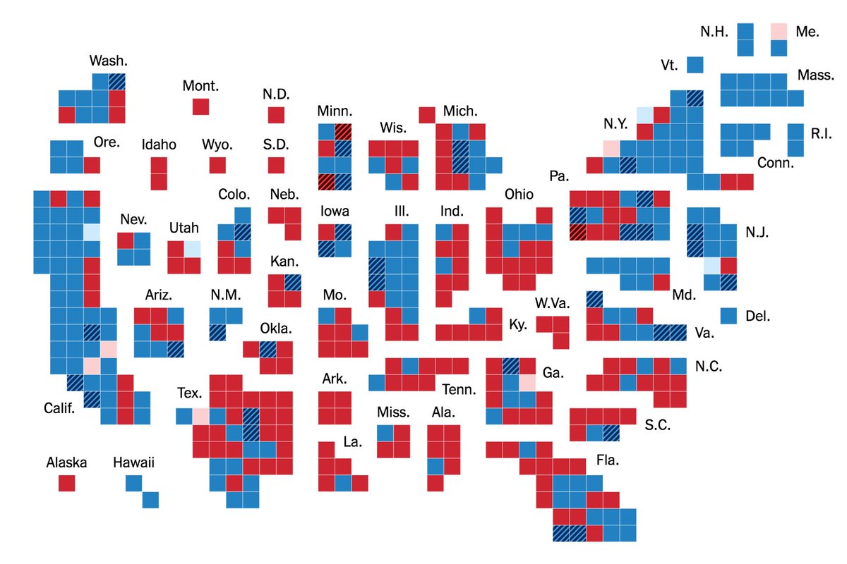
1/ Cartograms are already abstract. Keeping the states contiguous serves no useful purpose. In fact, it often makes them worse. Weird shapes, adjacency where there is none IRL etc. They become almost impossible to read as actual maps.
2/ With that constraint gone, you can:
a) Label them all directly! Immediately more readable.
b) Exploit the freedom of the newly created white space and labels to position the states so that the whole thing — wait for it — actually resembles a map of the US!
a) Label them all directly! Immediately more readable.
b) Exploit the freedom of the newly created white space and labels to position the states so that the whole thing — wait for it — actually resembles a map of the US!
3/ No other district-level cartogram that I've seen compares to this. It's not even close. I think I might be in love.
Here's the live version: nytimes.com/interactive/20…
Here's the live version: nytimes.com/interactive/20…