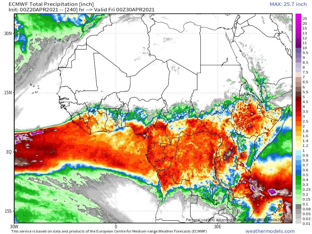
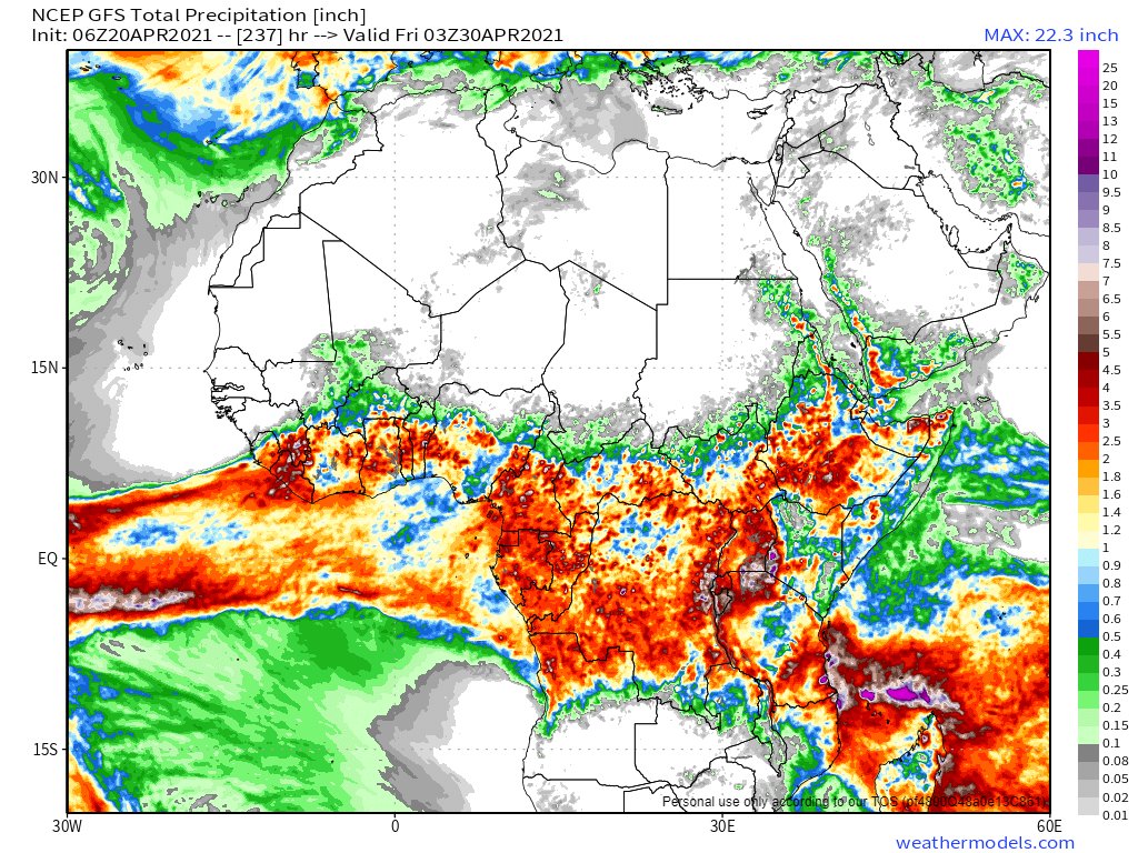
Ethiopia forecast rainfall update: 21st April 2021
GFS, KMA and ECMWF Model forecasts - all 10 days.
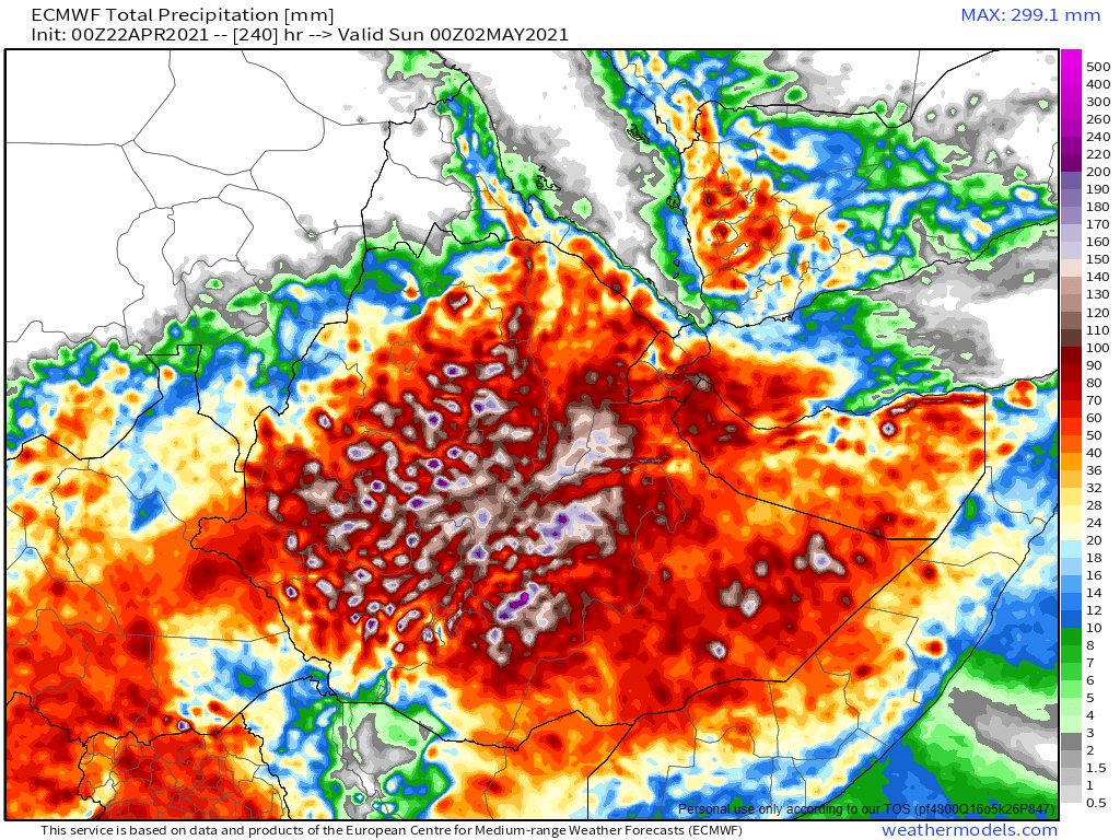
NOTE: There is a significant increase in expected rain over the 10 day period compared to forecasts from earlier in April.
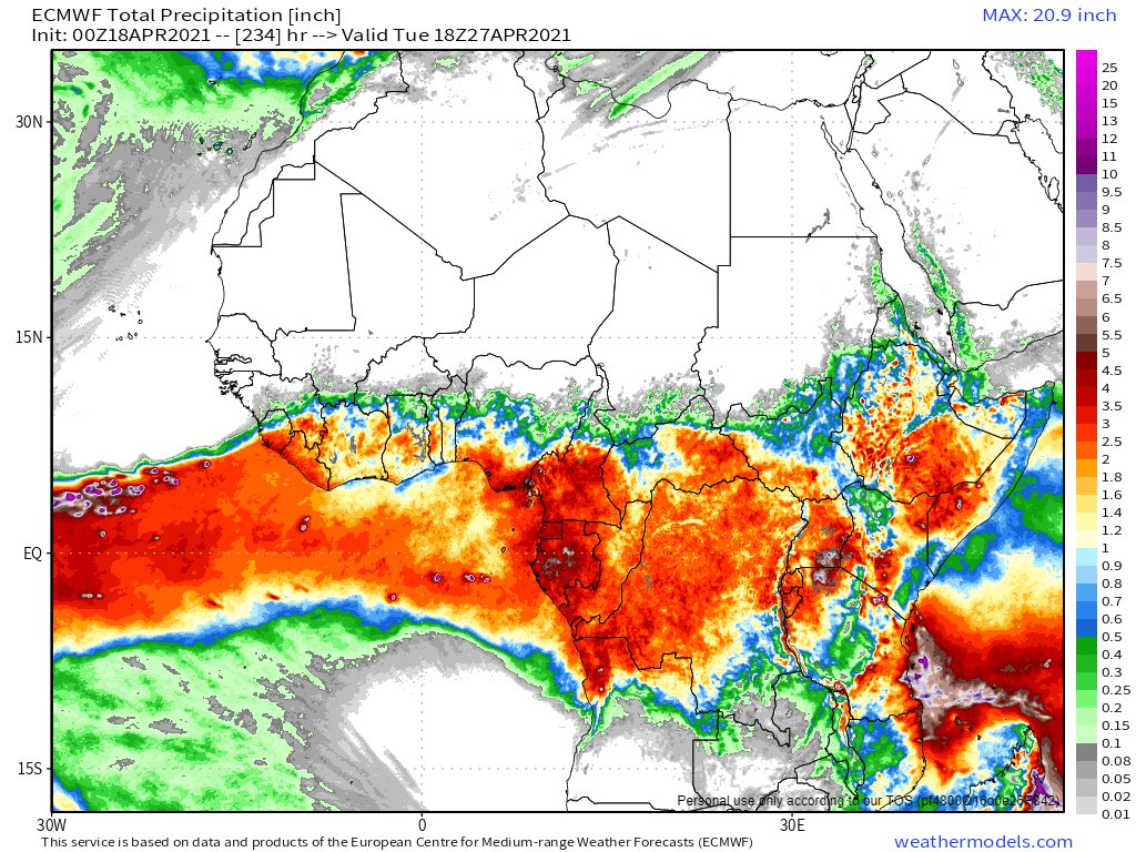
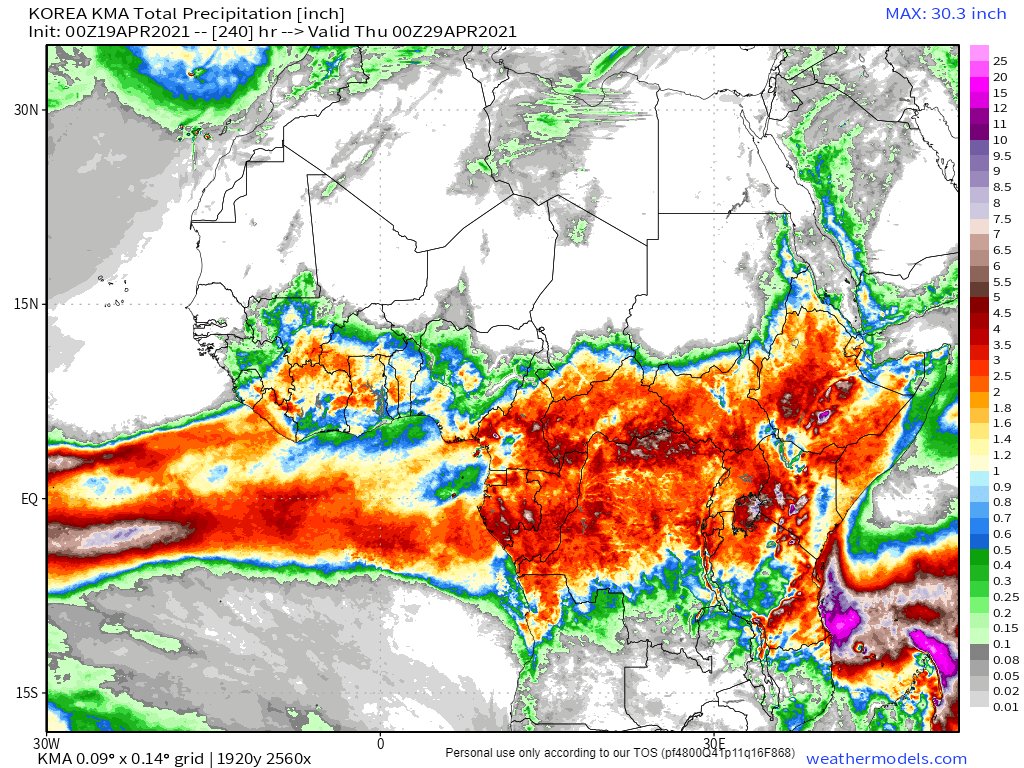
GFS, KMA and ECMWF Model forecasts - all 10 days.
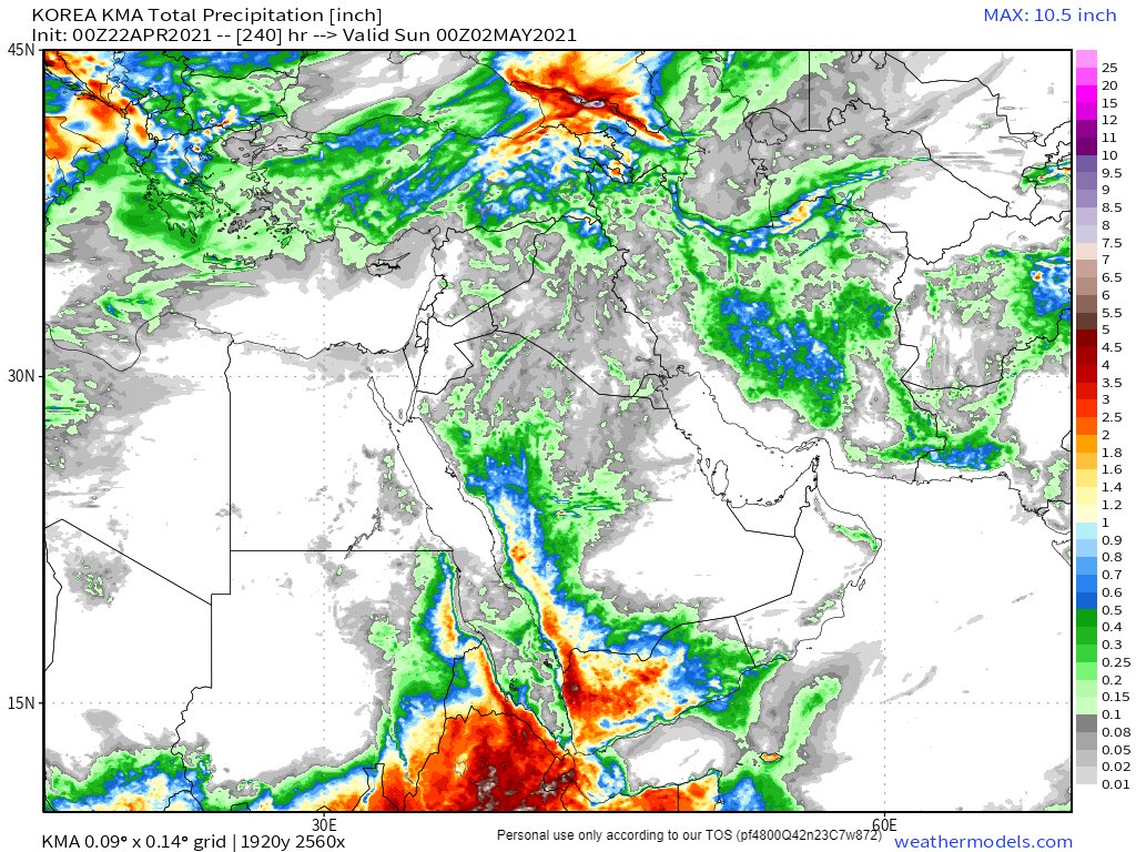
NOTE: There is a significant increase in expected rain over the 10 day period compared to forecasts from earlier in April.


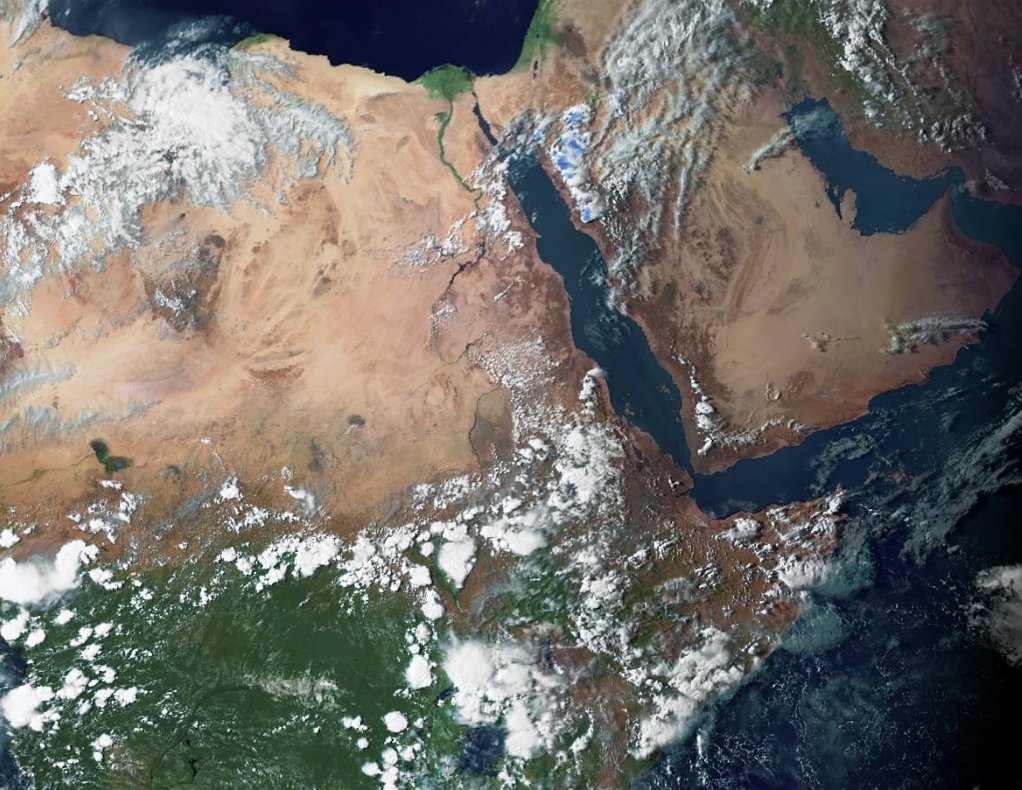
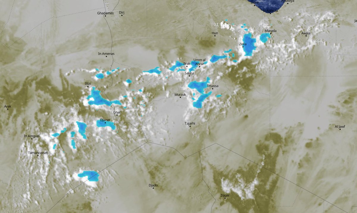
Here is an animation from this afternoon of rain cloud formation over the Blue Nile Basin today. It is picking up speed.
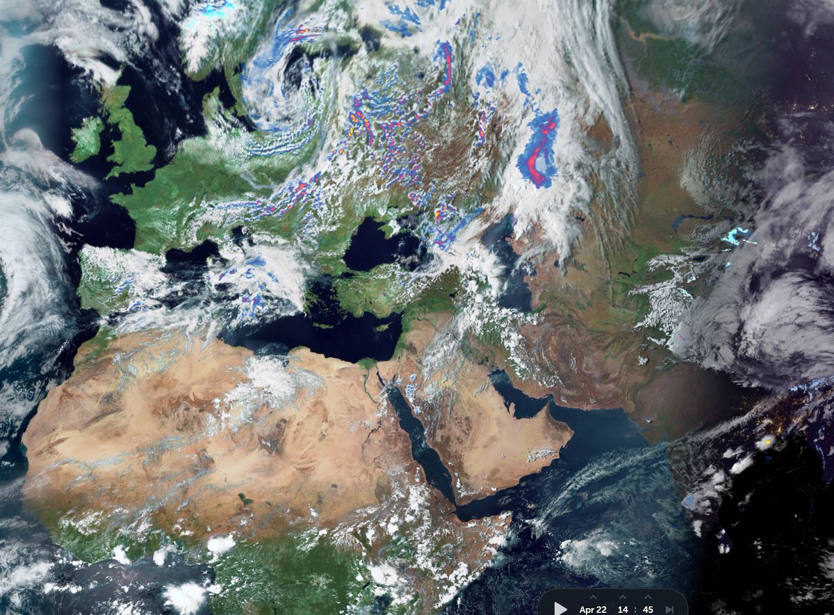
And here is an animation of an explosive burst of convection south of Mogidishu in Somalia. In 5 hours the storm had grown to be larger than the island of Ireland.
The little rainy season is gaining strength over the Horn of Africa. This animation shows storm activity this afternoon and evening in the #BlueNile #Abbay river basin in #Ethiopia, where the waters flowing into the #Gerd originate.
• • •
Missing some Tweet in this thread? You can try to
force a refresh