Thread:

I had earlier posted that I am not confident about Covid Nos & few asked explanation

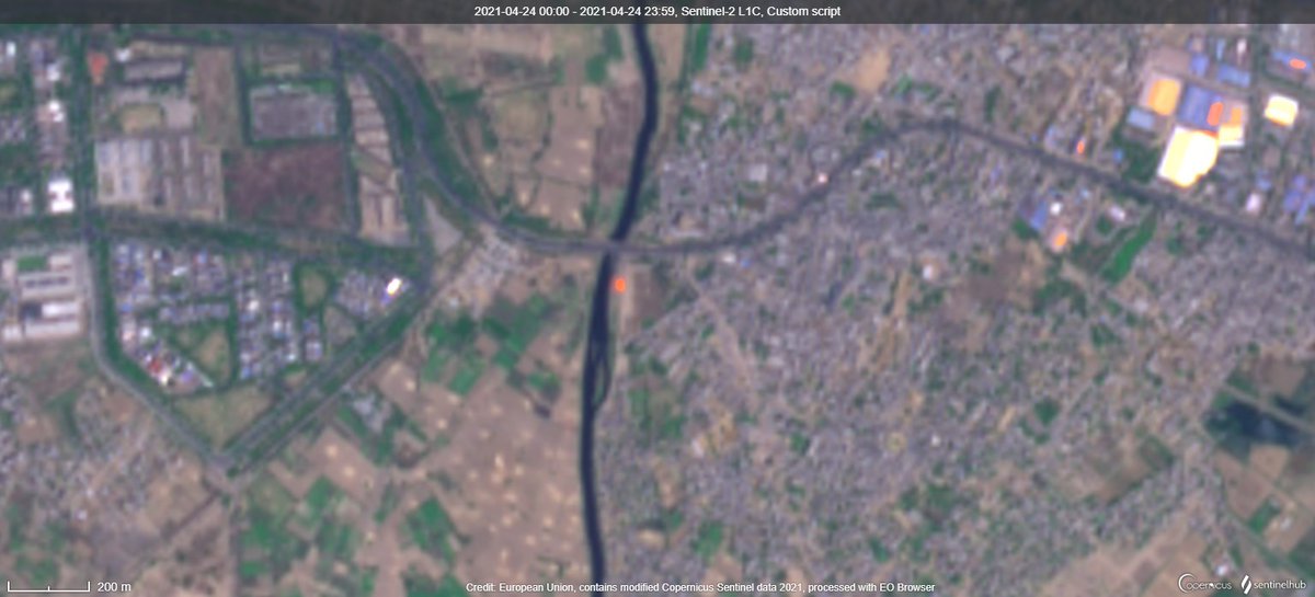
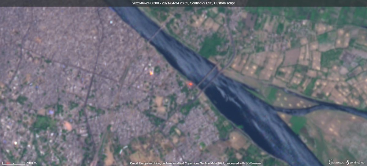
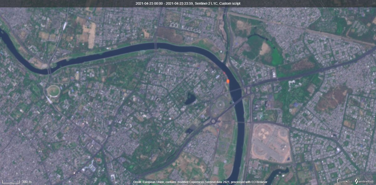
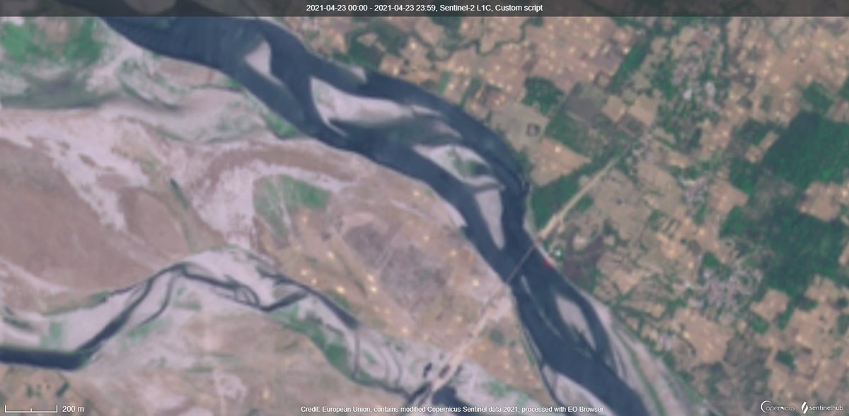
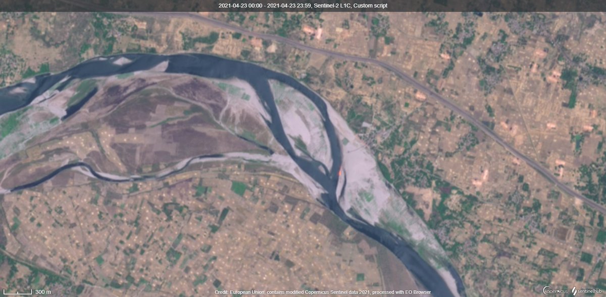
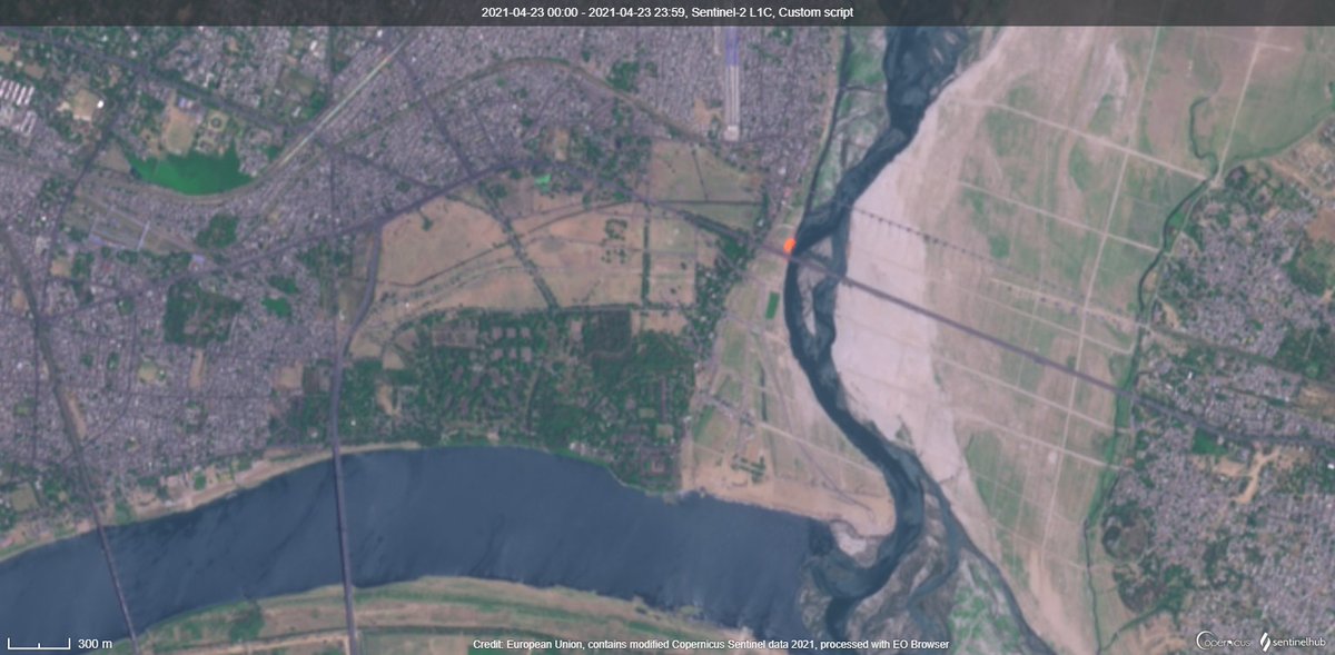
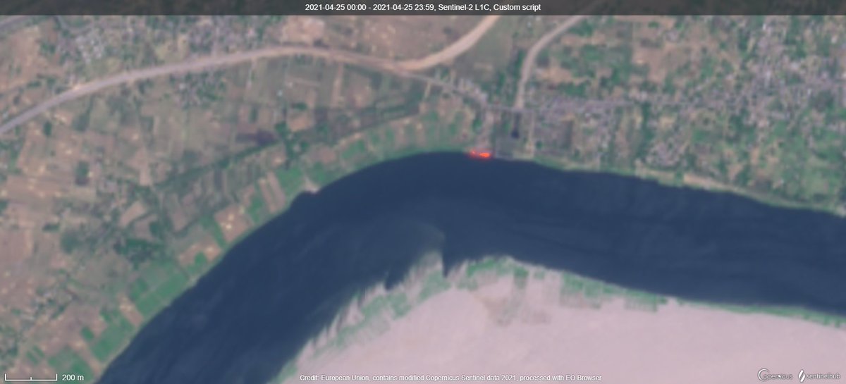
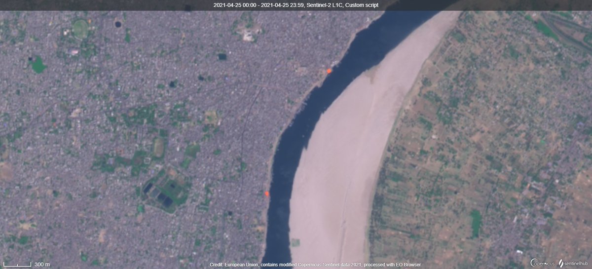
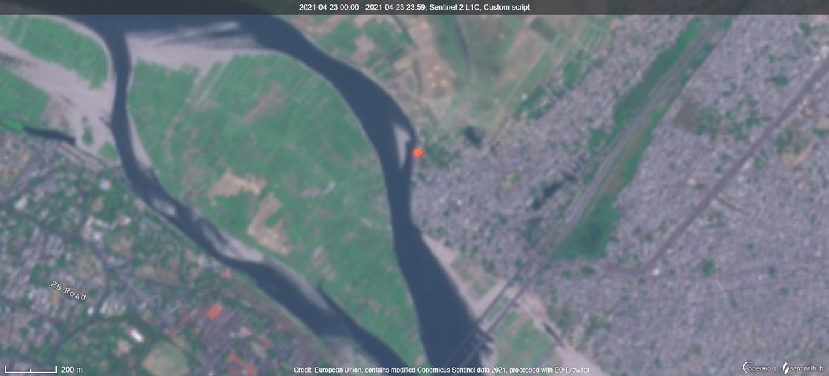
Attaching satellite images where SWIR bands have picked up fire signals in crematoriums(orange colour). In most cases, this is 1st time detected or ten times intensity detected in past
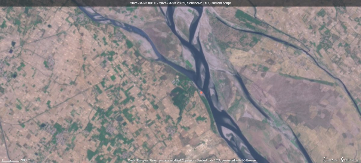
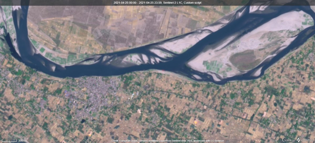
Images from NOIDA, Vrindavan, Mathura, Lucknow (Clockwise from left top)

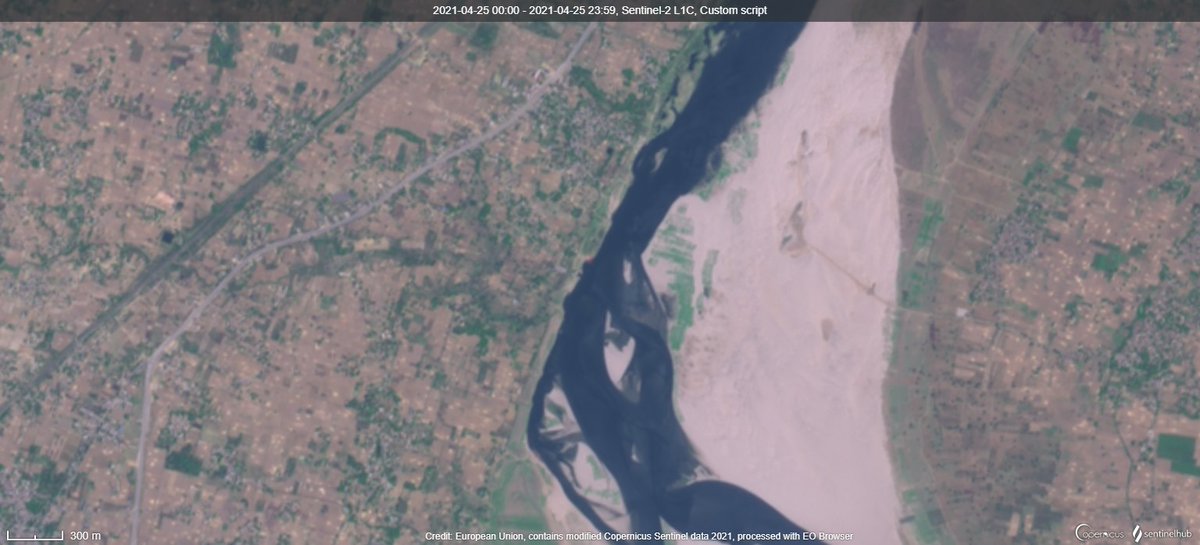
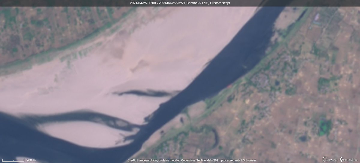
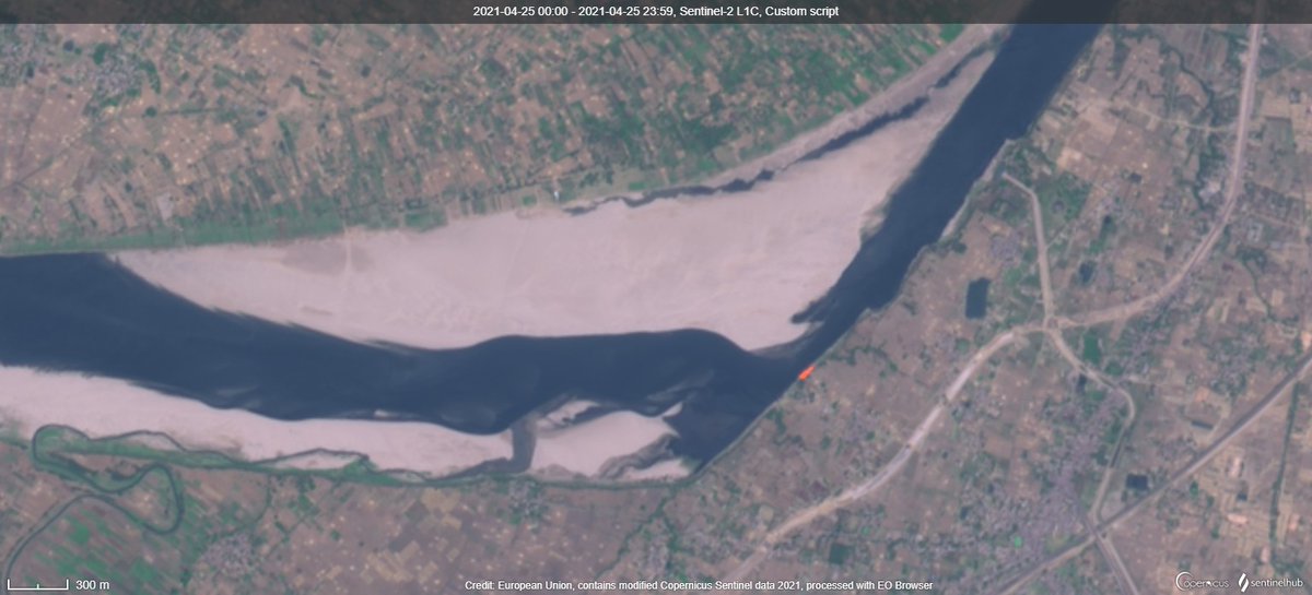
Orangish -red colour is the place of the ghats where these cremations take place
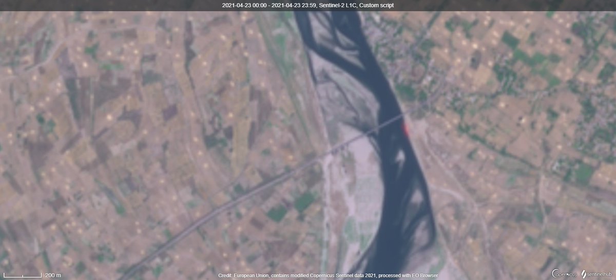
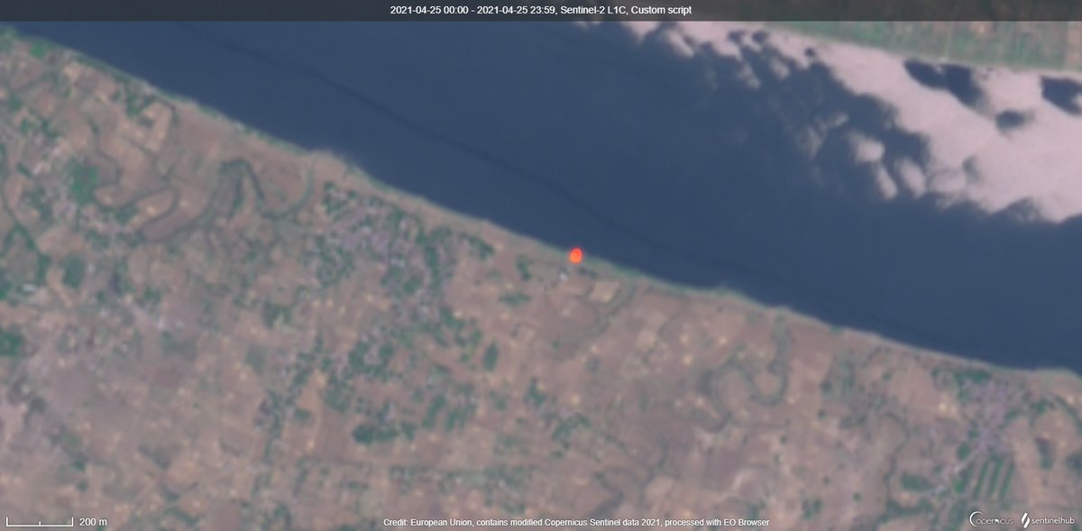
DhoriGhat, Baksar, Bhitoura, Fatehpur Ganga (These are Mild Signals)
Unchahar, Manikpur, SringverpurDham , KarentiGhat
Prayagraj, Patna, Mubarakpur, PipraBrijlal
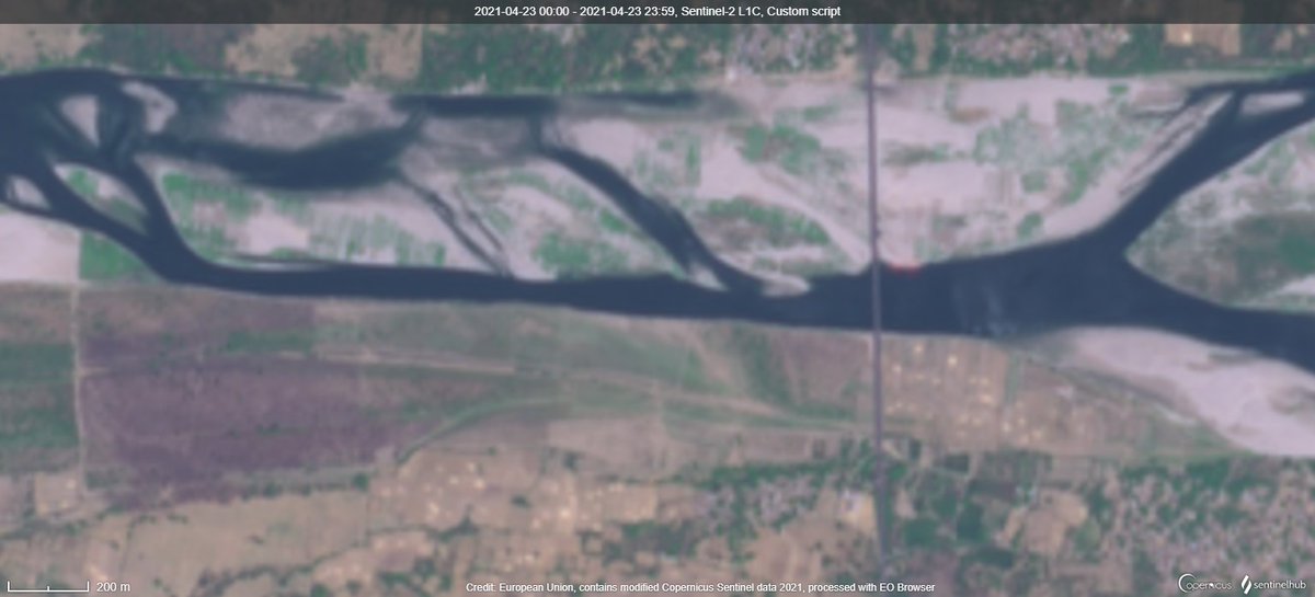
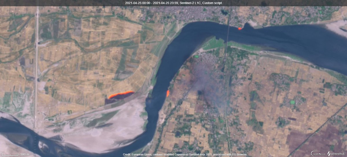
Dhanghat, GolaBazaar, Gaurajainnagar, DohriGhat (A farm fire also can be seen along with two crematorium fires)
Sahiagarh, Ballia, Ghazipur, Gahmar
Saidpur, Gaurapurwar, Nizammudinpur, Kaili
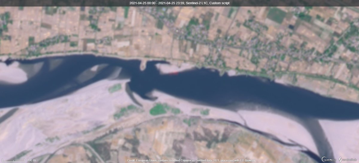
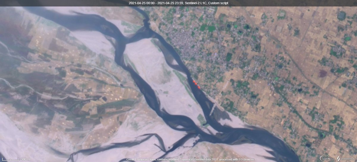
Varanasi - Funeral fires have been detected in the past but never in this intensity
Chunar, Saraiya Kamarghatta, Shivrajpur
Bithoor, Shuklaganj (Kanpur)
I can go on.. These are all seen just in UP (1 in Bihar) along major rivers alone.

But these many fires with the intensity (never been seen before) dont seem to match normal death rate. This is reason why I am not going to make any maps with reported death or case statistics.
All Satellite images from @CopernicusEU @sentinel_hub
Script from @Pierre_Markuse
So sorry for posting such depressing news but this seems to be very bad than what we see/told and I hope all of you stay safe.

I also hope Twitter hasn't reduced resolution for a clear view.

Also note: Some images like those for Varanasi are from today morning!
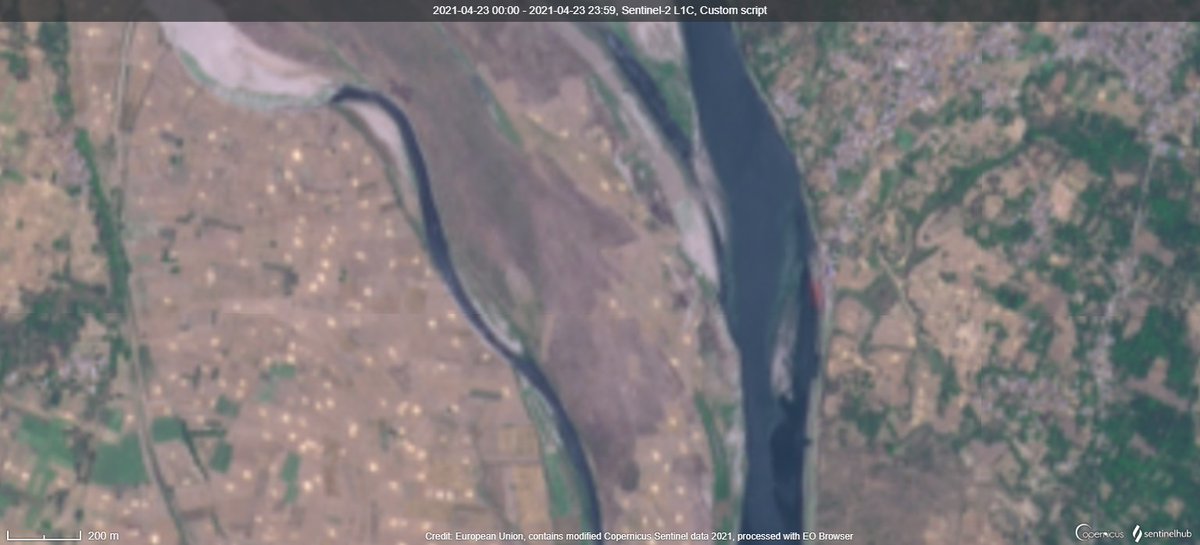
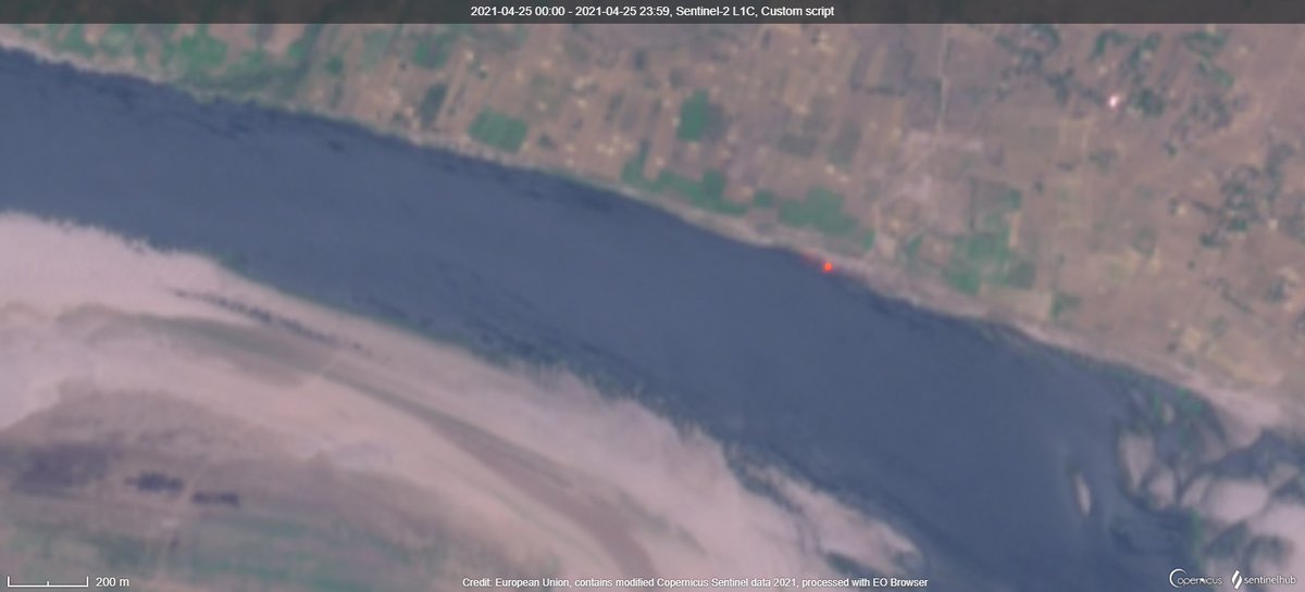
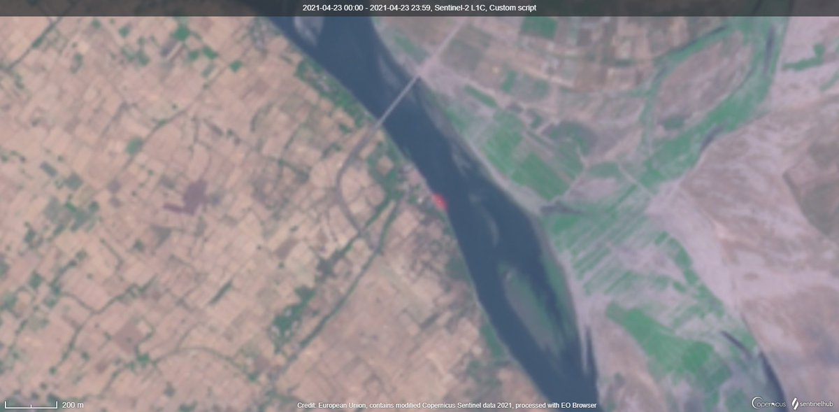
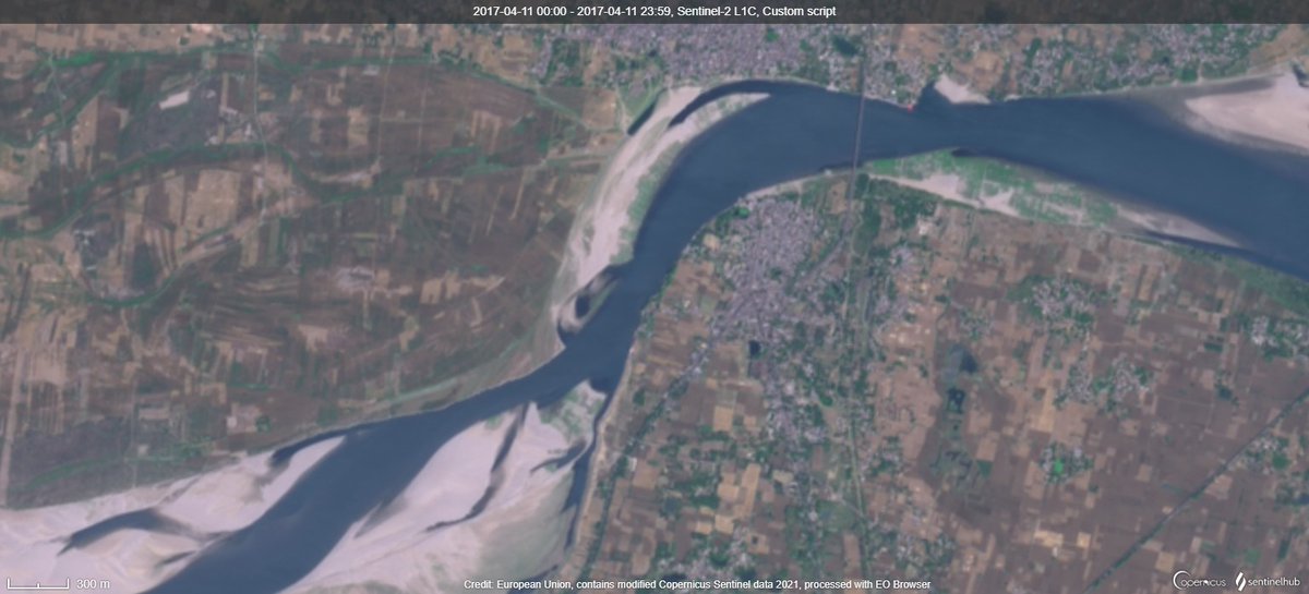
A typical pre-covid (second wave) image for Dohrighat in the left from 2017 April. (Mild orange can be seen)

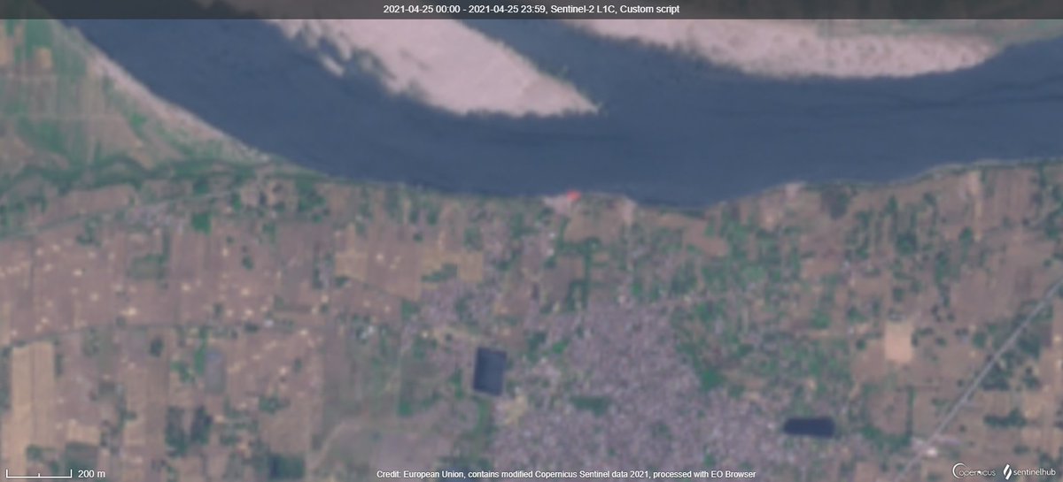
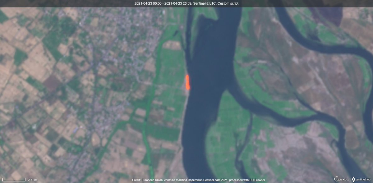
Image from today morning in the right.

Ignore the farm fire in the left side of today's satellite image. But check the intensity of the two fires in the river ghats.
Adding Tilak Vihar, Delhi

• • •

Missing some Tweet in this thread? You can try to force a refresh
 

Keep Current with Raj Bhagat P #Mapper4Life

Raj Bhagat P #Mapper4Life Profile picture

Stay in touch and get notified when new unrolls are available from this author!

Read all threads

This Thread may be Removed Anytime!

PDF

Twitter may remove this content at anytime! Save it as PDF for later use!

Try unrolling a thread yourself!

how to unroll video
  1. Follow @ThreadReaderApp to mention us!

  2. From a Twitter thread mention us with a keyword "unroll"
@threadreaderapp unroll

Practice here first or read more on our help page!

More from @rajbhagatt

13 Mar
May had been asking me whether Isha encroached forest lands. IMO this is deviating from actual issue. Read full thread

Isha didNOT build on forest dept lands as such but it VIOLATED rules in other ways

Old Satellite image & map show that it was not forest but revenue land
Inorder to protect out environment, we had framed laws to secure permissions from necessary authorities. Since it was farmland and since it came under Hill Area Conservation Authority, necessary permissions were to be secured from respective offices
In their webpage, Isha says that they secured permission to construct statue on Sep - Nov 2016. But prior to securing permission itself they started constructing. Attached #Satellite images from Jan & Feb 2016 show that construction had already started before securing permission
Read 9 tweets
12 Mar
#SaudiArabia #NEOM

WORKERS KINGS
Cause It would be insane to have palaces for kings without golf courses in the desert
Carefully engineered quarters and compound for security officials and other workers in royal palace. But unlike the royals they dont deserve green.
Read 7 tweets
5 Mar
Short story/Thread:

There was a Madras high court order on lake encroachment & judge said "whether it is 112 crores or 1K crores, we will destroy it. Get bulldozers ready"

But my lord, Madurai Bench of Madras High court was constructed in lake

Old Satellite image attached
1/n
And may be we'll get justice from the lower district court in Madurai. But that is also built on a lake
May be we should go even lower to the law college... But law college is also on a lake
Read 13 tweets
25 Feb
A Kutty (Short) Story with Satellite Images about a hamlet near Tirunelveli, #TamilNadu

In 2003, the hamlet can be seen (marked in orange). It is next to Tirunelveli - Madurai railway line. There's a crossing (marked in black) through which people went to the nearby main road
Around 2018, Railways decided to build an underpass for this village so that they can double track this corridor. Concrete boxes can be seen in the image
And they started constructing the underpass by digging as seen in this satellite image
Read 10 tweets
24 Feb
The new Geospatial Data guidelines are revolutionary but it can do more!

My comments as published in @TheWireScience:

science.thewire.in/the-sciences/t…

Thanks: @1amnerd

FYI: @PrinSciAdvGoI @drharshvardhan @IndiaDST

Read thread for highlights!
Best part in the guidelines! "License Raj" is to be dismantled...
A Logical move! I personally learned many defense areas because they appeared black in satellite images 🤣
Read 11 tweets
24 Feb
This man who is part of a national media network has published a wrong map of India as per Indian law. It shows parts of Ladakh which were ceded by Pakistan to China and around Siachen as "not part" of India.

Will the government punish him? #Curious
For those who are not sure of which place I am talking about
What does the law say?
Read 4 tweets

Did Thread Reader help you today?

Support us! We are indie developers!


This site is made by just two indie developers on a laptop doing marketing, support and development! Read more about the story.

Become a Premium Member ($3/month or $30/year) and get exclusive features!

Become Premium

Too expensive? Make a small donation by buying us coffee ($5) or help with server cost ($10)

Donate via Paypal Become our Patreon

Thank you for your support!

Follow Us on Twitter!