#SaudiArabia #NEOM

WORKERS KINGS
Cause It would be insane to have palaces for kings without golf courses in the desert
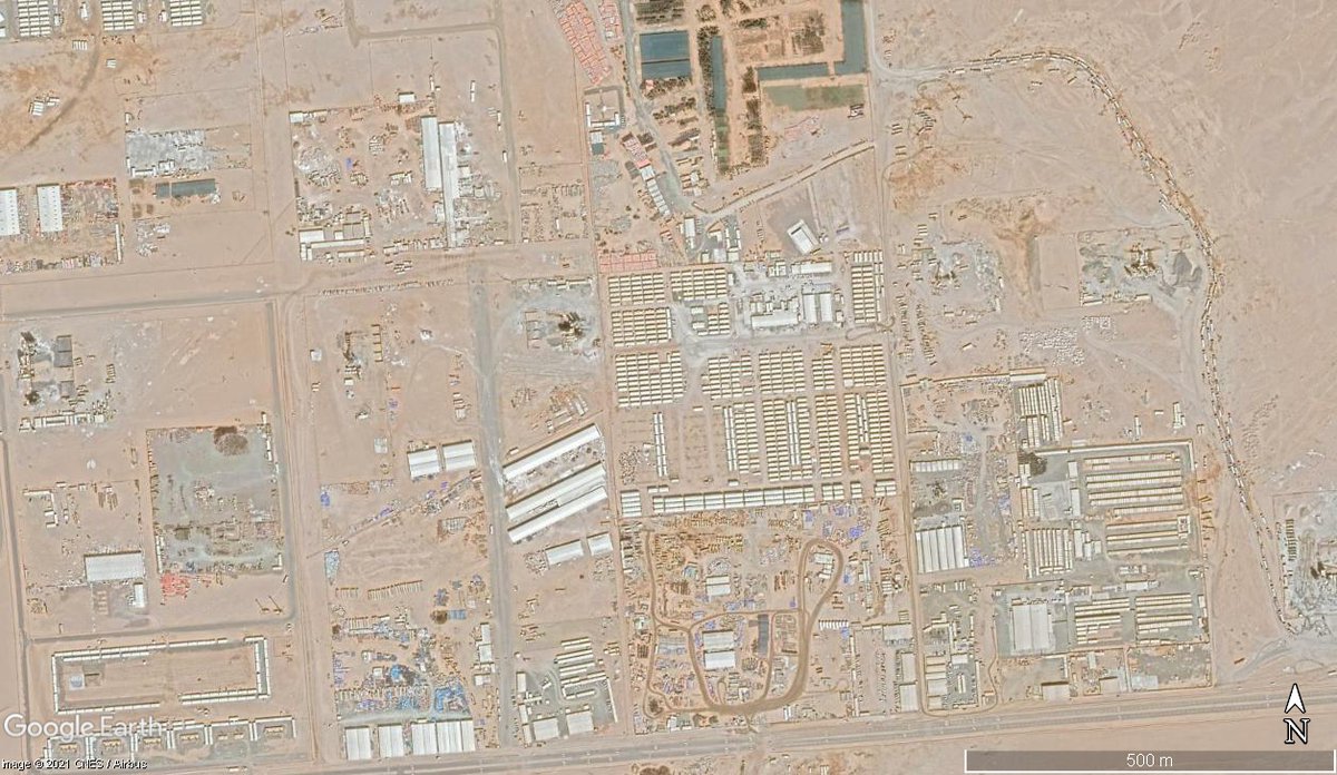
Carefully engineered quarters and compound for security officials and other workers in royal palace. But unlike the royals they dont deserve green.
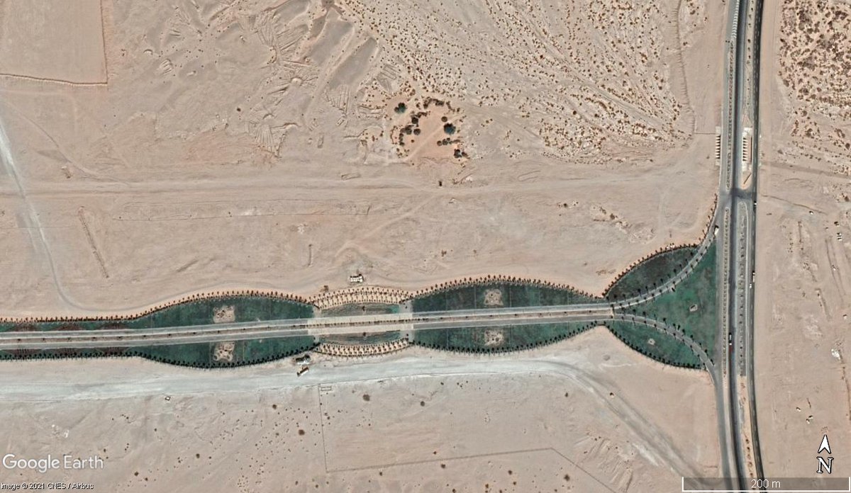
But the approach which the royals take should be green..
8 Helipads at the side of the palace were not enough. So they put two more in front of the palaces but not obstructing their golf courses
After all this, they couldn't put that design in the center of the roundabout.. Why it is that way will remain a secret
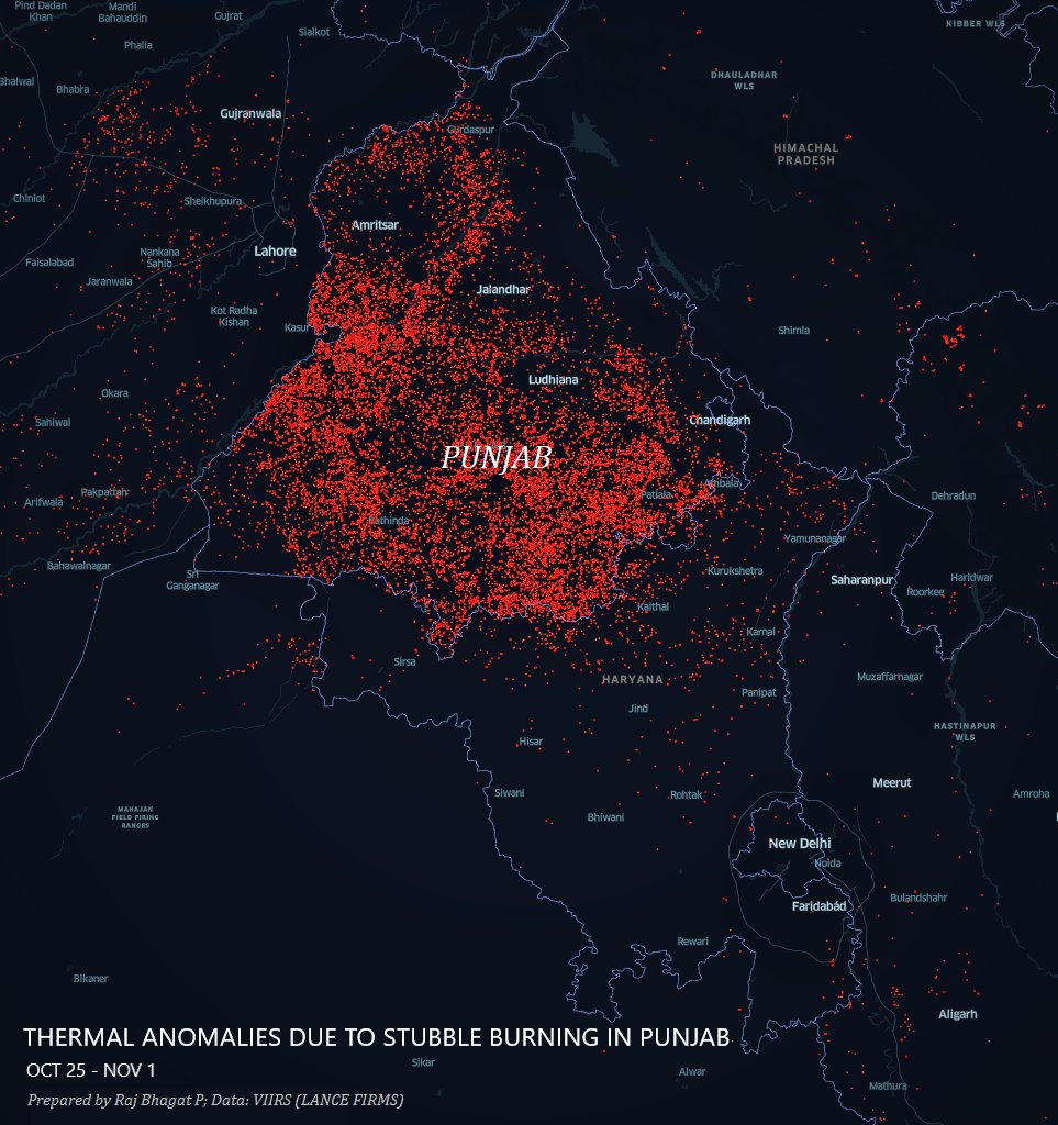
Basically 3 classes of tickets
1. Royal
2. Servants
3. Construction workers (probably & predominantly migrant)

The 3 have to live in different worlds as the project shapes up

• • •

Missing some Tweet in this thread? You can try to force a refresh
 

Keep Current with Raj Bhagat P #Mapper4Life

Raj Bhagat P #Mapper4Life Profile picture

Stay in touch and get notified when new unrolls are available from this author!

Read all threads

This Thread may be Removed Anytime!

PDF

Twitter may remove this content at anytime! Save it as PDF for later use!

Try unrolling a thread yourself!

how to unroll video
  1. Follow @ThreadReaderApp to mention us!

  2. From a Twitter thread mention us with a keyword "unroll"
@threadreaderapp unroll

Practice here first or read more on our help page!

More from @rajbhagatt

13 Mar
May had been asking me whether Isha encroached forest lands. IMO this is deviating from actual issue. Read full thread

Isha didNOT build on forest dept lands as such but it VIOLATED rules in other ways

Old Satellite image & map show that it was not forest but revenue land ImageImage
Inorder to protect out environment, we had framed laws to secure permissions from necessary authorities. Since it was farmland and since it came under Hill Area Conservation Authority, necessary permissions were to be secured from respective offices
In their webpage, Isha says that they secured permission to construct statue on Sep - Nov 2016. But prior to securing permission itself they started constructing. Attached #Satellite images from Jan & Feb 2016 show that construction had already started before securing permission ImageImageImageImage
Read 9 tweets
5 Mar
Short story/Thread:

There was a Madras high court order on lake encroachment & judge said "whether it is 112 crores or 1K crores, we will destroy it. Get bulldozers ready"

But my lord, Madurai Bench of Madras High court was constructed in lake

Old Satellite image attached
1/n
And may be we'll get justice from the lower district court in Madurai. But that is also built on a lake
May be we should go even lower to the law college... But law college is also on a lake
Read 13 tweets
25 Feb
A Kutty (Short) Story with Satellite Images about a hamlet near Tirunelveli, #TamilNadu

In 2003, the hamlet can be seen (marked in orange). It is next to Tirunelveli - Madurai railway line. There's a crossing (marked in black) through which people went to the nearby main road
Around 2018, Railways decided to build an underpass for this village so that they can double track this corridor. Concrete boxes can be seen in the image
And they started constructing the underpass by digging as seen in this satellite image
Read 10 tweets
24 Feb
The new Geospatial Data guidelines are revolutionary but it can do more!

My comments as published in @TheWireScience:

science.thewire.in/the-sciences/t…

Thanks: @1amnerd

FYI: @PrinSciAdvGoI @drharshvardhan @IndiaDST

Read thread for highlights!
Best part in the guidelines! "License Raj" is to be dismantled...
A Logical move! I personally learned many defense areas because they appeared black in satellite images 🤣
Read 11 tweets
24 Feb
This man who is part of a national media network has published a wrong map of India as per Indian law. It shows parts of Ladakh which were ceded by Pakistan to China and around Siachen as "not part" of India.

Will the government punish him? #Curious
For those who are not sure of which place I am talking about
What does the law say?
Read 4 tweets
1 Nov 20
#30DayMapChallenge
Map 1: Points

Thermal anomalies observed across Northern India in the last one week. These are primarily stubble-burning crop fire incidents in #Punjab. Image
#30DayMapChallenge
Map 2: Lines (Only one line though 😋)

#Viz shows the elevation profile of Nilgiri Mountain Railway in Tamil Nadu which is an UNESCO world heritage site Image
#30DayMapChallenge
Map 3: Polygons

#Map shows 3 Polygon layers for #Kolkata City

1. Municipal corporation -in 🔴
2. Kolkata Urban Area -Satellite est. -in ⬛️
3. Hooghly River -in 🔵

DYK: More than 2/3rds of Kolkata's urban agg population lives outside the Kolkata Corporation? Image
Read 18 tweets

Did Thread Reader help you today?

Support us! We are indie developers!


This site is made by just two indie developers on a laptop doing marketing, support and development! Read more about the story.

Become a Premium Member ($3/month or $30/year) and get exclusive features!

Become Premium

Too expensive? Make a small donation by buying us coffee ($5) or help with server cost ($10)

Donate via Paypal Become our Patreon

Thank you for your support!

Follow Us on Twitter!