I'd be interested in some computer modellers views of this. The experience of those of us with weather model powered interfaces in our hands have come to realise that a technology that was formerly fairly reliable in Europe isn't really coping.
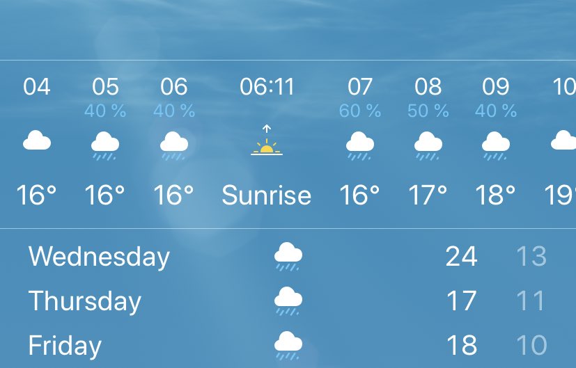
I have a live example here in Bretagne which is about to play out in real time. This is what my phone says. Rain is coming in 8 hours time. Lowish probability and only lasts four hours.
But this is the view looking out my window.
It may be harmless and it may not rain on me. But I would bet dollars to donuts that the @apple weather smarts have no idea it’s there.
This satellite feed from @zoom_earth runs in 15 minute increments so this animation may now be about 25 minutes out of date.
That storm is almost certainly this one and its most probably about 50kms away at the most. And as you can see behind it is a broiling storm front.
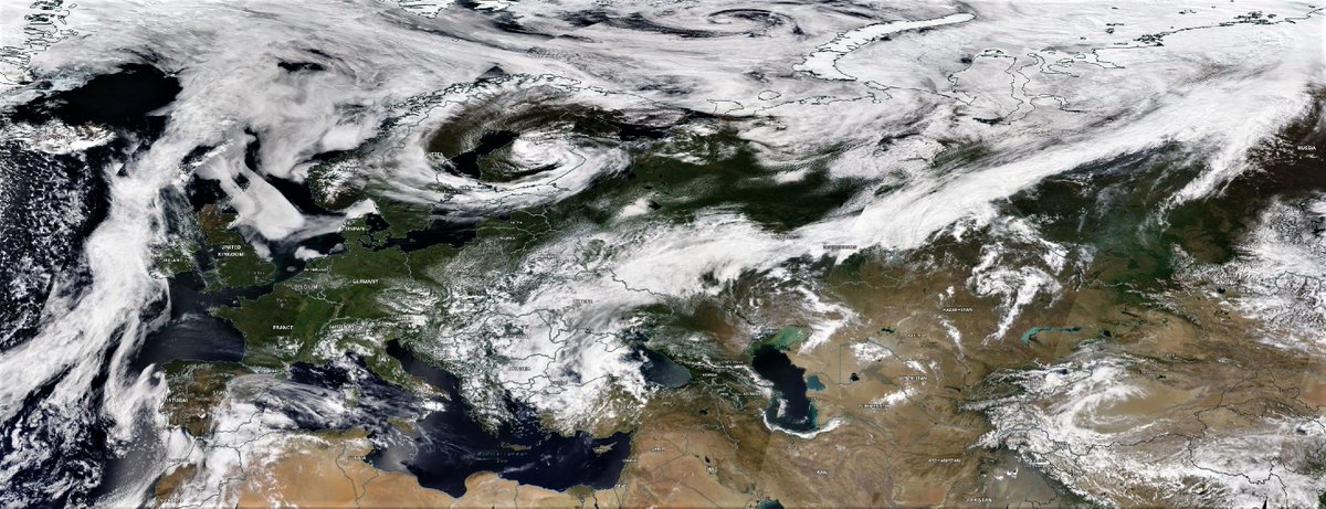
Zooming out you can see this storm front runs from Monaco to Brest and there are significant areas of storm activity well behind the front. By morning this will be in Belgium.
Update: Was probably being a bit harsh on the models here. The weather app has updated following the storm flare up. It’s now due to arrive in an hour.
Just saw some lightning. I do like a good storm.
But seriously the weather is going a bit bonkers here. And by here I mean the entire North Western Hemisphere.
• • •
Missing some Tweet in this thread? You can try to
force a refresh
Rains in Ethiopia and adjacent East African parts of the the Nile watersheds have been pumping today. Also across Somalia and Somali land, Sudan, South Sudan and south into areas west of Uganda feeding into Lake Victoria.
Today's rainfall forecasts follow with commentary.
The image above from @NASA Modis shows the upper Nile Basin and areas to the west this morning.
This animation below shows the same area this evening. Storms are once again dancing off the coast of Jeddah, rain surrounds Medina and clouds are gathering over Chad and Sudan.
Here's a close up of the cloud formation over Chad and Sudan today. If you look closely you can see two layers moving in different directions. Some clouds aligning with the westward motion of the monsoon and others, lighter in colour moving north east.
Well its hard to know where to begin with today's #MiddleEast and #HornOfAfrica rainfall forecasts.
The action is now further north, and west. Here we see the consequences of the first phase of what appears to be becoming a continuous #WesternSaharaPlume.
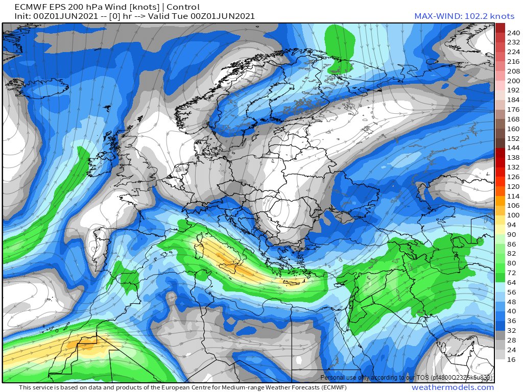
An bit of a battle us underway between a high pressure system over Northern Erope and the plume which is entering at the bottom left in this image of Jetstream level 250Hpa 11km high winds.
While the model forecasts remain optimistic that an orderly jetstream may eventually appear, so far this has not happened. And in the meantime these winds are picking up moisture in the tropics and taking it in large quantities to places where its not expected.
A full plume event is becoming obvious in central & eastern Europe + Russia. We also have thunderstorms over the Red Sea, and a low circulation heading towards a collision with water vapour over Israel.
Today's forecasts follow.
Visually speaking this is the most extraordinary looking satellite observation of the day.
Now into its sixth day the #EastAfricaWaterPlume has been generating lots of rain over the Red Sea, both last night and today, & right now just off the coast of Jeddah. @Arab_Storms
Here we see a wider view while it is not that obvious in this view, the stream of water vapour heading up the Western Sahara coast is running fast and hot. Later I will post an initial post tracking its impact in Europe. But for now its worth looking closer at North Africa.
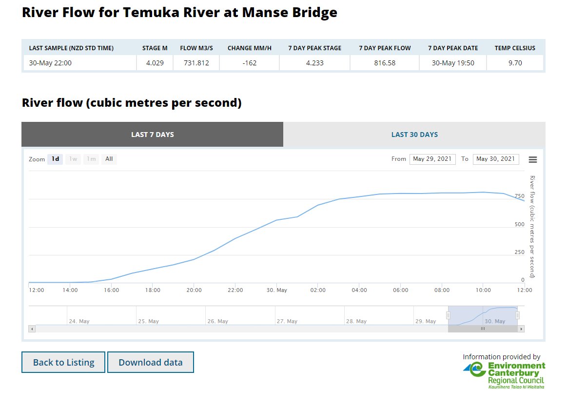
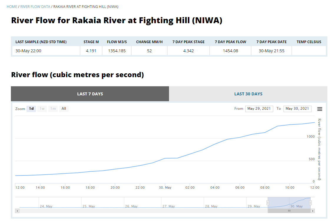
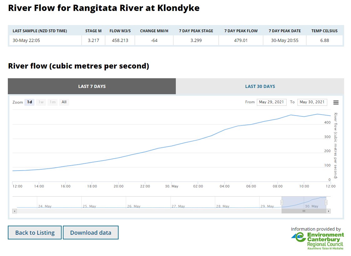
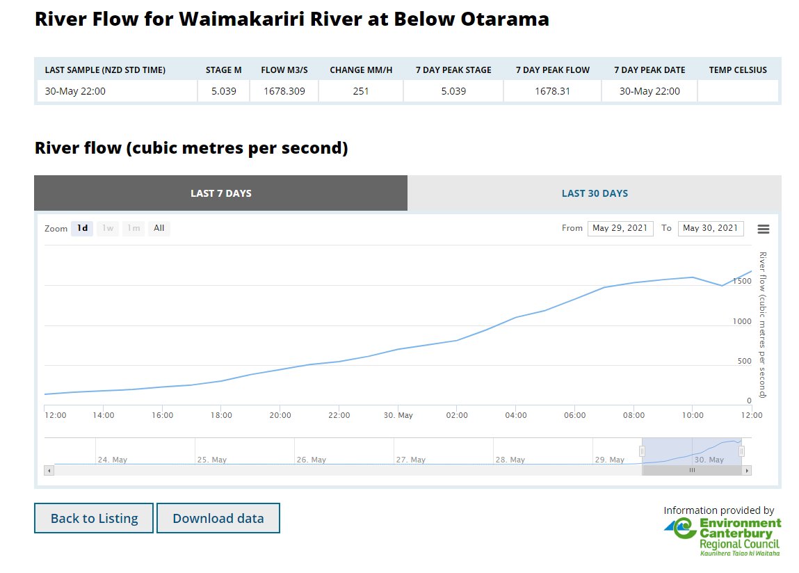
Upstream flow gauges in Temuka, Rangitata, Rakaia & Waimakariri appear to be peaking or in the case of the Waimakariri close to peaking.
Meanwhile the official ECAN alerts page seems to not be freaking out, so that's all good >> ecan.govt.nz/home/flood-war….
Steady as she flows.
"Breakouts" in the Ashburton vicinity & inland, are the major concern at present. But whatever "breakouts" are they sound a lot less alarming than floods and evacuations.
Also no alarm around the major rivers, yet. Also good.
The remaining concern will be river mouth flood/tide collisions. High tide timing today is around 6.30am near Timaru, 7.50am at the Rakaia and around 8.30am in Christchuch and at the Waimakariri river mouth.
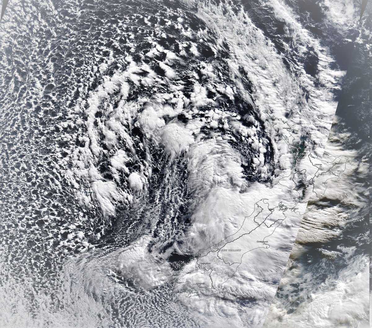
Here is a wider view. This will definitely continue through a fair bit of the night. Question is now how long will it continue tomorrow? The forecast models showed the plume you see coming in from the right sort of petering out and disengaging and tracking north.
NOTE: This is not an official forecast. But it is alarming. It seems that that peculiar cloud formation is special in a number of rather alarming ways. [Image: @NOAA's GFS model forecast, latest run.]