Rains in Ethiopia and adjacent East African parts of the the Nile watersheds have been pumping today. Also across Somalia and Somali land, Sudan, South Sudan and south into areas west of Uganda feeding into Lake Victoria.
Today's rainfall forecasts follow with commentary.
Today's rainfall forecasts follow with commentary.

The image above from @NASA Modis shows the upper Nile Basin and areas to the west this morning.
This animation below shows the same area this evening. Storms are once again dancing off the coast of Jeddah, rain surrounds Medina and clouds are gathering over Chad and Sudan.
This animation below shows the same area this evening. Storms are once again dancing off the coast of Jeddah, rain surrounds Medina and clouds are gathering over Chad and Sudan.
Here's a close up of the cloud formation over Chad and Sudan today. If you look closely you can see two layers moving in different directions. Some clouds aligning with the westward motion of the monsoon and others, lighter in colour moving north east.
This is the first time this year we have seen cloud over this area so far north into both Eastern Sudan and Chad.
These are areas which are in the heart of the deep Sahara desert. Pictures
1. Chad & Libya.
2. Sudan
3. A map showing the scale of this.
These are areas which are in the heart of the deep Sahara desert. Pictures
1. Chad & Libya.
2. Sudan
3. A map showing the scale of this.

This video, released today by UNSG @antonioguterres - addressing the role of Oceans in balancing weather & and talking about our need to help them do so- is an excellent introduction to the next series of animations.
https://twitter.com/antonioguterres/status/1399823496511905799?s=20
The UNSG didn't mention the Atlantic but he could have, as it is the main driver of all the unusual weather phenomena we are seeing in the North Western Hemisphere.
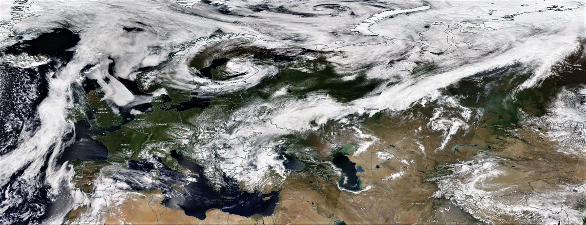
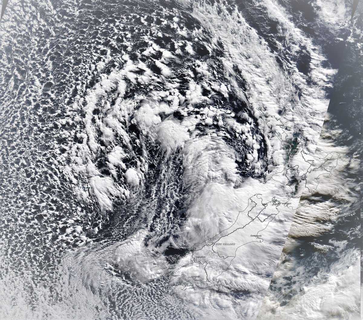
The three weather systems bumping into each other over Ireland illustrate this nicely.
The three weather systems bumping into each other over Ireland illustrate this nicely.
Again, this probably wasn't on @antonioguterres's mind during his announcement, but it could have been. This GFS animation shows massive four water vapour pipelines pumping moisture into Europe over the next seven days, two of which we can see in the animation above.
This animation shows the Eastern side of the Atlantic this morning. Top left a large wet north Atlantic cloud mass is pushing in from the west.
Bottom left a #WesternSaharaPlume sourced fromthe Atlantic is crossing Algeria & disrupting weather around the Black Sea, upper right.
Bottom left a #WesternSaharaPlume sourced fromthe Atlantic is crossing Algeria & disrupting weather around the Black Sea, upper right.
Here's a closer view of the collision this afternoon. The storm front advancing up the Moroccan coastline is splitting in two as it is colliding with a high pressure system heading south. Half is going east along the med. Half north west over Ireland.
This close up shows the eastern arm of the Atlantic plume coming up the Western Sahara Coast. The western arm is also there but not visible as its not condensing and forming into cloud.
Here's view of this from the satellites who can see the invisible water vapour. This is a forecast but only six hours into the latest run it is as good as a weather observation.

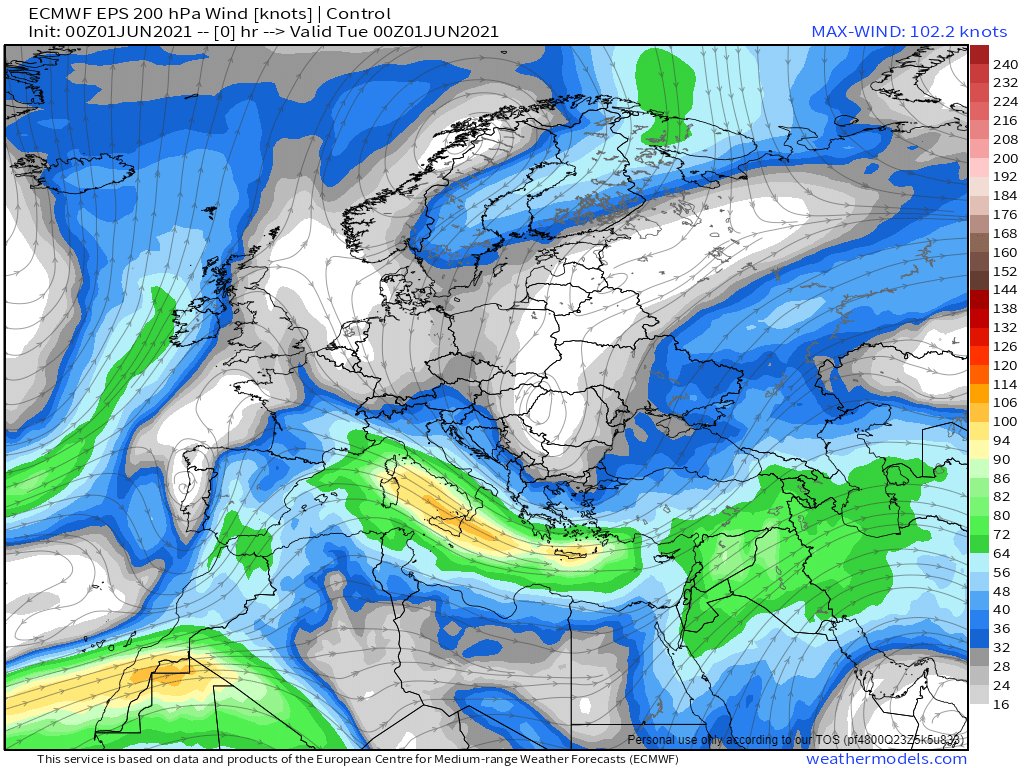
And here is a view of Europe in a week's time, after the subcontinent has been fully filled with moisture.

In case you are wondering. This is not what is expected in June in Europe.
I cannot say with confidence that this has never happened before, but I seriously doubt it. And it may not.... this is only a forecast. But over seven days these things are now pretty reliable.
I cannot say with confidence that this has never happened before, but I seriously doubt it. And it may not.... this is only a forecast. But over seven days these things are now pretty reliable.
So here are today's 10-day North Africa rainfall forecasts.


Ethiopia and the Horn of Africa.


The Middle East....


Europe...


India....


Eurasia...


Apologies for the late delivery of these forecasts today and the abbreviated format. Internet connectivity issues.
/ENDS
@Threadreaderapp unroll
/ENDS
@Threadreaderapp unroll
• • •
Missing some Tweet in this thread? You can try to
force a refresh