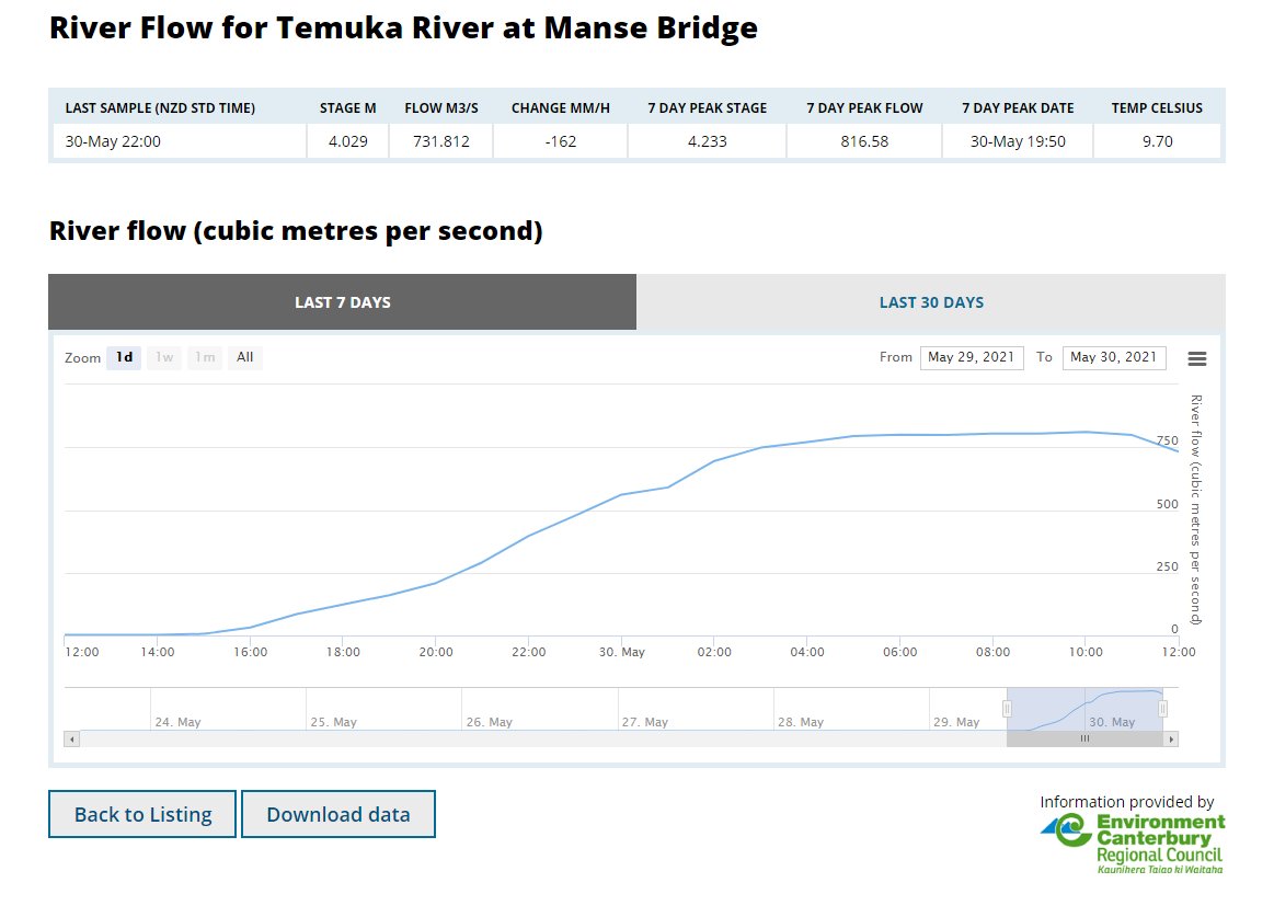
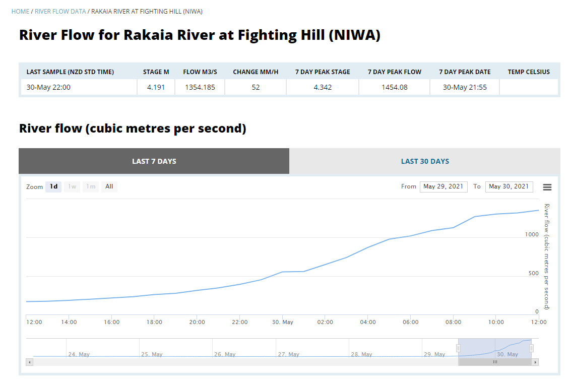
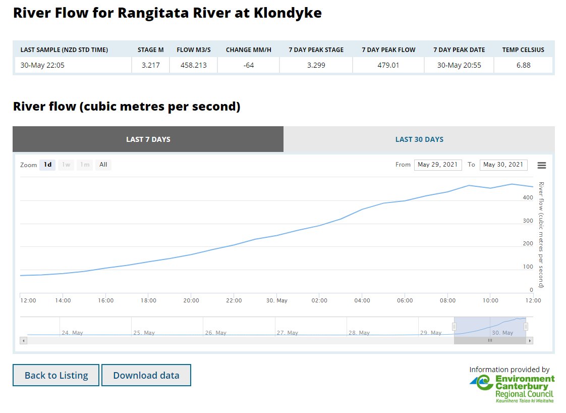
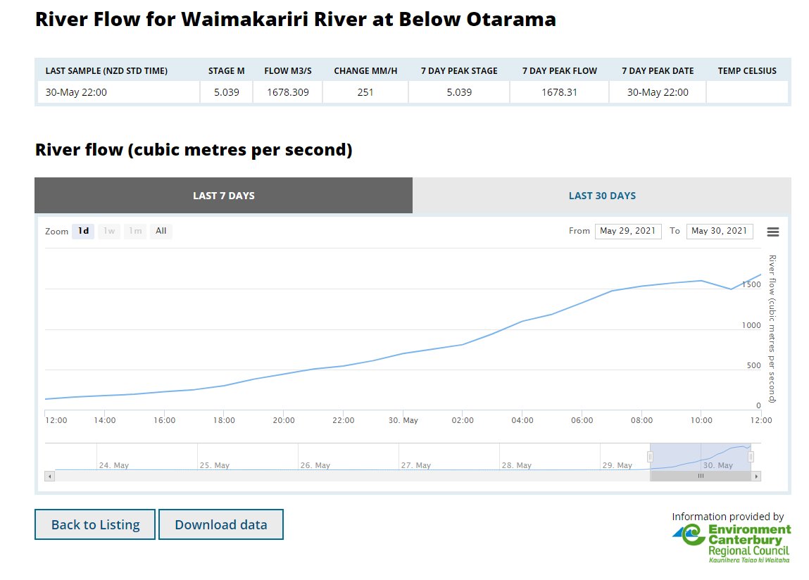
Upstream flow gauges in Temuka, Rangitata, Rakaia & Waimakariri appear to be peaking or in the case of the Waimakariri close to peaking.
Meanwhile the official ECAN alerts page seems to not be freaking out, so that's all good >> ecan.govt.nz/home/flood-war….
Steady as she flows.
"Breakouts" in the Ashburton vicinity & inland, are the major concern at present. But whatever "breakouts" are they sound a lot less alarming than floods and evacuations.
Also no alarm around the major rivers, yet. Also good.
The remaining concern will be river mouth flood/tide collisions. High tide timing today is around 6.30am near Timaru, 7.50am at the Rakaia and around 8.30am in Christchuch and at the Waimakariri river mouth.
And there is also 40kmh onshore wind and waves. However on the other hand these are steep rivers, they are not very tidal and the river beds and mouths are designed for huge floods. And as ECAN isn't mentioning them I don't think they are worried either. Except about sightseeing.
As usual,the worst flooding will almost certainly be in Christchurch itself, as it is low lying and has never sorted out its rivers, over more than 150 years.
As for who to blame, if it happens again, I nominate Brownlee. He was in charge and his electorate was flood prone.
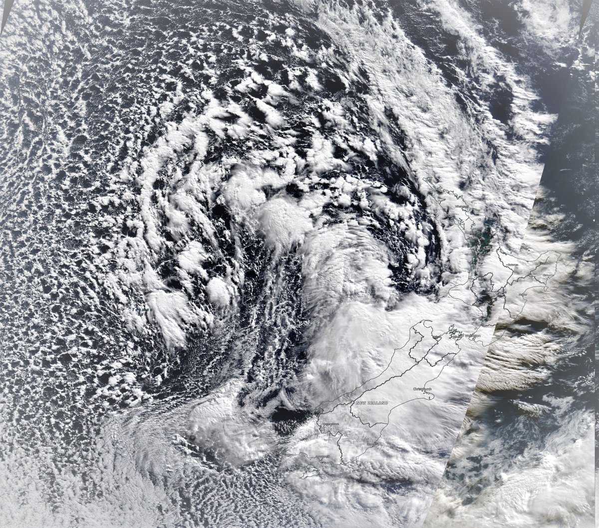
Meanwhile this storm is still full on blasting Te Wai Pounamu's East Coast with high winds and rain from Oamaru to Wellington now just after midnight.
Tomorrow is going to be a terrible day to be on the roads in NZ. Everywhere from the look of things.
• • •
Missing some Tweet in this thread? You can try to
force a refresh
Well its hard to know where to begin with today's #MiddleEast and #HornOfAfrica rainfall forecasts.
The action is now further north, and west. Here we see the consequences of the first phase of what appears to be becoming a continuous #WesternSaharaPlume.
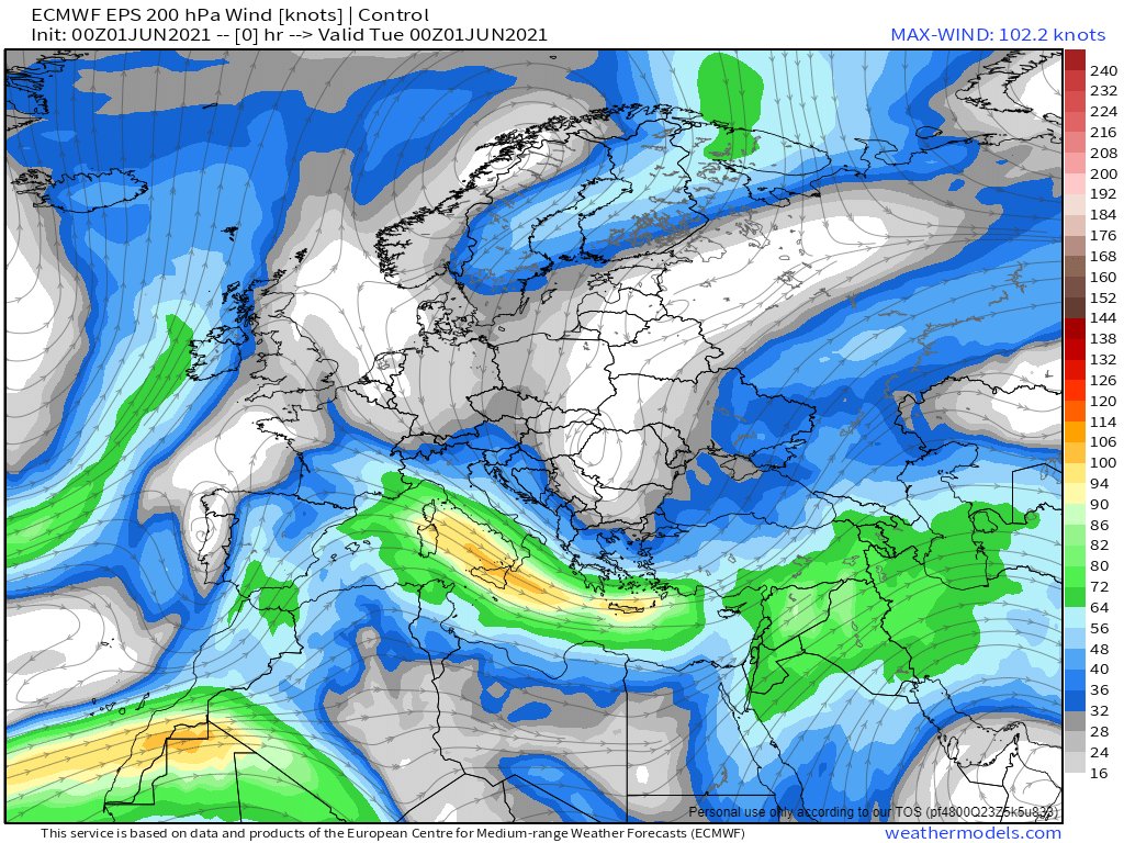
An bit of a battle us underway between a high pressure system over Northern Erope and the plume which is entering at the bottom left in this image of Jetstream level 250Hpa 11km high winds.
While the model forecasts remain optimistic that an orderly jetstream may eventually appear, so far this has not happened. And in the meantime these winds are picking up moisture in the tropics and taking it in large quantities to places where its not expected.
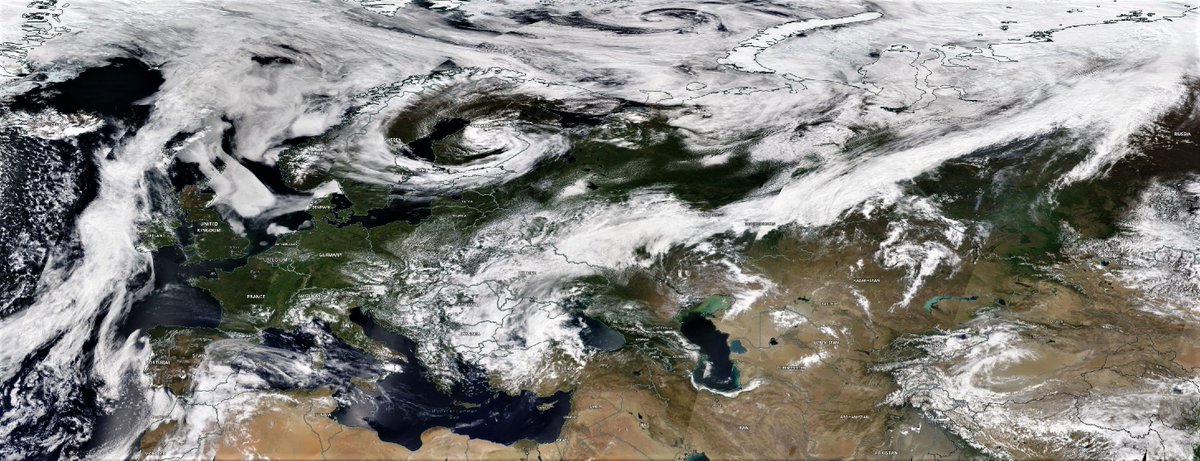
A full plume event is becoming obvious in central & eastern Europe + Russia. We also have thunderstorms over the Red Sea, and a low circulation heading towards a collision with water vapour over Israel.
Today's forecasts follow.
Visually speaking this is the most extraordinary looking satellite observation of the day.
Now into its sixth day the #EastAfricaWaterPlume has been generating lots of rain over the Red Sea, both last night and today, & right now just off the coast of Jeddah. @Arab_Storms
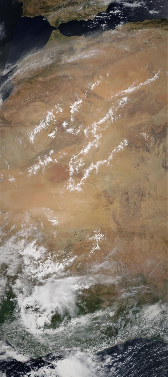
Here we see a wider view while it is not that obvious in this view, the stream of water vapour heading up the Western Sahara coast is running fast and hot. Later I will post an initial post tracking its impact in Europe. But for now its worth looking closer at North Africa.
Here is a wider view. This will definitely continue through a fair bit of the night. Question is now how long will it continue tomorrow? The forecast models showed the plume you see coming in from the right sort of petering out and disengaging and tracking north.
NOTE: This is not an official forecast. But it is alarming. It seems that that peculiar cloud formation is special in a number of rather alarming ways. [Image: @NOAA's GFS model forecast, latest run.]
With Cyclone #Yaas soaking up all the moisture east of the #MiddleEast and #HornOfAfrica it was a relatively calm day. Albeit not without another intense set of storms along the Red Sea Coast in the Jinzan mountains.
Today's rainfall forecasts follow.
The days began relatively quiet on the #WestAfricanMonsoon front thanks to Cyclone #Yaas. This image shows a strip from the Libyan Coast across the Sahara down to the Congo.
And it remained fairly quiet over the great forests of equatorial Africa today. But further West over the Ivory Coast and the West Sahara the #WestAfricaWaterPlume continued to pump water vapour across the Sahara into Europe.
Here is the continuation of the #WestAfricaWaterPlume transformation of European weather this morning into something which is both unpredictable and not particularly nice, i.e. windy wet and cold.
The following three animations are offered to help Europeans who are curious to understand what is going on. Our weather reports tend to be geographically confined in a manner that obscures the bigger picture.
The first shows the water vapour picture over 84 hours till Friday arpund midday. The #WestAfricaWaterPlume can be seen coming in bottom left over Algeria. simultaneously another storm is coming in at speed into the British isles. Hence all the rain.