A big day for #WestAfricaMonsoon observation.
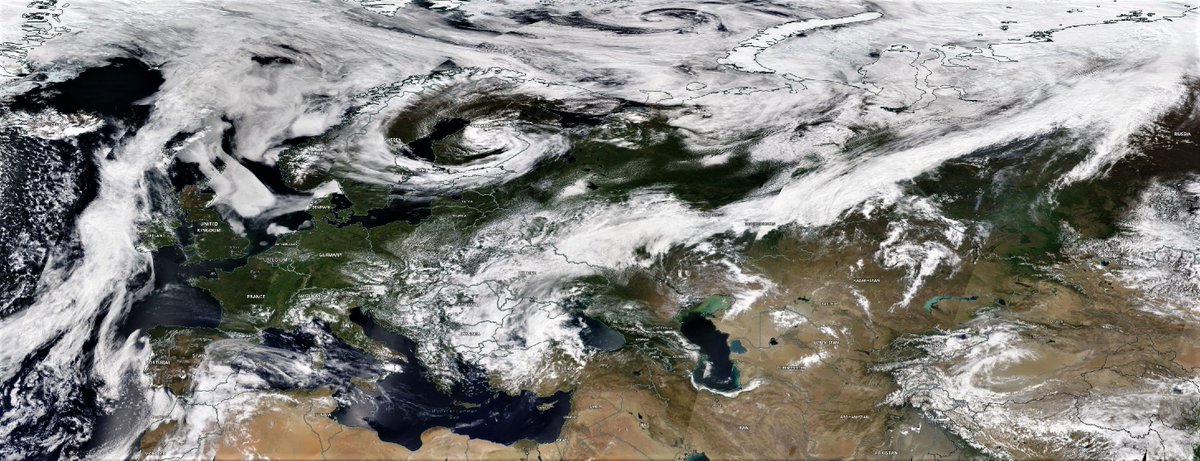
A full plume event is becoming obvious in central & eastern Europe + Russia. We also have thunderstorms over the Red Sea, and a low circulation heading towards a collision with water vapour over Israel.
Today's forecasts follow.
A full plume event is becoming obvious in central & eastern Europe + Russia. We also have thunderstorms over the Red Sea, and a low circulation heading towards a collision with water vapour over Israel.
Today's forecasts follow.
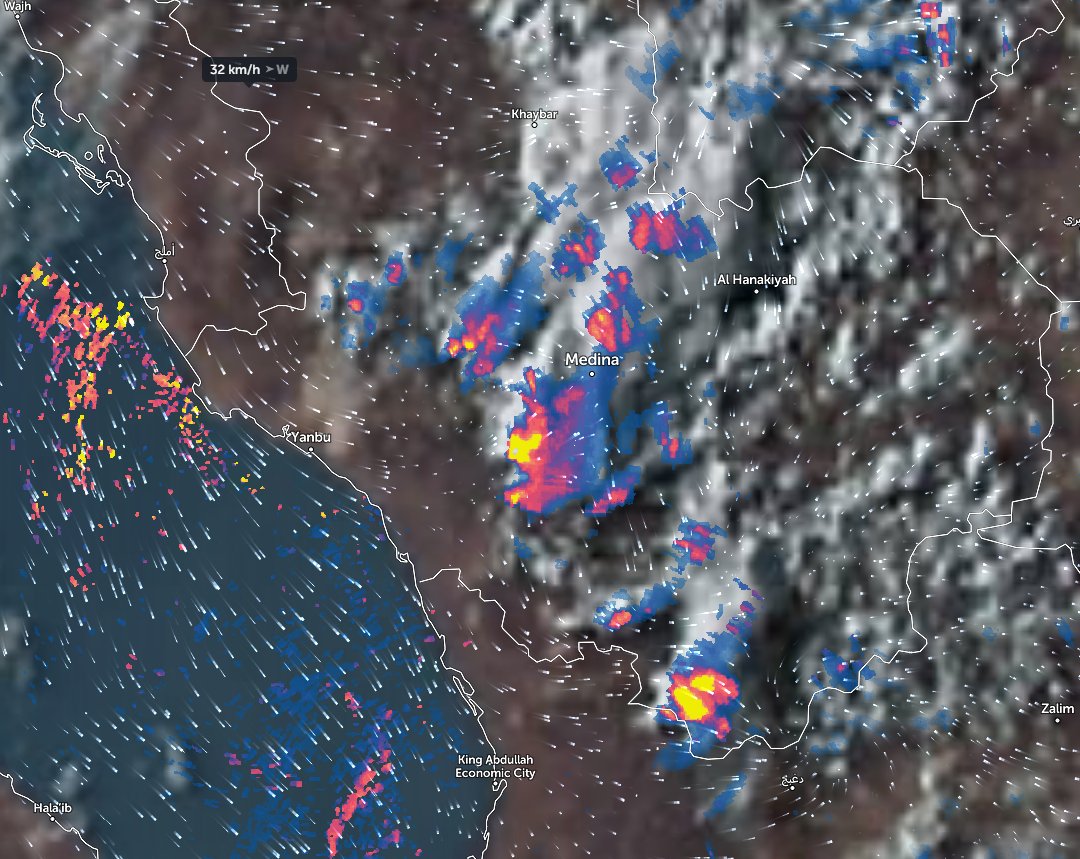
Visually speaking this is the most extraordinary looking satellite observation of the day.
Now into its sixth day the #EastAfricaWaterPlume has been generating lots of rain over the Red Sea, both last night and today, & right now just off the coast of Jeddah. @Arab_Storms
Now into its sixth day the #EastAfricaWaterPlume has been generating lots of rain over the Red Sea, both last night and today, & right now just off the coast of Jeddah. @Arab_Storms
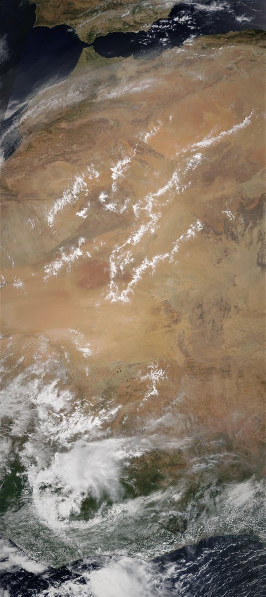
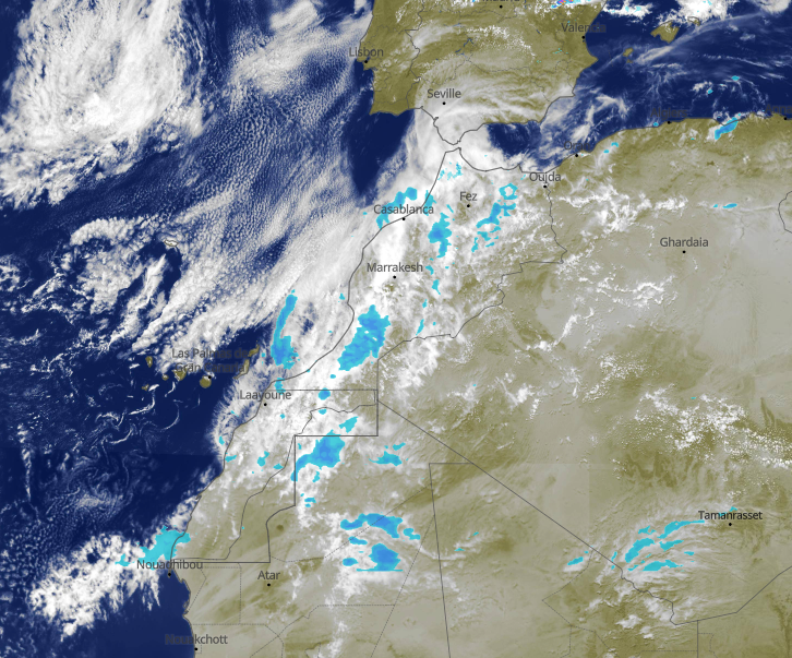
Here we see a wider view while it is not that obvious in this view, the stream of water vapour heading up the Western Sahara coast is running fast and hot. Later I will post an initial post tracking its impact in Europe. But for now its worth looking closer at North Africa.
This strip up the coast of Western Sahara is mostly desert and this #DesertRain has now been falling pretty much continuously for serveral days, not just here but also inland over Algeria. The rain field is roughly three times the size of the UK. This is small in Sahara scale. 
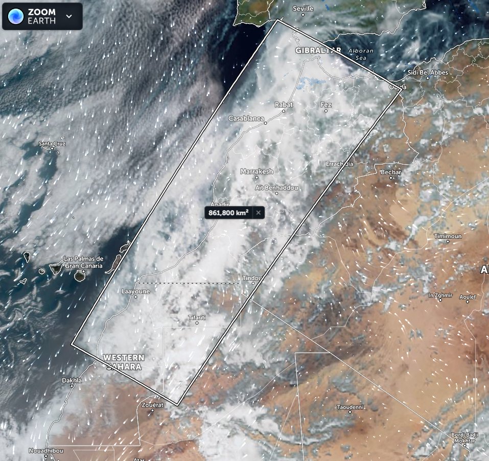
Here's another view of the tip of this latest #WestAfricaWaterPlume, the third major one this year, showing its speed, power and trajectory. This has consistently involved a right turn, aiming for the southern end of Italy and Sicily with a lot of moisture heading south-east.
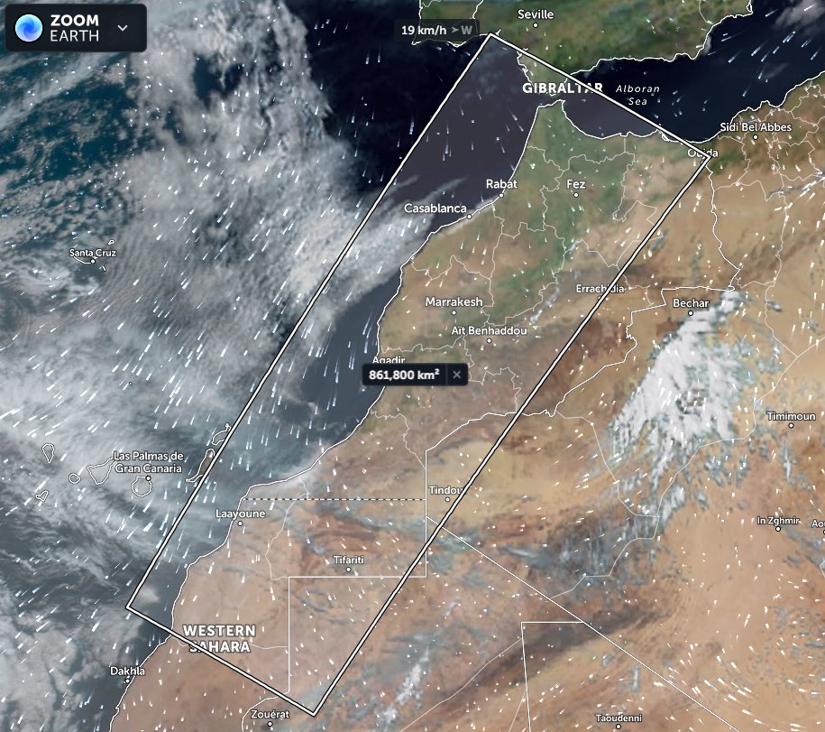
This view shows Mediterranean Sea cloud movements from which you can just discern the trajectory of the water vapour which is heading in multiple directions simultaneously. Some north east over the Black Sea and a lot east-south-east along the Med. coast towards the Levant.
In this animation you can see the broader picture, including were it seems most of the moisture traversing Europe the last few days is headed, up a well trodden past to the east of Moscow into the Arctic. This time the trajectory is the lowest it has been thus far.
For now though we will maintain our attention on the Middle East and North Africa where possibly the most interesting #ArabianStorms activity to date is underway. There is a lot going on in this image from the first post in this thread. And we are going to break it down a bit.
But first some background. This is the area in which we now think what we call "civilisation" - i.e. cities & states - first appeared in the Western Hemisphere.
This @The_Histocrat series is a perfect introduction to this subject. youtube.com/playlist?list=…
This @The_Histocrat series is a perfect introduction to this subject. youtube.com/playlist?list=…
The archeological record from this area suggests in the relatively recent past i.e. within the last 20,000 years there was significant climatic change here, including as recently as the beginning of Egyptian civilization forests, grasslands and wild game.

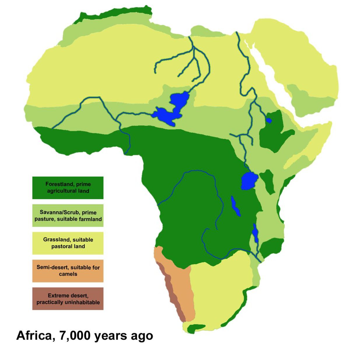
In this more humid world the area around the red-sea was the bridge between Asia and Africa and it is thought that humans migrated in both directions through here possibly for millions of years. And this may also explain in some part why this area is so religiously important.
The areas in which we are seeing interesting storm and cloud activity today are the areas which appear to be where humanity discovered farming around 18,000 years ago.
And there are other interesting things about today's weather besides.
And there are other interesting things about today's weather besides.
Today's weather has several novel properties not yet seen.
1. meandering and moderate ground level winds.
2. thunderstorms over the red sea
3. a layer of higher altitude water transport across Egypt into Jordan/Israel.
& a modest system with associated moisture west of Cairo.
1. meandering and moderate ground level winds.
2. thunderstorms over the red sea
3. a layer of higher altitude water transport across Egypt into Jordan/Israel.
& a modest system with associated moisture west of Cairo.
A characteristics of these #WestAfricanMonsoon plumes is their complexity. Multiple plume streams appear to be located within the same stack of air.
Here are three.
1. cloud at top is heading north.
2. In middle a low heading east
3. Right bottom high-alt clouds north east.
Here are three.
1. cloud at top is heading north.
2. In middle a low heading east
3. Right bottom high-alt clouds north east.
And then when you look at this with ground level winds over laid you see none of this movement relates at all to what is happening above.
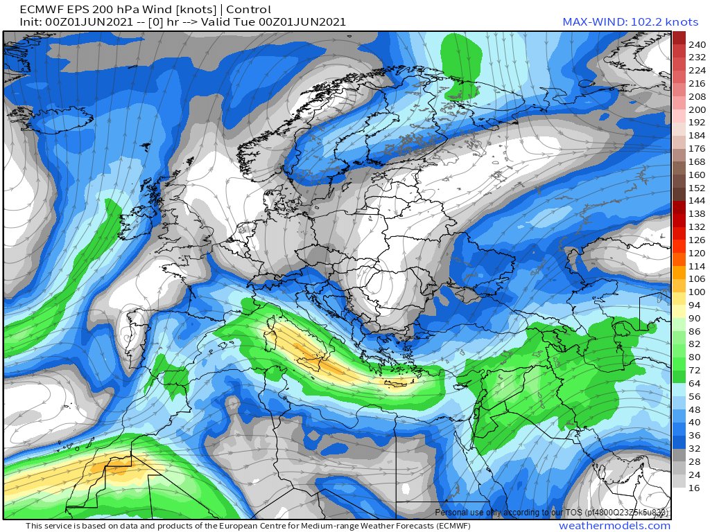
Moreover all this is completely befuddling all the weather models.
Moreover all this is completely befuddling all the weather models.
Specifically: The 2 leading weather models, US GFS and Euro ECMWF, have not been able to forecast rainfall in the #middleeast with even a modicum of accuracy for the past two months. Why? And why have there been large storms in Saudi every day for weeks?
What has changed?
What has changed?
I confess have no answers to these questions, but I am definitely very curious, hence this series.
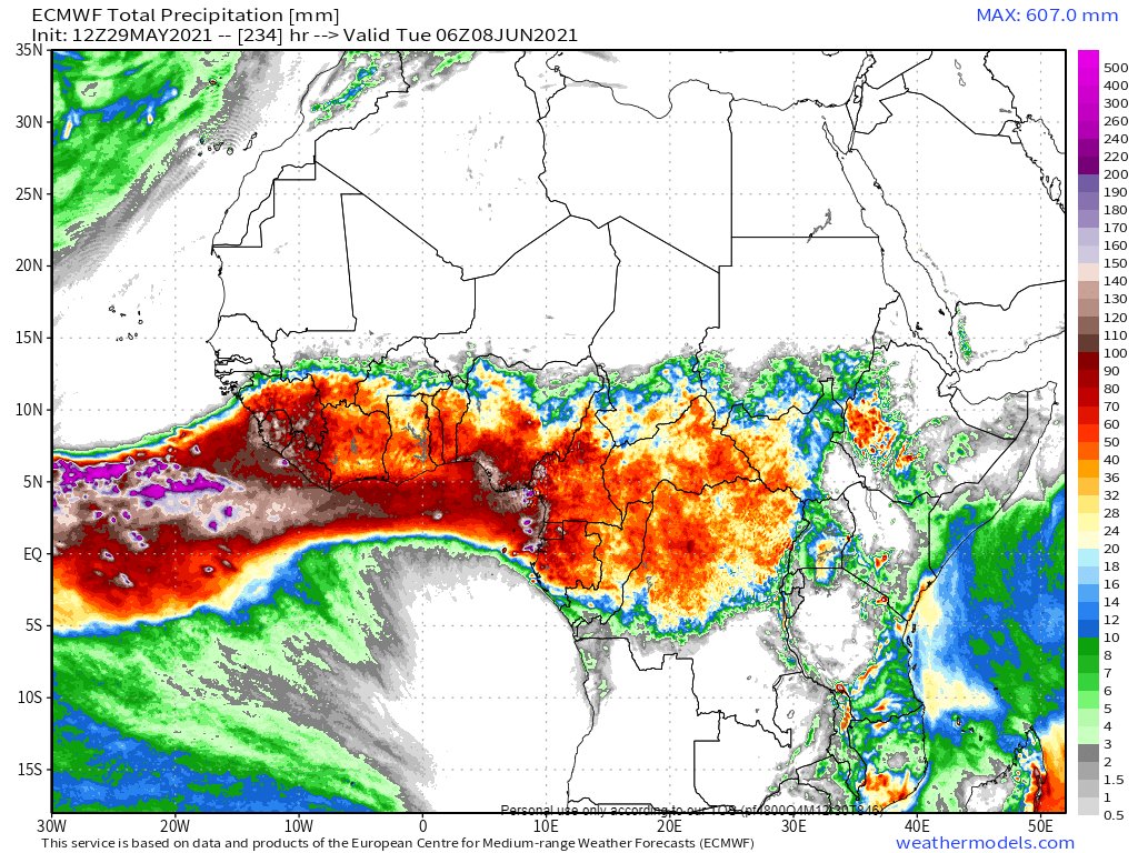
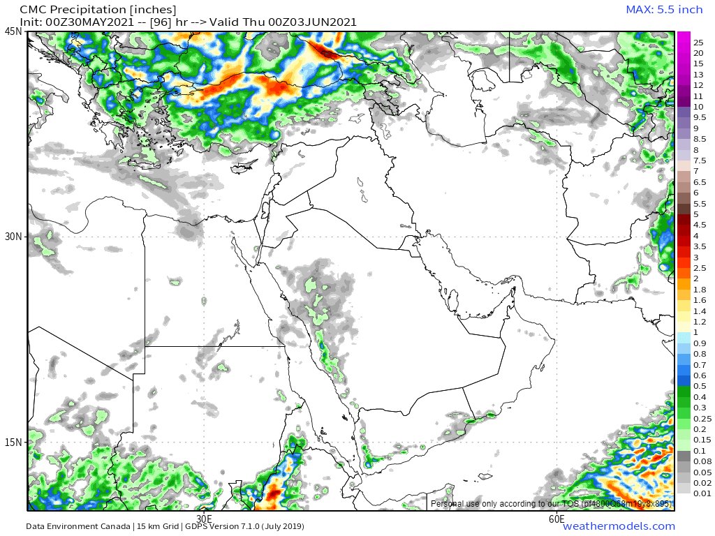
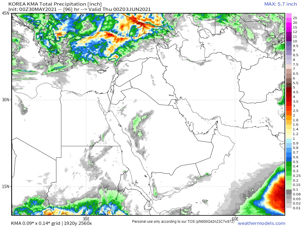
Which brings me to today's forecasts. Starting with today's 10-day North African accumulated rainfall prognostications from the CMC, KMA, GFS and ECMWF models.
Which brings me to today's forecasts. Starting with today's 10-day North African accumulated rainfall prognostications from the CMC, KMA, GFS and ECMWF models.
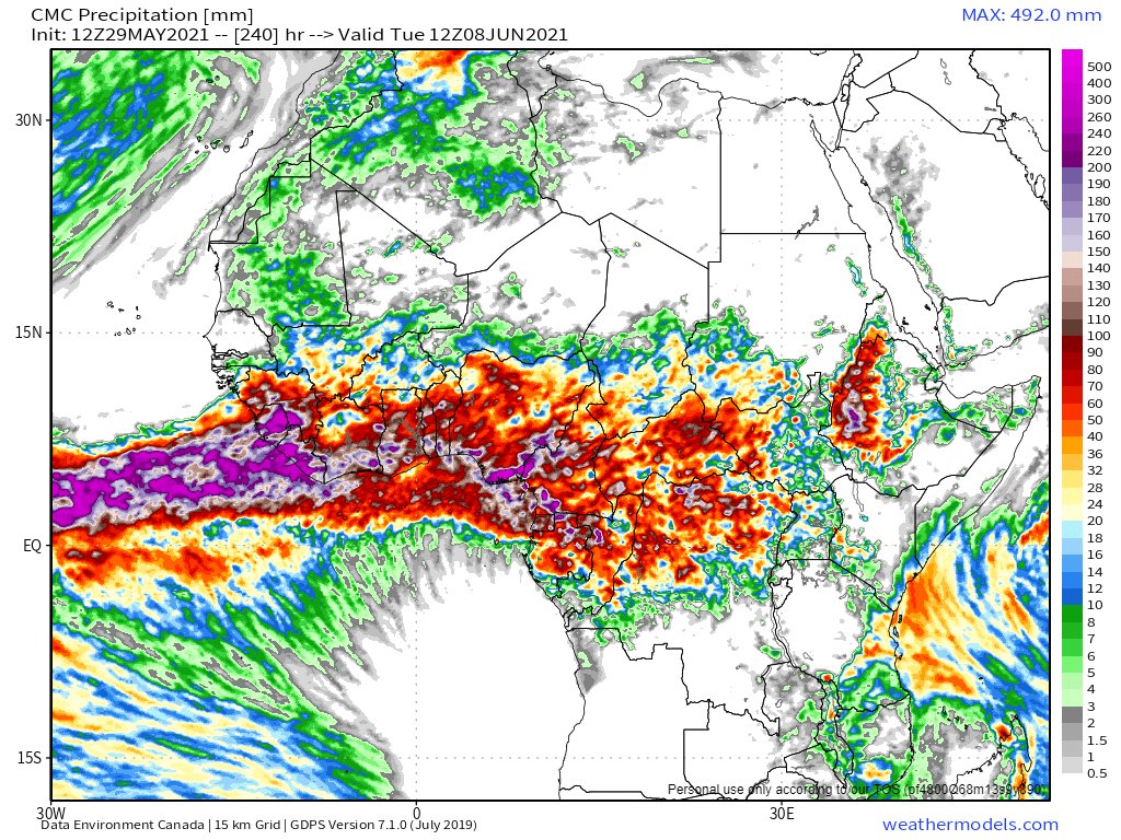
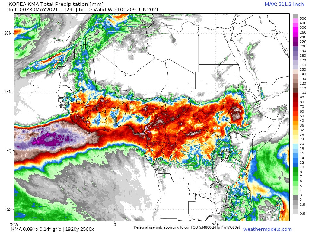
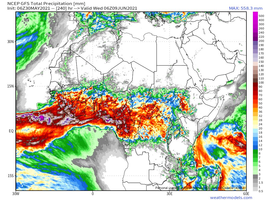
Here's the CMC water vapour model over 10 days.
Frankly it seems implausible.
It looks like the Sahara is going to find itself fully covered with water vapour. But thing is, over time the CMC model is often getting this thing right. Also the others now say much the same.
Frankly it seems implausible.
It looks like the Sahara is going to find itself fully covered with water vapour. But thing is, over time the CMC model is often getting this thing right. Also the others now say much the same.
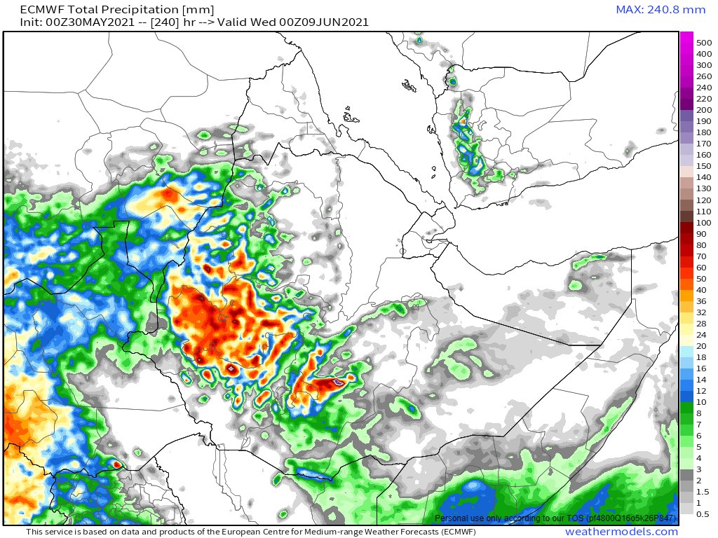
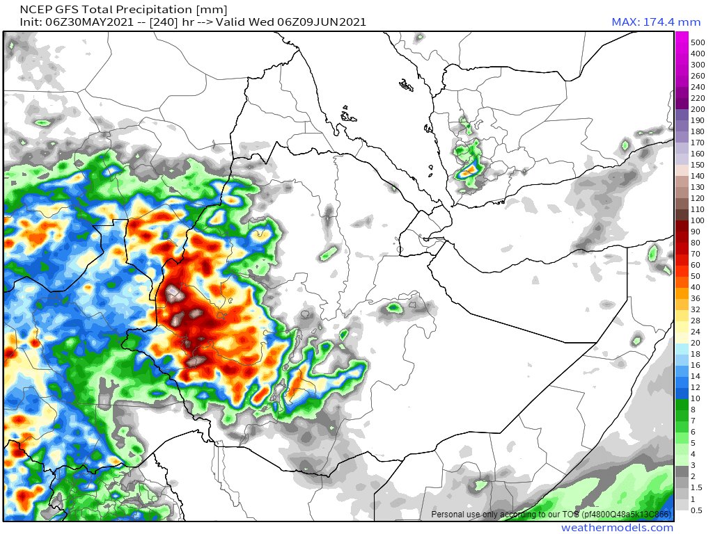
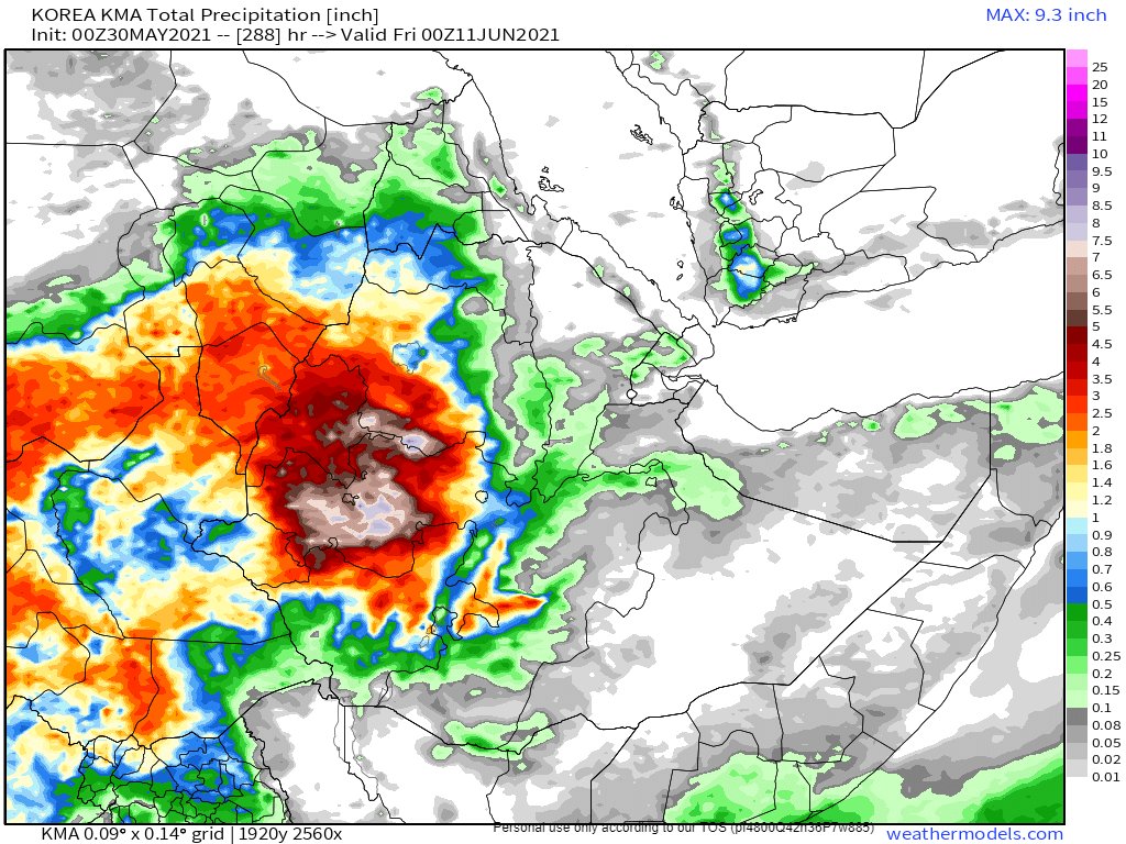
Here are today's #HoA rainfall forecasts.
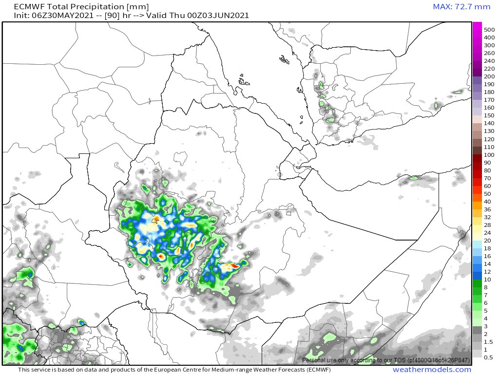
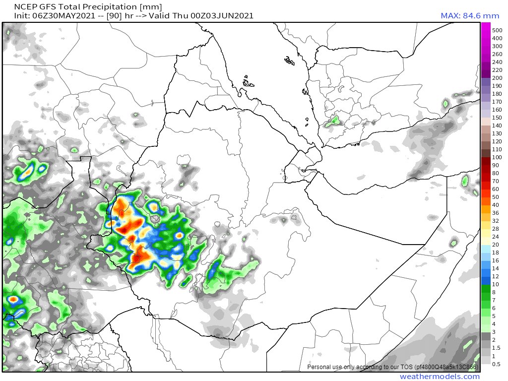
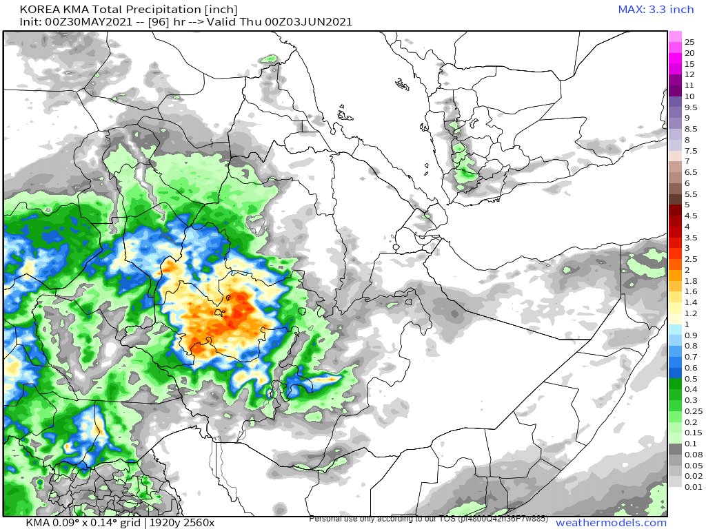
30th May 10-day rain (plus 12 day from KMA) forecasts for the #HornOfAfrica. The three models are now closer to each other than they have been for a couple of weeks.
#Sudan #SouthSudan #Ethiopia #Somalia #Somaliland #GERD
30th May 10-day rain (plus 12 day from KMA) forecasts for the #HornOfAfrica. The three models are now closer to each other than they have been for a couple of weeks.
#Sudan #SouthSudan #Ethiopia #Somalia #Somaliland #GERD

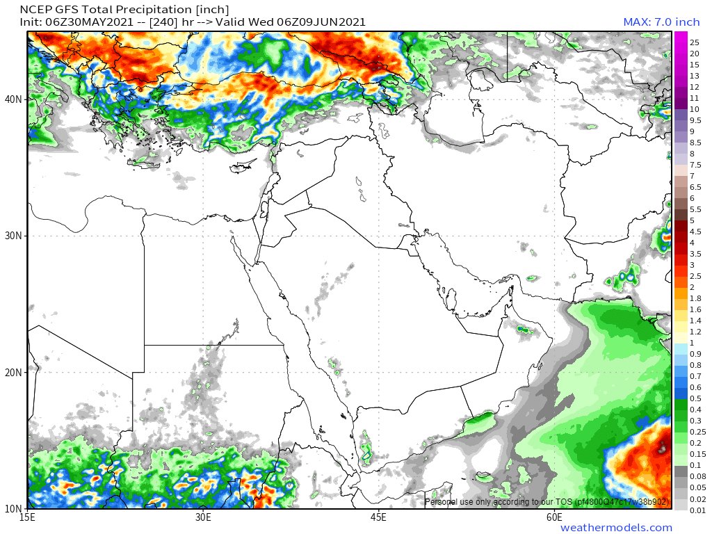
And 3-Day rain forecasts to midnight Wednesday.
It seems the clear weather in the Horn will persist for a bit longer before the rains return to full strength.
#Sudan #SouthSudan #Ethiopia #Somalia #Somaliland #GERD
It seems the clear weather in the Horn will persist for a bit longer before the rains return to full strength.
#Sudan #SouthSudan #Ethiopia #Somalia #Somaliland #GERD
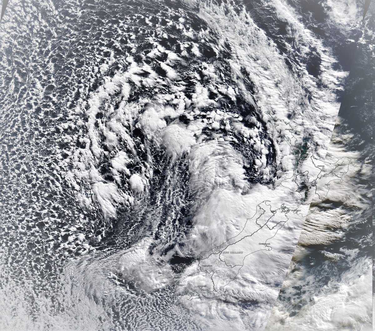
Today's view over the #HornOfAfrica is wonderfully clear.
[Thanks to @NASA Modis Worldview, for its service to this planet.]
[Thanks to @NASA Modis Worldview, for its service to this planet.]

A selection of videos follow collected by @Arab_Storms from eyewitnesses of the extraordinary weather being seen at the moment in the Western Hemisphere.
This first one is from Algeria from Saturday evening.
This first one is from Algeria from Saturday evening.
https://twitter.com/Arab_Storms/status/1399030695981375498?s=20
This video showing an extraordinary lightning display is from the Prophet's City Medina, in Saudi yesterday.
It has been raining in Medina again today for most of the afternoon.
It has been raining in Medina again today for most of the afternoon.
https://twitter.com/Arab_Storms/status/1398927119741292548?s=20.
And finally a video from Taif, which is just inland from Mecca where it has been raining and hailing again today. By now Taif's rainfall so far this year must be quite high.
https://twitter.com/Arab_Storms/status/1399015734227836938?s=20
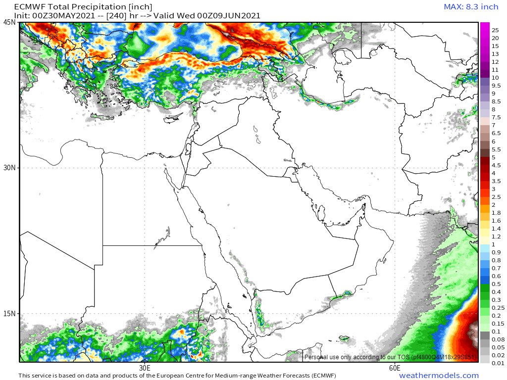
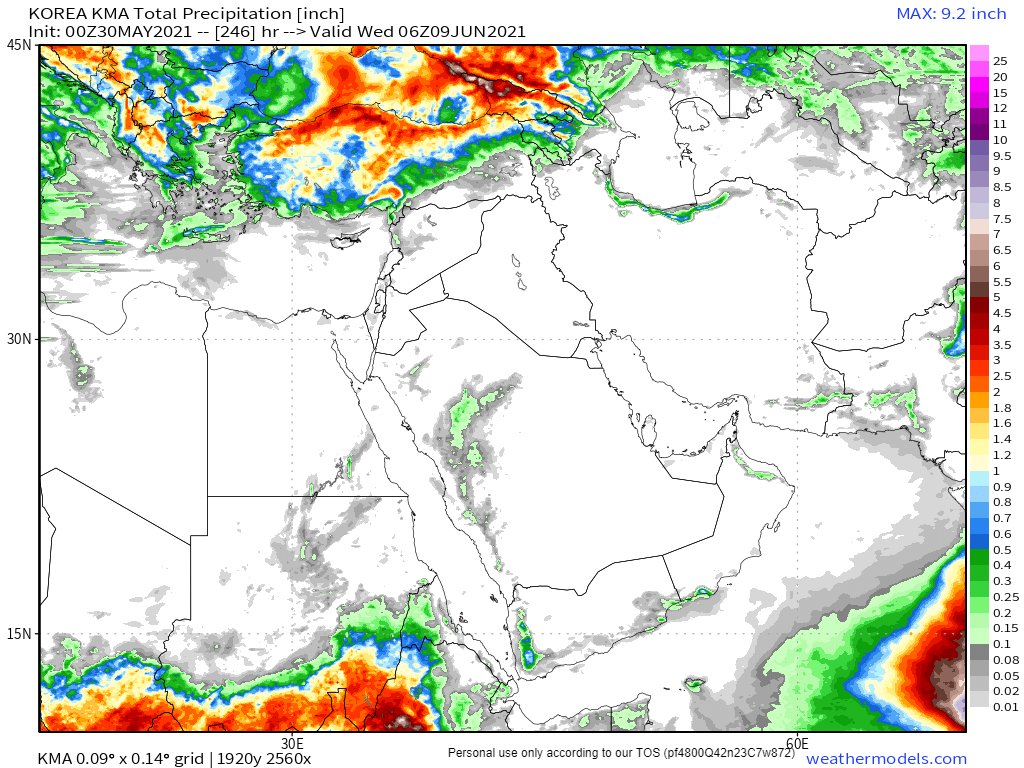
May 30th, 10 day accumulated rain forecasts for the #MiddleEast from the GFS, ECMWF, CMC & KMA weather models.
@Arab_Storms
#ArabianStorms
#KSA #Yemen #Oman #Jordan #Sudan #Iran #Syria #GERD #Sudan #DesertRain
الله أعلم
@Arab_Storms
#ArabianStorms
#KSA #Yemen #Oman #Jordan #Sudan #Iran #Syria #GERD #Sudan #DesertRain
الله أعلم

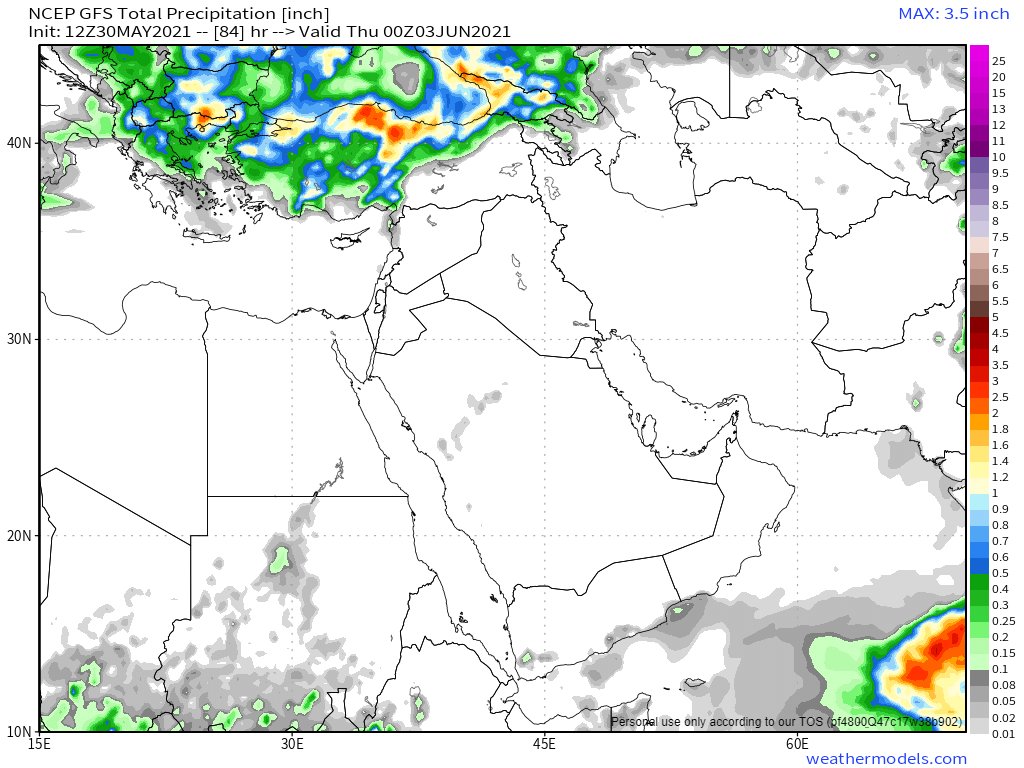
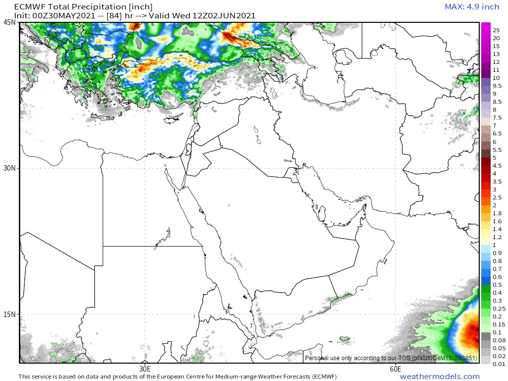
And 3 day forecasts from the same models to midnight Wednesday.
@Arab_Storms
#ArabianStorms
#KSA #Yemen #Oman #Sudan #Iran #Sudan #DesertRain #Makkah
الله أعلم
@Arab_Storms
#ArabianStorms
#KSA #Yemen #Oman #Sudan #Iran #Sudan #DesertRain #Makkah
الله أعلم
And its a wrap....
• • •
Missing some Tweet in this thread? You can try to
force a refresh