Make that three threads. This year we have seen some specific identifiable climate anomalies/abnormalities which are brought us these storms, and which are far from over.
@jonathanwatts And this pictorial thread from back in May was an attempt to draw attention to the strange weather Europe has experienced since the Spring. It focuses on the role of the West Africa Monsoon which is contributing to the current storm.
Climate scientists are not really that interested in specific causation processes, just the results. What is happening in Europe is actually very obvious - there is much more water in the atmosphere, coming from the tropics.
@jonathanwatts The polar vortex is completely borked and jets are running wild as a result with water being transported in unusual quantities on unusual vectors. This storm being one example of many.
• • •
Missing some Tweet in this thread? You can try to
force a refresh
This thread provides a tour of the global biosphere in pictorial form.
The animations were acquired from @zoom_earth on July 14th, and take us on a journey beginning in the North East Pacific over the course of a single day.
There has been a sharp increase in discussion of climate change weather extremes in the context of the flood calamity in Western Europe, wildfires in the North West US, and the #ArabianMonsoonBurst
This thread looks at the big picture right now. What's next?
The image above from @meteoblue shows most of the Northern Hemisphere & rainfall at the moment. The intense blobs of colour indicate high rainfall from thunderstorms.
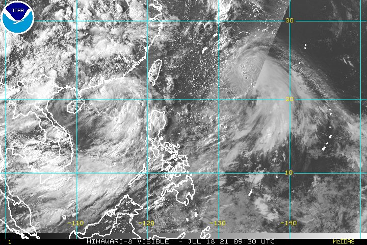
What is immediately apparent looking at this is that there is an immediate issue now in the West Pacific.
What will soon be Typhoon In-Ha is forecast to make landfall in Taiwan and then stall bringing massive rainfall to the Philippines, China and Taiwan.
There is second tropical storm to the left of what will soon be In-ha which is simultaneously bringing extreme weather to HK.
The German and European low country flooding of last week is astonishing and terrifying. This thread compiles youtube videos of the coverage. The death toll is still expected to rise significantly.
The previous video was @Channel4News 16th July report. Here is their 17th July report.
The animation above is for 12 hours hence the arriving and departing light effect. As always the engine behind this is the Indian Monsoon which you can see here this morning gathering strength.
A close up from the end of today shows how the big storms over #SaudiArabia are generating new atmospheric rivers of moisture, or plumes, over the Sahara, you can see these top right.
[Note: Atmospheric rivers are often invisible, this one becomes visible as night falls.]
This is a long statement, probably a bit too long, but interesting and important. My reading is that Ethiopia has not yet decided to abandon the unilateral ceasefire, but that frustration is going, both with the TPLF and their ongoing offensive....
... and with ongoing one-sided diplomatic/media understanding of the Tigray conflict.
The @nytimes story from @declanwalsh (see below) has become a lightning rod for public and government concerns that Ethiopia is not being listened to or being given due respect internationally.
The German storm has now, as forecasted move south east and is now centered over the Adriatic. Its presentation has the appearance of a storm which is receiving its energy from an Atmospheric River of water.
Here's a 90 hour accumulated forecast for Italy. The storm is continuing to move very slowly.