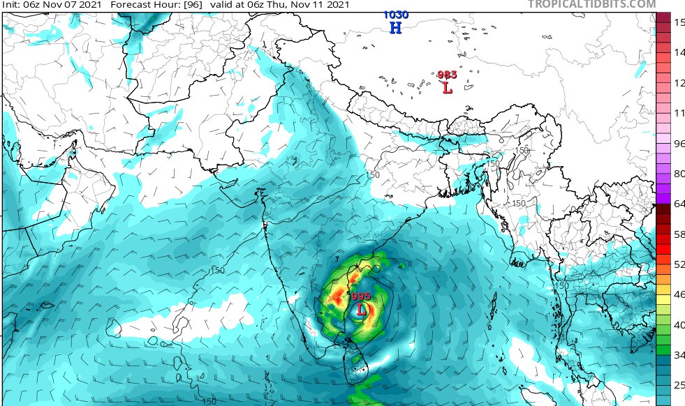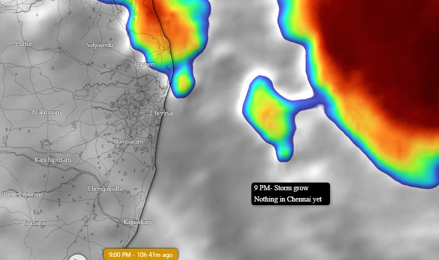
Extremely heavy rainfall alert for #Chennai
Close to 200+ mm rainfall is expected in most places in the city overnight.
#ChennaiRains #ChennaiRain #ChennaiRains2021 #ChennaiFlood #Chennai1913 #chennaiairport #ChennaiCorporation #TamilNaduRains #TamilNadu #TamilnaduRainUpdate
Close to 200+ mm rainfall is expected in most places in the city overnight.
#ChennaiRains #ChennaiRain #ChennaiRains2021 #ChennaiFlood #Chennai1913 #chennaiairport #ChennaiCorporation #TamilNaduRains #TamilNadu #TamilnaduRainUpdate

I am still seeing messages where people are asking whether it would rain as it is being "hyped". Please note that if it doesn't happen we would be the happiest.
But unfortunately - the blogging community on the whole is of the same opinion that there would be heavy rains
But unfortunately - the blogging community on the whole is of the same opinion that there would be heavy rains
Not only Chennai
#Kanchipuram #Chengalpattu #Kallakurichi #Villupuram #Cuddalore #Nagapattinam #Karaikkal #Pondicherry #Ranipet #Thiruvallur #Vellore and even #Krishnagiri should be on high alert as the system is expected to move inland
#Kanchipuram #Chengalpattu #Kallakurichi #Villupuram #Cuddalore #Nagapattinam #Karaikkal #Pondicherry #Ranipet #Thiruvallur #Vellore and even #Krishnagiri should be on high alert as the system is expected to move inland
Take care of your near and dear ones, charge your phones and power banks as quickly as possible and move to safe places.
Remember one thing- this is as extraordinary a situation as #ChennaiFloods 2015
#Rains will continue till tomorrow afternoon post which it will reduce
Remember one thing- this is as extraordinary a situation as #ChennaiFloods 2015
#Rains will continue till tomorrow afternoon post which it will reduce
This system - 80% - will cross land as a deep depression. Models are suggesting that it would cross right through #Chennai . In that case, Southern #AndhraPradesh would also receive good rainfall owing to outer bands.
20% chances still exists for this to become a #cyclone
20% chances still exists for this to become a #cyclone
And most importantly- do not venture out and stay home. A humble request to all the private companies would be to encourage people to work from home or if not provide a day leave. And this would save many from getting stranded.
Keep your vehicles in high-rise areas - and thereby you can avoid any damage. There are reports of water contamination and related infections. So boil the water and drink. Have your essentials - rice, biscuits etc.
I think I have covered all aspects of a disaster. Humble request again- stay safe wherever you are. We will get through this.👍
Follow #government agencies for all emergency updates.
Shall try to stay connected as much as I can- with regular updates.
Follow #government agencies for all emergency updates.
Shall try to stay connected as much as I can- with regular updates.
• • •
Missing some Tweet in this thread? You can try to
force a refresh


