Tim Davis Profile picture
Dec 27, 2021 10 tweets 12 min read Read on X
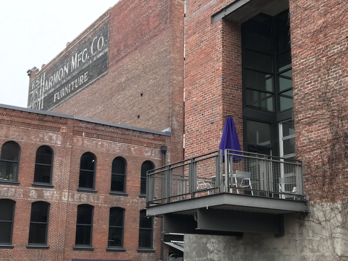
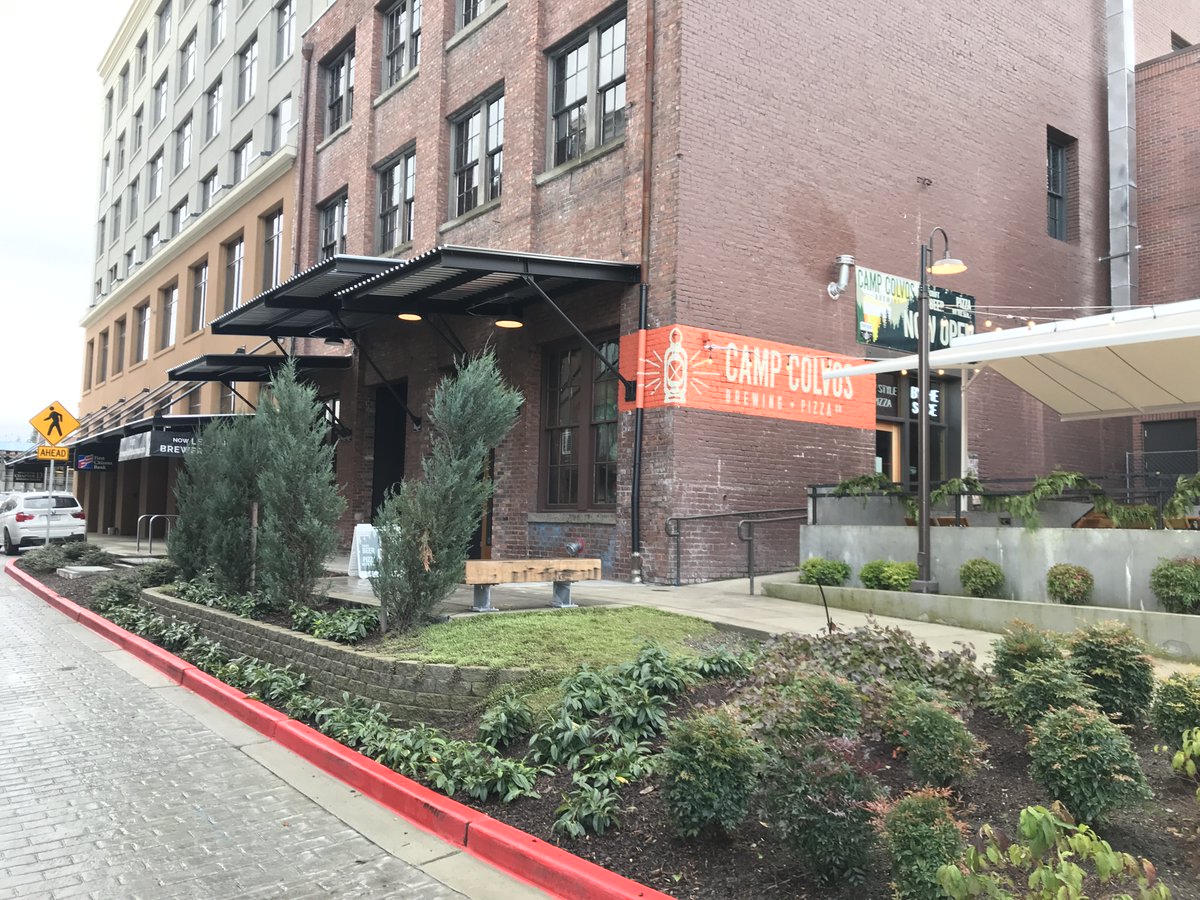
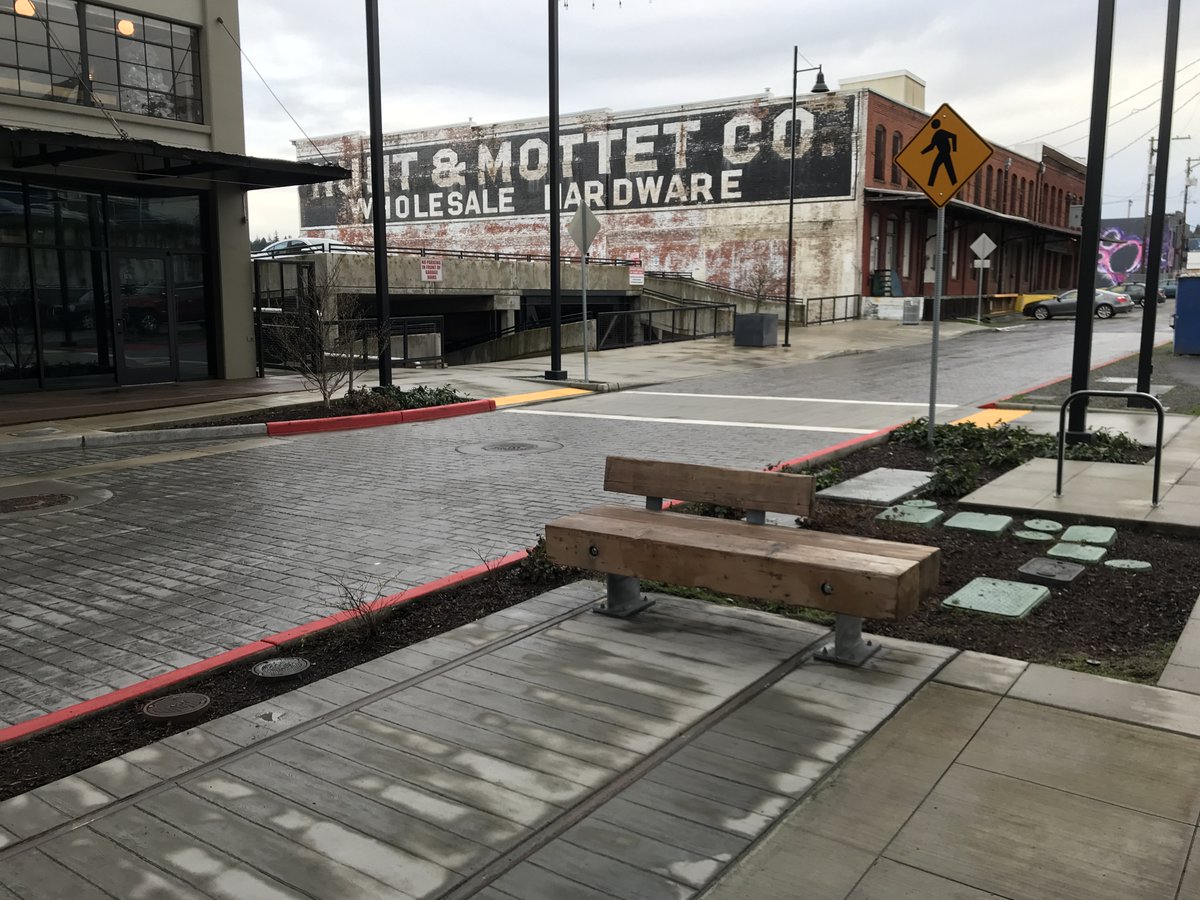
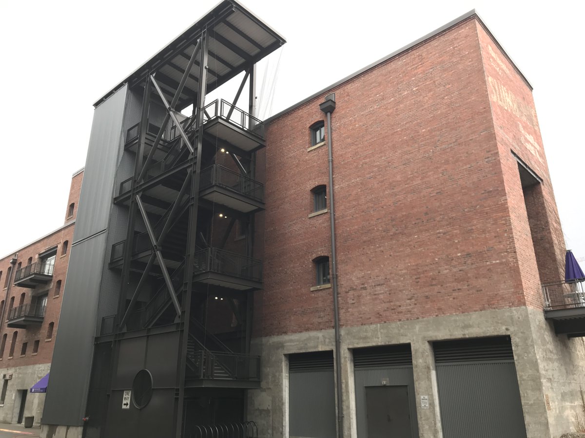
Thread, with lots of photos: Commerce Street (between S 21st and 23rd), the heart of #Tacoma's Brewery Blocks, *must* become CAR-FREE. Its potential is incredible!! Without cars, it could quickly become the most exciting, European-feeling corridor in the entire Pacific Northwest!
Here's the Google Street View of the 2100 block of S Commerce St. Would this be a *glorious* car-free block or what? The couple I talked to (previous photo) agreed 100%! They walk their dog all the time, and they can't stand the cars, especially at night, when mischief happens.
The breweries are STUNNING here. And we all know that drinking + driving = disaster. Removing #cars will dramatically increase both safety and urban vibrancy. Imagine the VIEWS from these historic buildings when PEOPLE replace CARS! @CityofTacoma
/4: You can easily take transit here--yet another reason to ditch the cars from just ONE stretch of the #Brewery Blocks. These breweries & buildings are so beautiful. #Tacoma
/5: There is already WAYY too much car #parking in all surrounding blocks. Just make this ONE little stretch of Commerce St PEOPLE-friendly! Take over the street! I will NOT give up until the #cars are GONE. 99.9% of #Tacoma will still be car-dominated. All I ask for is 2 blocks.
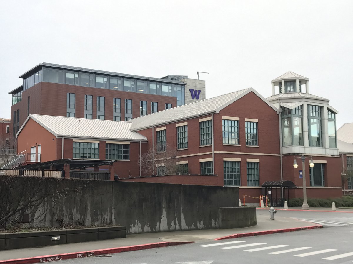
/6: Imagine the perfect connection to UWT, which is *already* largely car-free. You could literally walk/bike/roll directly to campus. And the most notorious meth corner in the Brewery Blocks would be eliminated!!
Again: look at the seamless transition to the UW-#Tacoma campus! @uwtacoma needs to be a partner in the effort to make S Commerce St car-free from 21st to 23rd!! Also: *driving* north on Commerce through 21st is *incredibly* dangerous; you can't see #cars flying downhill!
/8: The Brewery district is growing up super quickly! It NEEDS this signature car-free center. Everyone I talked to in person agreed 100%! It'll bring WAY more eyes on the street and greatly reduce the drug-dealing at that roundabout at the south end of UW-Tacoma @uwtacoma
Final shots (for now). Everyone I talked to at Camp Colvos (great #pizza!!) and @7seasbrewing Brewing agreed: S Commerce St between 21st & 23rd would be an *incredibly vibrant, safe and exciting* corridor with the #cars removed. Plus, it'll add *hundreds* of outdoor dining spots!
Do your magic and #unroll, please! :) Thanks, @threadreaderapp!

• • •

Missing some Tweet in this thread? You can try to force a refresh
 

Keep Current with Tim Davis

Tim Davis Profile picture

Stay in touch and get notified when new unrolls are available from this author!

Read all threads

This Thread may be Removed Anytime!

PDF

Twitter may remove this content at anytime! Save it as PDF for later use!

Try unrolling a thread yourself!

how to unroll video
  1. Follow @ThreadReaderApp to mention us!

  2. From a Twitter thread mention us with a keyword "unroll"
@threadreaderapp unroll

Practice here first or read more on our help page!

More from @kettlemoraine

Oct 25, 2023
My NIMBY tower-dwelling old neighbors are all celebrating yet another years-long delay for a 30-story tower in #Portland's RiverPlace, just south of downtown. It's pretty pathetic. Here's the (paywall) article; I'll copy its entire contents in this thread: bizjournals.com/portland/news/…
Here's the entire article (1/n):
FYI @maccoinnich, @andersem

The developer of a 30-story residential skyscraper on the Willamette said the project is indefinitely "on hold" after permitting took a long time and financing became too difficult to secure.
@maccoinnich @andersem "We missed our window," said Aaron Jones, co-president of Eastbank Development, an affiliate of NBP Capital.

Jones previously planned on breaking ground midway through this year, where the RiverPlace Athletic Club once operated.

[still fuming about Portland's permit process!]
Read 21 tweets
Jan 7, 2021
Taking a break from the #CapitolSiege to ask everyone a question I ponder ALL the time: Which urban neighborhoods bordering major waterfronts offer safe *pedestrian* access to the actual WATER—and preferably to long linear parks offering > 1000’/300m of continuous water access?
I've spent MANY hours looking at Google Maps for ways to walk to the river from residential neighborhoods in cities all over the U.S. Access is TERRIBLE. I'm sooo envious of #Vancouver, BC. It's frustrating how cut off we are by seawalls, railroads, industry, private homes... /2
Hood River is an incredible town, and it’s the undisputed windsurfing capital of Earth. But, just like ALL of Oregon’s Columbia River towns, I-84 completely severs all possible pedestrian connections between residential areas and the river itself. /3
Read 22 tweets
Jan 5, 2021
The U.S. has ~300 cities whose population exceeds 100K. Most of them have "buffered" (by PAINT: 0 protection) bike lanes, with the (car) #parking lane along the curb. SWITCH the bike & parked car lane, and you'd have traffic-calming and a MUCH safer #cycling experience. @PBOTinfo
I cannot stand seeing streets that are "improved" for "cyclists" by putting a wide bike lane *between* parked and moving cars. #Portland's N Denver Ave is a classic example. SWITCH the bike lane & car #parking lane; it solves many issues simultaneously! /2
Biking between the curb and parked cars means that there's almost *zero* car movement around you, outside of intersections. Door-zone biking is nearly eliminated--and if a passenger door does open, you're not thrown into car traffic. /3
Read 9 tweets
Jun 7, 2020
1/ This thread will be a VERY sobering analysis of some of the $billions (and $trillions, when pensions are included) that go solely to the #police--not including fire departments & other emergency management divisions of municipal budgets. @alex_zee @NigelJaquiss
2/ I've been saying for many years that over-militarized #police departments cripple #cities' budgets at BEST--and are brutal & racist at worst. NYPD's annual budget: $5 billion!! @NYCMayor’s proposed $24M cut is well under *1/200th* of the budget.
3/ New York City spends more on policing (possibly $6B/year, in fact!) than it does on the Departments of Health, Homeless Services, Housing Preservation and Development, and Youth and Community Development *combined*.
Read 18 tweets
Mar 8, 2020
Between 1993 & 2017, total freeway lane-miles in the 100 largest U.S. metro areas increased by 42% (31% more than the population growth of 32%). So, free-flow on highways resulted, right, DOTs? Wrong: congestion skyrocketed by 144% (4.5X higher than the population growth).

2/7
And yes: 42% is 31% higher than 32%. Errors with percentages, especially regarding #elections, are made constantly. OK, back to crushing the “building your way out of congestion” logic: #Nashville’s traffic delay increased by 329%, or ~5.5X the % increase in lane-miles added. 3/7
Read 8 tweets

Did Thread Reader help you today?

Support us! We are indie developers!


This site is made by just two indie developers on a laptop doing marketing, support and development! Read more about the story.

Become a Premium Member ($3/month or $30/year) and get exclusive features!

Become Premium

Don't want to be a Premium member but still want to support us?

Make a small donation by buying us coffee ($5) or help with server cost ($10)

Donate via Paypal

Or Donate anonymously using crypto!

Ethereum

0xfe58350B80634f60Fa6Dc149a72b4DFbc17D341E copy

Bitcoin

3ATGMxNzCUFzxpMCHL5sWSt4DVtS8UqXpi copy

Thank you for your support!

Follow Us!

:(