
The debate around old-growth forests in #bcpoli often heats up around quantity vs quality.
Megathread on #oldgrowth logging and the gutting of prime, valley-bottom forest in B.C.:
Megathread on #oldgrowth logging and the gutting of prime, valley-bottom forest in B.C.:

The vast majority of remaining old-growth in this province is what scientists call "lower productivity" forests -- stands in areas where conditions like elevation, slope and aspect make for forests with smaller trees smaller less biodiversity.


This old-growth still matters --I've been in some really cool mountain-side or shore-bog forests-- but in addition to holding less ecological value, it's also less valuable as timber and because of that it is hugely over-represented compared to other old-growth.
The kind of forest you imagine when you close your eyes and think of old-growth: that is what is exceptionally rare.
"High-productivity" old-growth forest sounds weird and technical, so this type of forest is often shorthanded to "valley-bottom old-growth."
#bcpoli #oldgrowth
"High-productivity" old-growth forest sounds weird and technical, so this type of forest is often shorthanded to "valley-bottom old-growth."
#bcpoli #oldgrowth

This valley-bottom old-growth is what all of the fuss is about.
After a century of industrial logging, to get into an old-growth forest now you usually have to travel to a valley, then go up the sides of it, away from the main river channel and away from the gentlest terrain.
After a century of industrial logging, to get into an old-growth forest now you usually have to travel to a valley, then go up the sides of it, away from the main river channel and away from the gentlest terrain.
Again, this is still old-growth forest, but the trees are smaller, there is less undergrowth, less density, less wildlife.
It's not the iconic, huge-tree forests that's beloved around the world, and at the heart of so much conflict here.
Most of that forest has been cut down.
It's not the iconic, huge-tree forests that's beloved around the world, and at the heart of so much conflict here.
Most of that forest has been cut down.
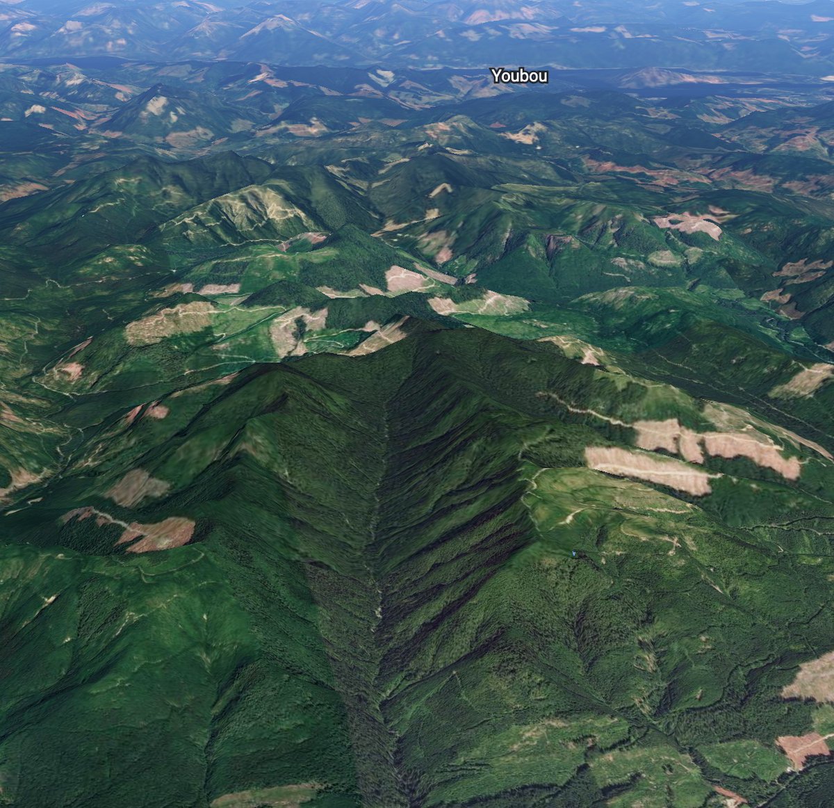
We can see this out on the land, and we can see it from our computer or phone thanks to free-imaging programs like Google Earth.
I play around on this program a lot, and a while ago I started taking screen shots of hollowed out valleys.
I'm going to share some of these here.
I play around on this program a lot, and a while ago I started taking screen shots of hollowed out valleys.
I'm going to share some of these here.
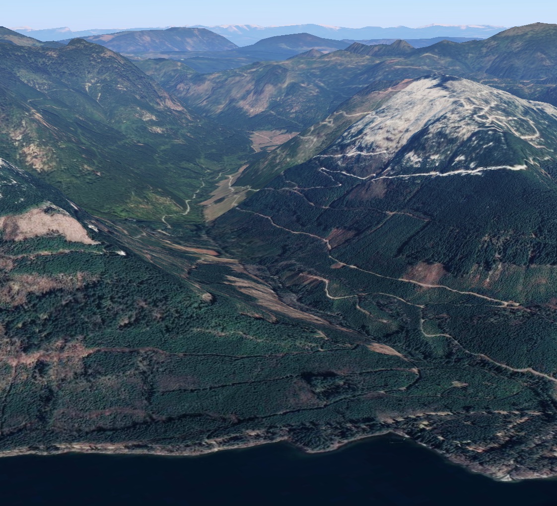
In most of the images, you'll see that there are trees growing back, because trees do grow back.
But these second growth forests are fields of trees the exact same age, with less light getting through a far less biodiversity. Totally incomparable to what they replaced.
But these second growth forests are fields of trees the exact same age, with less light getting through a far less biodiversity. Totally incomparable to what they replaced.


These images are all from Vancouver Island, which is only 3.31% of B.C.'s total land area.
I can't stress enough how non-exhaustive this list is -- it's just screenshots I snapped as I came across valleys where the logging practice I've described above is easily visible.
I can't stress enough how non-exhaustive this list is -- it's just screenshots I snapped as I came across valleys where the logging practice I've described above is easily visible.
Ok, let's get into it.
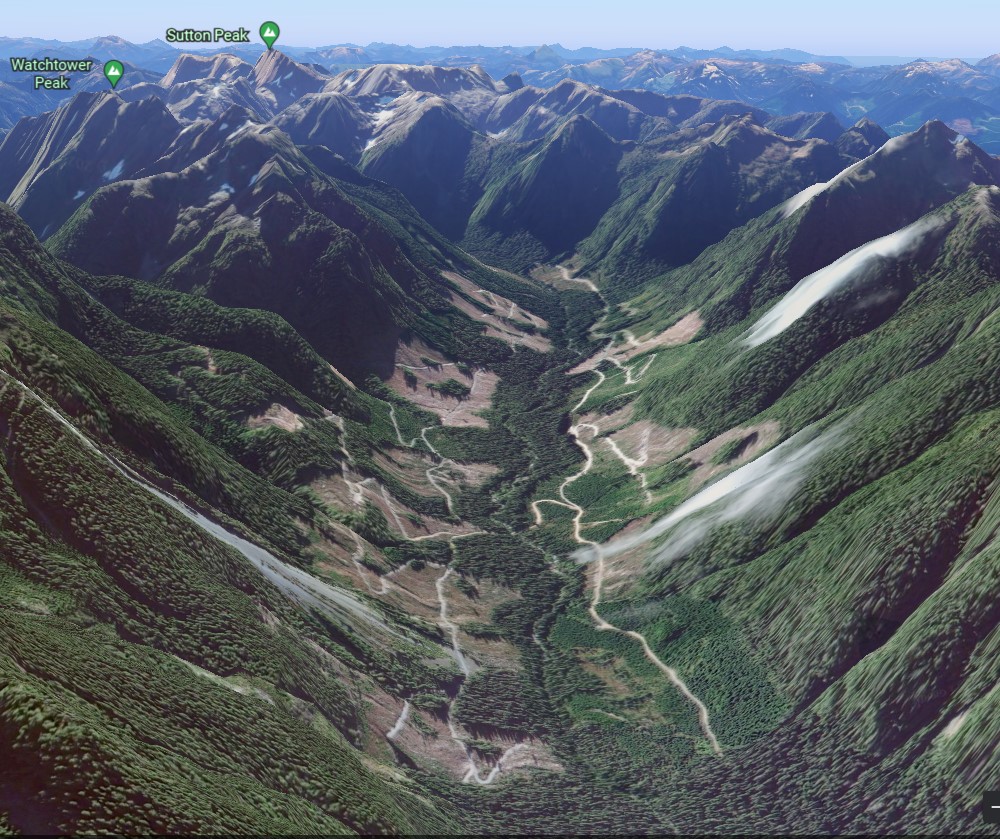
We'll start with the one I showed at the start of this thread.
Tessium Creek in unceded Ma'amtagila territory on the northeast Island is the place that really drove this dynamic home for me when I first visited in 2018.
#bcpoli #oldgrowth @Maamtagila
We'll start with the one I showed at the start of this thread.
Tessium Creek in unceded Ma'amtagila territory on the northeast Island is the place that really drove this dynamic home for me when I first visited in 2018.
#bcpoli #oldgrowth @Maamtagila

A thin strip of forest along the creek, and pretty much the rest of the entire watershed is a young plantation.
That little intact patch in the back of the valley?
It's gone --logged in 2021 (there's a big lag time on Google Earth, and I haven't steeled myself to visit yet).
That little intact patch in the back of the valley?
It's gone --logged in 2021 (there's a big lag time on Google Earth, and I haven't steeled myself to visit yet).
Next we'll go to the next valley over, Naka Creek.
Again, almost the entire valley bottom of both the upper and lower part of the creek has been logged.
#bcpoli #oldgrowth #forestry
Again, almost the entire valley bottom of both the upper and lower part of the creek has been logged.
#bcpoli #oldgrowth #forestry


Next, two watersheds up from Naka, Schmidt Creek in Tlowitsis/Ma'amtagil territory.
The Google Earth imaging is way out of date here, as the east wall of this valley (left side) now has several massive clearcuts:
The Google Earth imaging is way out of date here, as the east wall of this valley (left side) now has several massive clearcuts:

Moving a little inland, we've got the Schoen River, near Schoen Lake Provincial Park, on Kwakwakwakw territories, where about half the valley-bottom old-growth is gone, and logging continues:
Further north, the Bonanza River (Logging Bonanza River?) and Kaipit Creek, both in Namgis Territory:


Next, the heartbreaking imagery of the Salmon River, in We Wai Kai territory just outside Sayward, a relatively flat watershed that's been logged exceptionally hard:

Moving further south still, these are the Cruikshank and upper Oyster Rivers, both in K'omoks territory and both on the edge of Strathcona Park. Again, not much old-growth remains on the valley floor.


Let's take a break to contrast these images with what more intact areas look like on Google Earth.
Here are the lower Tsitika (with logging upriver) in Tlowitsis territory, the Carmanah (with logging on one side) in Ditidaht territory and Fairy Creek in Pacheedaht territory:
Here are the lower Tsitika (with logging upriver) in Tlowitsis territory, the Carmanah (with logging on one side) in Ditidaht territory and Fairy Creek in Pacheedaht territory:


Valleys like the Tsitika, Carmanah and Fairy Creek are incredibly precious, for a million different reasons. They are far to scarce. All have seen hard-fought protest and civil disobedience campaigns and local Indigenous leadership to establish permanent or temporary protection.
Ok, back to the carnage.
Swinging over to the west coast, this is Dinah Lake and the neighbouring drainage, in Mowachat-Muchalaht territory in the southern part of Nootka Sound:
Swinging over to the west coast, this is Dinah Lake and the neighbouring drainage, in Mowachat-Muchalaht territory in the southern part of Nootka Sound:

The next territory over is Hesquiaht, in the northern part of the legendary Clayoquot Sound, where we see the Escalante River and one of her tributaries:


Next territory over is Ahousaht Territory, in the heart of Clayoquot Sound.
This is the Atleo River, logged decades ago now, where the second growth is returning but the roads are still clearly visible in what was once prime old-growth forest.
This is the Atleo River, logged decades ago now, where the second growth is returning but the roads are still clearly visible in what was once prime old-growth forest.

We'll jump up to the northwest Island, to Benson River and Blue Ox Creek, near Victoria Lake in Quatsino Territory:

And now down to the south central Island, this is the Elsie Lake/Lanternman Creek area in Tseshat Territory, not far from the logging hub of Port Alberni:

Because of the more gentle terrain, the picture is even heavier on Southern Vancouver Island.
This is the Nanaimo River valley, in Snuneymuwx territory, where almost all of the valley floor has been logged, much of it twice.
This is the Nanaimo River valley, in Snuneymuwx territory, where almost all of the valley floor has been logged, much of it twice.

Around Lake Cowichan is another extremely heavily logged area. This is McKay Creek and the East Robertson River, in Ts'uubaa-asatx and Cowichan Tribes territory:

To the southwest, this is the Klanawa River, inland from the West Coast Trail in Huu-ay-aht Territory:

And further south, the San Juan Valley in Pacheedaht Territory:

Anyways, I'm gonna stop here, but I hope this thread helps provide a bit of context for the conversation around old-growth forests in B.C. It's important that old-growth is just quantified, but qualified.
#bcpoli #oldgrowth #WorthMoreStanding
#bcpoli #oldgrowth #WorthMoreStanding
Government and industry claims that there is "lots of old-growth remaining" need to be understood in the context that the vast majority of what they're referring to is on the mountain-tops -- the edges of all the images in this thread.
The ecologically rich, culturally significant, iconic old-growth forests that the bulk of the conflict in this province is about is found primarily in the bottoms of valleys, which, for the most part, have all been logged out.
As I mentioned above, the trees grow back, and many decades down the road they can be extracted again. But in terms of the rich native forest ecosystems, those are gone after logging, and we need to grapple with that.
#bcpoli #oldgrowth #forestry
#bcpoli #oldgrowth #forestry
If you're still reading, thank you for sticking with this. Its grim subject matter, but this stuff is on my mind all the time, so it's helpful to share a bit and talk it out.
To learn more about where things are at with old-growth forests in BC, you can check out this explainer below, and don't hesitate to DM me if you have any questions:
wildernesscommittee.org/news/cutting-t… #bcpoli #oldgrowth
wildernesscommittee.org/news/cutting-t… #bcpoli #oldgrowth
• • •
Missing some Tweet in this thread? You can try to
force a refresh


