
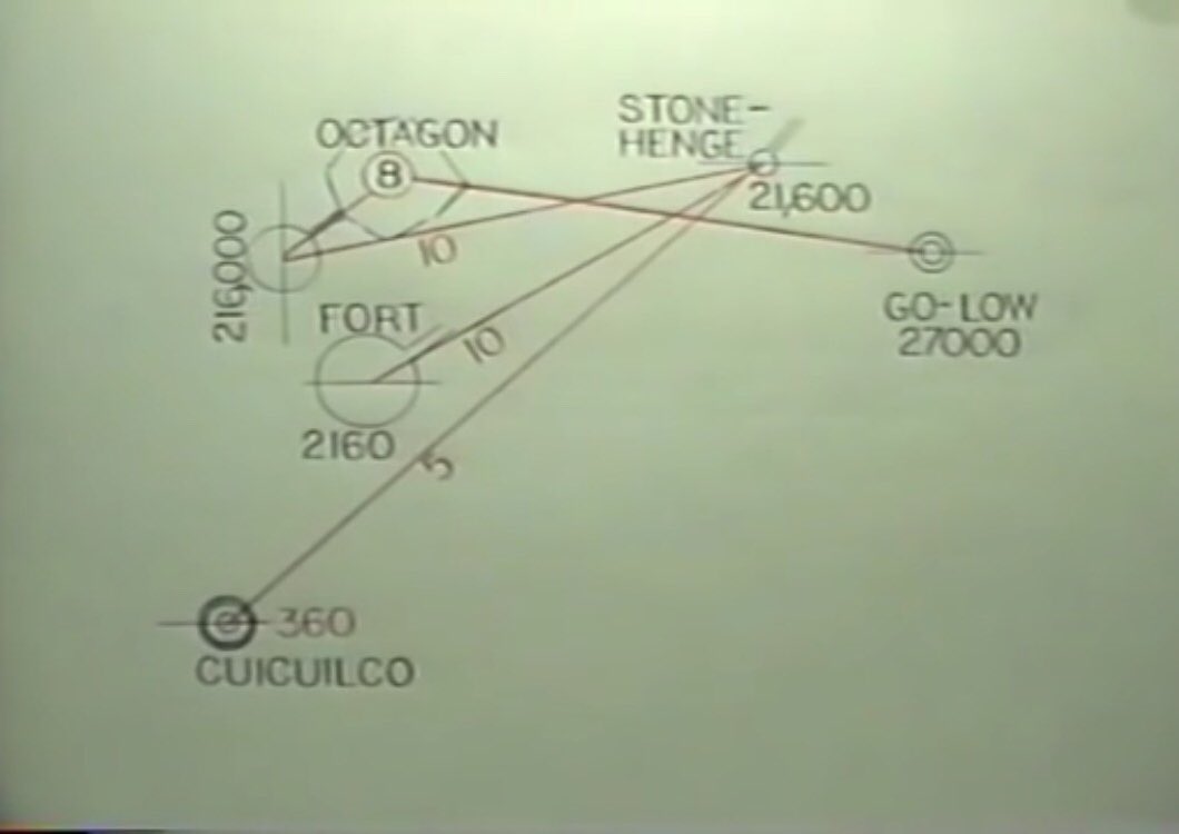
But why is the Go-Low circle here?
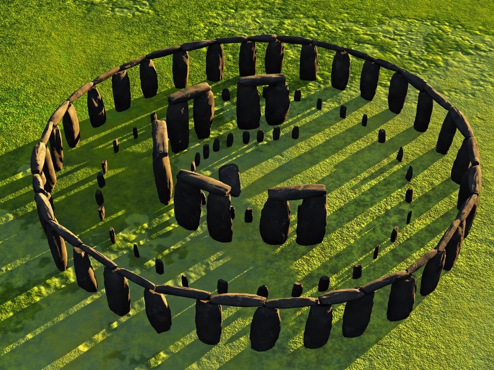
Stonehenge from afar is made up of lintels & uprights. Which gives 3 base nos
2
15
60
60x15x2=1800
Inner circle Stonehenge is broken
15x1800=27,000=Go-Low
Connects SH and GL
Stonehenge from afar is made up of lintels & uprights. Which gives 3 base nos
2
15
60
60x15x2=1800
Inner circle Stonehenge is broken
15x1800=27,000=Go-Low
Connects SH and GL
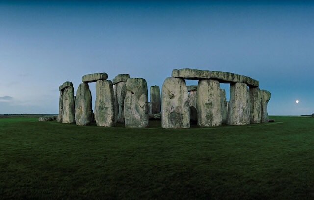
The outer circle of SH is not broken
1800/5=360
What is at 360?
The Great Pyramid at Giza is, but it is not round like Stonehenge. So what is?
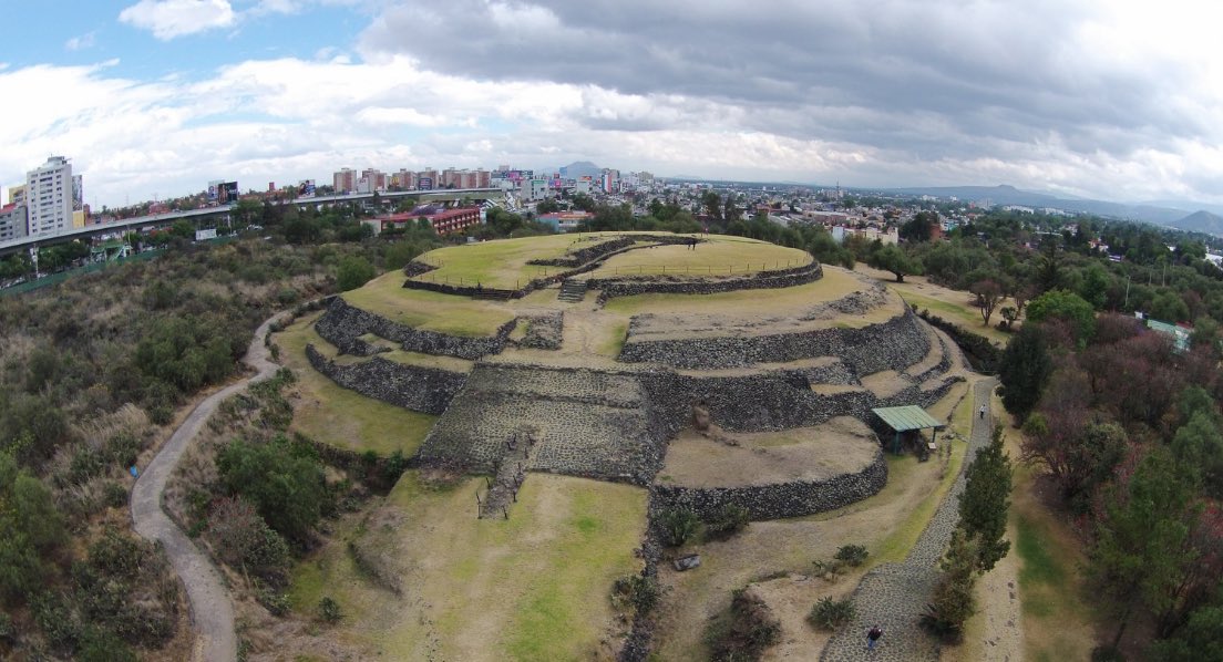
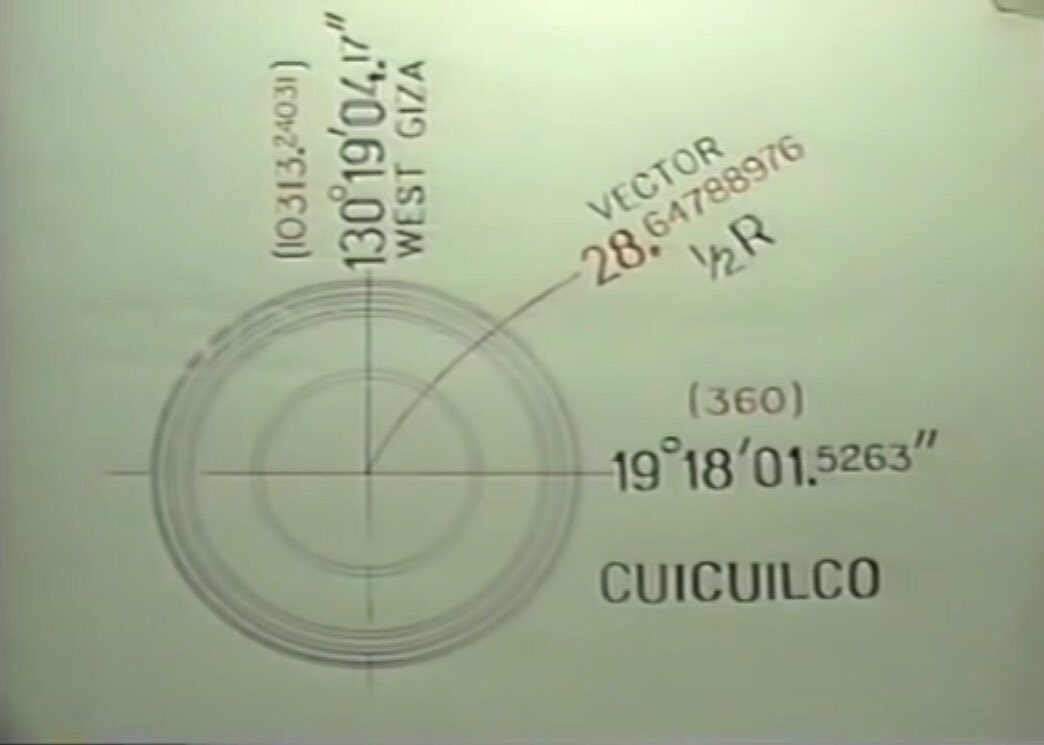
Mexico’s Cuicuilco is round at
19deg 18’ 01.52631”
19x18x01.52631=360.
1800/5=360
What is at 360?
The Great Pyramid at Giza is, but it is not round like Stonehenge. So what is?
Mexico’s Cuicuilco is round at
19deg 18’ 01.52631”
19x18x01.52631=360.
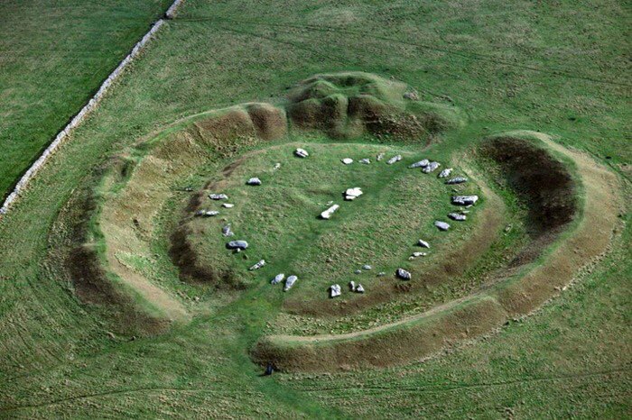
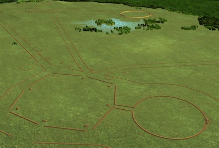
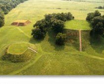
Thus Cuicuilco, Go-Low, Stonehenge, The Great Octagon at Newark Ohio & The Fort built by the Hopewell Indians are all analogues.
Our spherical maths uses the constant π
But if we multiply the 2 constants π x 360 = 1130.973355
We get this 3rd constant that excludes π
And in this way we can get a new set of ancient constants, based on the radian.
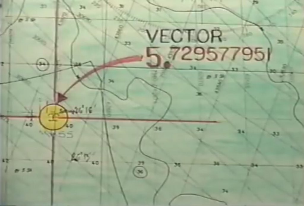
360 / 2 π = R = 57.29577951 deg
But if we multiply the 2 constants π x 360 = 1130.973355
We get this 3rd constant that excludes π
And in this way we can get a new set of ancient constants, based on the radian.
360 / 2 π = R = 57.29577951 deg
So what is Cuicuilco with its 4 terraces saying?
360/ 4 π = 28.64788976 = R/2
Exactly 1/2 Radian
Now another constant
So 360 x R/2 = 10,313.24031
The area of ANY 360 deg circle.
π R ² = 3282.80635/10313.24031
10,313.24031 is the grid longitude of Cuicuilco
130 19’ 04.175”
360/ 4 π = 28.64788976 = R/2
Exactly 1/2 Radian
Now another constant
So 360 x R/2 = 10,313.24031
The area of ANY 360 deg circle.
π R ² = 3282.80635/10313.24031
10,313.24031 is the grid longitude of Cuicuilco
130 19’ 04.175”

So Cuicuilco is an equation of its location relative to the Pyramid at Giza.
It explains the formula for the surface area of a sphere
360 x 4 x 1/2 R = SAS = 41252.96
SAS/4 = area circle =10313.2403
SAS x 1/3 R = vol of sphere = 787873.524
As the top terrace is set back
It explains the formula for the surface area of a sphere
360 x 4 x 1/2 R = SAS = 41252.96
SAS/4 = area circle =10313.2403
SAS x 1/3 R = vol of sphere = 787873.524
As the top terrace is set back
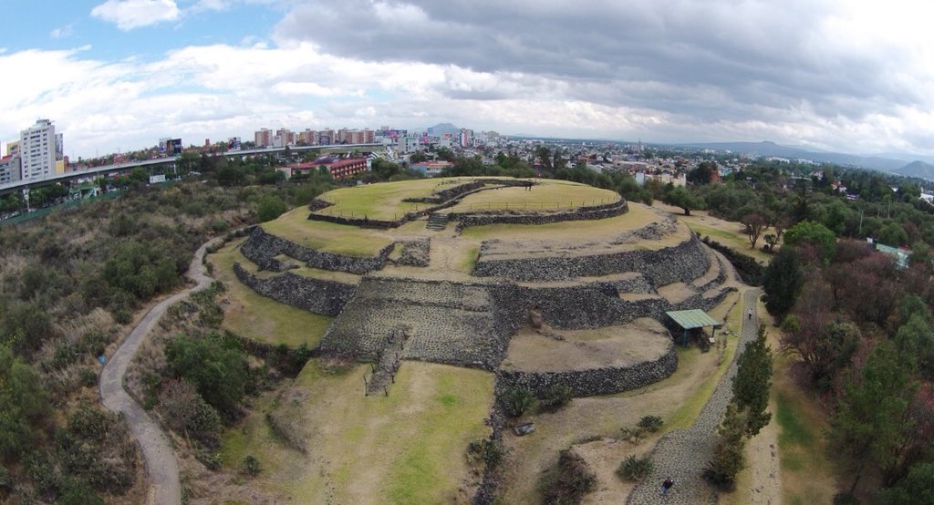
Over 3 others, the formula is 1/3 R
All without π, but in a Radian based in a GLOBAL MATRIX
This reappears at the Mycerinus smaller pyramids 7,8 & 9 on the Giza plateau at a latitude of the surface area of the 360 deg sphere.
All without π, but in a Radian based in a GLOBAL MATRIX
This reappears at the Mycerinus smaller pyramids 7,8 & 9 on the Giza plateau at a latitude of the surface area of the 360 deg sphere.

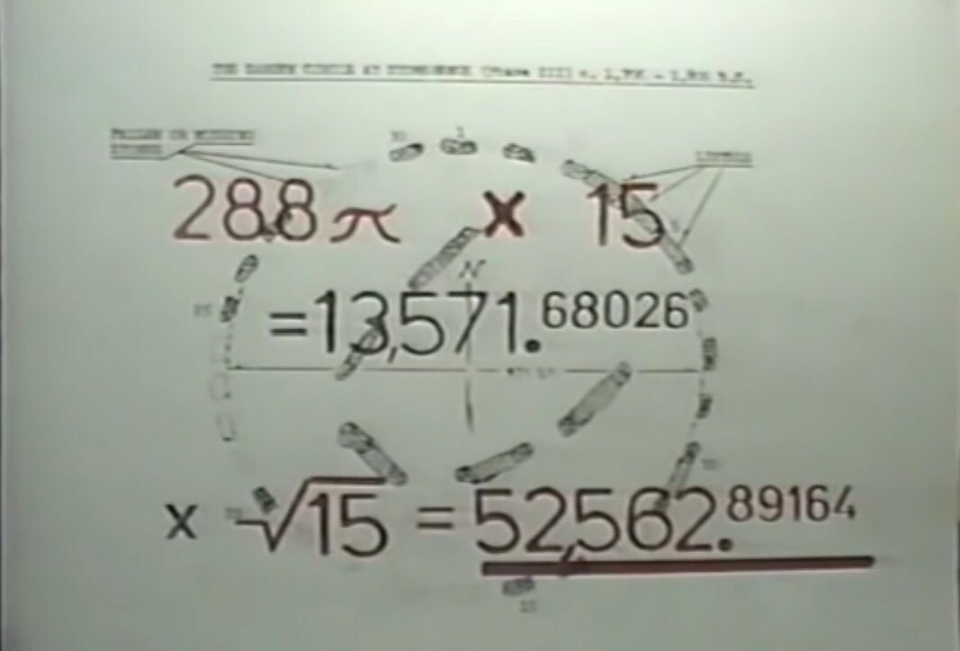
Stonehenge has an irrational display of 15 stones suggesting the irrational no the square root of 15 - using this gives its longitude relative to the Great Pyramid at Giza.
Other lost constants that can be derived at Stonehenge and the Great Pyramid are
√2160 = 46.4780015
1/3 R = 19.09859317
√VS = 887.6223994
√15
√60
R
1/2 R
1/3 R
2 π
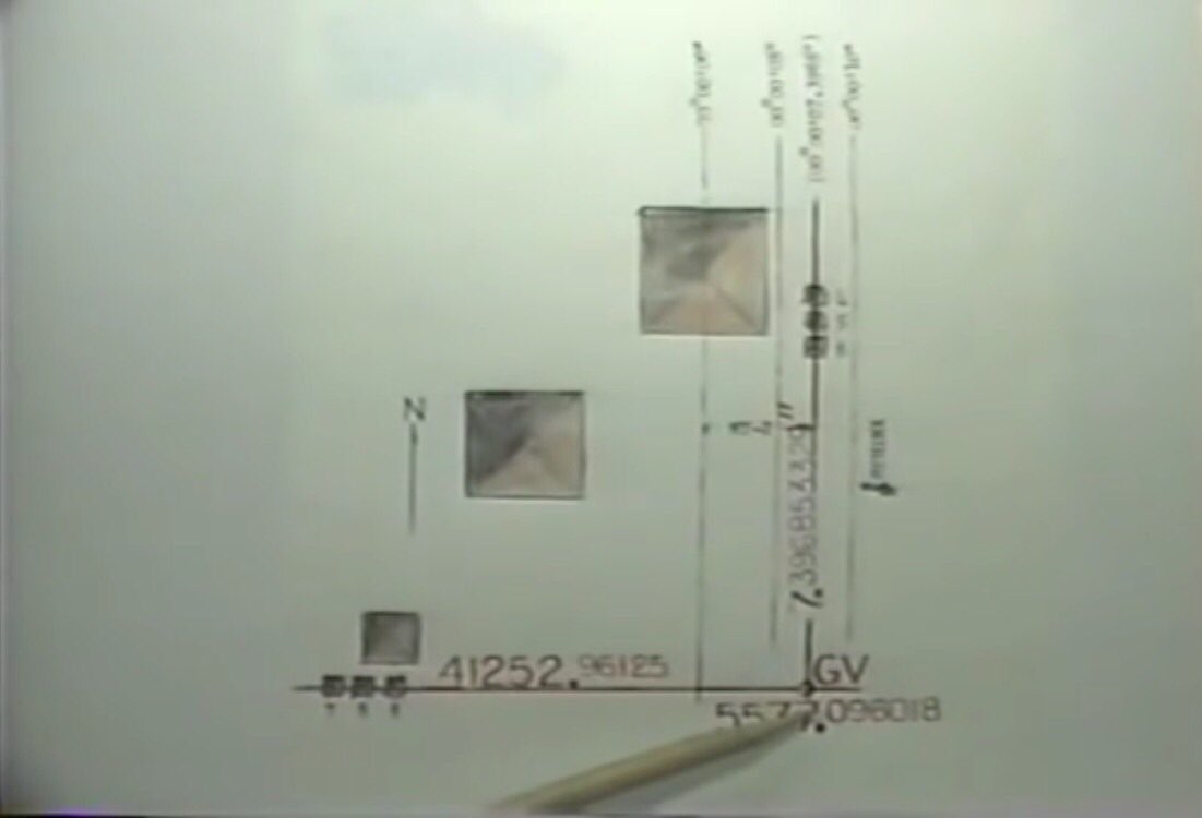
√2160 / 2 π = 7.396853329 (longitude of small pyramids 4,5,6)
√7.396853329 = 2.719715671 (megalithic yard)
√2160 = 46.4780015
1/3 R = 19.09859317
√VS = 887.6223994
√15
√60
R
1/2 R
1/3 R
2 π
√2160 / 2 π = 7.396853329 (longitude of small pyramids 4,5,6)
√7.396853329 = 2.719715671 (megalithic yard)

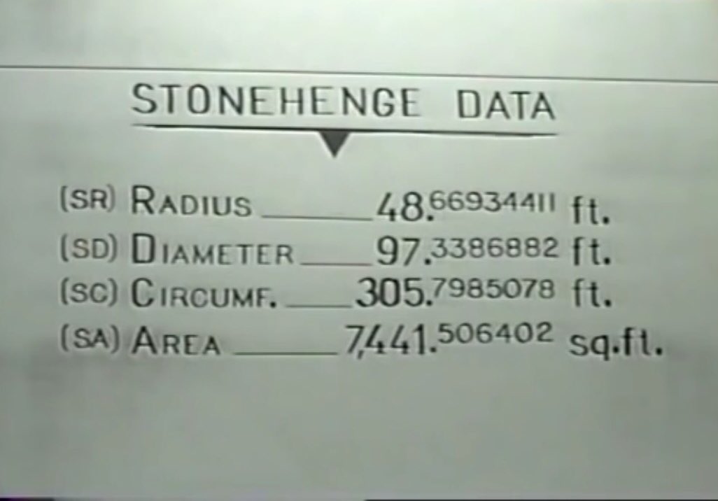
360/ (MYxMY) = 48.66934411
(MYxMY)/2 π = 1.177245771
aka Megalithic Alternate π (AP)
360/(AP) = 305.7985078 = SC in feet
R/(AP)= 48.66934411 = SR in feet
Stonehenge a Calculator rendered in rock.
(MYxMY)/2 π = 1.177245771
aka Megalithic Alternate π (AP)
360/(AP) = 305.7985078 = SC in feet
R/(AP)= 48.66934411 = SR in feet
Stonehenge a Calculator rendered in rock.

Back to the Giza Plateau in Egypt
The six small pyramids line up at the intersection of 2 azimuths(also the surface area of a sphere (Cuiluico) & the square of a megalithic yard to give another constant the Giza Vector (GV) = 41252.96125/7.39685339
= 557.096018
The six small pyramids line up at the intersection of 2 azimuths(also the surface area of a sphere (Cuiluico) & the square of a megalithic yard to give another constant the Giza Vector (GV) = 41252.96125/7.39685339
= 557.096018
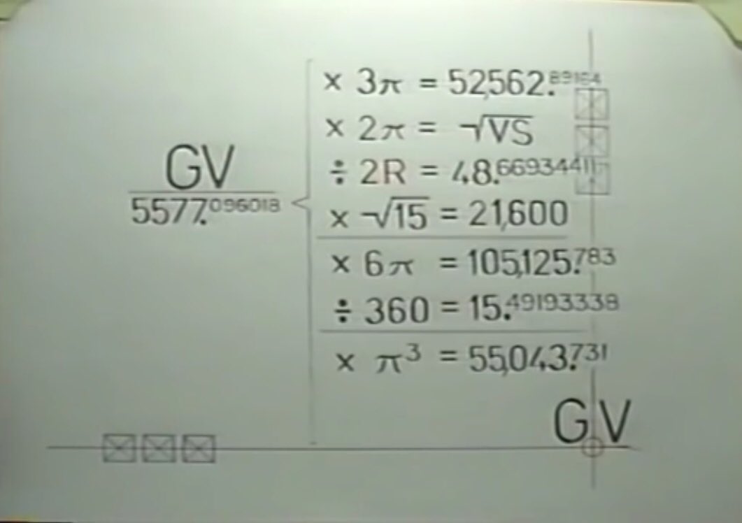
Stonehenge explained what to do. These calculations:
Three Pyramids
X3 π gives the grid longitude of
X3 π gives the grid longitude of
2 sets of Pyramids for the Giza Vector
GV x 2 π = √VS
GV/2R = exact radius of Stonehenge in feet
GV x √15 = grid latitude of Stonehenge
6 Pyramids make GV
GV x 6 π gives the grid longitude of the world’s longest at Cholula Mexico
GV x 2 π = √VS
GV/2R = exact radius of Stonehenge in feet
GV x √15 = grid latitude of Stonehenge
6 Pyramids make GV
GV x 6 π gives the grid longitude of the world’s longest at Cholula Mexico
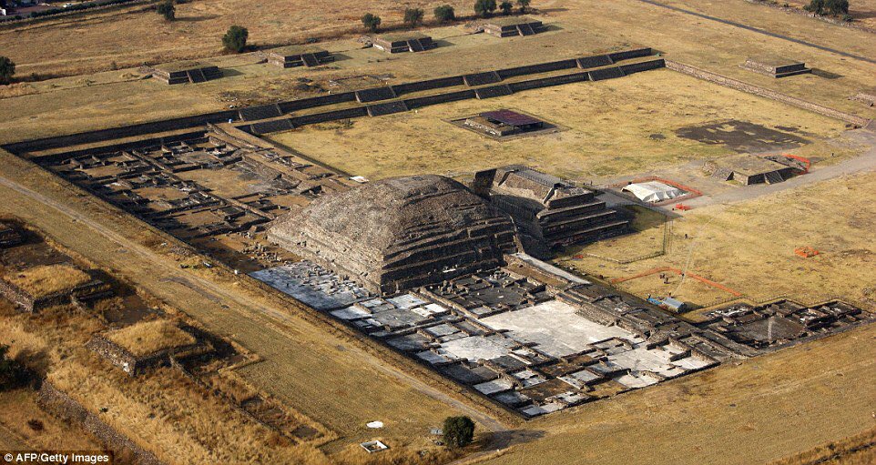
GV / 360 = 15.49193338 from the world’s tallest the Great Giza Pyramid gives the location of the 13 square mile City complex at Teotithuacan Mexico
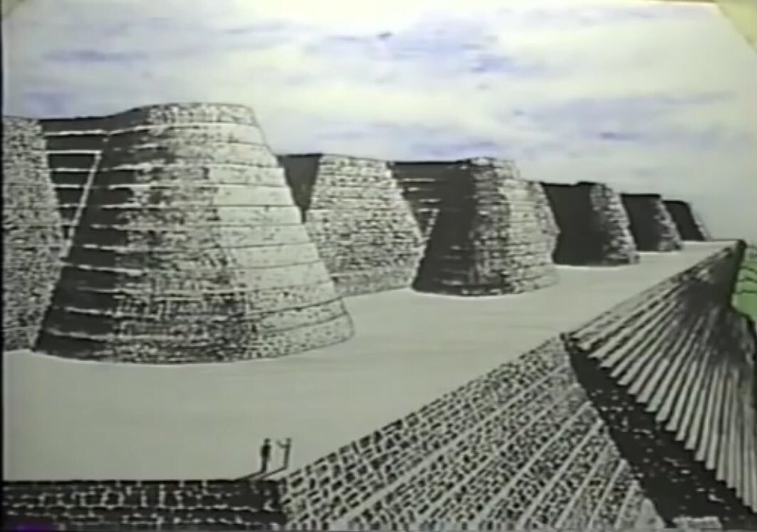
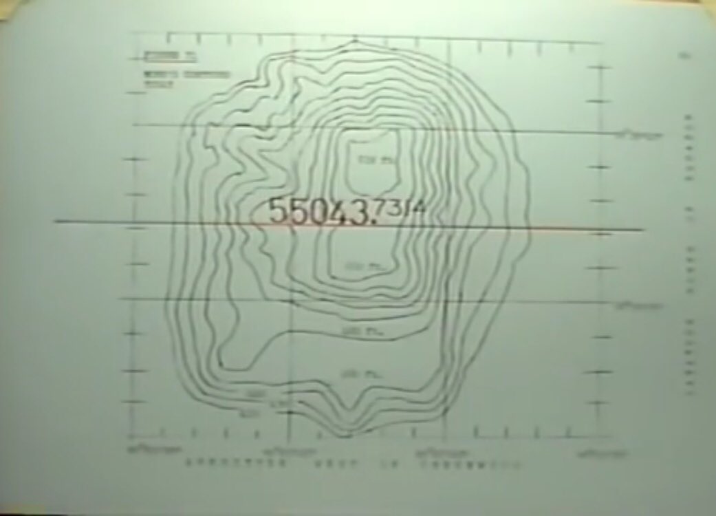
GV x πx πx π = 55043.7314 North America’s largest pyramid.
Back to the Great Pyramid at Giza. Although the facing stones have been removed its measurements are not lost.
It’s meridian=360, but this goes through both poles N & S ie 90 deg
90/R/(AP)= 1.334297702
x 360 = 480.3471728 feet
= the original height
Or R/360=0.159154 x GPC =GPH
It’s meridian=360, but this goes through both poles N & S ie 90 deg
90/R/(AP)= 1.334297702
x 360 = 480.3471728 feet
= the original height
Or R/360=0.159154 x GPC =GPH

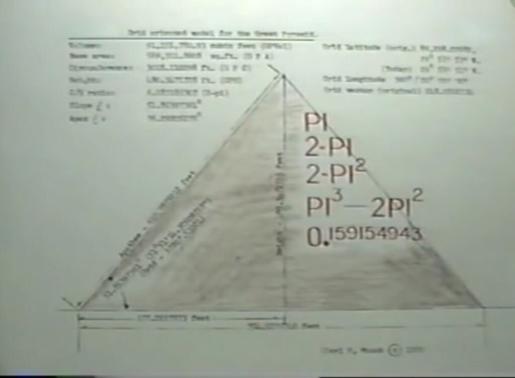
Specs of the Great Pyramid:
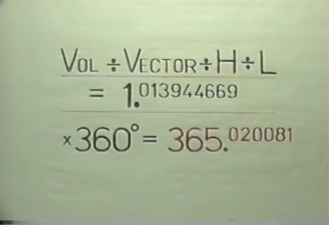
It gives the length of the Solar Year at that time:
365.020081 days which is slightly shorter than our current year length of 365.2421988 - our years have been lengthening (The Mayans recorded the length as 365.2420 at AD 500)
365.020081 days which is slightly shorter than our current year length of 365.2421988 - our years have been lengthening (The Mayans recorded the length as 365.2420 at AD 500)
This Solar Year appears from various constants of the Global Matrix
30 π x √15 = 365.020081
365.020081/ (πx πx π)
= 11.77245771
locked into place.
2 π x π = 0.159154943
= H/C at the Great Pyramid
= SR/SC at Stonehenge
x 360 = R
x R = 9.118906529= Quetzcoatl Complex Vector
30 π x √15 = 365.020081
365.020081/ (πx πx π)
= 11.77245771
locked into place.
2 π x π = 0.159154943
= H/C at the Great Pyramid
= SR/SC at Stonehenge
x 360 = R
x R = 9.118906529= Quetzcoatl Complex Vector
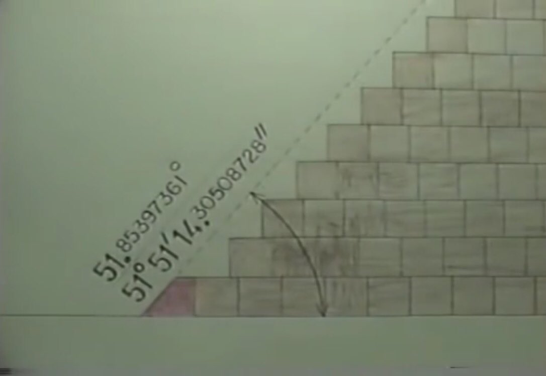
The Great Pyramid still had its base layer
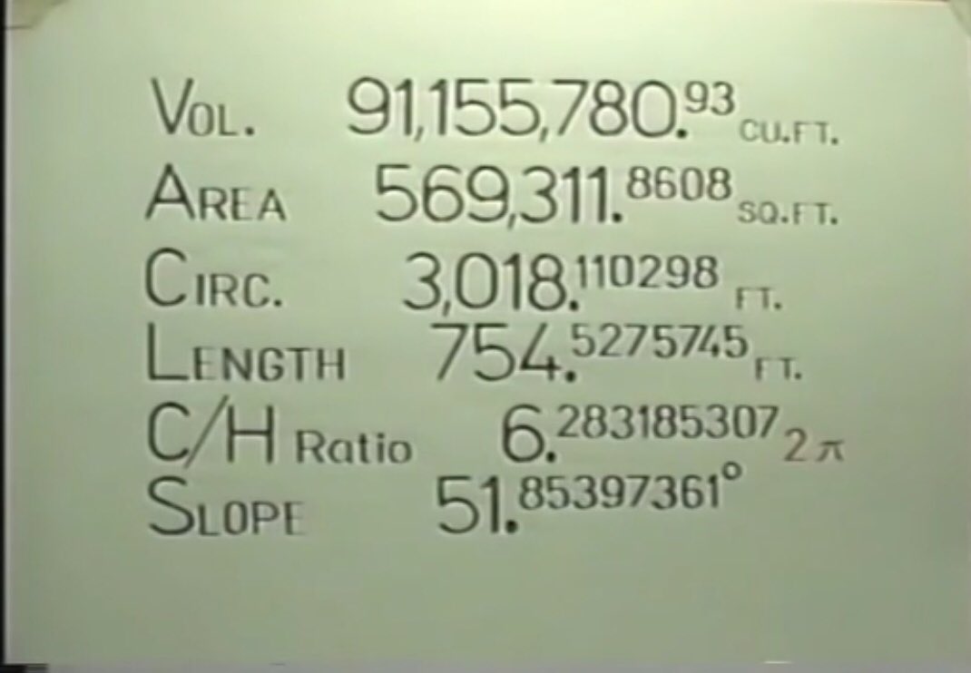
Tan of 51.85397361 = 1.2732395
x π x π x π = 2 π x π
Tan of 51.85397361 = 1.2732395
x π x π x π = 2 π x π
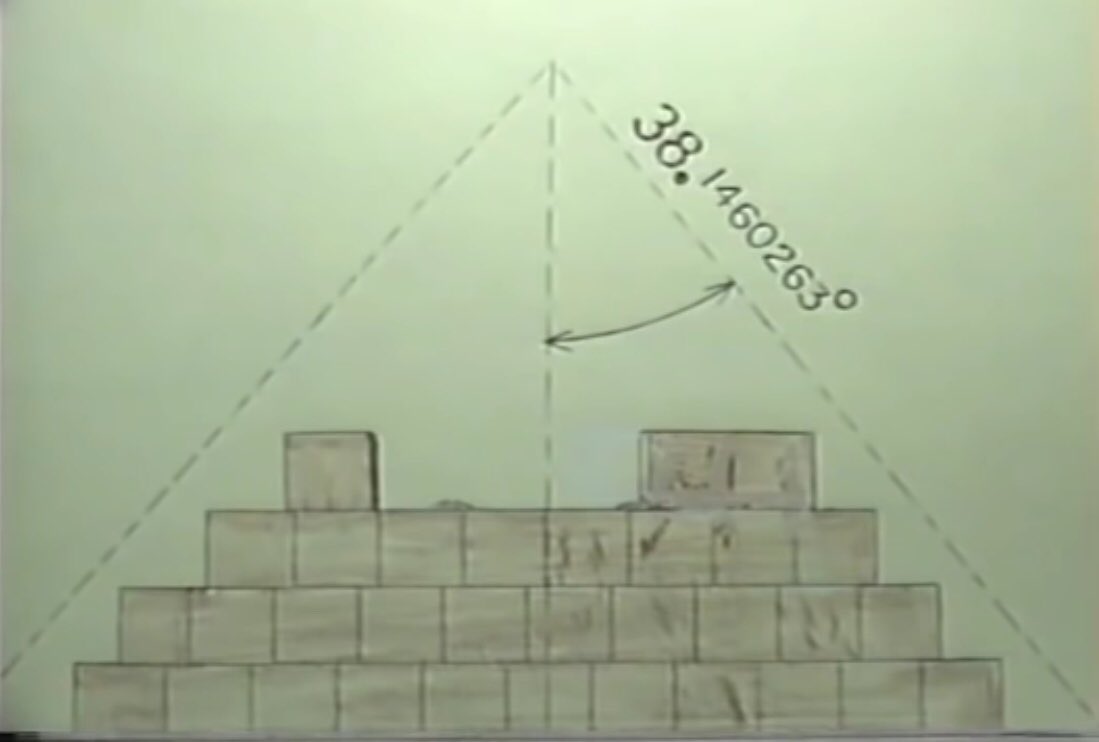
At the apex
Tan of 38.1460263 = 0.785398163
A pyramid with four sides
x 4 = 3.1415926.... = π
The Great Pyramid is π from top to bottom.
Tan of 38.1460263 = 0.785398163
A pyramid with four sides
x 4 = 3.1415926.... = π
The Great Pyramid is π from top to bottom.
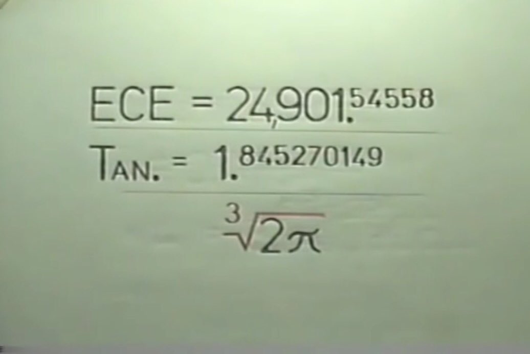
The Great Pyramid on the original 0 meridian should also mark its latitude:
The Equator is 24,901.54558 statute miles long.
Tan (24901.54558) = 1.845270149
= the cubed root of 2 π
The Equator is 24,901.54558 statute miles long.
Tan (24901.54558) = 1.845270149
= the cubed root of 2 π
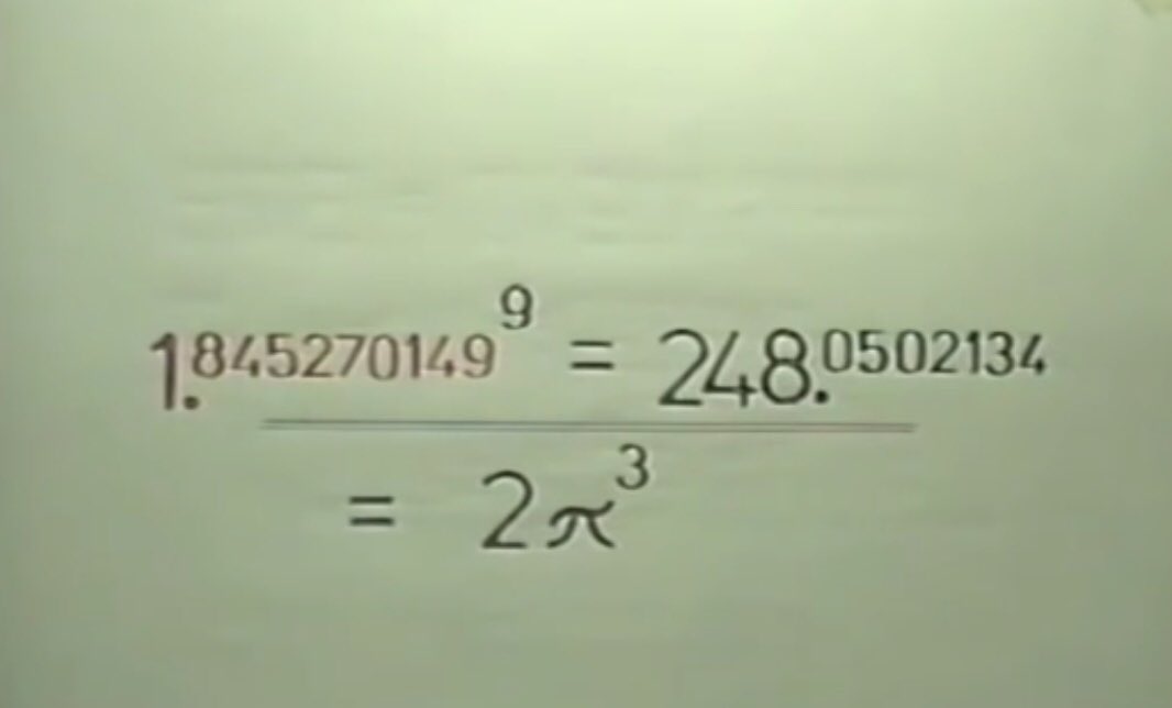
The Pyramid has 4 sides, 4 base corners & an apex, 9 features.
So raise this number to the power of nine and get the cube of 2 π
We must find something in the matrix that uses this number
So raise this number to the power of nine and get the cube of 2 π
We must find something in the matrix that uses this number
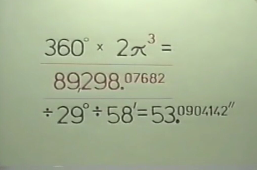
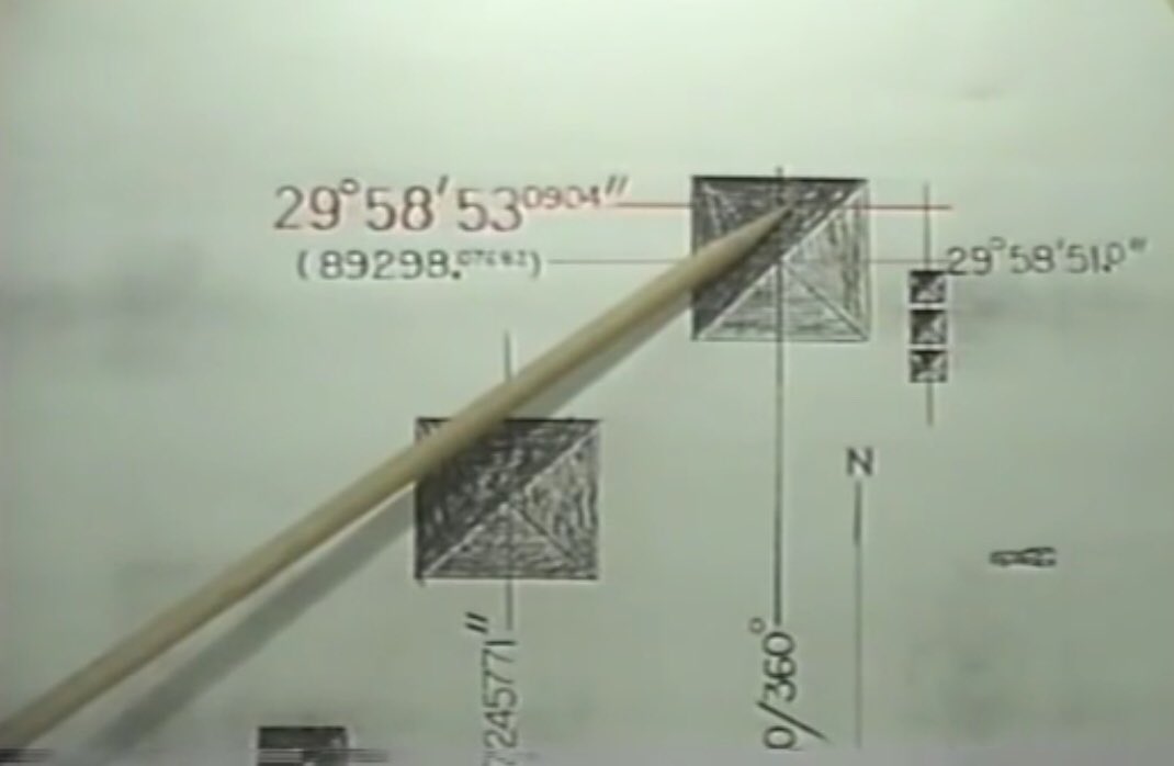
The Pyramid is at 360 longitude so applying this gives the latitude of the exact middle of the north face of the Great Pyramid itself
29 deg 58’ 53.0904142
But why not the Apex?
29 deg 58’ 53.0904142
But why not the Apex?
The Apex was linked with something bigger, astronomy.
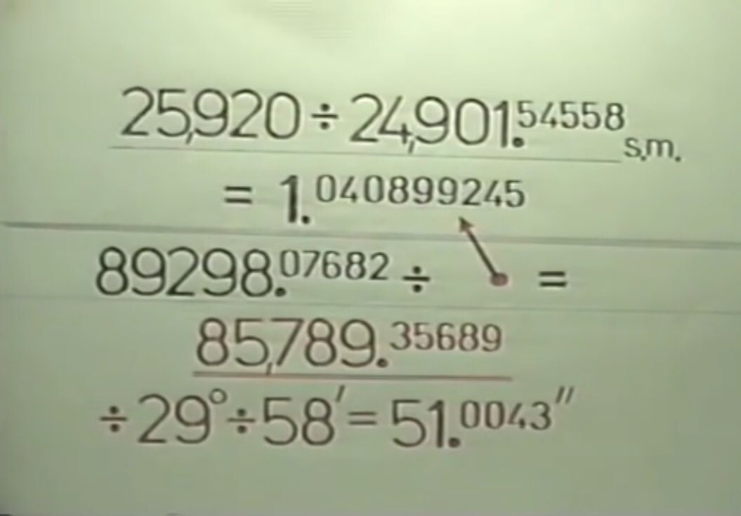
The procession of the equinoxes = 25,920
The Earth’s Circumference =
24,901.545558 Sm
Grid latitude on the North face of the Great Pyramid =
89298.07682
Which the calculation below gives
the Apex at 29 deg 59’ 51.0043”
The procession of the equinoxes = 25,920
The Earth’s Circumference =
24,901.545558 Sm
Grid latitude on the North face of the Great Pyramid =
89298.07682
Which the calculation below gives
the Apex at 29 deg 59’ 51.0043”
“The Matrix is Exquisite”
I could carry on giving you all the maths that justifies the linkages, but I’m sure I’ll try your patience as well as mine. Carl Munck gives all the calculations in the 3 videos, which you can look at for yourself. From now on I shall just link sites.
I could carry on giving you all the maths that justifies the linkages, but I’m sure I’ll try your patience as well as mine. Carl Munck gives all the calculations in the 3 videos, which you can look at for yourself. From now on I shall just link sites.
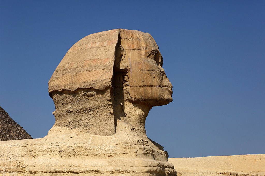
The Kitten (at least 10,000 years old) and its Mother
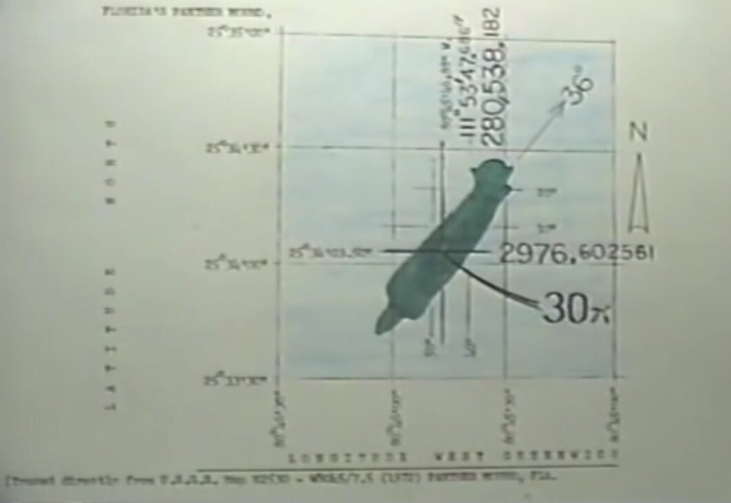
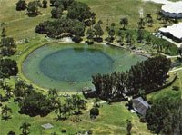
The Sphinx and the Panther Mound in the Everglades, Florida.
The Sphinx and the Panther Mound in the Everglades, Florida.
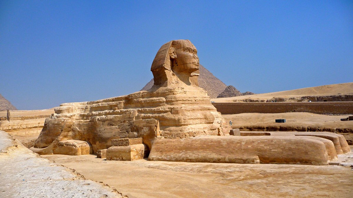
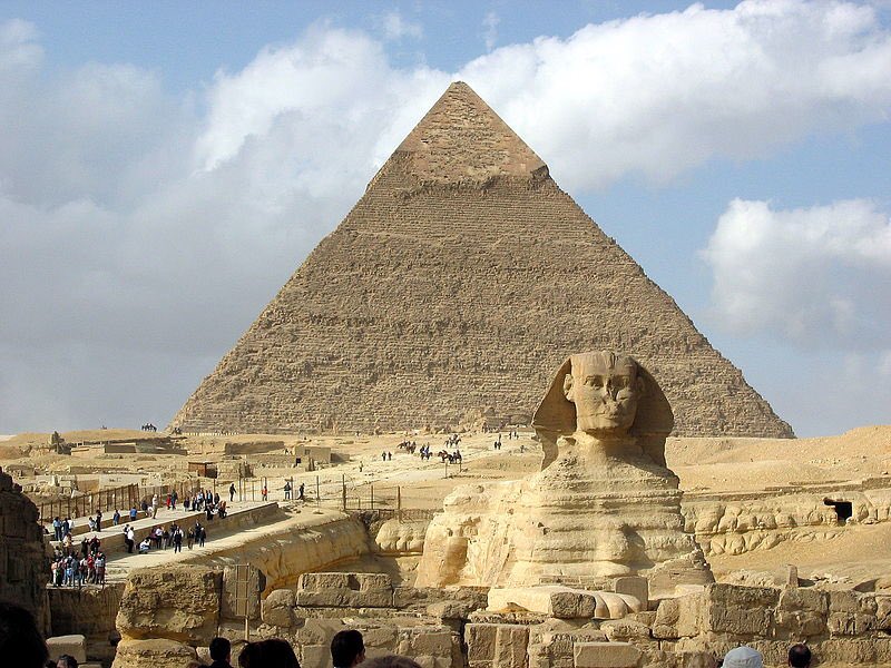
The 2 Faces in the Matrix
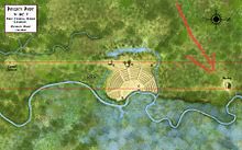
The head of the Sphinx and the Great Face at Poverty Point in North Eastern Louisiana, where the hillock called Motley Mound is the Eye
The head of the Sphinx and the Great Face at Poverty Point in North Eastern Louisiana, where the hillock called Motley Mound is the Eye
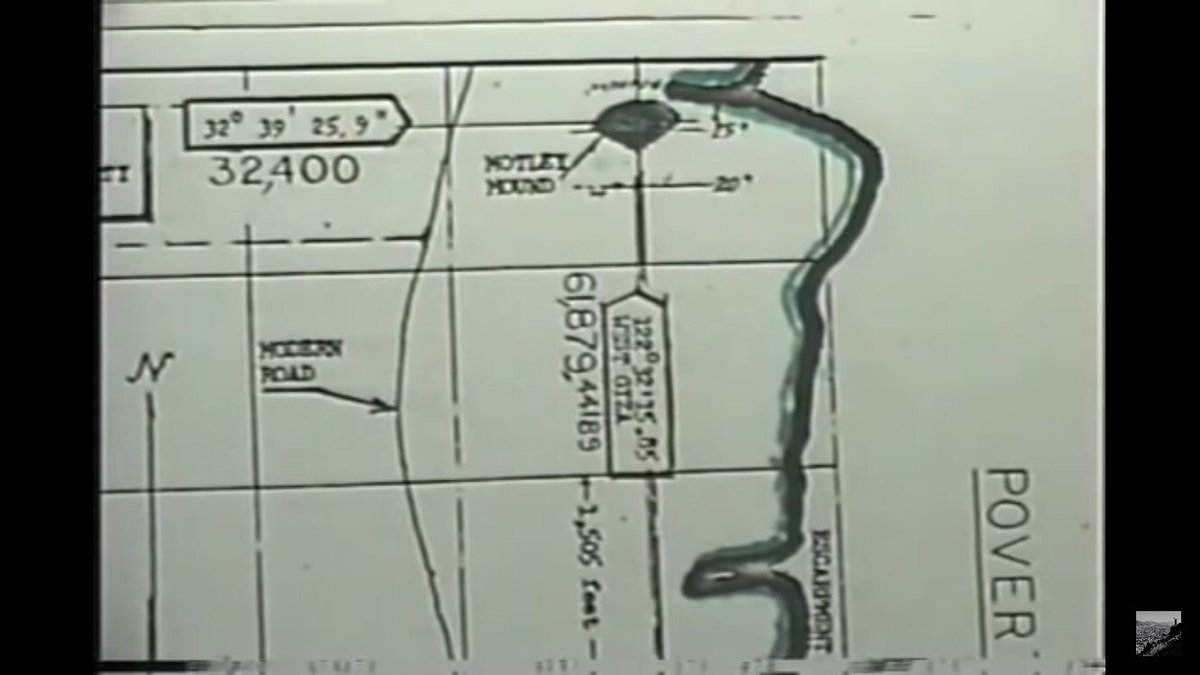
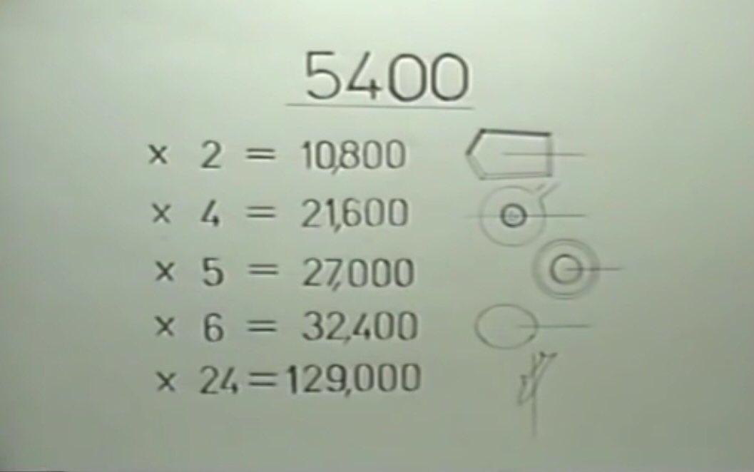
The Sphinx at Vector 5400 address the matrix in rational numbers & irrational constants.
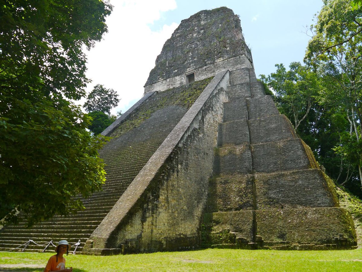
These link the Sphinx to Giza’s Khafre Pyramid, Stonehenge, Temple 4 of the Mayan’s the Temple of the Double Headed Serpent at Tikal, Guatemala
These link the Sphinx to Giza’s Khafre Pyramid, Stonehenge, Temple 4 of the Mayan’s the Temple of the Double Headed Serpent at Tikal, Guatemala

Also Mississippi’s Emerald mound, Germany’s Go-Low Circle & North Bimini’s Shark Mound in the Bahamas


The Matrix plan is at least as ancient as the Sphinx. Many of the sites have been obliterated over time but there are a couple of things that can’t be, not yet.
A bit more Great Pyramid maths:
This is the grid latitude of another large formation, a five-sided pyramid
A bit more Great Pyramid maths:
This is the grid latitude of another large formation, a five-sided pyramid


On Mars......
at Cydonia, grid latitude 9929.184896. A 1.6 mile long monster Pyramid, called the D & M pyramid. Was it intelligently have been made?
Might it have once marked a Prime Meridian on Mars?
at Cydonia, grid latitude 9929.184896. A 1.6 mile long monster Pyramid, called the D & M pyramid. Was it intelligently have been made?
Might it have once marked a Prime Meridian on Mars?

Its latitude rolls off the Martian equator. If the prime meridian is on the D & M at 360deg you get the following calculation of the vector 27.58106916


About 10 miles NNE is the face.


If we place a tetrahedron inside a sphere it’s corners at its base always strike the surface at 19.5 deg N or S of the equator. Energies manifest themselves at these latitudes in all planets of the solar system. Eg storms on Jupiter, the volcanoes of Hawaii, Olympus Mons on Mars


Such a tetrahedron in the language of the matrix has
3 x 60 deg corners
= 180 deg
x 4 faces = 720 deg
Applying the Great Pyramids 2 π
This ends up at 41 deg 11 ‘ 10.03080”, which gives us The Face.
3 x 60 deg corners
= 180 deg
x 4 faces = 720 deg
Applying the Great Pyramids 2 π
This ends up at 41 deg 11 ‘ 10.03080”, which gives us The Face.


If this face really is in the matrix, then some of the constants like √2160 must generate something of interest operating on the grid latitude of Cydonia’s face
4523.893421/ √2160
= 97.3386882
= The diameter of Stonehenge in feet.
4523.893421/ √2160
= 97.3386882
= The diameter of Stonehenge in feet.


Can Cydonia’s face see other ancient monuments on Earth from Mars (unlikely all at the same time)?
1/3 π x 2/3 π x π
= 00deg 06.890283706’
Which is the Value of the face’s latitutude to the East of the 5-Sided Pyramid on Mars.
1/3 π x 2/3 π x π
= 00deg 06.890283706’
Which is the Value of the face’s latitutude to the East of the 5-Sided Pyramid on Mars.


If you raise the face’s longitude value to the ninth power you get this. The distance between Earth and Mars is given in many places as 35million statute miles.

Grid vector on the face is 656.5612703
Using a constant from the Great Pyramid at Giza & the procession of the equinoxes
= 25,920/(2π x π)= 656.5612703
Using a constant from the Great Pyramid at Giza & the procession of the equinoxes
= 25,920/(2π x π)= 656.5612703


Mars is the 5th body from the sun
5 π in the language of the matrix
656.5612703 x 5 π
= 10,313.24031
the Cuicuilco Area of the 360 circle.
5 π in the language of the matrix
656.5612703 x 5 π
= 10,313.24031
the Cuicuilco Area of the 360 circle.


Do the two mile long faces on the two planets talk to each other?
Yes through 90 deg giving 6R
Yes through 90 deg giving 6R


The role of Cydonia?
A master formula talking to our terrestrial matrix.
If you remove the Prime meridian thru the Pyramid on Mars, all this disappears into oblivion.
It happened before, but the ancients left 656 everywhere. Eg at the diameter at Go-Low 656 ft
A master formula talking to our terrestrial matrix.
If you remove the Prime meridian thru the Pyramid on Mars, all this disappears into oblivion.
It happened before, but the ancients left 656 everywhere. Eg at the diameter at Go-Low 656 ft


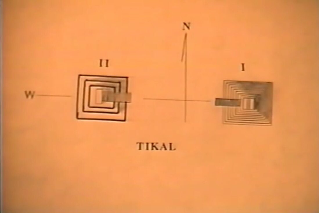
At Tikal Temple 1, Guatemala The Temple of the Giant Jaguar


Also Temple 2, The Temple of the Masks, Temple 3 Temple of the Jaguar Priest, & Temple 4 The Temple of the Double Headed Serpent all have platforms at 656ft high.


On Temple 5 the width of the staircase at ground level is 65.6 ft.

It’s easy for us to believe that the Egyptians built their Pyramids, the Celts Stonehenge & the Mayans their Monuments independently of each other. I hope the above has rocked that belief in you somewhat. Who devised the matrix to keep the knowledge alive during the Dark Ages?
Dogma dictates that humans got their jumpstart in Mesopotamia. But aren’t the creators of the Global Matrix smarter than the Phoenicians, the Babylonians, the Hebrews, the Egyptians and the Greeks? So what is our true history?

In 1968 Stanley Kubrick was onto something.
2001 A Space Odyssey
2001 A Space Odyssey


We now move onto Carl Munck’s second video “The Code” part 2 of 3 of The Matrix Revealed.
You can see the film here
But again I shall attempt to summarise on this thread below:
You can see the film here
But again I shall attempt to summarise on this thread below:

There are 3 themes running through this film:
Ancient Monuments:
Why I am, Where I am
Knowledge of the Ancients:
π
Metrology
Cryptography
Tangents tied to long distances
Global positioning
Extremes used to disseminate this knowledge to us.
Ancient constants from Giza & SH:
Ancient Monuments:
Why I am, Where I am
Knowledge of the Ancients:
π
Metrology
Cryptography
Tangents tied to long distances
Global positioning
Extremes used to disseminate this knowledge to us.
Ancient constants from Giza & SH:


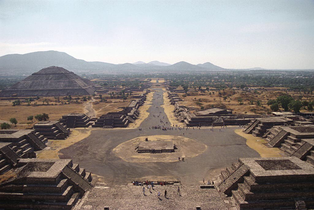
15.49193338 a constant used in the Western Hemisphere - laid out on this azimuth is the whole of the Prehistoric City of Teotihucan, Mexico along its Avenue of the Dead - a name given by a later people who did not understand that it is a university of the global matrix.


The Pyramid of the Sun
7,508 ft above sea level
Originally 750.8ft square
A few feet shorter than the Giza Great Pyramid
It is asymmetrical with 5 terraces & 6 faces & 2 lower terraces & 4 upper giving
2 π x 4 π x 5π x 6π which reduces to the sun’s latitude 19deg 41’ 30.010503”
7,508 ft above sea level
Originally 750.8ft square
A few feet shorter than the Giza Great Pyramid
It is asymmetrical with 5 terraces & 6 faces & 2 lower terraces & 4 upper giving
2 π x 4 π x 5π x 6π which reduces to the sun’s latitude 19deg 41’ 30.010503”


It says I am a π multiplex showing
Why I am Where I Am.
Divide the original calc by π and you get the area of Stonehenge.
Why I am Where I Am.
Divide the original calc by π and you get the area of Stonehenge.


Divide it by 2 π and get the grid latitude of Temple 4 at Tikal Guatemala


Divide by 5 π and you get the grid latitude of the Cholula Pyramid at Puebla in Mexico the largest on earth by volume. The Sun Temple was thus not to do with pagan sun worship, but the global matrix.


Taking the grid latitude divide by π and the azimuth of Teotihucan in Mexico you get the height of the Great Pyramid at Giza in Egypt in feet. Without dividing by the azimuth of the city you get area of Stonehenge in square feet.


These monuments were all built on the English measures of a foot & a mile, which as we see must be ancient. Since before joining the EU, metrification has been pushed onto the U.K. by the Continent leading to court cases such as that of the Metric Martyrs.
news.bbc.co.uk/1/hi/england/1…
news.bbc.co.uk/1/hi/england/1…

When a German archaeologists comprehensively measured Tikal he did so in metres. And found none of the relationships between the architecture and the constants.
But the US has not succumbed to metrification and they continue to use this ancient system.
But the US has not succumbed to metrification and they continue to use this ancient system.
It is an American Carl Munck who rediscovered the global matrix because of this.
Is there something much bigger behind the global drive to metrification than any of us thought?
What is this matrix disclosing?
What was Napoleon really doing in Egypt in 1798?
The Vatican’s role?
Is there something much bigger behind the global drive to metrification than any of us thought?
What is this matrix disclosing?
What was Napoleon really doing in Egypt in 1798?
The Vatican’s role?

Back to Tikal. Here the 12” foot is found everywhere.
Temple 4 location comes off the Sun Pyramid via 2 π. Its 9 terraces and location give its base area in feet.
For Pyramids thus measuring the base tells Why I am Where I Am. This is how the foot has been hidden for posterity.
Temple 4 location comes off the Sun Pyramid via 2 π. Its 9 terraces and location give its base area in feet.
For Pyramids thus measuring the base tells Why I am Where I Am. This is how the foot has been hidden for posterity.


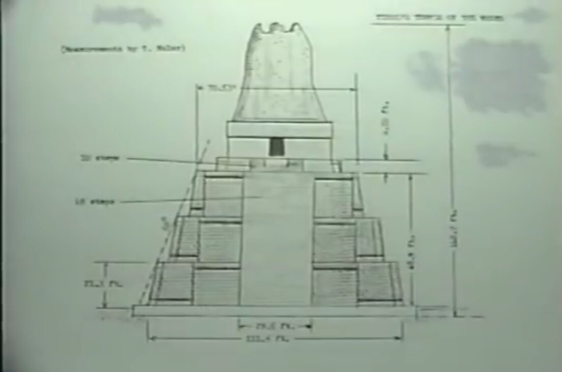
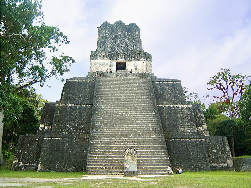
The 12” foot is explained on the facade of Temple 2 through the two flights of steps (49 + 10) and the width of the flight at the base.


Temples 2, 3 & 4 all face east. Temple 1, the Temple of the Giant Jaguar, faces west. This is nothing to do with Sun worship. The depth was measured at 759cm by the German, but this is 24.9015 ft. The actually the equatorial circumference around the Earth in miles


Its location can be pulled from the matrix several ways but its longitude west and east to the Great Pyramid at Giza are given in red below both of which give the grid longitude of 123,758.8838


Temple 4 has terrace 15.4919 (15.5) feet high. Slope angle is
72.6 deg
72.66= √5280
(5280 feet in a mile)
Its West Giza longitude has as its seconds
= 48.66934411”
= radius of Stonehenge in feet
This applies to all the longitudes of all the Pyramids at Tikal -all are constants
72.6 deg
72.66= √5280
(5280 feet in a mile)
Its West Giza longitude has as its seconds
= 48.66934411”
= radius of Stonehenge in feet
This applies to all the longitudes of all the Pyramids at Tikal -all are constants


For Temple 1 the West Giza longitude figure is 22.918311”
=2/5 radian
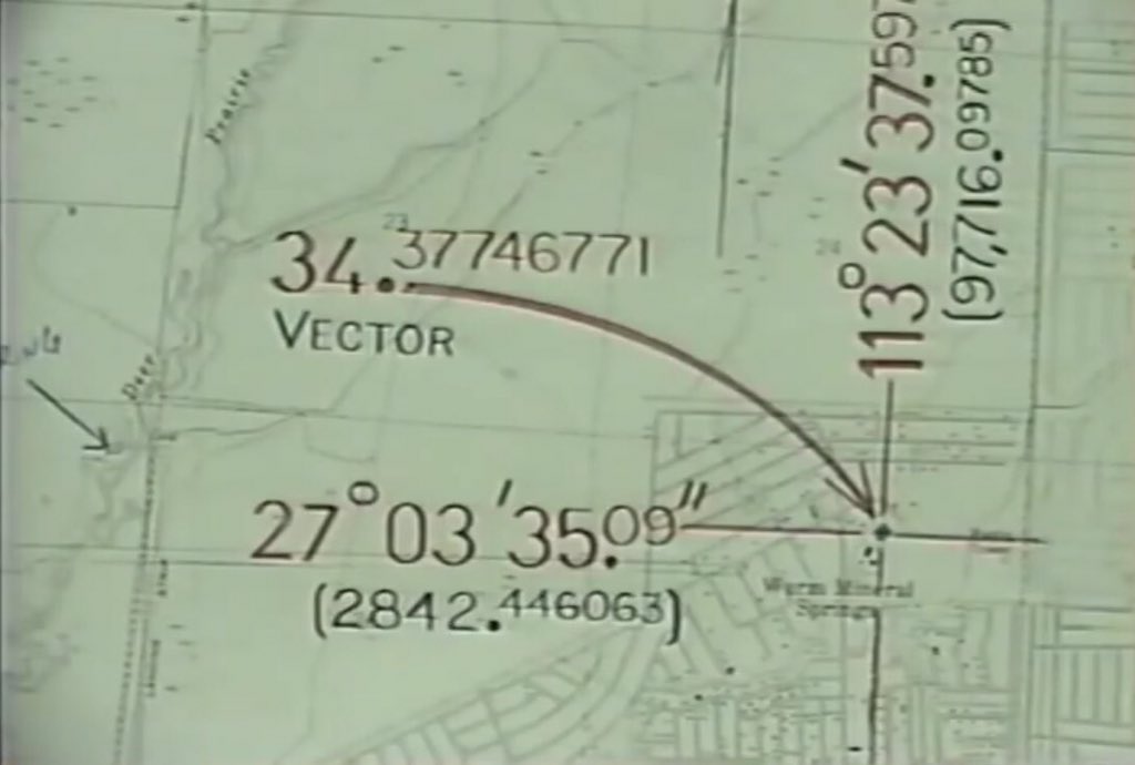
Temple 3 it is 34.377467”
=3/5 radian
This finds others in the matrix eg Florida’s Mound Key
=2/5 radian
Temple 3 it is 34.377467”
=3/5 radian
This finds others in the matrix eg Florida’s Mound Key


It also Vectors on Florida’s Warm Mineral Springs, reputed to have healing properties. But why? Is this the fabled Fountain of Youth of Ponce de León?
warmmineral.com
en.m.wikipedia.org/wiki/Fountain_…
warmmineral.com
en.m.wikipedia.org/wiki/Fountain_…

Only one other spring answers the constants in the matrix, the ancient Little Salt Spring is at 4/5 of the radian.
These natural springs have been flowing for many thousands of years.
These natural springs have been flowing for many thousands of years.


The only other spring with a Vector a fraction of a radian is Mud Hole Spring off the West Florida coast at 1/10 radian.
The Fountain of youth? Who knows. But there is something remarkable about these warm springs as they are encoded in the matrix.
en.m.wikipedia.org/wiki/Mud_Hole_…
The Fountain of youth? Who knows. But there is something remarkable about these warm springs as they are encoded in the matrix.
en.m.wikipedia.org/wiki/Mud_Hole_…
Is this ancient matrix about heated water? Or other forms of energy? Are these ancient sites beneficial to us?
Which ancient monuments are telling us what?
If this is about water could the N Bimini’s Shark Mound be telling us something?
Grid longitude =129600=360x360
Which ancient monuments are telling us what?
If this is about water could the N Bimini’s Shark Mound be telling us something?
Grid longitude =129600=360x360


This has a grid vector 2/3 π.
The “device” at Portsmouth Group A Earthworks Kentucky on the Ohio River gives a grid point value = 3
Monk’s Mound at Cahokia on the flood plain of the Mississippi River has a grid point value of 1/3 π
The “device” at Portsmouth Group A Earthworks Kentucky on the Ohio River gives a grid point value = 3
Monk’s Mound at Cahokia on the flood plain of the Mississippi River has a grid point value of 1/3 π


The face at Poverty Point: its Eye’s Vector is 1/30 radian.
Add all these four locations near water together and multiplying their grid point values we get a kite of value 4 π
Add all these four locations near water together and multiplying their grid point values we get a kite of value 4 π


If we replace the shark in the kite with the panther Mound and now divide all the values into the PMV, the kite value changes to 5 π


These monuments are all about water.
If we swung the kite tail to 3 π or 6 π.
Replace the panther mound with the Mud Hole GPV 1/10R gives
34.37746771 = 3/5 Radian.
Which is also the grid point of Warm Mineral springs.
H2O mounds >> H2O sources.
If we swung the kite tail to 3 π or 6 π.
Replace the panther mound with the Mud Hole GPV 1/10R gives
34.37746771 = 3/5 Radian.
Which is also the grid point of Warm Mineral springs.
H2O mounds >> H2O sources.

Bolivia’s Great Akapana Pyramid has 16 right angles in its ground plan, it too tells us
Why It Is Where It Is.
Why It Is Where It Is.


The Great Pyramid contains the π ratio.
The Tangent of the angle of slope x the 4 sides
=0.785395175 x 4 = π
This instruction should thus be applied to other Pyramids.
The Tangent of the angle of slope x the 4 sides
=0.785395175 x 4 = π
This instruction should thus be applied to other Pyramids.

Applying π as instructed at Giza
90x16x π
=4523.89421
= 16 deg 33’ 08.5679 S of the equator
Map it’s position against the oldest known monument and we find the exact same number as latitude of Cydonia’s face North of the Martian equator.
Which came first?
90x16x π
=4523.89421
= 16 deg 33’ 08.5679 S of the equator
Map it’s position against the oldest known monument and we find the exact same number as latitude of Cydonia’s face North of the Martian equator.
Which came first?


But why is π needed in the location of Akapana?
It was not needed at Stonehenge and the latitude of the previous monuments in the global matrix.
60x360=21600 or
51deg 10’ 42.35”
These worldwide builders knew there are 360deg in a circle, and used the same location as OUR equator.
It was not needed at Stonehenge and the latitude of the previous monuments in the global matrix.
60x360=21600 or
51deg 10’ 42.35”
These worldwide builders knew there are 360deg in a circle, and used the same location as OUR equator.

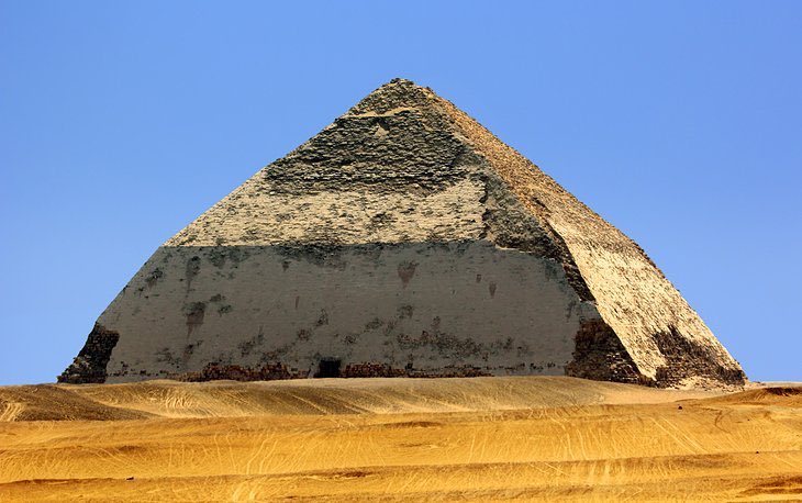
The Dashur Bent Pyramid is 40 km south of Cairo, built by the Old Kingdom Pharaoh Sneferu ca 2600BC.
The design gives 8 sides and 9 corners inc the apex, which encodes its latitude. Two Pyramids
360/2 =180 is its longitude.
It was deliberately bent to show
Why It Is Where It Is.
The design gives 8 sides and 9 corners inc the apex, which encodes its latitude. Two Pyramids
360/2 =180 is its longitude.
It was deliberately bent to show
Why It Is Where It Is.


The Kukulcan Pyramid at Chichen Itza Mexico is
Why It Is Where It Is
52,560=119 deg 42’ 10.516206” to the west of Giza GP, about an inch out as mandated by the code.
When this matrix was mapped out the year was 365.020081 days long.
9x4x4x365.020081=52,562.89164 As at Stonehenge
Why It Is Where It Is
52,560=119 deg 42’ 10.516206” to the west of Giza GP, about an inch out as mandated by the code.
When this matrix was mapped out the year was 365.020081 days long.
9x4x4x365.020081=52,562.89164 As at Stonehenge


The El Tajín Pyramid at Veracruz decorates with 365 niches 6 terraces with 60 steps is also
Why it is Where It Is.
Why it is Where It Is.


The Pyramid of the Magicians at Uxmal, Mexico has this floor plan which is thus telling us to square the circle to gives the West Giza longitude of this Pyramid.


We have dug around these monuments & in them. Reams have been written about them.
But we have not understood what they actually are.
They tell us that our ancestors knew geo-positioning, sophisticated mathematics, equatorial distances & astronomy.
The monuments are time capsules
But we have not understood what they actually are.
They tell us that our ancestors knew geo-positioning, sophisticated mathematics, equatorial distances & astronomy.
The monuments are time capsules
The Woodhenge at Cahokia Illinois consisted of 48 huge logs 410 feet diameter circle. Like Akapana It needs π to specify its latitude, whereas all the others have not.


Silbury Hill, Wiltshire, England is the largest manmade Mound in Europe. 2 circles top & base, slope angle 30 deg and π gives the latitude of Silbury, a number also used to position the large Keferen Pyramid at Giza.


Because it is so large, Silbury counts as a significant monument in the matrix.
Dividing its latitude by its longitude this gives its Coordinate Intercept (CI) in the Matrix.
SCI=2.548320898
Which links it to the latitude of Monk’s Mound at Cahokia, North America’s largest Mound.
Dividing its latitude by its longitude this gives its Coordinate Intercept (CI) in the Matrix.
SCI=2.548320898
Which links it to the latitude of Monk’s Mound at Cahokia, North America’s largest Mound.


This means that significant talks to significant in this global matrix.
Cahokia’s Monk’s Mound has
20 corners = 20 π
4 terraces =4 π
Multiplied = 789.568
Which is its original width in feet.
Cahokia’s Monk’s Mound has
20 corners = 20 π
4 terraces =4 π
Multiplied = 789.568
Which is its original width in feet.


The La Venta Mound Mexico is flat-topped with 30deg slope and with 10 manmade ridges & gullies gives
10 π x 30 deg = 942.4777961
= 18deg 06 ‘ 08.726”
=latitude
The NW Ramp on an azimuth of 343.746771
= 6 Radian
343.746771 x 10 x 10 =34377.46771
125deg 10’ 27.50197416
=longitude
10 π x 30 deg = 942.4777961
= 18deg 06 ‘ 08.726”
=latitude
The NW Ramp on an azimuth of 343.746771
= 6 Radian
343.746771 x 10 x 10 =34377.46771
125deg 10’ 27.50197416
=longitude


Its CI
=LACI=36.475626
multiplied by 21600
=787,873.524
= volume of a sphere.
The Pyramid has been formally dated to 500BC & poss much older.
This beats the Babylonians & Greeks in the ancient mathematics stakes.
=LACI=36.475626
multiplied by 21600
=787,873.524
= volume of a sphere.
The Pyramid has been formally dated to 500BC & poss much older.
This beats the Babylonians & Greeks in the ancient mathematics stakes.


Oil exploration destroyed a number of other mounds that could have been see from its summit.
The next π Mound is at Etowah Georgia, next to the river
2 ramps = 2 π
4 x 90 deg corners at the base and many elsewhere
2 π x 4 π x 90 = 7106.115169
= 7106.115169
= 34 deg 07’ 29.857”
The next π Mound is at Etowah Georgia, next to the river
2 ramps = 2 π
4 x 90 deg corners at the base and many elsewhere
2 π x 4 π x 90 = 7106.115169
= 7106.115169
= 34 deg 07’ 29.857”

Divide Etowah’s grid latitude by 5
= 1421.223034
= the latitude of Ohio’s Serpent Mound (with its 5 coils)
= 1421.223034
= the latitude of Ohio’s Serpent Mound (with its 5 coils)


Back to Guatemala’s Tikal Temple 1, the Temple of the Giant Jaguar built supposedly by the Maya 1000 years ago.
2x24=48 90deg corners of base terrace
9 terraces
= 432 90deg corners
432x90=38,880
1+9 = 10 frontal features
38880x10=388,000
/π=123758.8837
=120deg 45’ 22.91831181”
2x24=48 90deg corners of base terrace
9 terraces
= 432 90deg corners
432x90=38,880
1+9 = 10 frontal features
38880x10=388,000
/π=123758.8837
=120deg 45’ 22.91831181”

It needs π for its longitude to the West of Giza’s Great Pyramid so it is another π monument.
It faces the opposite way to the other temples at the site because its encoded longitude is the long way around the Earth.
239deg 14’ 36.98711411” to its East.
It faces the opposite way to the other temples at the site because its encoded longitude is the long way around the Earth.
239deg 14’ 36.98711411” to its East.

Hebrew cubits
Egyptian cubits
Roman cubits
Babylonian cubits
Zimbabwe cubits
All varied in value over time, & so no constants.
But the foot and the mile kept reappearing on these monuments.
The English only standardised the statute mile in 1593 AD (QEI)
But it is here in Tikal
Egyptian cubits
Roman cubits
Babylonian cubits
Zimbabwe cubits
All varied in value over time, & so no constants.
But the foot and the mile kept reappearing on these monuments.
The English only standardised the statute mile in 1593 AD (QEI)
But it is here in Tikal


The 12 inch foot is also defined again at El Tajín where 60 steps rise 60 feet.


At Poverty Point’s huge earthen concentrics where its diameter is 3950 feet, one foot for every mile of the earth’s polar radius, we are shown the relationship between feet and miles.

Anyone wanting to suppress this information can just assert that the field measurements are wrong. But at Kukulcan the 90 deg angle & 365 steps which we established represents 365.00281 the length of the year at the time of building.
365.020081/90=4.055778
=tangent of 7123.85068
365.020081/90=4.055778
=tangent of 7123.85068

The exact surface distance over the earth from Kukulcan to the Great Pyramid at Giza has been confirmed as 7123.8 statute miles by the US Geological Survey.
The tangent to mile message here is obvious.
The tangent to mile message here is obvious.

Poverty Point Eye to Florida’s huge Panther Mound is
4.055778678 x 4.055778678
= 16.44934068
4.055778678 x 4.055778678
= 16.44934068

As far back as the written record the powerful have tried to adulterate the system.
E.g. Solon the Athenian poet & Statesman ca 550 BC tried to impose a new system of weights & measures for political reasons.
The Establishment has been trying ever since.
E.g. Solon the Athenian poet & Statesman ca 550 BC tried to impose a new system of weights & measures for political reasons.
The Establishment has been trying ever since.

The powerful would love the secrets of the Pyramids to be hidden and drastic steps were taken to do just that. The shrouding continues today - metric measurements making Temple 2 at Tikal just a Temple to the Moon and Teotihucan just a place of Sun worship.

No now is the time to find out
What We Can While We Can
Feet & miles are the units of measure
π is the key to a higher level in the matrix
But what distinguishes
Rational Pyramids from
Irrational π Pyramids from
Effigy mounds from
Wildly corrupted designs?
What We Can While We Can
Feet & miles are the units of measure
π is the key to a higher level in the matrix
But what distinguishes
Rational Pyramids from
Irrational π Pyramids from
Effigy mounds from
Wildly corrupted designs?


How do we know where & how to Retrieve π multiplexes?
We know the Serpent Mound is a π Monument because of its grid latitude using constants, is 72 π x 2 π = 1421.223034
π is not obvious here, & we weren’t supposed to find it as it belongs to the next level in the code.
We know the Serpent Mound is a π Monument because of its grid latitude using constants, is 72 π x 2 π = 1421.223034
π is not obvious here, & we weren’t supposed to find it as it belongs to the next level in the code.

To do this we need data from Giza. The Mykerinos Pyramid was originally 226.194 feet high = 72 π
It is a true miniature of the Great Pyramid, another 3D model of π & 2 π
72 π x 2 π = 1421.223034
= length of its perimeter
= latitude of the Serpent Mound
Much to glean from Giza
It is a true miniature of the Great Pyramid, another 3D model of π & 2 π
72 π x 2 π = 1421.223034
= length of its perimeter
= latitude of the Serpent Mound
Much to glean from Giza


Tan of 11.77245771
= 3865.145
= 3865.145

Now we embark on Carl Munck’s Video 3/3 “The Code”
So far we have looked at the code system with its Pyramids, Mounds, Maps & Numbers.
It is a complex message hidden in plain sight.
Hidden in numbers, which in general people don’t like.
So far we have looked at the code system with its Pyramids, Mounds, Maps & Numbers.
It is a complex message hidden in plain sight.
Hidden in numbers, which in general people don’t like.
Also people can assign meaning to numbers that actually mean something else.
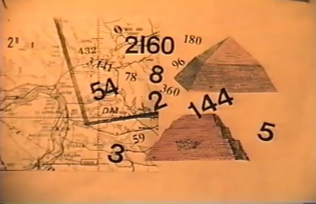
The ancient science of Gematria (an Assyro-Babylonian-Greek system of alphanumeric code or cipher) generates rational nos such as 144 & 432 considered sacred, but others such as 54, 96 are not gematrian.
The ancient science of Gematria (an Assyro-Babylonian-Greek system of alphanumeric code or cipher) generates rational nos such as 144 & 432 considered sacred, but others such as 54, 96 are not gematrian.
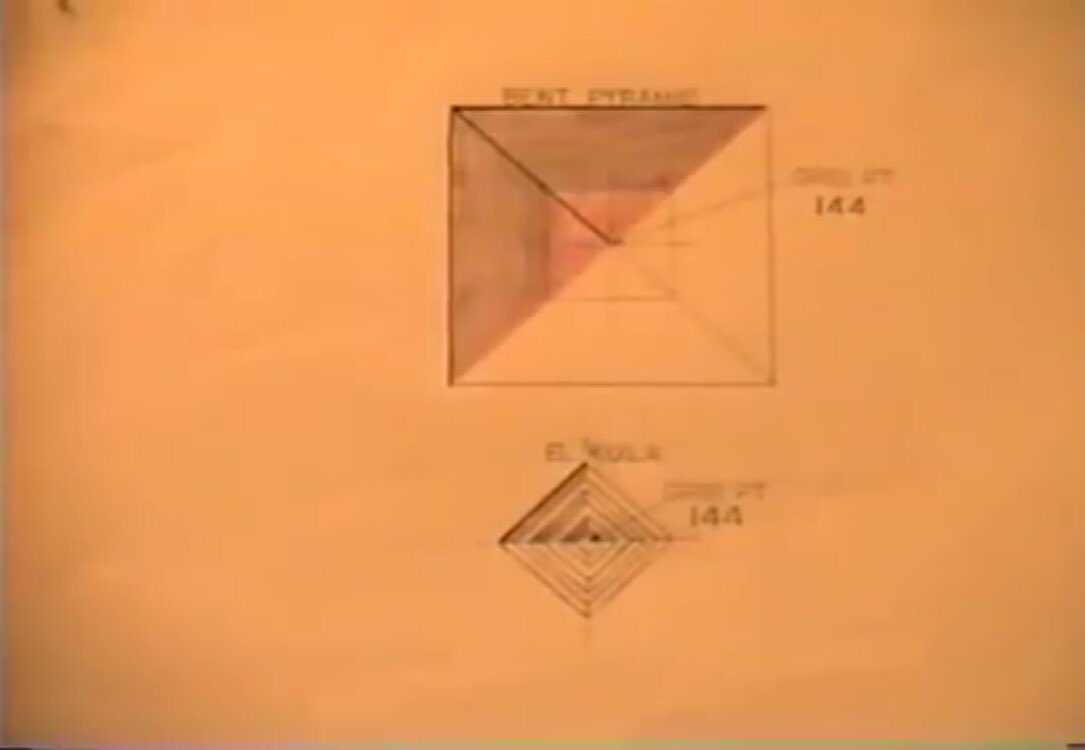
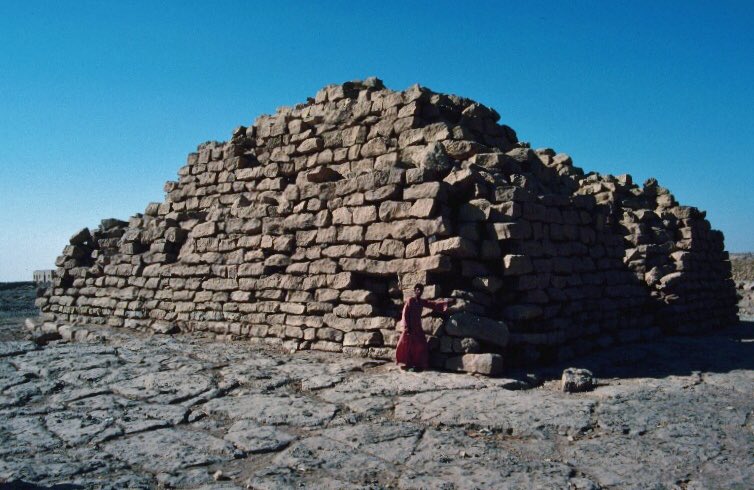
Some of these holy gematria numbers eg 144 in the grid position of certain Pyramids eg Egypt’s Bent Pyramid & the smaller El Kula Pyramid. But Why?
It is currently unknown.
In Jewish gematria 144 means light. See gematrix.org
If they do mean light why are they not lit?
It is currently unknown.
In Jewish gematria 144 means light. See gematrix.org
If they do mean light why are they not lit?
Where, or what, is the switch that turns them on? A frequency perhaps?
The higher Gematria 432 was also used in the grid at "el-haram el-kaddab" (the "False Pyramid") - called False as its outer casing stones lie in a heap at its base. Why? Faulty construction? Something else?
The higher Gematria 432 was also used in the grid at "el-haram el-kaddab" (the "False Pyramid") - called False as its outer casing stones lie in a heap at its base. Why? Faulty construction? Something else?


Was it deliberate? If frequency & vibration are representative of Gematria numbers, was it a sustained musical note that shook this Pyramid apart? A resonance frequency? Like at the Tacoma Narrows Bridge?


If it were a musical note, then perhaps it was a good idea to tune our orchestras to “A” at 440Hz rather than the sacred Gematria 432 Hz, which could perhaps have set up a destructive resonant frequency in the Pryramid, as happened at Tacoma.
“Little Horn”
“I Form The Light”
“Little Horn”
“I Form The Light”


However there are other numbers in the code that have multiple meanings and intent.
96 not gematrian but sacred to some, but was used at Temple 1 - The Temple of the Giant Jaguar, Tikal, Guatemala. Taller than it is wide, steeper than any Egyptian Pyramid, there are 96 steps.
96 not gematrian but sacred to some, but was used at Temple 1 - The Temple of the Giant Jaguar, Tikal, Guatemala. Taller than it is wide, steeper than any Egyptian Pyramid, there are 96 steps.

What does this 96 mean? Depending on your belief system they can be made to mean anything. But to understand the message we need to follow the architect’s logic, and the Global Matrix. If we do this, the Pyramids of the system become the individual pages of an encyclopaedia.
Chapter 1 Earth’s history
1/3 around the Earth is the original 120th meridian. Between 120 & 121 there are a number of aboriginal Pyramids.
Rocks Lake Wisconsin
Uxmal Mexico
Tikal Guatemala
Copan Honduras
1/3 around the Earth is the original 120th meridian. Between 120 & 121 there are a number of aboriginal Pyramids.
Rocks Lake Wisconsin
Uxmal Mexico
Tikal Guatemala
Copan Honduras


The largest are at Tikal.
The most unusual is Rock Lake, as the pyramids are submerged. Why on earth would you build a Pyramid in a depression & then flood the site?
Unless you were trying to explain something.
The grid latitudes for Rock Lake Delta Mound & Tikal T1 are identical
The most unusual is Rock Lake, as the pyramids are submerged. Why on earth would you build a Pyramid in a depression & then flood the site?
Unless you were trying to explain something.
The grid latitudes for Rock Lake Delta Mound & Tikal T1 are identical

=2788.548
Rocks Lake >> Temple 1
What on Temple 1 is significant?
The pyramids in the lake are submerged and difficult to investigate, whereas Tikal Temple 1 is easy to study.
Is this conveying the message
As Above, So Below?
Does Tikal explain other submerged places?
Rocks Lake >> Temple 1
What on Temple 1 is significant?
The pyramids in the lake are submerged and difficult to investigate, whereas Tikal Temple 1 is easy to study.
Is this conveying the message
As Above, So Below?
Does Tikal explain other submerged places?
Tikal T1 points west.
Go to Giza & come back eastward - a total of 96 meridians to the Ryuku Island to the South West of Japan. 96 deg 45 mins east of Giza divers found submerged Temples.
The steps on Temple 1 >> Meridians
Tikal Temple 1 is at 120 deg 45 explaining itself 45’
Go to Giza & come back eastward - a total of 96 meridians to the Ryuku Island to the South West of Japan. 96 deg 45 mins east of Giza divers found submerged Temples.
The steps on Temple 1 >> Meridians
Tikal Temple 1 is at 120 deg 45 explaining itself 45’


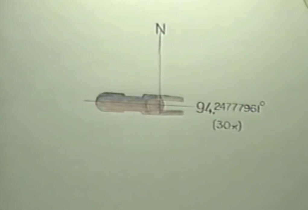
Remember this at the top of this thread? The Yonaguni Monument east of Taiwan is this submerged monument at Okinawa to which Tikal T1 refers.
T1 the message of submerged monuments & transfers it westward to Okinawa.
As Above So Below It Says
Look Under the Water it Says.
So if we want to find the lost continents of the past, we know how to do it.
Earth’s history. In Stone & geolocation not parchment or clay tablets
As Above So Below It Says
Look Under the Water it Says.
So if we want to find the lost continents of the past, we know how to do it.
Earth’s history. In Stone & geolocation not parchment or clay tablets

Tikal Temple 2 faces East with 59 steps >> 59 meridians to West of Giza >> The Seewarte Seamounts on the North Atlantic Ridge.
Aka the Atlantis-Plato-Cruiser-Great Meteor Seamount Group
a north-south trending group of extinct submarine volcanoes
en.m.wikipedia.org/wiki/Seewarte_…
Aka the Atlantis-Plato-Cruiser-Great Meteor Seamount Group
a north-south trending group of extinct submarine volcanoes
en.m.wikipedia.org/wiki/Seewarte_…
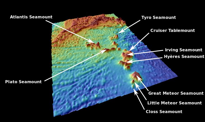
Munck mentions the Cruiser Seamount about which (& re others) Wikipedia is strangely quiet. The ocean here is 1/2 mile deep. The earth’s crust here is very unstable. What was once above water is now far below.

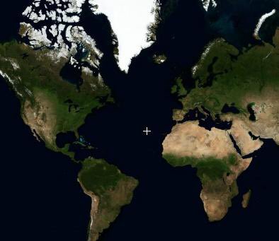
But there is the fable of SS Jesmond, a huge shoal of dead fish & an island that appeared & disappeared in March 1882. It was reported as being located opposite the Straights of Gibraltar - the ancient Pillars of Hercules where Plato said Atlantis to be
uniqueexplorer.blogspot.com/2012/11/ss-jes…
uniqueexplorer.blogspot.com/2012/11/ss-jes…
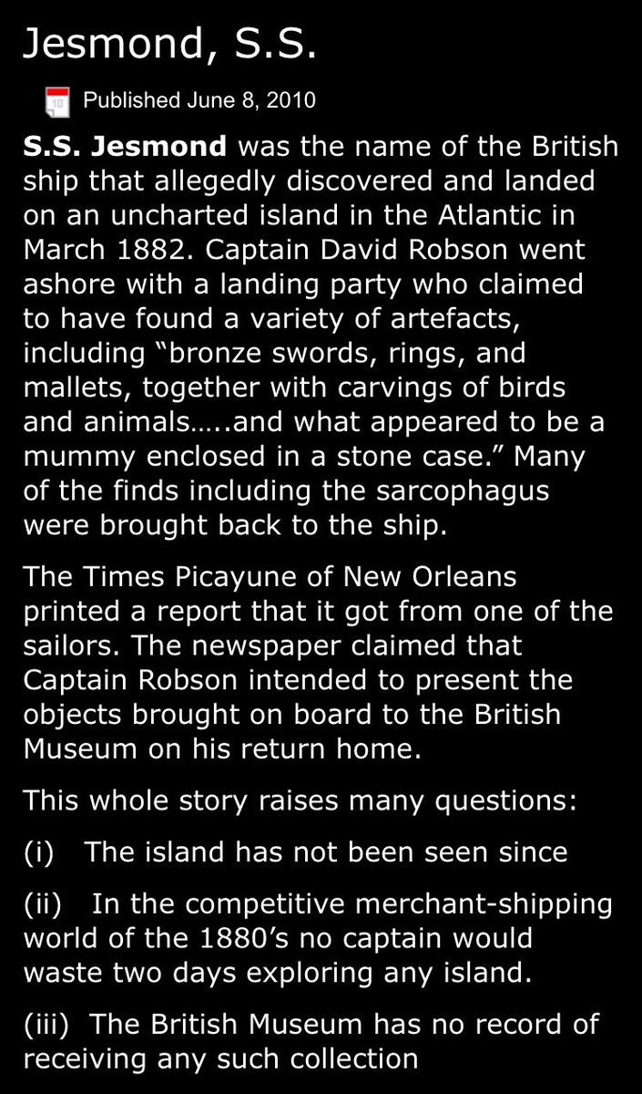

Artefacts from the dripping wet Island were collected & the encounter logged by the Jesmond’s Captain & the coordinates of
28 deg 40‘ west of Greenwich
A ship’s log is a legal document.
On the return trip the landmass was gone.
=59deg 48” west of Giza (3 miles W of T2’s call)
28 deg 40‘ west of Greenwich
A ship’s log is a legal document.
On the return trip the landmass was gone.
=59deg 48” west of Giza (3 miles W of T2’s call)
Tikal’s T5 has lost its steps. However, it faces North between T1 which addresses Lemuria and T2 which addresses Atlantis. What is it pointing to in the North? Another lost place? Ancient Hyperborea?
(or lost Mu?)
Or the latitudes of the other 2 which only speak of longitudes.
(or lost Mu?)
Or the latitudes of the other 2 which only speak of longitudes.


Next we go to Bolivia’s ancient site of Tiwanaku, pre-Inca in origin.
Its Gate of the Sun is the largest single block sculpture ever found. Made from andesite, the hardest terrestrial rock there is, you would need carbon steel to scratch its surface.
But carved how, with what?
Its Gate of the Sun is the largest single block sculpture ever found. Made from andesite, the hardest terrestrial rock there is, you would need carbon steel to scratch its surface.
But carved how, with what?


Modern people would require a laser to cut this.
So
Who?
How?
When?
Tiwanaku’s Pyramid (Tiahuanaco) the Akapana offers some clues. It is the most easterly of all pyramids in the Western Hemisphere.
So
Who?
How?
When?
Tiwanaku’s Pyramid (Tiahuanaco) the Akapana offers some clues. It is the most easterly of all pyramids in the Western Hemisphere.


It is also the most southerly of all the super pyramids in the W Hemisphere.
Before we find
Why it Is Where it Is
We must branch out into paleomagnetism. This science studies the residual strength & orientation of magnetism in ancient rocks & how the N pole has varied with time
Before we find
Why it Is Where it Is
We must branch out into paleomagnetism. This science studies the residual strength & orientation of magnetism in ancient rocks & how the N pole has varied with time

Ancient lava flows align with the direction of the Earth’s magnetic field at their time of cooling, which leads to the dating of the magnetite rocks of any volcanic eruption. This gives the former locations of the North Pole. Our current North Pole is only for 12,000 years old.

The previous North Pole was 30 deg South at Canada’s Atpatok Island in Ungava Bay, Northern Quebec, to the East of Hudson Bay and West of the Southern tip of Greenland.
Or 60deg N & 68deg West
on today’s maps.
Or 60deg N & 68deg West
on today’s maps.

If you run a meridian between the former & present North Poles (which the ancients evidently did, indicating that they too knew the recent the science paleomagnetism) & continue the line 180deg from Tiahuanaco (Tiwanaku) you meet the 1000 feet high White Pyramid at Xian China.


In China these pyramids near the Terracotta Army are believed to be the tombs of the Qin Emperors.


To the East of Xian are the Lemurian undersea Temples off Okinawa at 96deg 45’ 03.87” to the East of Giza (from Tikal’s Temple 1). Working with actual longitudes & not grid ones:
Tiwanaku 99deg48’17” W
Xian 80deg11’42” E
Lemuria 96deg45’03”
Tiwanaku 99deg48’17” W
Xian 80deg11’42” E
Lemuria 96deg45’03”

Subtracting China’s Longitude from Lemuria’s gives
16deg 33’ 21.235”
= the Latitude of Tiwanaku (South)
16deg 33’ 21.235”
= the Latitude of Tiwanaku (South)

Tiwanaku monuments spread from the Kalasasaya NE to Pumapunku in the SW. The latitude goes right through the centre of the site. Which is older, Lemuria or Tiwanaku? Lemuria is from the Akpatok Ice Age. Lemuria sank 8,060 years ago, according to Col. James Churchward.


That the ruins at Yonagumi Okinawa were recorded in the 96 steps of Tikal’s Temple 1 and in the geolocation maths above, indicates that they were something very special. Perhaps the last capital of Lemuria?
The largest monument found at Yonagumi is 262 feet long
The largest monument found at Yonagumi is 262 feet long
and 16 feet below the ocean’s surface. And the base of the temple is 65.6 feet deep. Tikal Temple 5’s fallen staircase is 65.6 feet wide at the base.


How could they have known? During the Akpatok Ice Age the oceans were some 450 feet lower than they are today. The ocean’s basins refilled with water as the glaciers melted which suggests this monument went under water some 5,000 years ago. And its base some 7,000 years ago.

Going back to Churchward’s date of 8,060 years ago, the ocean’s then were 88 feet lower, making it then ca 23 feet above sea level. So Yonaguni became swamped some 7000 years ago, so must be older than this. Powers here thus governed the construction of Tiwanaku > 7,000 years ago
Tiwanaku max possible age is 12,000 years because that is when the North Pole moved both old & new positions are on the meridian.
Churchward claimed that Easter Island marked the southern end of ancient Lemuria.
Churchward claimed that Easter Island marked the southern end of ancient Lemuria.


On a globe draw a line from Easter Island to the Great Pyramid at Giza. This line crosses Peru - across the strange geoglyphs known as the Nazca Lines, in fact. Which is where we shall go next.


The Great Triangle at Nazca has several parallel lines flowing from West to East. They lie on the Easter/Giza line. What is the message? 8 lines on the west. Only 2 proceed across the middle to reach 5 to the east.
So the message
=8 /2 / 5
= 0.8
So the message
=8 /2 / 5
= 0.8


There are 2 equilateral triangles depicted one inside the other.
= 3 x 2 x 60deg
= 360 deg
0.8 x 360 deg = 288
288 x 60 deg of the triangle
= 17,280
= 14 deg 41’ 30.104” S
= its latitude.
= 3 x 2 x 60deg
= 360 deg
0.8 x 360 deg = 288
288 x 60 deg of the triangle
= 17,280
= 14 deg 41’ 30.104” S
= its latitude.

For its longitude
The triangle has 3 corners:
3 x 17280
= 51,840
=106 deg 15’ 32.603 West of Giza
Right through the centre of the triangle.
Grid point = 3
(Hence why 2x triangle & not ⭕️ depicted here)
The triangle has 3 corners:
3 x 17280
= 51,840
=106 deg 15’ 32.603 West of Giza
Right through the centre of the triangle.
Grid point = 3
(Hence why 2x triangle & not ⭕️ depicted here)

Nazca is the Rosetta Stone of the Pyramid Global matrix.
It speaks of our own ancient terrestrial history.
Manos gives
4+5 fingers = 9
1 90deg angle
90deg x 9 x 4 x 5
= 16,200
= 14 deg 41’ 28.232” S
2 ears
2 arms
16,200 x 2 x 2
=64,800
=106deg 14’ 43.6” W of Giza
It speaks of our own ancient terrestrial history.
Manos gives
4+5 fingers = 9
1 90deg angle
90deg x 9 x 4 x 5
= 16,200
= 14 deg 41’ 28.232” S
2 ears
2 arms
16,200 x 2 x 2
=64,800
=106deg 14’ 43.6” W of Giza

Another of the Geoglyphs:
Spiral, Needle, Gt Rectangle group
Rectangle> 360 deg
Spiral > part spiral, part arcs
360 deg x 4 x 2 = 2880
= latitude 14 deg 40’ 0.514” S
Spiral, Needle, Gt Rectangle group
Rectangle> 360 deg
Spiral > part spiral, part arcs
360 deg x 4 x 2 = 2880
= latitude 14 deg 40’ 0.514” S


Nazca the one place in the earth that is most suitable for a blackboard written by the ancients to us.
No wind, rain, no erosion, hostile to vegetation.
Write something there and it is there for millennia.
No wind, rain, no erosion, hostile to vegetation.
Write something there and it is there for millennia.

Every detail must be studied carefully
Eg the Great Spiral is not actually a Spiral.
The Great Rectangle it too can be decoded.
There are fish, monkeys, birds like the hummingbird.
Eg the Great Spiral is not actually a Spiral.
The Great Rectangle it too can be decoded.
There are fish, monkeys, birds like the hummingbird.


And the Condor with 6 feathers to the East and 5 to the West, when decoding.
Remember the Birdmen Statues on Easter Island....
Unless you decode the Global Matrix with precision you won’t reach the higher levels of knowledge hidden within.
Remember the Birdmen Statues on Easter Island....
Unless you decode the Global Matrix with precision you won’t reach the higher levels of knowledge hidden within.


