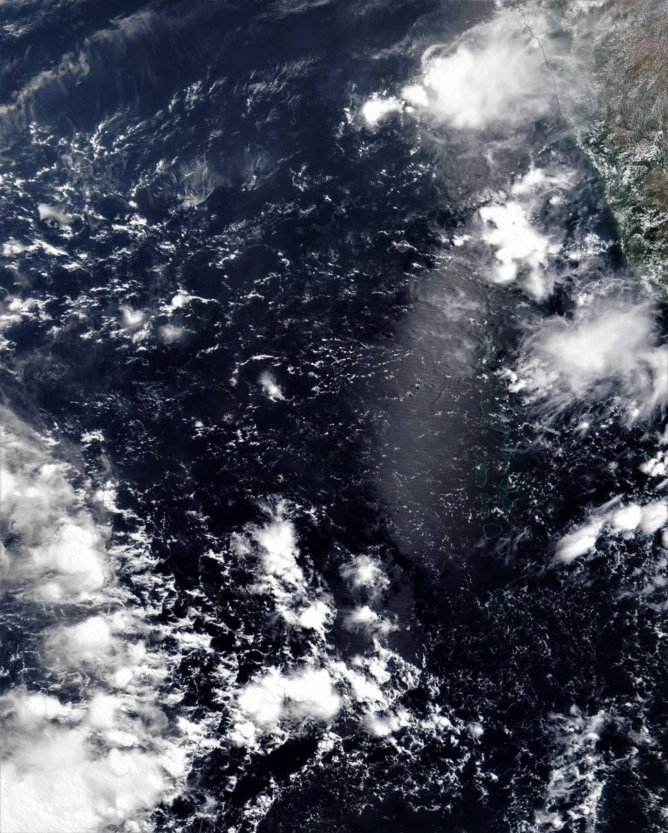
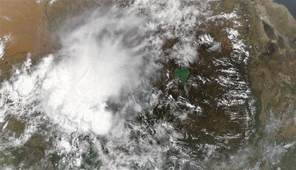
A massive storm over the Ethiopian Highlands directly over the #GERD today. @NASA Modis landsat image taken this morning.
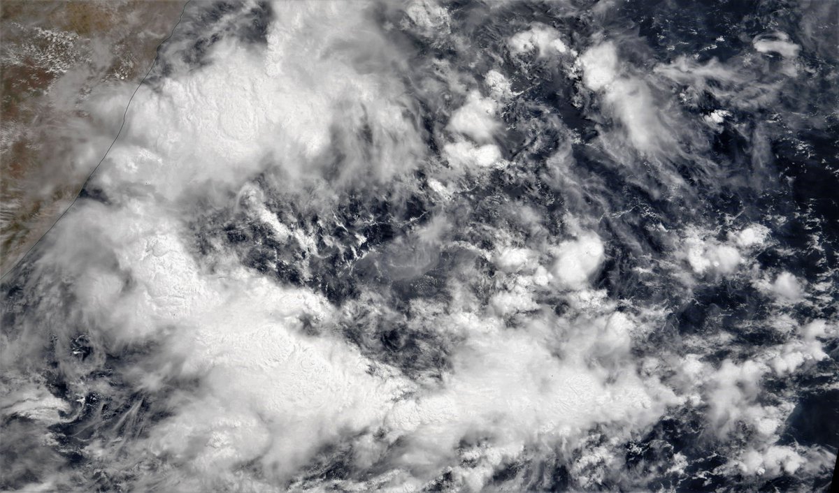
And this is the area off the Horn of Africa where the simulation models think a Cyclone may begin to form towards the end of the coming week.
Two low centers are currently modeled by the GFS, ECMWF and KMA models to form Wednesday/Thursday the southernmost of which is forecast to track in a southerly direction.
The northerly cyclone (*) is currently modeled to track north and make landfall on the Arabian Peninsula early next week.

[* Neither storm exists yet.]
The official source of advisories in relation to cyclones and typhoons is here, and may be worth bookmarking >> metoc.navy.mil/jtwc/jtwc.html

• • •

Missing some Tweet in this thread? You can try to force a refresh
 

Keep Current with Alastair Thompson

Alastair Thompson Profile picture

Stay in touch and get notified when new unrolls are available from this author!

Read all threads

This Thread may be Removed Anytime!

PDF

Twitter may remove this content at anytime! Save it as PDF for later use!

Try unrolling a thread yourself!

how to unroll video
  1. Follow @ThreadReaderApp to mention us!

  2. From a Twitter thread mention us with a keyword "unroll"
@threadreaderapp unroll

Practice here first or read more on our help page!

More from @althecat

9 May
The two computer models which are known for their prowess in predicting cyclones continue to forecast cyclone formation in the Arabian Sea in coming days.

The question of whether these cyclones will form hangs over today's #MiddleEast and #HornOfAfrica rainfall forecasts.
This image shows the Arabian Sea area where the GFS and ECMWF models are both expecting cyclone formation within the next 10 days, at different times and in different places. Image
Here's the GFS 9th May model forecast for today showing formation starting on Friday and landfall five days later.
Read 14 tweets
8 May
Halftime update On US HoA Special Envoy Jeffrey Feltman's 10 Day mission:

On the eve of his arrival in Ethiopia the stage has been set with four fairly neutral statements, indicating willingness of all national parties to seek a peaceful resolution of their disputes. #GERD
P.S. A claim is being made that Feltman has also spoken to the exiled leader of Tigray's TPLF, which initiated the war in Nov. by attacking Ethiopia's garrison in Mekelle.

However this news has not been reliably verified.
A late breaking story from @TheNationalNews provides some significant new information, i.e. that the AU President is also engaging in a shuttle diplomacy effort to resolve the #GERD dispute between Egypt Sudan and Ethiopia.
Read 6 tweets
8 May
A lengthy backgrounder story from @VOA - the U.S. Government's funded international news service - on the #GERD dam dispute.

US Tries to Help Resolve Ethiopian Dam Dispute voanews.com/middle-east/us…
Also on U.S. Envoy Feltman's peace efforts, here is a Reuters report on the Sudan meetings held yesterday. swissinfo.ch/eng/sudanese-o…
The report contains very little that is new (see below 1 paragraph) but the full statement from the Sudanese Head of State contains quite a lot more (attached tweet).
Read 12 tweets
8 May
Today's Rainfall Forecasts for the #HornOfAfrica and #MiddleEast follow in this thread.

Below you see the Ethiopian Highlands from this morning and including most of the #BlueNile #GERD #Abay watershed . The large storm on the left is mostly over Sudan. On the RHS is #Lalibela.
Here you see an animation of the storm starting up this morning.
This satellite image (@NASA Modis ) shows the area in the Arabian Sea which computer models indicate could generate two cyclones in coming days. You can see the latest GFS forecast runs for those cyclones in the attached thread.
Read 16 tweets
7 May
We have a shift to on-shore westerly wind in the Horn of Africa region today, which, I confess means little to me beyond being a new thing in the data. But it seems significant, as there is more water over the sea.

Today's rainfall/cyclone forecasts for the region follow.
Here's a view from this afternoon & the direction of travel is pretty stable. For me onshore winds bringing wet air towards mountains means lots more rain. If anyone is aware of the usual timing of this switch I would be interested.
Here are African 10-Day Accumulated rain forecasts. All of which now show the impact of the two Cyclones which are now in the forecast window.
Read 16 tweets
7 May
I like @Keir_Starmer, he’s a nice guy, and clearly he thinks that being a sober and sensible person who takes responsibility for things is what the voters want. And maybe one day it will be. It’s fine for me now. But....
... the thing is it’s anachronistic in this day and age of political showpony-ship. And I expect his problem is that many voters just don’t get him. They don’t recognise his kind of politics and think it a bit weird.
They are used to politicians who are passionate (Corbyn) or articulate (Blair) or Gruff (Brown) or charming (@jacindaardern NZ) or combative (@ScottMorrisonMP Aus) or imperious (Merkle and Macron).
Read 4 tweets

Did Thread Reader help you today?

Support us! We are indie developers!


This site is made by just two indie developers on a laptop doing marketing, support and development! Read more about the story.

Become a Premium Member ($3/month or $30/year) and get exclusive features!

Become Premium

Too expensive? Make a small donation by buying us coffee ($5) or help with server cost ($10)

Donate via Paypal Become our Patreon

Thank you for your support!

Follow Us on Twitter!

:(