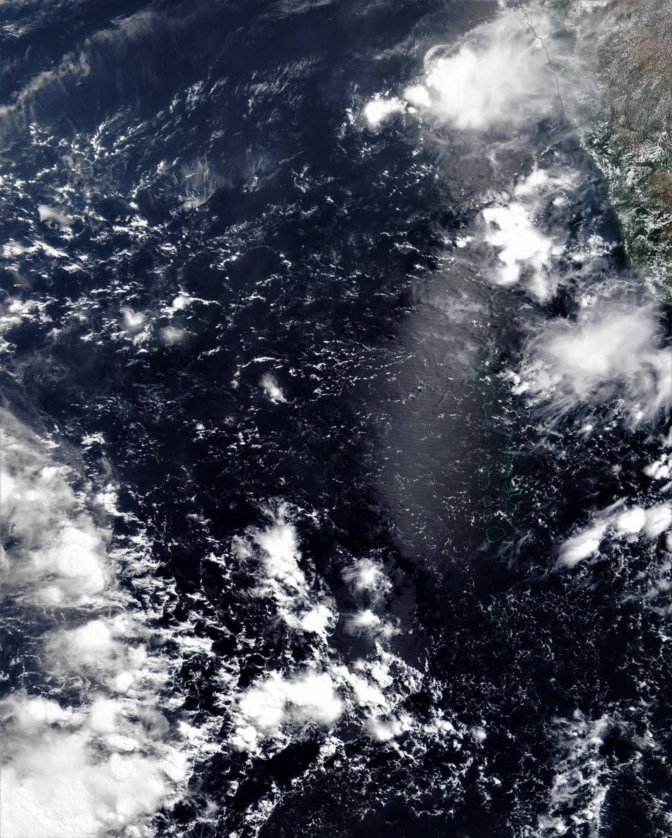
We have a shift to on-shore westerly wind in the Horn of Africa region today, which, I confess means little to me beyond being a new thing in the data. But it seems significant, as there is more water over the sea.
Today's rainfall/cyclone forecasts for the region follow.
Today's rainfall/cyclone forecasts for the region follow.
Here's a view from this afternoon & the direction of travel is pretty stable. For me onshore winds bringing wet air towards mountains means lots more rain. If anyone is aware of the usual timing of this switch I would be interested.
Here are African 10-Day Accumulated rain forecasts. All of which now show the impact of the two Cyclones which are now in the forecast window. 


The two animations which follow are both from the U.S. GFS model which is arguably the best and most experienced in forecasting cyclonic paths. In this one you see two lows briefly and then one cyclone heading south. The other one heads north.
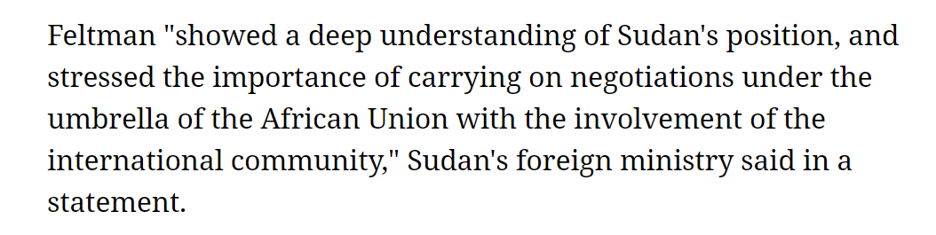
And here is the northern Cyclone (*), which is modeled (as yesterday) - to make landfall on the Arabian Peninsula near the Yemen/Oman border.
(* Not yet formed)
(* Not yet formed)
As someone just mentioned the filling of the #GERD in the replies even without the change of wind direction and two cyclones, it already looked as if there was going to be no problem filling the #GERD - here's real deal data from the expert, @TirusewAsefa.
https://twitter.com/TirusewAsefa/status/1390361895362826240?s=20
And here are the forecasts:
First up, May 7th, 10-day accumulated rain forecasts, for Ethiopia and the Horn of Africa from the @ECMWF, GFS and KMA weather models.
#Sudan #SouthSudan #Ethiopia #GERD #Africa #HornOfAfrica #DesertRain
First up, May 7th, 10-day accumulated rain forecasts, for Ethiopia and the Horn of Africa from the @ECMWF, GFS and KMA weather models.
#Sudan #SouthSudan #Ethiopia #GERD #Africa #HornOfAfrica #DesertRain


+ Here are 3-day accumulated rain forecasts, to Midnight Monday, for #Ethiopia and the Horn of Africa, again from the @ECMWF, GFS and KMA weather models.
#Sudan #SouthSudan #Ethiopia #GERD #Africa #HornOfAfrica #DesertRain
#Sudan #SouthSudan #Ethiopia #GERD #Africa #HornOfAfrica #DesertRain


And now we move on to the #ArabianStorms section of the bulletin. It has been a very busy day today as indicated in this eyewitness video from @Arab_Storms excellent storm feed.
https://twitter.com/Arab_Storms/status/1390640139676921857?s=20
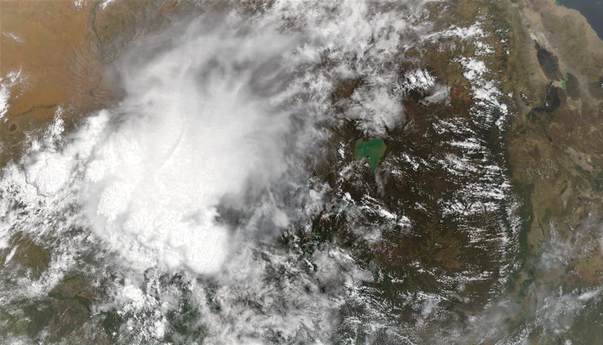
In this image of the broad peninsula you can see the storms that caused this in the far left. Meanwhile along the north side of the Red Sea you can see a line of storms once again all the way from the Gulf of Aden to Medina.
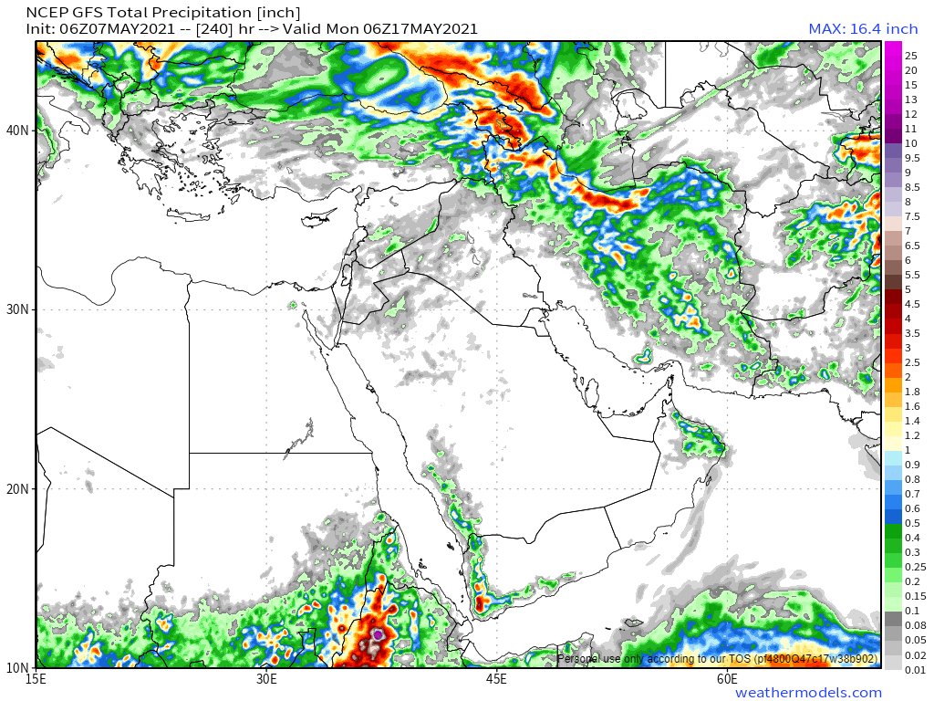
Here are today's, May 7th, 10 day accumulated rain forecasts, for the #MiddleEast from the GFS, ECMWF, CMC & KMA weather models.
@Arab_Storms
#ArabianStorms
#KSA #Yemen #Oman #Jordan #Sudan #Iran #Syria #GERD #Sudan #DesertRain
الله أعلم
@Arab_Storms
#ArabianStorms
#KSA #Yemen #Oman #Jordan #Sudan #Iran #Syria #GERD #Sudan #DesertRain
الله أعلم


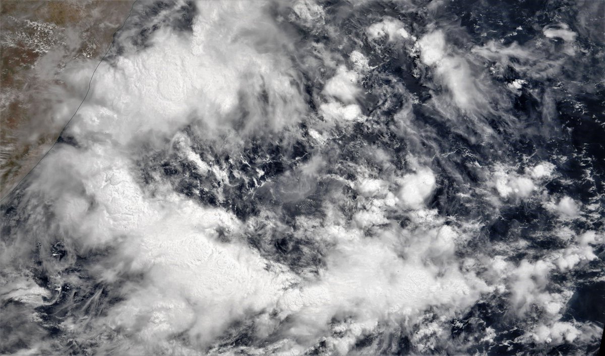
An @NOAA picture of the Arabian Peninsula taken this morning. The high-speed water vapour transport across Yemen has now been running continuously for several days. The 2nd band of clouds in the north is new however.

May 7th, 3 day accumulated rain forecasts (to Saturday at Midnight), for the #MiddleEast from the GFS, ECMWF, CMC & KMA weather models.
@Arab_Storms
#ArabianStorms
#KSA #Yemen #Oman #Jordan #Sudan #Iran #Syria #GERD #Sudan #DesertRain
الله أعلم
@Arab_Storms
#ArabianStorms
#KSA #Yemen #Oman #Jordan #Sudan #Iran #Syria #GERD #Sudan #DesertRain
الله أعلم


And here are four more @NASA images from this morning of Iran & the Caspian Sea, the Straights of Tiran, the Red Sea adjacent to #Mecca and #Jeddah, and the #Euphrates Delta in Iraq.
#Iran #CaspianSea #Yemen #GulfOfAden #RedSea #Makkah #Iraq #Ur #Kuwait #Arabia
#Iran #CaspianSea #Yemen #GulfOfAden #RedSea #Makkah #Iraq #Ur #Kuwait #Arabia


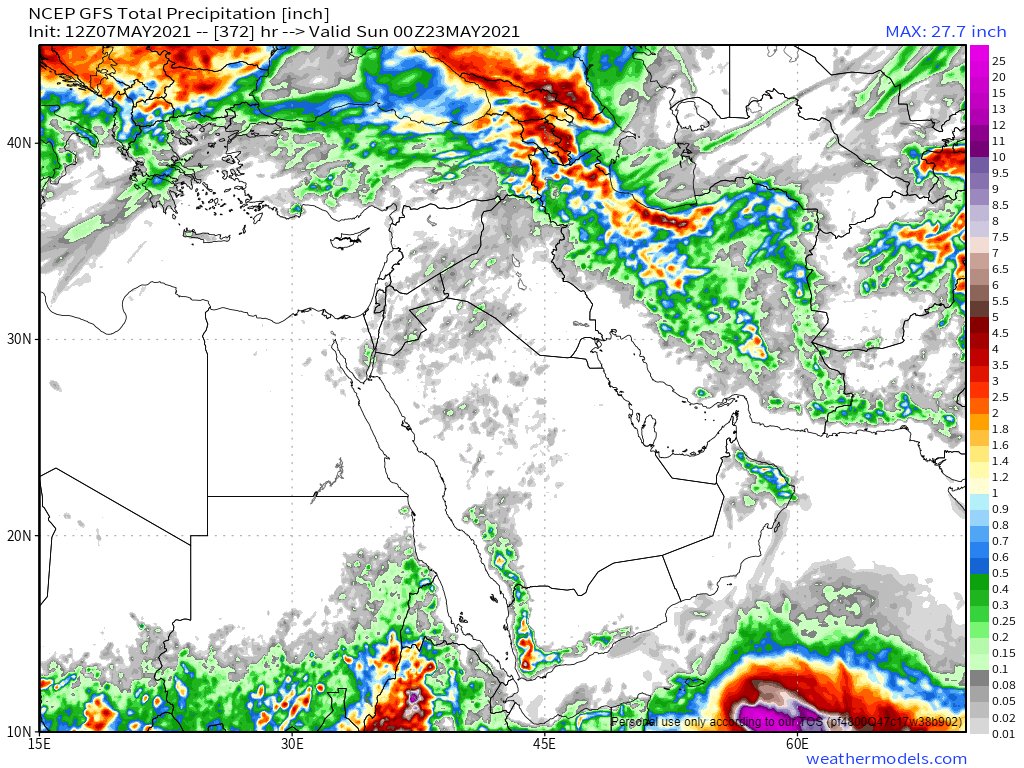
And the final forecast for tonight for the #MiddleEast contains ultra-long range accumulated rain computer model forecasts, NOAA's 16-Day GFS (the last three model runs - the difference being the cyclone) + Korea's 12 day KMA model.
الله أعلم
الله أعلم


And to sign off an image of the sun setting for the day on the Horn of Africa.
/ENDS
/ENDS
• • •
Missing some Tweet in this thread? You can try to
force a refresh