Today's Rainfall Forecasts for the #HornOfAfrica and #MiddleEast follow in this thread.
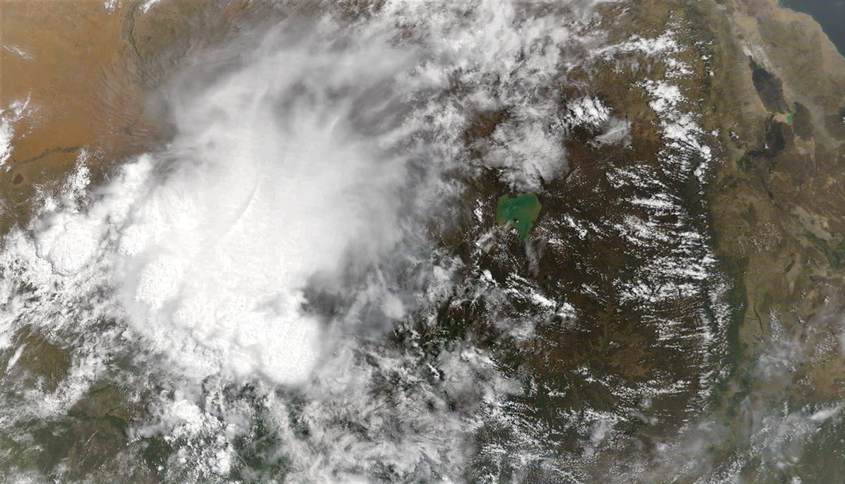
Below you see the Ethiopian Highlands from this morning and including most of the #BlueNile #GERD #Abay watershed . The large storm on the left is mostly over Sudan. On the RHS is #Lalibela.
Below you see the Ethiopian Highlands from this morning and including most of the #BlueNile #GERD #Abay watershed . The large storm on the left is mostly over Sudan. On the RHS is #Lalibela.
Here you see an animation of the storm starting up this morning.
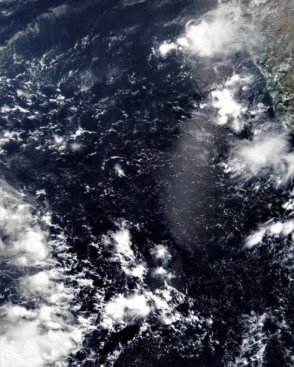
This satellite image (@NASA Modis ) shows the area in the Arabian Sea which computer models indicate could generate two cyclones in coming days. You can see the latest GFS forecast runs for those cyclones in the attached thread.
https://twitter.com/althecat/status/1391004928861249537?s=20
These three to day precipitation forecasts suggest that even if a cyclone doesn't form, or make landfall, the area of storm activity off the coast of Somalia and Kenya may by itself produce very significant rainfall over the Horn in coming days.


This animation illustrates how this area of storm activity over the Arabian Sea is effectively an East African Monsoon. (Scientific literature on the idea can be found here >> pubs.er.usgs.gov/publication/70… )
And here are today's rainfall forecasts:
First up, May 8th, 10-day accumulated rain forecasts, for Ethiopia and the Horn of Africa from the @ECMWF, GFS and KMA weather models.
#Sudan #SouthSudan #Ethiopia #GERD #Africa #HornOfAfrica #DesertRain #Somalia #Somaliland
First up, May 8th, 10-day accumulated rain forecasts, for Ethiopia and the Horn of Africa from the @ECMWF, GFS and KMA weather models.
#Sudan #SouthSudan #Ethiopia #GERD #Africa #HornOfAfrica #DesertRain #Somalia #Somaliland


+ Here are 3-day accumulated rain forecasts, to Midnight Monday, for #Ethiopia and the Horn of Africa, again from the @ECMWF, GFS and KMA weather models.
#Sudan #SouthSudan #Ethiopia #GERD #Africa #HornOfAfrica #DesertRain #Somalia #Somaliland
#Sudan #SouthSudan #Ethiopia #GERD #Africa #HornOfAfrica #DesertRain #Somalia #Somaliland


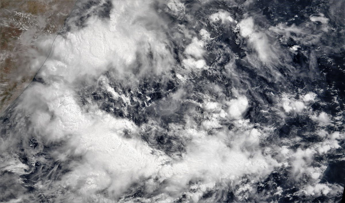
Another satellite image this time of the red sea. And in the desert adjacent you can see the Nile all the way to the border of South Sudan.

Today again the #ArabianStorm epicenter was Oman this time with huge storms along the entire North East Coast. Red Sea storms were modest today.
And the videos compiled by @Arab_Storms of the weather tody in #Oman is also extraordinary.
https://twitter.com/Arab_Storms/status/1391062031969579013?s=20
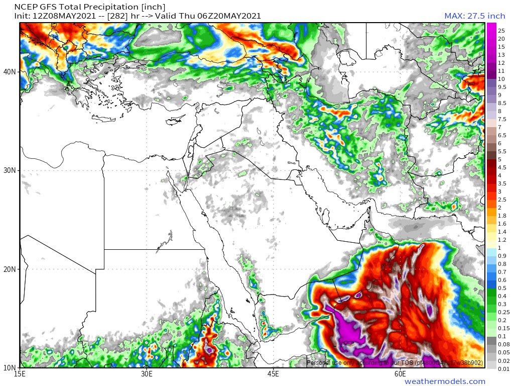
Here are today's, May 8th, 10 day accumulated rain forecasts, for the #MiddleEast from the GFS, ECMWF (both showing a Cyclone), CMC & KMA weather models.
@Arab_Storms
#ArabianStorms
#KSA #Yemen #Oman #Jordan #Sudan #Iran #Syria #GERD #Sudan #DesertRain
الله أعلم
@Arab_Storms
#ArabianStorms
#KSA #Yemen #Oman #Jordan #Sudan #Iran #Syria #GERD #Sudan #DesertRain
الله أعلم


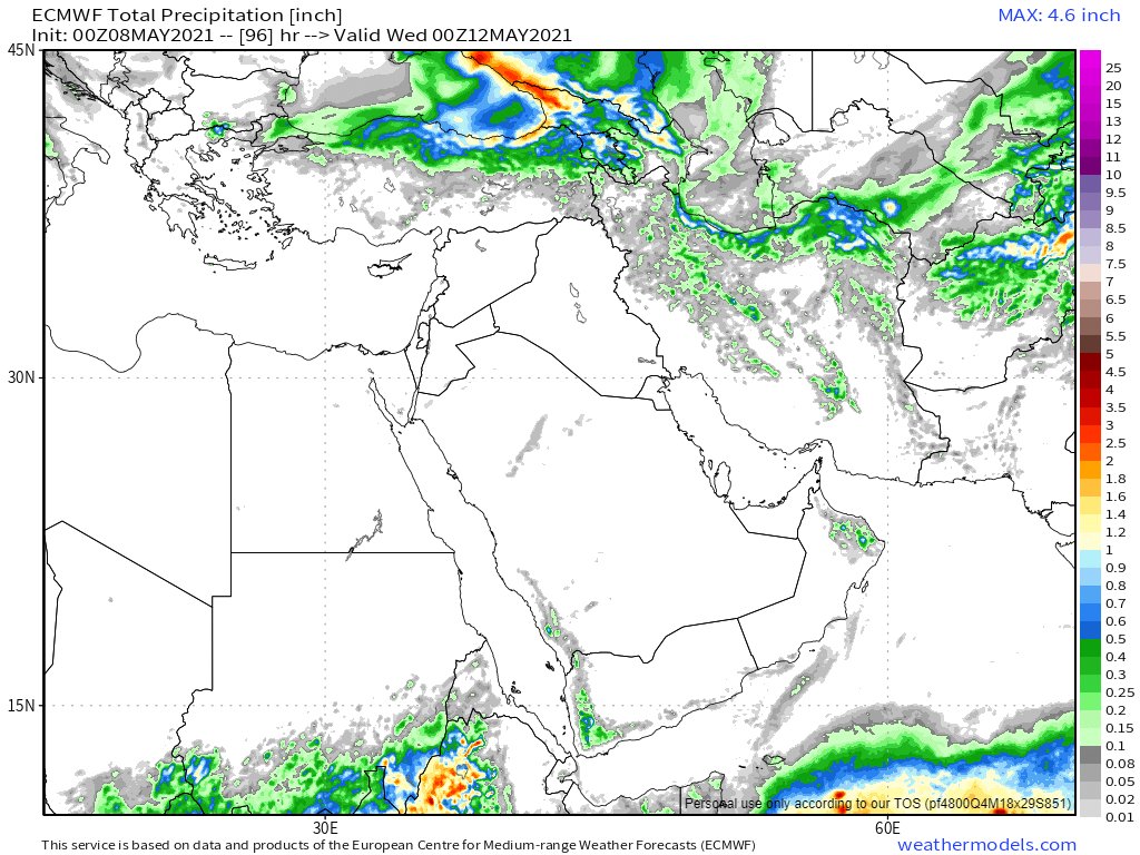
May 8th, 3 day accumulated rain forecasts (to Saturday at Midnight), for the #MiddleEast from the GFS, ECMWF, CMC & KMA weather models.
@Arab_Storms
#ArabianStorms
#KSA #Yemen #Oman #Jordan #Sudan #Iran #Syria #GERD #Sudan #DesertRain
الله أعلم
@Arab_Storms
#ArabianStorms
#KSA #Yemen #Oman #Jordan #Sudan #Iran #Syria #GERD #Sudan #DesertRain
الله أعلم


These four model forecasts GFS, ACCESS-G, CMC and ECMWF show atmospheric water vapour in 10 days time (rain clouds). All four models now expect a cyclone (*) to arrive at roughly the same time.
(*Cyclone not formed yet)
الله أعلم
(*Cyclone not formed yet)
الله أعلم


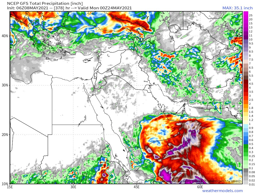
And the final forecasts for tonight for the #MiddleEast contains ultra-long range accumulated rain computer model forecasts, NOAA's 16-Day GFS (the last three model runs - the difference being the cyclone) + Korea's 12 day KMA model (no Cyclone).
الله أعلم
الله أعلم


ENDS
@ThreadreaderApp Unroll
@ThreadreaderApp Unroll
• • •
Missing some Tweet in this thread? You can try to
force a refresh