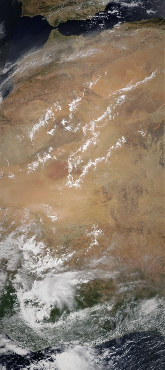
Here is the continuation of the #WestAfricaWaterPlume transformation of European weather this morning into something which is both unpredictable and not particularly nice, i.e. windy wet and cold.
The following three animations are offered to help Europeans who are curious to understand what is going on. Our weather reports tend to be geographically confined in a manner that obscures the bigger picture.
The first shows the water vapour picture over 84 hours till Friday arpund midday. The #WestAfricaWaterPlume can be seen coming in bottom left over Algeria. simultaneously another storm is coming in at speed into the British isles. Hence all the rain.
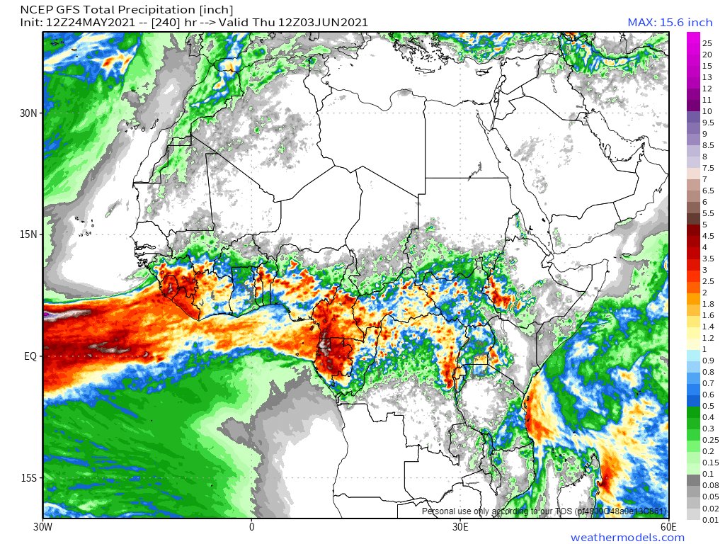
Above you can see an area without rain crossing from West to East, from UK to the Baltic. This corresponds with the low pressure area you see here which has come in from the Arctic and is dry air. The combination of dry cold air and warm wet air is unstable =rain.
And finally the cold. The low system moving east results in flows of cold air from the North Atlantic flowing into Western Europe and that accounts for the cold nights and daytime temperatures in their teens at a time when they should be in their 20s.
Finally, its worth noting that it could have been worse. The two Indian Ocean cyclones #Tauktae last week and now #Yaas have been impeding the flow of water vapour west along the equator from the Pacific. Had they not done so, this weeks water plume may have been much stronger.

• • •

Missing some Tweet in this thread? You can try to force a refresh
 

Keep Current with Alastair Thompson

Alastair Thompson Profile picture

Stay in touch and get notified when new unrolls are available from this author!

Read all threads

This Thread may be Removed Anytime!

PDF

Twitter may remove this content at anytime! Save it as PDF for later use!

Try unrolling a thread yourself!

how to unroll video
  1. Follow @ThreadReaderApp to mention us!

  2. From a Twitter thread mention us with a keyword "unroll"
@threadreaderapp unroll

Practice here first or read more on our help page!

More from @althecat

25 May
With Cyclone #Yaas soaking up all the moisture east of the #MiddleEast and #HornOfAfrica it was a relatively calm day. Albeit not without another intense set of storms along the Red Sea Coast in the Jinzan mountains.

Today's rainfall forecasts follow.
The days began relatively quiet on the #WestAfricanMonsoon front thanks to Cyclone #Yaas. This image shows a strip from the Libyan Coast across the Sahara down to the Congo. Image
And it remained fairly quiet over the great forests of equatorial Africa today. But further West over the Ivory Coast and the West Sahara the #WestAfricaWaterPlume continued to pump water vapour across the Sahara into Europe. Image
Read 16 tweets
24 May
Cyclone #Yaas is just 2 days away from landfall on the North Eastern Indian Coast in the Odisha and once onshore is forecast pass over the ancient city of Jaipur.


Today's #MiddleEast #Sahara and #HornOfAfrica forecasts follow.
We have a stunningly clear image of the #NileBasin this morning from @NASA Modis from Cairo to Lake Victoria showing the impact of the April and May rains on the landscape.
In today's 10-Day North Africa rain forecasts the European @ECMWF model remains unconvinced about the impact of #WestAfricaWaterPlumes on the Sahara, which as you will soon see are once again having a spectacular impact on European weather.
Read 18 tweets
24 May
Cyclone #Yaas has turned very quickly into a massive powerful storm which is currently forecast to reach "Very Severe Cyclone" strength (on the threshold between Cat 1 and Cat 2 Hurricane strength) overnight tomorrow before making landfall.
Here you see a near live @zoom_earth animation of #CycloneYaas and outer rainbands already over the North Western shows of the Bay of Bengal.
Here is a @NASA Modis satellite image taken this morning of #Yaas, it looks like it is fairly rapidly organising itself.
Read 7 tweets
22 May
On another road trip, this time leaving Europe’s #CityOfPeace possibly permanently. Image
I have had two and a half years at the amazing @EU_Commission funded @HumanBrainProj, mostly helping with the effort to launch @EBRAINS_eu a research infrastructure for computational brain research which will be its legacy. ImageImageImage
This morning as I left I visited a favourite spot near Ferney-Voltaire where Mt Blanc was fully visible for the first time in ages to say goodbye. Image
Read 16 tweets
22 May
This morning's rainfall forecast is actually last nights (I am in the process of moving - a bit stretched. There is a lot going on.

Here we see the ongoing impacts of a #WestAfricaWaterPlume coming into the Middle East and 2 large storms, one over Syria and one over Medina
Here are last night's 10-day rainfall forecasts for North Africa which are nothing short of astonishing with respect especially to what is expected in #Algeria and #Mauritania. The largest forecast #DesertRain event to date.
This animation is from the is morning and shows the current status of both #WestAfricanMonsoon events. The Plume directed at the #MiddleEast is continuing and the one in the west Sahara is strengthening.
Read 16 tweets

Did Thread Reader help you today?

Support us! We are indie developers!


This site is made by just two indie developers on a laptop doing marketing, support and development! Read more about the story.

Become a Premium Member ($3/month or $30/year) and get exclusive features!

Become Premium

Too expensive? Make a small donation by buying us coffee ($5) or help with server cost ($10)

Donate via Paypal Become our Patreon

Thank you for your support!

Follow Us on Twitter!

:(