With Cyclone #Yaas soaking up all the moisture east of the #MiddleEast and #HornOfAfrica it was a relatively calm day. Albeit not without another intense set of storms along the Red Sea Coast in the Jinzan mountains.
Today's rainfall forecasts follow.
Today's rainfall forecasts follow.
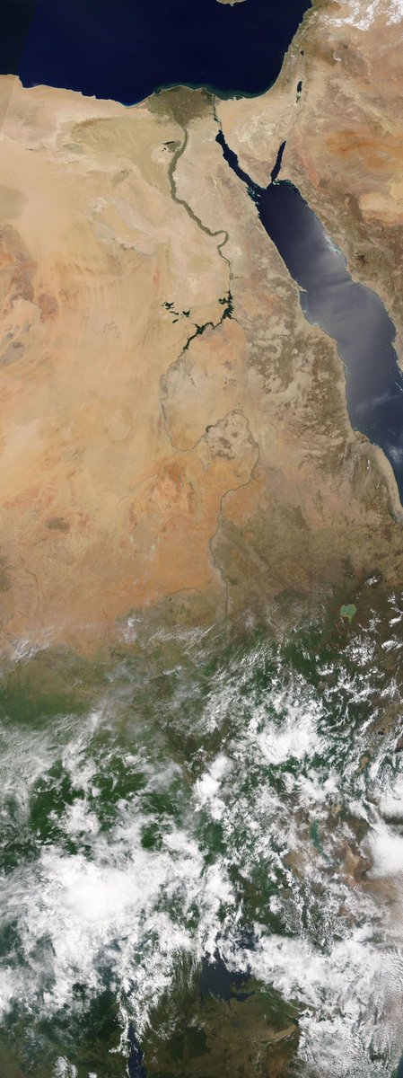
The days began relatively quiet on the #WestAfricanMonsoon front thanks to Cyclone #Yaas. This image shows a strip from the Libyan Coast across the Sahara down to the Congo. 

And it remained fairly quiet over the great forests of equatorial Africa today. But further West over the Ivory Coast and the West Sahara the #WestAfricaWaterPlume continued to pump water vapour across the Sahara into Europe.
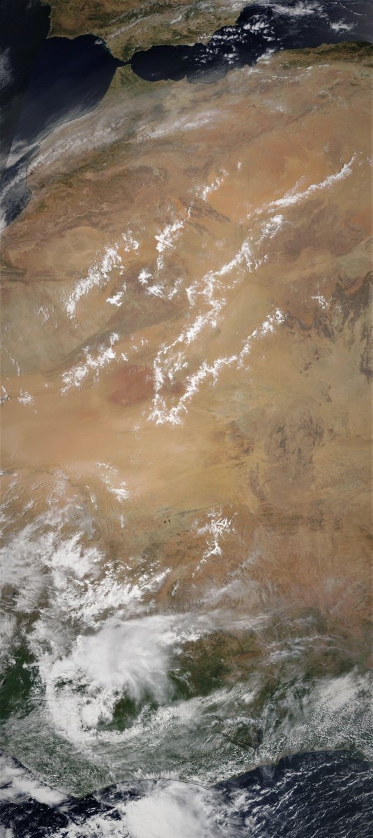
In the morning as you see in the image above it appeared fairly subdued by by nightfall the scale of the water vapour transport was far more apparent.
Here are three views of what the weather models thought was going around the time of the @Zoom_Earth animation above.


And in this animation you can see the impact of this #WestAfricaWaterPlume further north this evening.
This is a picture of the intense rain/storm activity underway over North Eastern Europe.
The attached tweet thread shows the 1st wave of this last night, over northern Italy and Western Europe. TLDR version >> its making it cold wet and windy all over.
The attached tweet thread shows the 1st wave of this last night, over northern Italy and Western Europe. TLDR version >> its making it cold wet and windy all over.
https://twitter.com/althecat/status/1397147517415038978?s=20

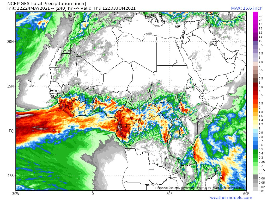
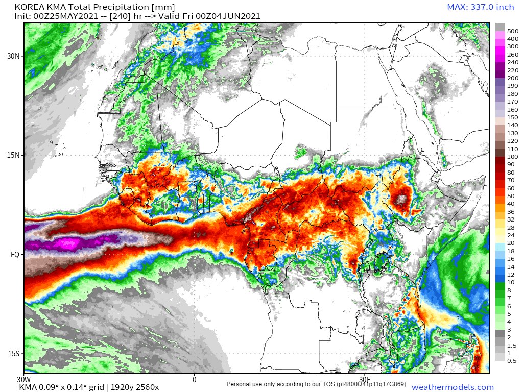
Here are today's 10 day rain forecasts for North Africa. Note the extent of forecast rain in the CMC and KMA models for the Western Sahara. This is set to be a long event from the look of things.


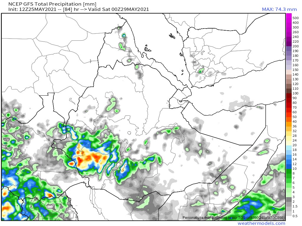
Here are today's #HoA rainfall forecasts.
25th May 10-day rain forecasts for the #HornOfAfrica remain subdued, seemingly because of the influence of Cyclone #Yaas. That said there is a difference of opinion on magnitude.
#Sudan #SouthSudan #Ethiopia #Somalia #Somaliland #GERD
25th May 10-day rain forecasts for the #HornOfAfrica remain subdued, seemingly because of the influence of Cyclone #Yaas. That said there is a difference of opinion on magnitude.
#Sudan #SouthSudan #Ethiopia #Somalia #Somaliland #GERD


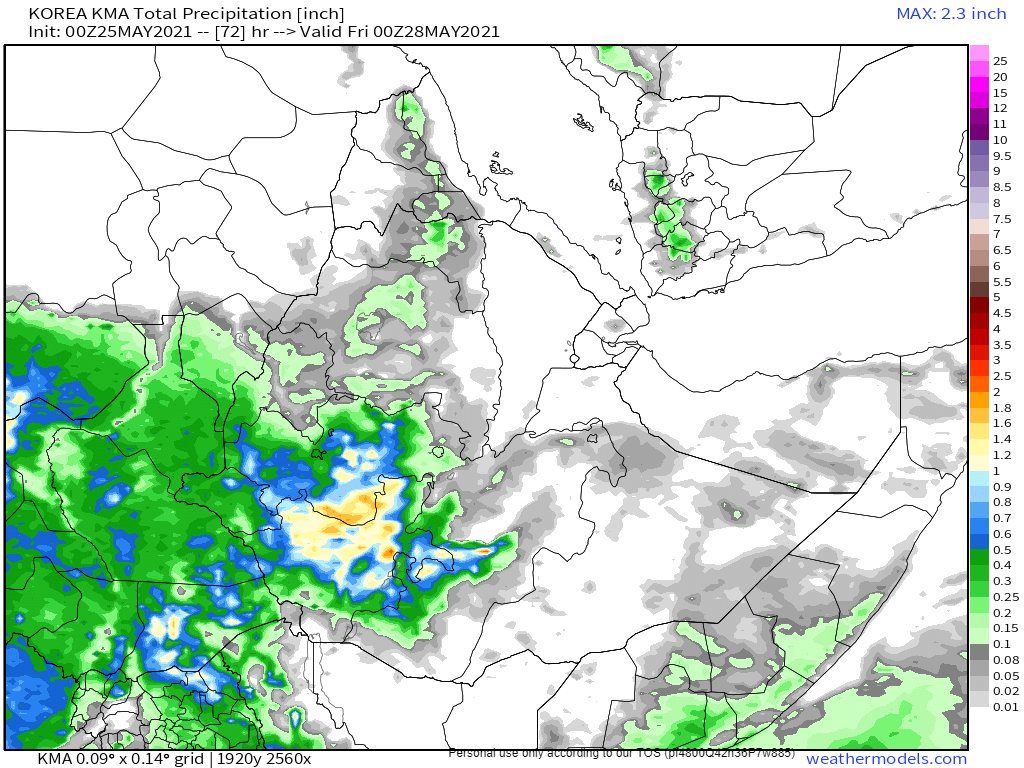
3-day forecasts for the same area show rain expected till midnight Friday by the ECMWF, GFS and KMA models. Given the rains so far during the "little rainy" season in the Horn I expect this is fairly welcome.
#Sudan #SouthSudan #Ethiopia #Somalia #Somaliland #GERD
#Sudan #SouthSudan #Ethiopia #Somalia #Somaliland #GERD

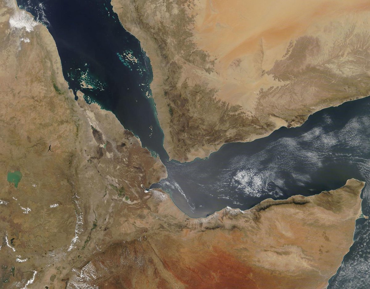
The first of these two images of #Yemen, #Eritrea, #Ethiopia and #Somaliland is from 11th March, the second from today. Fresh green growth can be clearly seen. Note: The resolution of the image is 1 pixel per km2.

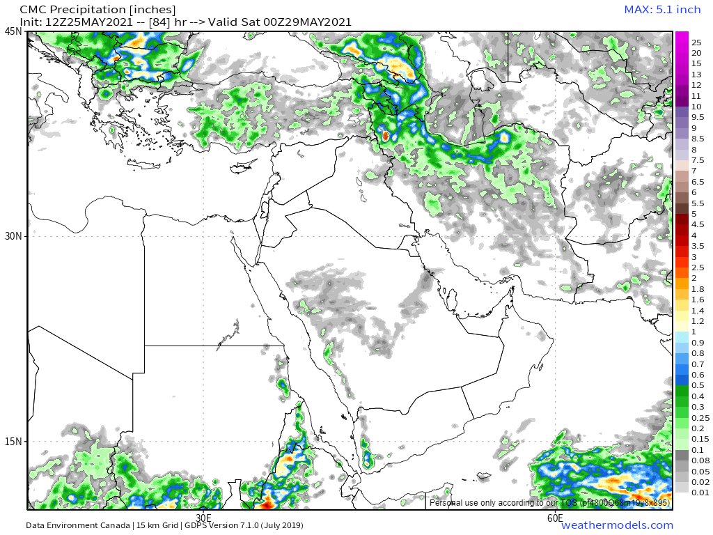
May 25th, 10 day accumulated rain forecasts for the #MiddleEast from the GFS, ECMWF, CMC & KMA weather models.
@Arab_Storms
#ArabianStorms
#KSA #Yemen #Oman #Jordan #Sudan #Iran #Syria #GERD #Sudan #DesertRain
الله أعلم
@Arab_Storms
#ArabianStorms
#KSA #Yemen #Oman #Jordan #Sudan #Iran #Syria #GERD #Sudan #DesertRain
الله أعلم


And 3-Day forecasts to midnight Friday. Looking at these and comparing them with what is happening one gets the impression the weather modelers are occupied by bigger issues that #ArabianStorms.


Today's #ArabianStorms were non trivial, and if you look closely reveal significant complexity to the wind directions over the area. The resumption of storm activity along the Western side of the Red Sea is also a new feature.
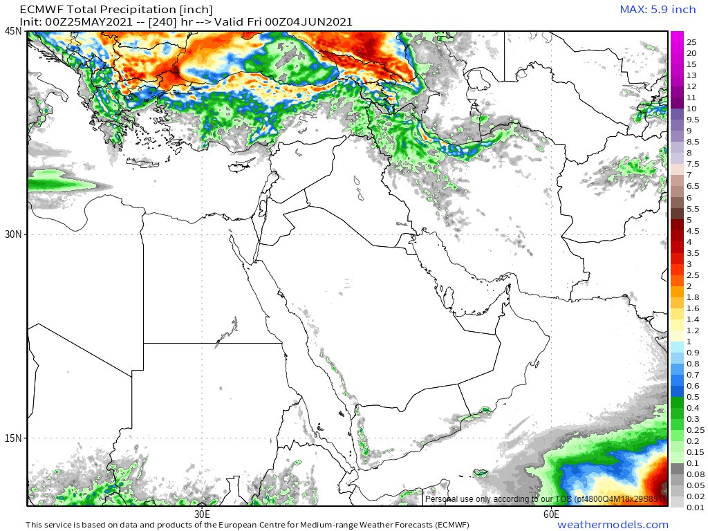
The #MiddleEast long-range 16 day and 12 day forecasts from the GFS and KMA models. Again we have the last two runs from each model here.
@Arab_Storms
#ArabianStorms
#KSA #Yemen #Oman #Jordan #Sudan #Iran #Syria #GERD #Sudan #DesertRain
الله أعلم
@Arab_Storms
#ArabianStorms
#KSA #Yemen #Oman #Jordan #Sudan #Iran #Syria #GERD #Sudan #DesertRain
الله أعلم


ENDS/
@ThreadreaderApp unroll
@ThreadreaderApp unroll
• • •
Missing some Tweet in this thread? You can try to
force a refresh