Cyclone #Yaas has turned very quickly into a massive powerful storm which is currently forecast to reach "Very Severe Cyclone" strength (on the threshold between Cat 1 and Cat 2 Hurricane strength) overnight tomorrow before making landfall.
Here you see a near live @zoom_earth animation of #CycloneYaas and outer rainbands already over the North Western shows of the Bay of Bengal.
Here is a @NASA Modis satellite image taken this morning of #Yaas, it looks like it is fairly rapidly organising itself.
Here's a GFS accumulated rainfall forecast for #CycloneYaas through to Saturday. The rain tends to fall mostly on the North Eastern side of these storms and will bring significant rainfall and high winds across all of Bangladesh and around Calcutta.
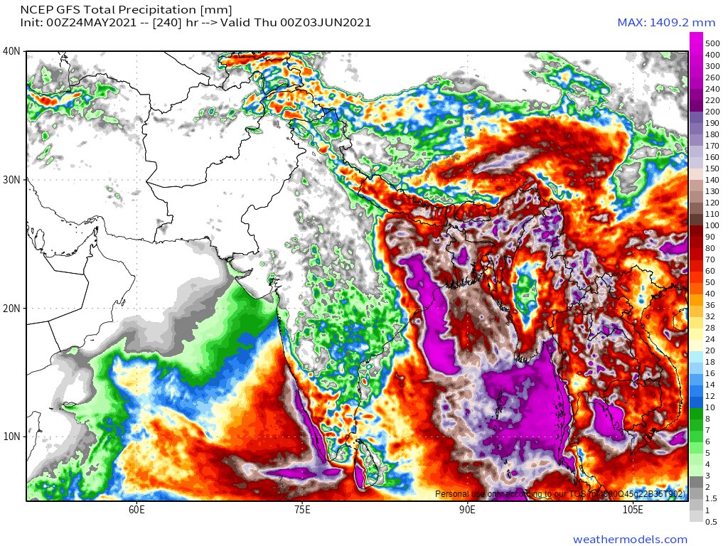
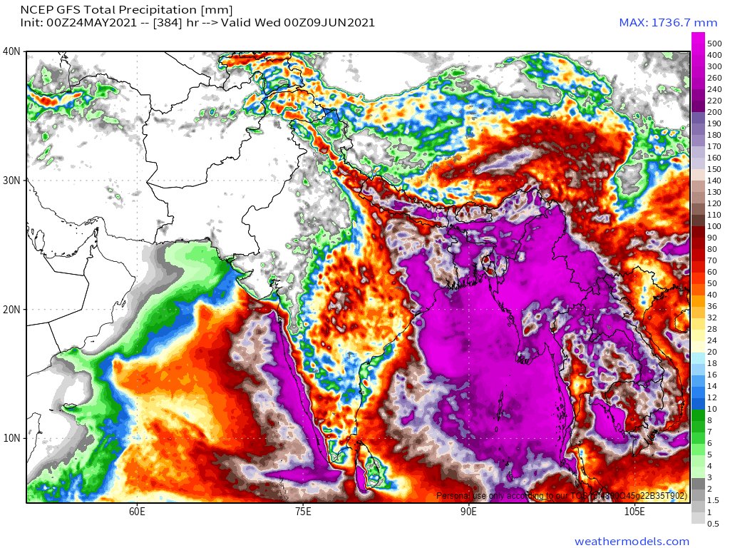
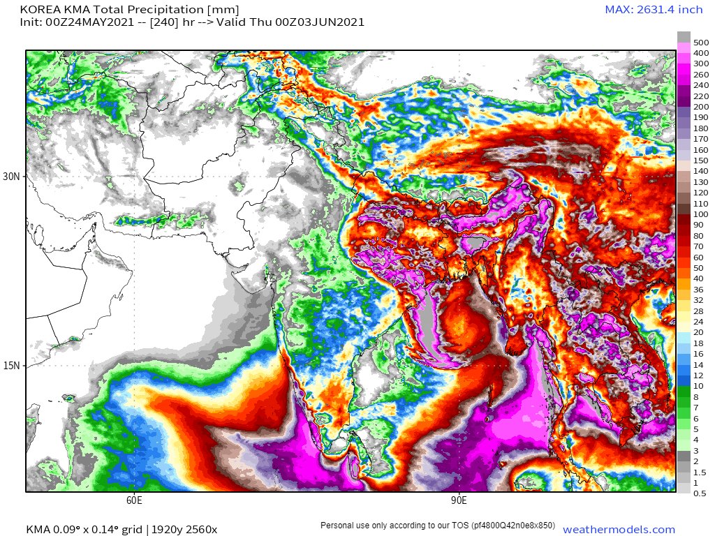
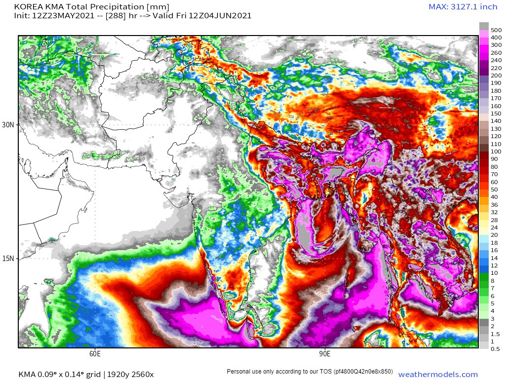
As the storm is expected to bring a large number of small low pressure centers together over the region rainfalls over a 10 day period and beyond are massive. Here are GFS forecasts for 10-day and 16-Day accumulated rainfall totals.
#YaasCyclone is certainly going to herald the beginning of the Indian Monsoon season on June 1st in a spectacular manner.
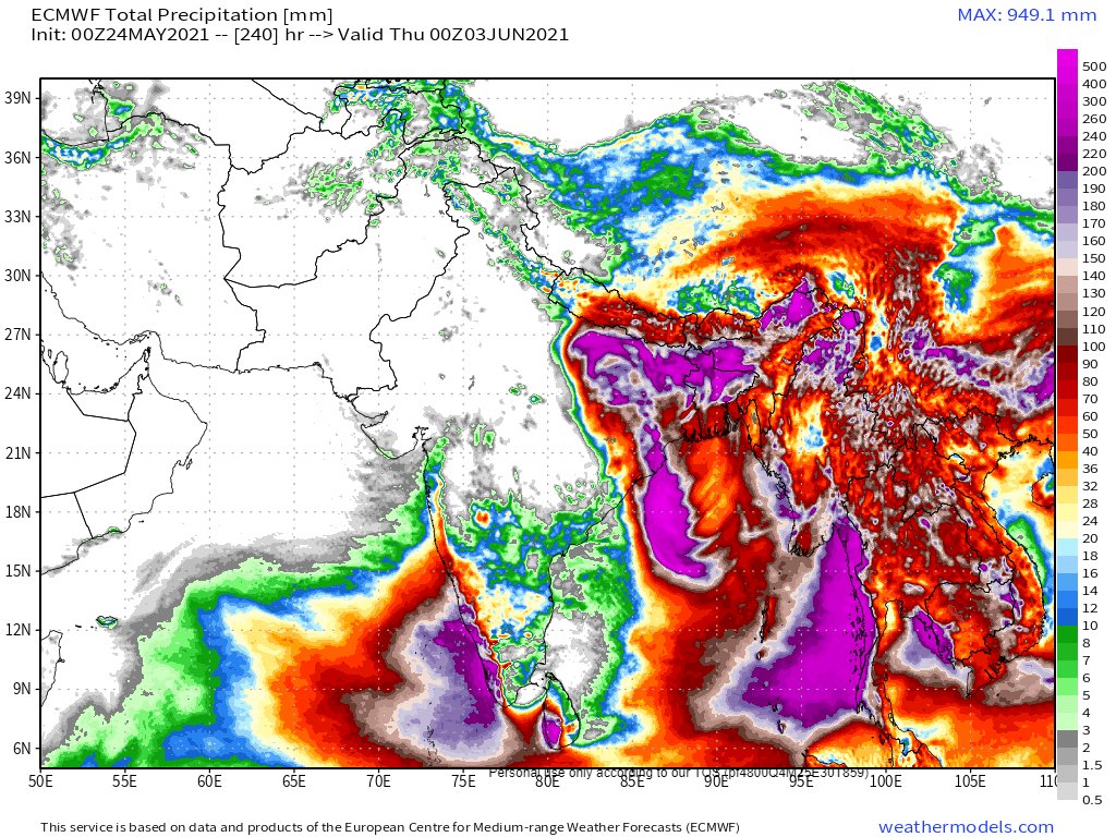
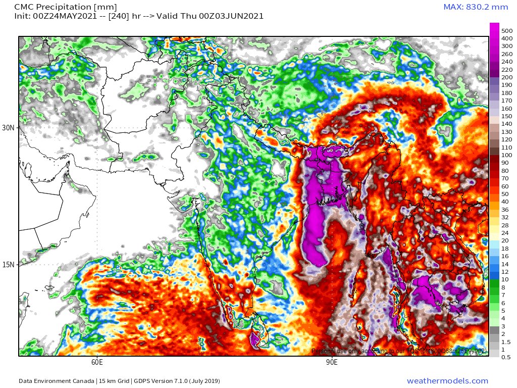
Here are the other major models views on rainfall the first three are 1-day forecasts, the last one is 12 days.
Finally. This global precipitable water simulation through to June 1st shows some interesting context about the intensity of the rainfall potential in the West Pacific and Indian Ocean tropical areas at the moment.
Its almost as if there is a water vapour traffic jam underway.
• • •
Missing some Tweet in this thread? You can try to
force a refresh
With Cyclone #Yaas soaking up all the moisture east of the #MiddleEast and #HornOfAfrica it was a relatively calm day. Albeit not without another intense set of storms along the Red Sea Coast in the Jinzan mountains.
Today's rainfall forecasts follow.
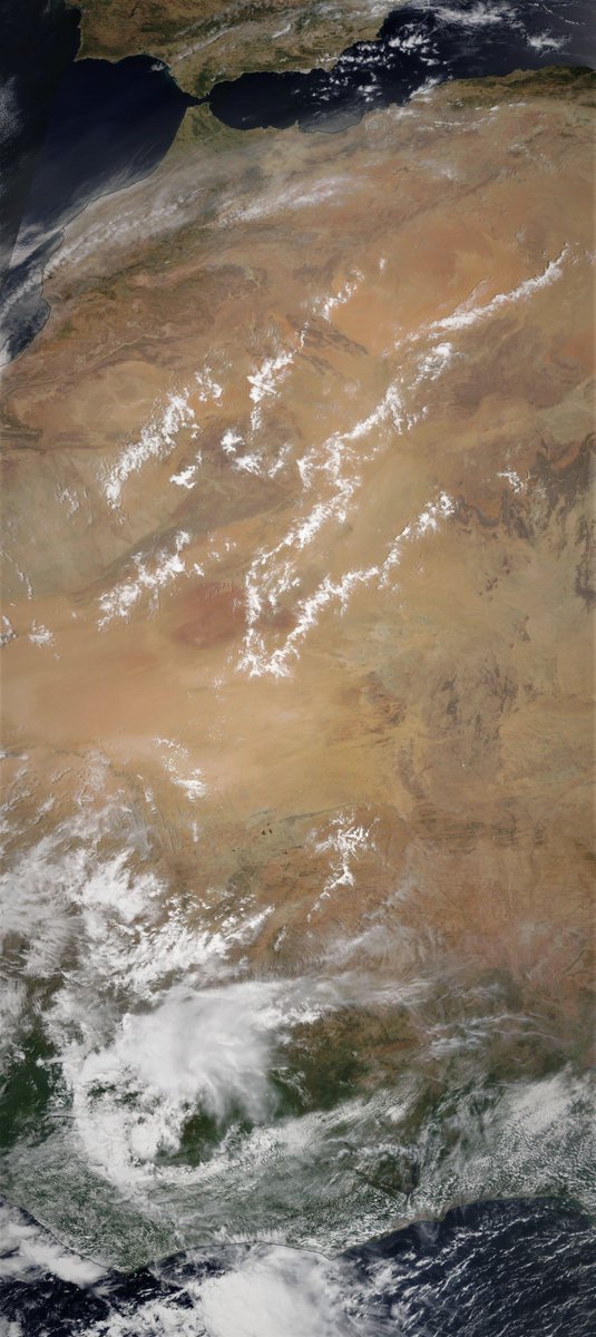
The days began relatively quiet on the #WestAfricanMonsoon front thanks to Cyclone #Yaas. This image shows a strip from the Libyan Coast across the Sahara down to the Congo.
And it remained fairly quiet over the great forests of equatorial Africa today. But further West over the Ivory Coast and the West Sahara the #WestAfricaWaterPlume continued to pump water vapour across the Sahara into Europe.
Here is the continuation of the #WestAfricaWaterPlume transformation of European weather this morning into something which is both unpredictable and not particularly nice, i.e. windy wet and cold.
The following three animations are offered to help Europeans who are curious to understand what is going on. Our weather reports tend to be geographically confined in a manner that obscures the bigger picture.
The first shows the water vapour picture over 84 hours till Friday arpund midday. The #WestAfricaWaterPlume can be seen coming in bottom left over Algeria. simultaneously another storm is coming in at speed into the British isles. Hence all the rain.
Cyclone #Yaas is just 2 days away from landfall on the North Eastern Indian Coast in the Odisha and once onshore is forecast pass over the ancient city of Jaipur.
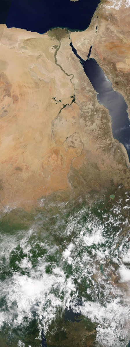
We have a stunningly clear image of the #NileBasin this morning from @NASA Modis from Cairo to Lake Victoria showing the impact of the April and May rains on the landscape.
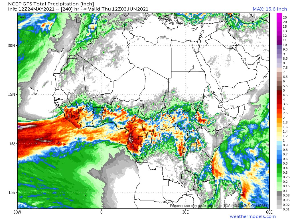
In today's 10-Day North Africa rain forecasts the European @ECMWF model remains unconvinced about the impact of #WestAfricaWaterPlumes on the Sahara, which as you will soon see are once again having a spectacular impact on European weather.
On another road trip, this time leaving Europe’s #CityOfPeace possibly permanently.
I have had two and a half years at the amazing @EU_Commission funded @HumanBrainProj, mostly helping with the effort to launch @EBRAINS_eu a research infrastructure for computational brain research which will be its legacy.
This morning as I left I visited a favourite spot near Ferney-Voltaire where Mt Blanc was fully visible for the first time in ages to say goodbye.
This morning's rainfall forecast is actually last nights (I am in the process of moving - a bit stretched. There is a lot going on.
Here we see the ongoing impacts of a #WestAfricaWaterPlume coming into the Middle East and 2 large storms, one over Syria and one over Medina
Here are last night's 10-day rainfall forecasts for North Africa which are nothing short of astonishing with respect especially to what is expected in #Algeria and #Mauritania. The largest forecast #DesertRain event to date.
This animation is from the is morning and shows the current status of both #WestAfricanMonsoon events. The Plume directed at the #MiddleEast is continuing and the one in the west Sahara is strengthening.