#Satellite investigations around #Ukraine crisis has many facets, opportunities & problems.
Short thread on potential for more research & findings
#OSINT, #Intelligence, #Ukraine️
#Journalism
Short thread on potential for more research & findings
#OSINT, #Intelligence, #Ukraine️
#Journalism
1) Most obvious: Showing the sheer extent of destruction from high-res satellite images. Like here (my video eval video) on a destroyed warehouse in Stoyanka, Kyiv region. Maxar, March 10.
https://twitter.com/nytimes/status/1501615070996049930
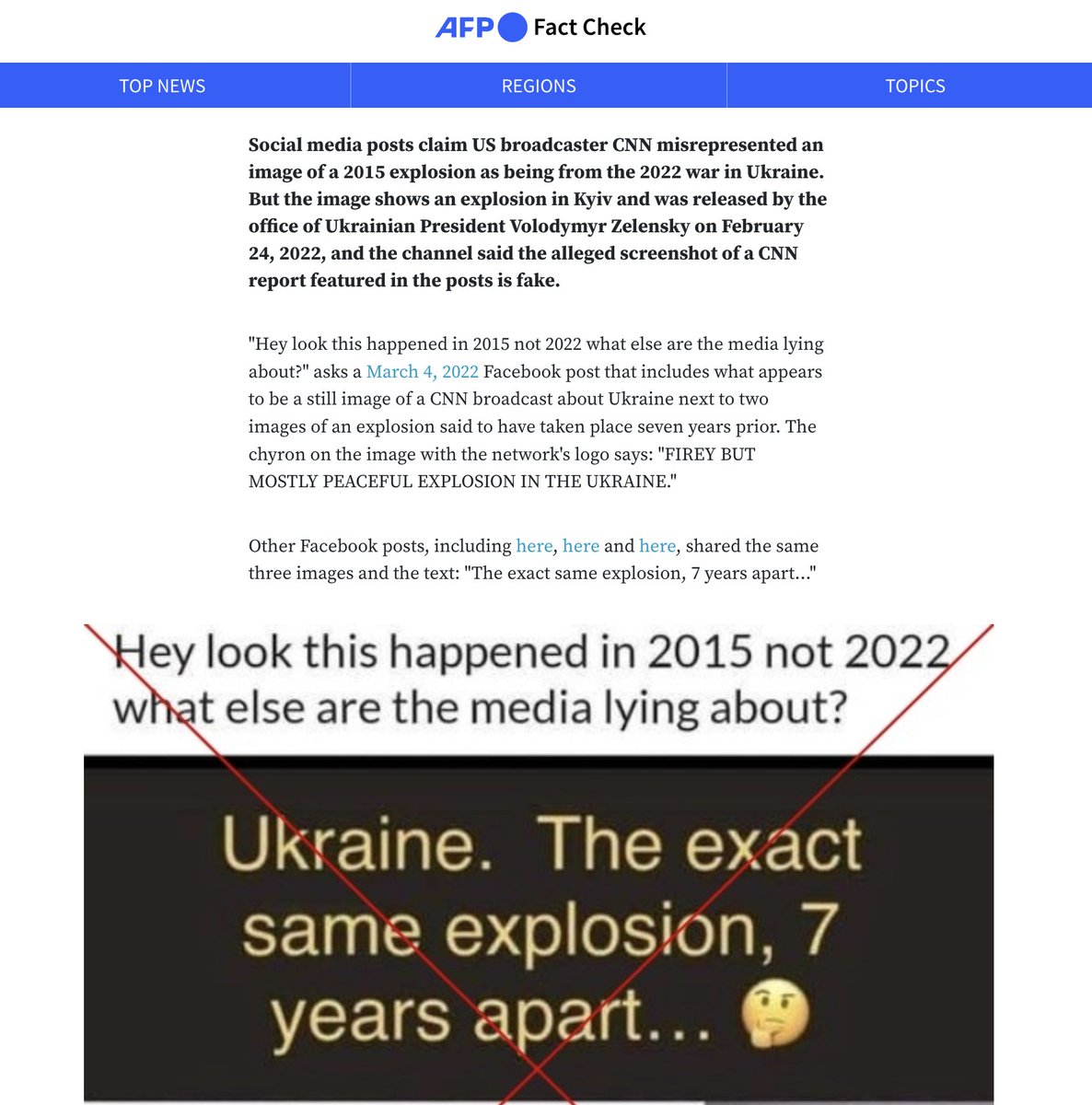
2) Satellite images can also help to dismiss #disinformation. Fake posts claimed that the warehouse in Stoyanka exploded/burned up in 2015. That's impossible. We see it untouched on dated images inf 2019 & April 2020 on Google Earth
Good tool: livingatlas.arcgis.com/wayback
Good tool: livingatlas.arcgis.com/wayback
3) Relying on changes: Something is/isn’t in a video/img but is/isn’t there anymore in satellite images: can serve as crucial evidence to verify whether video/imgs were taken after a certain date... later poss important in human right court cases
https://twitter.com/Techjournalisto/status/1501238213788250125
4) Analysis of sat images by others: Sat images can be part of leaked intelligence reports. When such footage does leak, find location and confirm time when classified report was produced -serving argument how early govs knew, and even from which satellite
https://twitter.com/marco_langbroek/status/1167809039872475136

5) Confirm/verify sanctioned (Russian) assets: High res imgs will show if they moved or remained in same place. There are great expls, such as @PutinIsAVirus + @marinetraffic location on #Yachtwatch of Putin's/other oligarch yachts via sat images
https://twitter.com/PutinIsAVirus/status/1501629885797867527
6) Then there is environmental damage from the attacks and explosion. On one hand, ships burning, as well as the confirmation of explosions at fuel depots. @planet img, March 11. MORE env analysis by @PAXforpeace /@wammezz paxforpeace.nl/news/overview/…
https://twitter.com/Reuters/status/1501094113197707270

7) Confirmation missile batteries & other troop equipment. Sentinel 1 reveal interferences that allow to a certain extent buildup of military equipment. A thread by @DahnJahn goes into this in detail:
https://twitter.com/DahnJahn/status/1499347785493229569

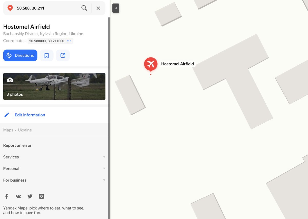
8) SAR images to confirm when invasion plans were actually executed. Leaked docs allowed to anticipate the invasion but satellite images shows that hours before troops on the UKR/Russian border were already on the move
custom-scripts.sentinel-hub.com
https://twitter.com/KyleJGlen/status/1500949479238914057
custom-scripts.sentinel-hub.com

9) Daily update: Everyday new war videos emerge. Mapping destruction matters. Maxar/ @EUSPACEIMAGING map damage to civilian infrastructure, s.a Mariupol-Chernihiv.
Crosscheck purpose of buildings (@openstreetmap Overpass API or Google/Yandex maps)
Crosscheck purpose of buildings (@openstreetmap Overpass API or Google/Yandex maps)

10) Check nature of civilian buildings and crosscheck damage (also of neighboring buildings): Mariupol, 47.104, 37.560 March 9, 2022, get more information in Yandex Maps on the area. Measure extent of damage via Google Earth Pro.
11) Slight changes in position matters: Sat images offer only a snapshot. Often, small changes of an object's position reveal patterns. For an Afghan conflict story, PC-12 moved at base, confirming use. In Ukraine, Turk. A400M is left, analysis by @Gerjon_
https://twitter.com/Gerjon_/status/1502383620241174530
12) Nightlight: VIIRS/other nightlight satellite sources can indicate changes: An order to cut lights to battle Russian invaders is visible on data. Then Russian power cuts, affecting civilians. It can also show Russian convoys gathering, great CNN piece shows ↙️

13) Evaluation of humanitarian sectors and refugee convoys:
On Feb 28, Google announ. to turn off live traffic updates in Ukraine. This leaves to check satellite data & civilians traffic queues (Maxar, 50.488, 30.527, cars leaving Kyiv)
wired.com/story/ukraine-…
On Feb 28, Google announ. to turn off live traffic updates in Ukraine. This leaves to check satellite data & civilians traffic queues (Maxar, 50.488, 30.527, cars leaving Kyiv)
wired.com/story/ukraine-…

14) Geolocation for verification of video or drone footage: Plenty of work by the @Cen4infoRes thanks to satellite images. It also helps to re-confirm findings by fellow #OSINT researchers, even if Chinese state media repeats it
https://twitter.com/RALee85/status/1501244704981192704

15) Censorship: we keep seeing areas blurred or removed from Google Earth and other mapping platforms. In China, this helped to reveal XJ camps (as Baidu Maps failed to load tiles for areas). Blurs less common but govs still request censorship (expl 2018)
fas.org/blogs/security…
fas.org/blogs/security…

16) Evaluating flooding as a warfare strategy. There are examples of analysis where satellite data helped to investigate flooding of areas to battle Russian troops. Open source Sentinel images offer bands to eval changes in moisture and water bodies.
https://twitter.com/wammezz/status/1502535940467744768?t=R-MoWfySBM-pxe1lndlXlQ&s=03


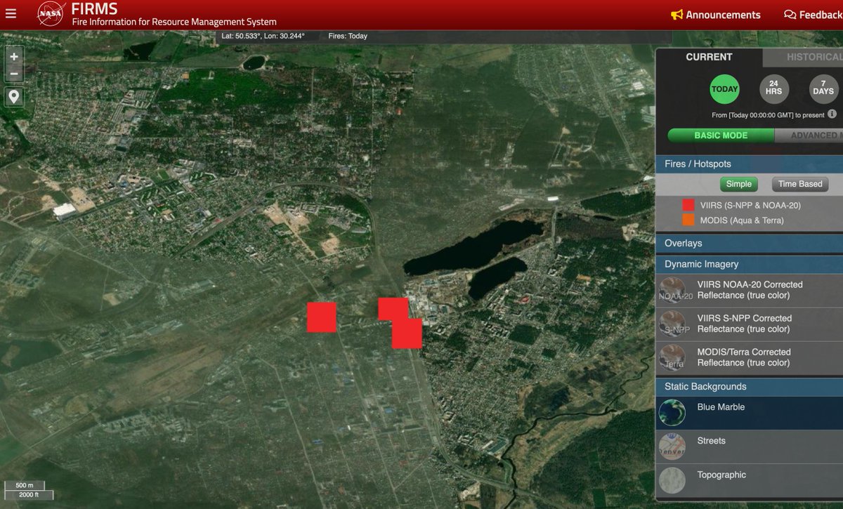
17) Heat: fires and explosion emit heat. Confirmed via infrared image band combos, we see more such analysis (Maxar here). But there are other tools such as Zoom Earth (live fire tracking) o& firms.modaps.eosdis.nasa.gov/map/
showing heatsources in the past 12hours
showing heatsources in the past 12hours
https://twitter.com/nytimes/status/1502377618577973253

18) Satellite images also reveals technological development. A NATO post shows troops relocating on Aug 21, 2014. Today, 8 years later, a teenager in his underpants can do the same analysis from home.
That's progress 😱
That's progress 😱
https://twitter.com/nato/status/505029265994567680
19) Agriculture: Evaluate previously burned areas: There are formulas to make those visible, So-called burn scars. Analysis on Ukraine shows how farmland is being affected by the war. Great analysis by @detresfa_
https://twitter.com/detresfa_/status/1502360335151681537?ref_src=twsrc%5Etfw%7Ctwcamp%5Etweetembed%7Ctwterm%5E1502360335151681537%7Ctwgr%5Ehb_1_8%7Ctwcon%5Es1_&ref_url=https%3A%2F%2Fwww.hindustantimes.com%2Fworld-news%2Frussiaukraine-war-satellite-imagery-shows-devastated-village-farmland-in-kyiv-101647059972732.html
20) 1000 different way to use #satellite imgs in investigating humanitarian/social/military/commercial situation in #Ukraine.
Problem: commercial sat firms dragged into the war - a boon/curse. Who decides who has access? Open source data must catch up on frequency/resolution
Problem: commercial sat firms dragged into the war - a boon/curse. Who decides who has access? Open source data must catch up on frequency/resolution

• • •
Missing some Tweet in this thread? You can try to
force a refresh