On Friday I took the chance to attempt a walk I’ve been planning for a while: connecting the Hutt Valley to Kāpiti via the Akatarawa Road. I had all day free, and the forecast was fine apart from a few possible afternoon showers, so off I went. 

The landscape was initially as I had imagined from aerial photos: a broad, mostly open valley with farms and lifestyle blocks. However, the road stayed far above the valley floor and river.

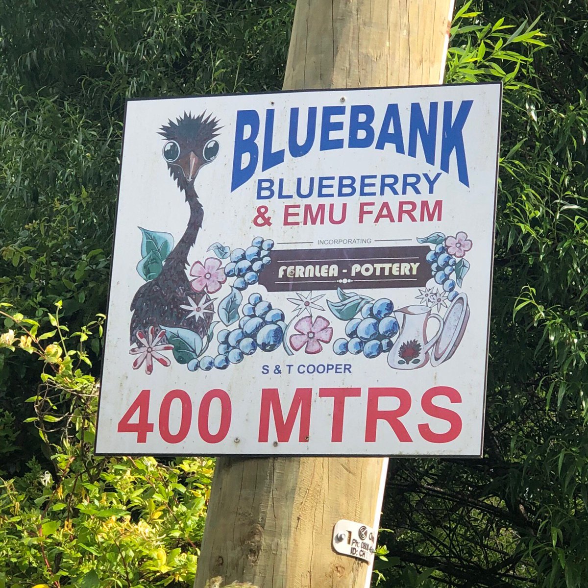
There’s a bit of commercial activity, but with a very laid-back attitude.

Not everyone seemed so laid-back, though.

Remember the ads for Bill Tito? He still has worthwhile (and forthright) advice.

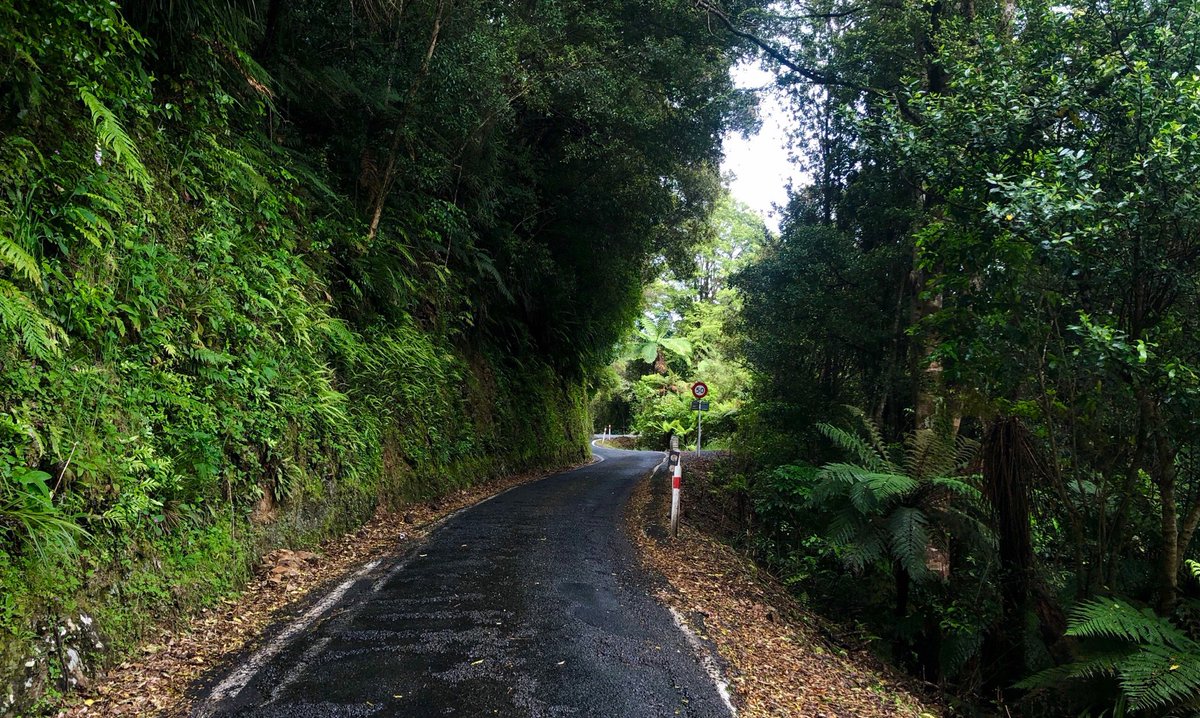
Sooner than I expected, the road started climbing up the side of the narrowing valley and into the forest. You can just glimpse the river at bottom left.

I felt like I was being watched.

The kamahi, hinau and rewarewa were all in full bloom, much to the delight of the bees. There was also lots of tutu, though, so I’d worry about honey.


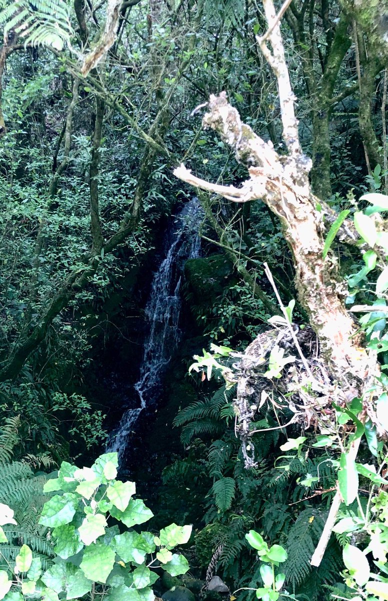
One advantage of walking is noticing things that you’d sail past in a car or on a bike, such as the many waterfalls tucked into the bush beside the road.


The road eventually climbed down to a broadening, isolated valley, where remnants of the sawmilling past are still in operation.

Some properties have clearly seen better days.

Others are much more kempt. This is Efil Doog, a “Garden of Art, which I kept misreading as “Evil Doge”.

This was an unexpected place for some “street” art.

I’d noticed a settlement marked on the maps: Cloustonville. I kept an eye out for a small township, but I’d walked right through it without noticing. Despite a population of over 300, it pretty much looked like this.

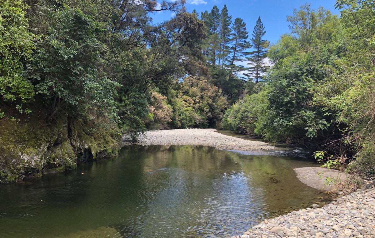
There still weren’t many opportunities to see the river (it mostly runs through private land, despite the valley being flanked by two forest parks), but when I did get the chance, it was delightful.

Can someone with more rural knowledge tell me what these circular things are? At first I thought they were settling ponds, but that didn’t make sense, and they look more agricultural.

I reached Staglands at about the halfway mark. A good spot for lunch, though if you’re freaked out by sparrows or pigeons stealing your chips, you’d be in for a shock here.


I’m used to wildlife sanctuaries concentrating on indigenous species, so the combination of rustic kiwiana and (often very) exotic birds cane as a bit of a shock.

Oh look, it’s the inevitable “Hooray for colonialism!” mock village. I can’t work out whether Staglands is delightfully quirky, disturbingly unheimlich, or some combination thereof. Still, the kids seem to love it.

This replica church under construction is a masterpiece of postmodern incongruity.

This is a ridiculous attempt to enforce a gender binary! Everyone knows the correct distinction is HENS and stags.

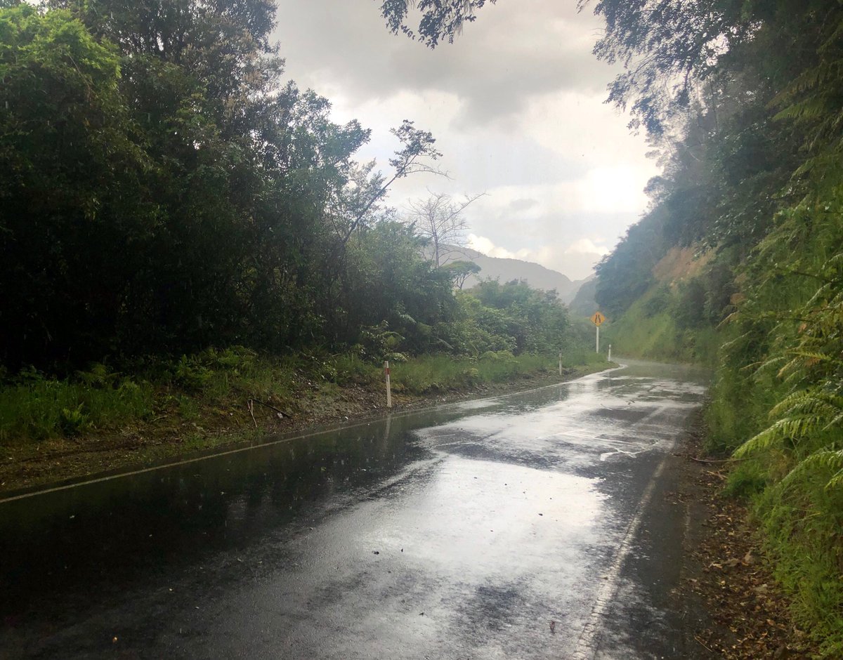
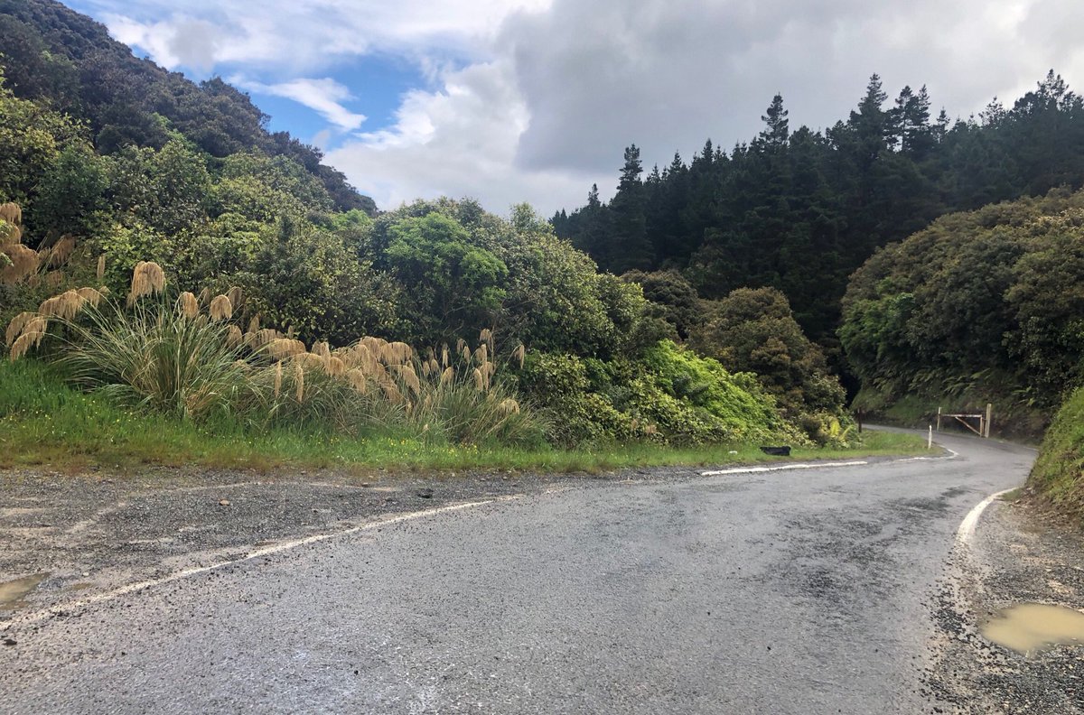
Back on the road, which once you get north of Staglands starts to become narrower and more precarious. A few of the threatened showers were drifting through, but the fat scattered drops were more refreshing than annoying after 20+km of walking in the heat.

The showers gradually became heavier, then BOOM! Full thunderstorm with torrential rain. The light jacket I’d packed would have been useless, and I was about 10km in either direction from shelter or cellphone coverage.
I tried waiting it out on the edge where the overhanging forest provided a modicum of shelter, but I got drenched anyway. I could have cadged a lift, but I was too damn stubborn. I just had to plough on through.

By now the road resembled the bullock track it was: little more than 2m wide at times. And some of the slips looked terrifying.

“It can’t be as bad as it looks!”, I thought. “Surely people know how to drive carefully in these conditions.” Then I looked down the bank on a few occasions where I’d noticed broken vegetation or skid marks.


Pay attention to Bill Tito, people!
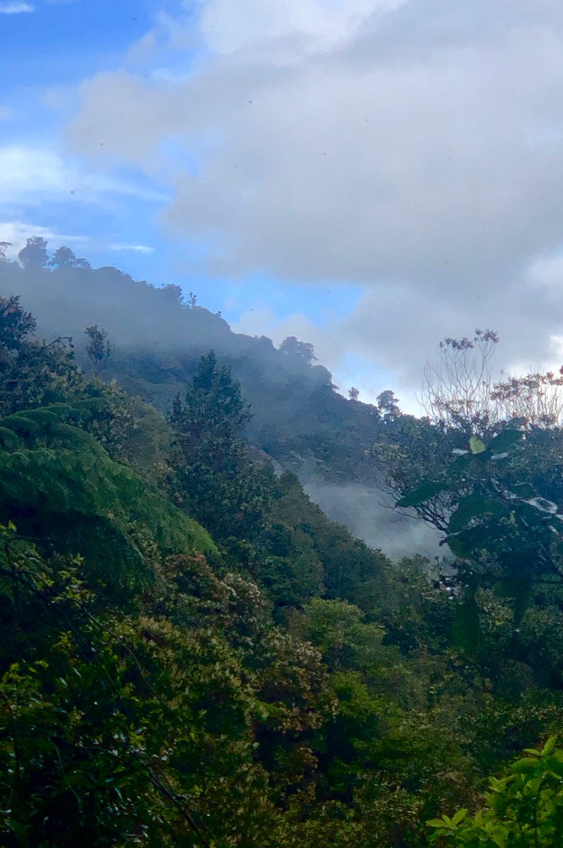
But when the storm cleared, revealing mist-wreathed gorges and forest giants festooned with epiphytes and lianas, you could imagine yourself back in the 1900s, when these valleys were the site of the last confirmed huia sightings.
And at the roadside: a wealth of landscapes in miniature


Eventually the ngahere began to thin out; pines appeared amid the beech and kamahi; the sky widened out ahead of me...

...and I was at the summit! The rain that fell by my left foot would find its way to Te Whanganui-a-Tara, while the rain by my right foot would reach the Tasman Sea dimly visible in the misty distance.

Meanwhile, right in front of me there was a Mad Max dystopian wasteland.

The road down was still more goat track than thoroughfare, but now the traffic was worse. Earlier it was families heading leisurely to Staglands; now it was 4pm on Friday and tradies in their utes rushing home from rural work. And the less said about canpervans, the better.

Abruptly, the landscape changed from dense, humid forest to broad agrarian valley.

My walking hat, which I’d bought at Lock & Co in St James’ and had worn in Nice and Venice, had resolutely kept the rain from running down the back of my deck for hours. Now the rain had eased, but the canvas was saturated, and the poor thing was more bedraggled than I was.

The amount of casual littering beside the road was often dispiriting, but it takes real effort to despoil the roadside like this!

The landscape was settling into established farmland and lifestyle blocks, though with a few touches of rural gothic.


And now for some Carpenter Gothic at Reikorangi (which roughly translates to “gate of heaven”, and deserves a much more thorough exploration). Around the back I bumped into an elderly gent, who I thought was a cleric or caretaker, but who “just pops in to pray now and then”.

I ended up trailing him for the rest of the way. With his hat, determined gait and white moustache, I got a vision of myself in 15-20 years time.

Looking back past the giant arrow to the ranges I’d crossed. The last few kilometres always feel the longest, and the increasingly aggressive traffic as the roads straightened made this section drag even more.

After 38km and 9 hours on the road, I’d never been so glad to see suburbia! And Kāpiti Island in the background.

And as a final treat, these views from the train home as the sun sank towards the Tasman Sea. Thank you for following this long and very damp journey.
Ah! A helpful friend tells me it’s a fish farm: pressreader.com/new-zealand/th…
Oops, missed the attachment on that one!