This thread will provide updates on the progress of the #WestAfricaWaterPlume as they come to hand. Sometimes animations, sometimes threads/commentaries....
The presentation of this Sahara water transit event this morning..... /1
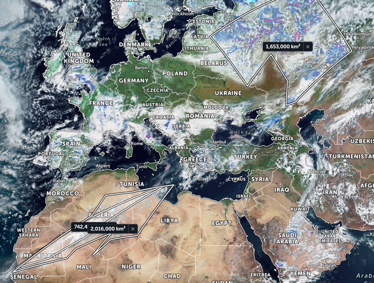
@zoom_earth has a nifty measurement tool which can probably be used to estimate the quantity of water in transit. At this stage the plume is being fed both directly off the Atlantic and also by the West African Monsoon through Mali.
A 10 day global model Access-G (Aus/UK) of precipitable water. Access-G, like GFS and ECMWF expects the plume over Africa to take a more northerly trajectory. [Note: At present CMC and KMA models have it turning more easterly towards the ME.]
During the 17th April event the moisture went in a straight line north over the Black Sea and resulted in the very large rainfall event you see still playing out now over Russia. And this appears to be happening again. If it does it may strengthen this system further.
• • •
Missing some Tweet in this thread? You can try to
force a refresh
In the animation above you can see a flow of clouds from Sudan to Oman. This flow actually originates to the South West in the Central African Republic. Here you see the CAR to Khartoum leg of the journey.
Over the day this stream of moisture intensified powering storms in Oman, which then split into two streams, one heading north over Iran and one to the East to India.
In the world of Africa/Europe/MiddleEast weather today has been quite spectacular, in a new and revealing way. And the star of the show has been the #WestAfricaWaterPlume.
The plume has now stolen the European stage entering stage left and heading directly towards Moscow. The precipitation animation below is from @meteoblue. Rain reports are not 100% accurate as they are satellite & not radar driven.
The #WestAfricaWaterPlume is rather spectacular in its presentation this morning. Roughly the size of Mexico and growing rapidly - a massive river of moisture which has just reached Italy.
This view shows satellite estimations of rainfall. Again the European @ECMWF weather model appears to have massively underestimated this event. Also on the face of what we can see so far it is turning Eastwards - which is not what many models were predicting.
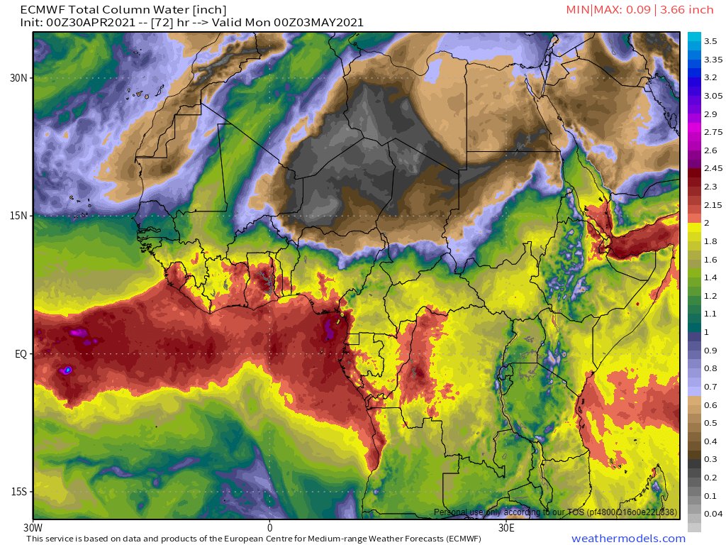
Here are the current ECMWF predictions as of now, at midnight today, and at midnight Saturday and Sunday.
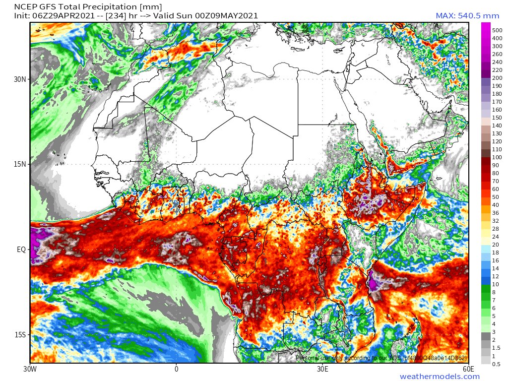
Today's 10-Day forecasts for North Africa [GFS, ECMWF, CMC, and KMA ]are now all expecting rain in West Africa as a #WestAfricaWaterPlume transports Atlantic water across the Sahara to the Mediterranean.
However they have divergent views on intensity and impact in EU/ME.
With moisture coming in across Sudan the #AranoamStorms along the Eastern side of the Red Sea have sparked up over the last few hours. But they are unlikely to have sufficient daylight left to strengthen significantly today.
Further south cloud and rain activity over the Horn of Africa has expanded to the West today with a line of clouds coming in from the Central African Republic, over Chad into the Sudan.