Today's #ArabianStorms went in a different direction during the day, but ended up in a familiar place in the end.
Today's #MiddleEast and #Ethiopia #HornOfAfrica rain forecasts follow in the thread below.
Today's #MiddleEast and #Ethiopia #HornOfAfrica rain forecasts follow in the thread below.
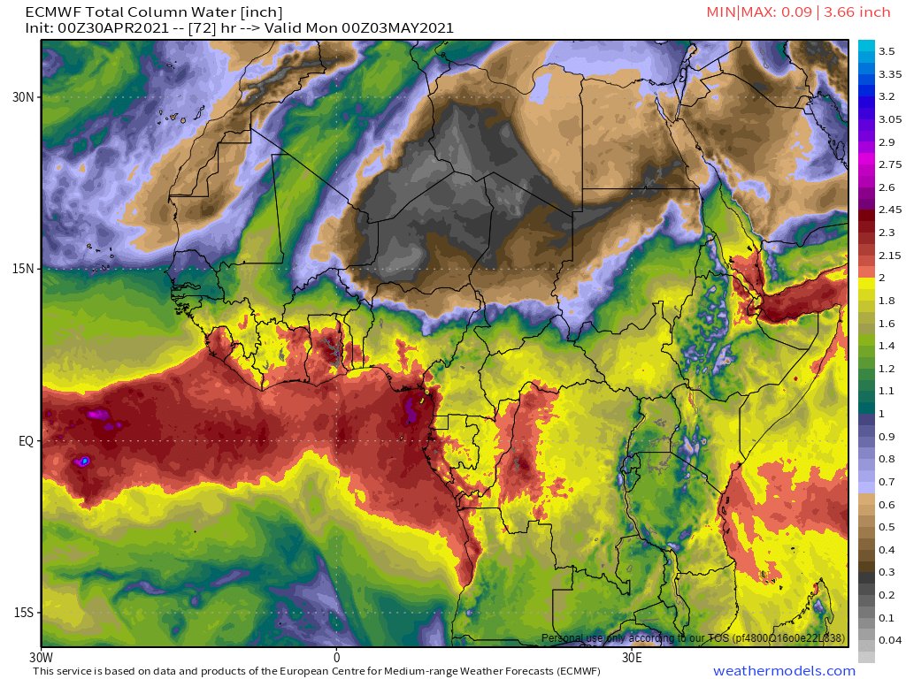
In the animation above you can see a flow of clouds from Sudan to Oman. This flow actually originates to the South West in the Central African Republic. Here you see the CAR to Khartoum leg of the journey.
Over the day this stream of moisture intensified powering storms in Oman, which then split into two streams, one heading north over Iran and one to the East to India.
Here you see the impact of the stream of water which seems to originate in the Central African Republic, arriving in India.
It turns out we really are all connected :)
It turns out we really are all connected :)
Then this afternoon we had a return to the expected pattern, with flair: Thunderstorms across the #HornOfAfrrica +a vigourous line of #ArabianStorms, from the Southern-most tip of the Arabian Peninsula in Yemen 1700kms north to Mecca.
As usual our forecasts begin with a 10-day GFS accumulated rainfall forecast for North Africa, showing a lot of rain from #Guinea north to the Mediterranean via #Mauritania, #Mali and #Algeria. 

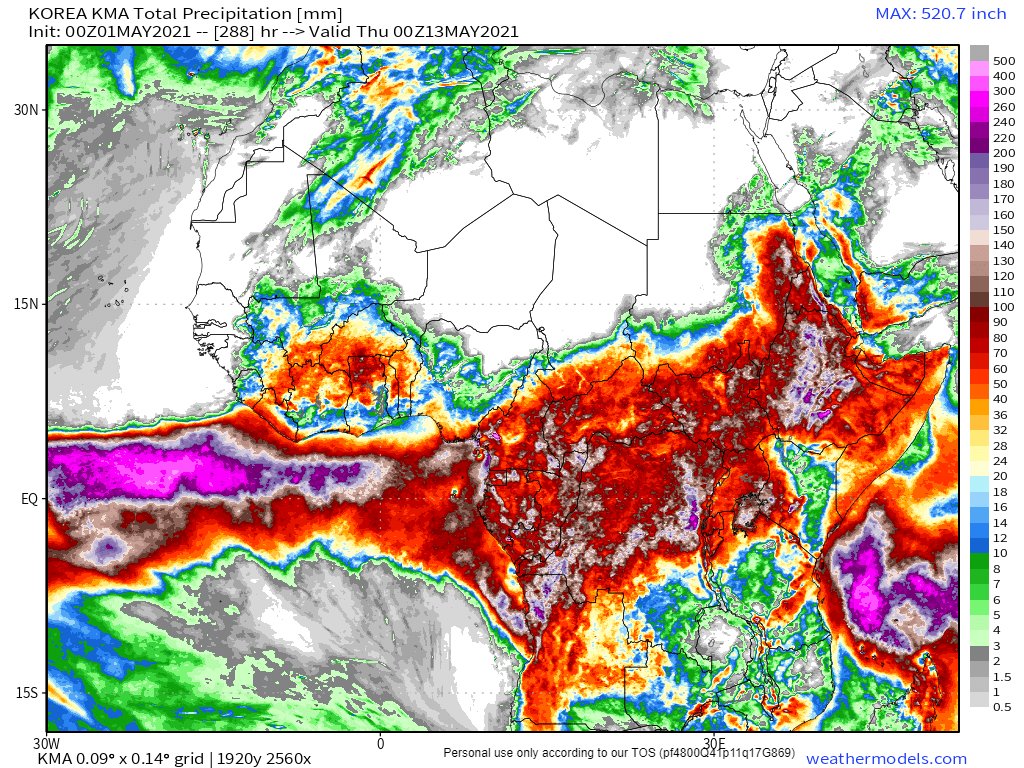
30th April 10-Day accumulated rain forecasts from the ECMWF, GFS and KMA forecast models are below. They are in agreement. Lots of rain across the entire #HornOfAfrica for the foreseeable. Still. 


30th April 10 day accumulated rain forecasts for the #MiddleEast from GFS, ECMWF, CMC, & KMA global weather models.
@Arab_Storms
#ArabianStorms
#KSA #Yemen #Oman #Levant #Jordan #Sudan #UAE #Iraq #Iran #Syria #Kuwait #GERD #NileBasin #HornOfAfrica #DesertRain
الله أعلم


@Arab_Storms
#ArabianStorms
#KSA #Yemen #Oman #Levant #Jordan #Sudan #UAE #Iraq #Iran #Syria #Kuwait #GERD #NileBasin #HornOfAfrica #DesertRain
الله أعلم


30th April, 3 day, accumulated rain forecasts (to Sunday at Midnight), for the #MiddleEast from the GFS, ECMWF, CMC & KMA weather models.
@Arab_Storms
#ArabianStorms
#KSA #Yemen #Oman #Jordan #Sudan #Iran #Syria #GERD #Sudan #DesertRain
الله أعلم


@Arab_Storms
#ArabianStorms
#KSA #Yemen #Oman #Jordan #Sudan #Iran #Syria #GERD #Sudan #DesertRain
الله أعلم


The final April accumulated rain forecast tonight.
30th April, ultra long-range, accumulated rain forecasts for the #MiddleEast from the GFS, GEFS (16-day) and KMA (12 day) models.
#ArabianStorms #Ramadan
الله أعلم


30th April, ultra long-range, accumulated rain forecasts for the #MiddleEast from the GFS, GEFS (16-day) and KMA (12 day) models.
#ArabianStorms #Ramadan
الله أعلم


@Threadreaderapp Unroll
@Threadreaderapp Unroll
@ThreadReaderApp unroll
• • •
Missing some Tweet in this thread? You can try to
force a refresh


