Today is the 10th consecutive day of extensive thunderstorm activity across #MiddleEast.
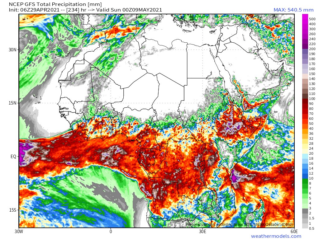
Meanwhile the #HornOfAfrica little rainy season which began in the 2nd week of April continues to strengthen.
29 April rainfall forecast reports for the region follows. [Images 29/4 @NASA]

Meanwhile the #HornOfAfrica little rainy season which began in the 2nd week of April continues to strengthen.
29 April rainfall forecast reports for the region follows. [Images 29/4 @NASA]


This thread contains images and animations of today's storm activity. /2
https://twitter.com/althecat/status/1387761465738792971?s=20
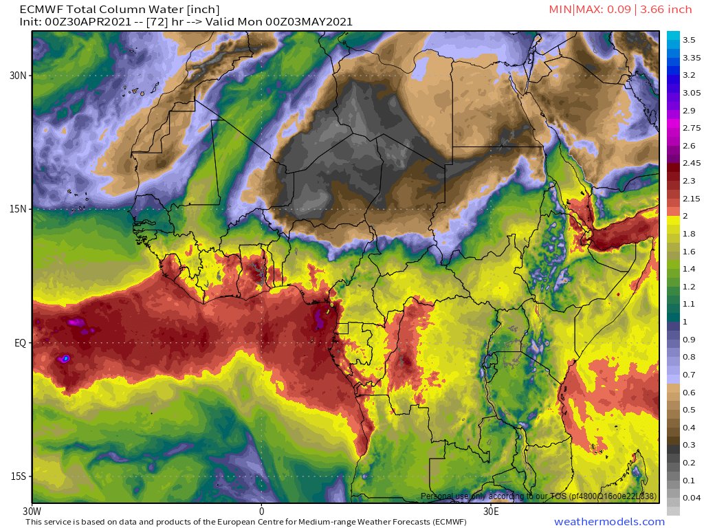
Today's 10-Day forecasts for North Africa [GFS, ECMWF, CMC, and KMA ]are now all expecting rain in West Africa as a #WestAfricaWaterPlume transports Atlantic water across the Sahara to the Mediterranean.
However they have divergent views on intensity and impact in EU/ME.


However they have divergent views on intensity and impact in EU/ME.


This animation shows the broad picture:
- The #WestAfricaWaterPlume in the West
- It's impact in Europe over the Aegean and Turkey
- Storms in the Middle East
- Clouds carrying water from Central into Sudan.
- A northerly cloud flow from the Gulf across Iran into Central Asia
- The #WestAfricaWaterPlume in the West
- It's impact in Europe over the Aegean and Turkey
- Storms in the Middle East
- Clouds carrying water from Central into Sudan.
- A northerly cloud flow from the Gulf across Iran into Central Asia
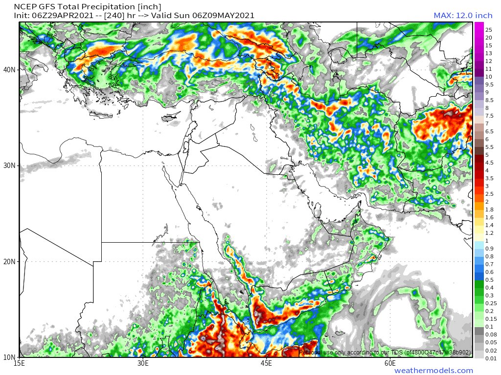
29th April 10-Day accumulated rain forecasts from the ECMWF, GFS and KMA forecast models are below. They are in agreement. Lots of rain across the entire #HornOfAfrica for the foreseeable. 


This animation shows a broad view across the #HornOfAfrica to the Central African Republic including a close up of clouds crossing Chad from the center of Africa bringing moisture across Northern Sudan.
Two eyewitness #ArabianStorms videos and image tweets from @Arab_Storms follow. Both from #UAE which received its second day of rain today - a lot more than yesterday.
https://twitter.com/Arab_Storms/status/1387775933558439938?s=20
The image above from the #UAE is eerily similar to videos we have seen recently from Saudi Arabia of overflowing dams. This one provides a sense of the intensity of today's storm over #Oman the #UAE and a fairly large area of #Yemen and #KSA.
https://twitter.com/Arab_Storms/status/1387757819575758848?s=20
29th April 10 day accumulated rain forecasts for the #MiddleEast from the GFS, CMC, KMA & GEFS weather models.
@Arab_Storms
#ArabianStorms
#KSA #Yemen #Oman #Levant #Jordan #Sudan #UAE #Iraq #Iran #Syria #Kuwait #GERD #NileBasin #HornOfAfrica #DesertRain
الله أعلم


@Arab_Storms
#ArabianStorms
#KSA #Yemen #Oman #Levant #Jordan #Sudan #UAE #Iraq #Iran #Syria #Kuwait #GERD #NileBasin #HornOfAfrica #DesertRain
الله أعلم


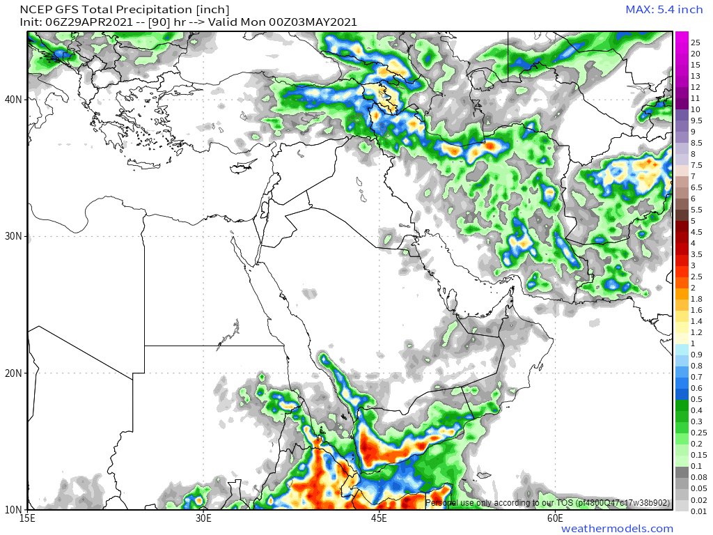
3 day accumulated rain forecasts (to Sunday at Midnight) for the #MiddleEast from the GFS, CMC, KMA and GEFS weather models.
@Arab_Storms
#ArabianStorms
#KSA #Yemen #Oman #Jordan #Sudan #Iran #Syria #GERD #Sudan #DesertRain
الله أعلم


@Arab_Storms
#ArabianStorms
#KSA #Yemen #Oman #Jordan #Sudan #Iran #Syria #GERD #Sudan #DesertRain
الله أعلم


For the past three days the scale of storms has been considerably larger than forecast. The GFS model consistently underestimates the scope and strength of storms.
This animation shows the rain the KMA model forecast for today, Fri. & Sat. and where, in 6 hr increments.
This animation shows the rain the KMA model forecast for today, Fri. & Sat. and where, in 6 hr increments.
The final 29th April rain forecast tonight provides ultra long-range accumulated rain forecasts for the #MiddleEast from the GFS, GEFS (16-day) and KMA (12 day) models.
#ArabianStorms #Ramadan
الله أعلم


#ArabianStorms #Ramadan
الله أعلم


• • •
Missing some Tweet in this thread? You can try to
force a refresh


