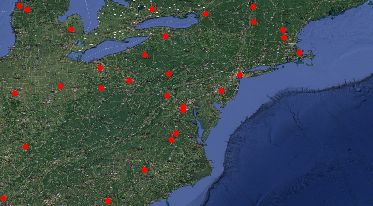
#Thread
#Elections are supposed to be about electing representations for framing legislations
However the geography behind delimitation which doesnt consider complex socio-economic conditions promote communal polarization leading to deterioration of Democractic values
1/n
#Elections are supposed to be about electing representations for framing legislations
However the geography behind delimitation which doesnt consider complex socio-economic conditions promote communal polarization leading to deterioration of Democractic values
1/n
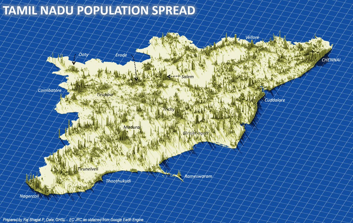
Understanding Delmitation:
The constituency delimitation is based on population. and for last delineation exercise, 2001 population was used. Average population was calculated to be 270000 people per constituency
#Map shows Population spread in Tamil Nadu
2/n
The constituency delimitation is based on population. and for last delineation exercise, 2001 population was used. Average population was calculated to be 270000 people per constituency
#Map shows Population spread in Tamil Nadu
2/n
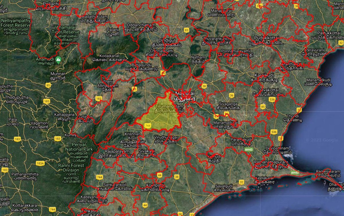
To delineate which village/town comes under which constituency, some rules are followed
To achieve the avg population, officials start with headquarters for the constituencies in district & add villages/towns within same or neighbouring taluks(subdistricts) in same district
3/n
To achieve the avg population, officials start with headquarters for the constituencies in district & add villages/towns within same or neighbouring taluks(subdistricts) in same district
3/n

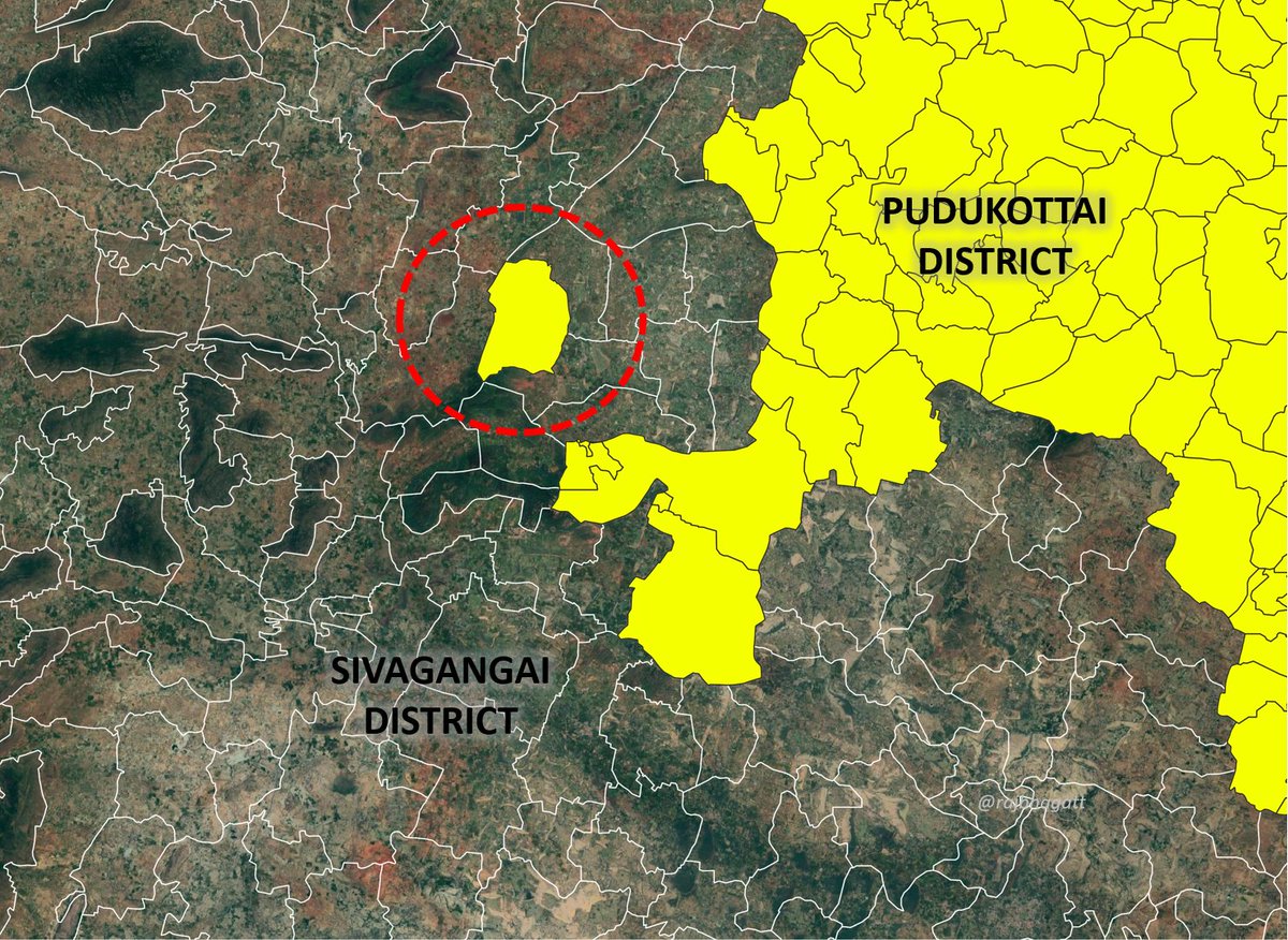
Pudukottai district has villages which are not contiguous with main district. This is a relic of British era. In this case, all such villages were added to constituencies of neighbouring district. But in other cases such crossing of district boundaries were not allowed
4/n
4/n
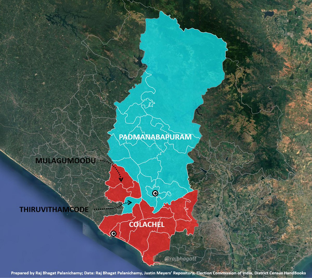
This doesnt mean that they haven't created islands during delineation process. For some reason, Thiruvithamcode rev.village has been added to Padmanabapuram constituency thus dividing Colachel const into 2 pieces
Thiruvathamcode gives its name to Travancore kingdom (FYI)
5/n
Thiruvathamcode gives its name to Travancore kingdom (FYI)
5/n
More the mismatch between Subdist population & avg population, the constituency boundaries become wierder
If you notice the case below from erstwhile #Coimbatore district, villages closer to other constituencies have been added to another constituency & thus HQs are at edges
6/n
If you notice the case below from erstwhile #Coimbatore district, villages closer to other constituencies have been added to another constituency & thus HQs are at edges
6/n

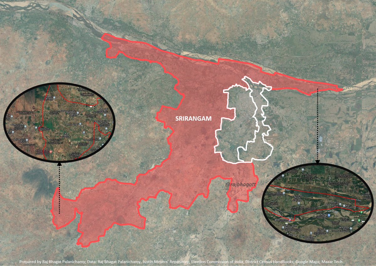
Because of this indiscriminate addition from neighbouring subdistricts, #Srirangam constituency (whose HQ is north of Trichy) is extreme in all 4 cardinal directions i.e Srirangam is more northern, more eastern, more western, & more southern than both Trichy constituencies!
7/n
7/n

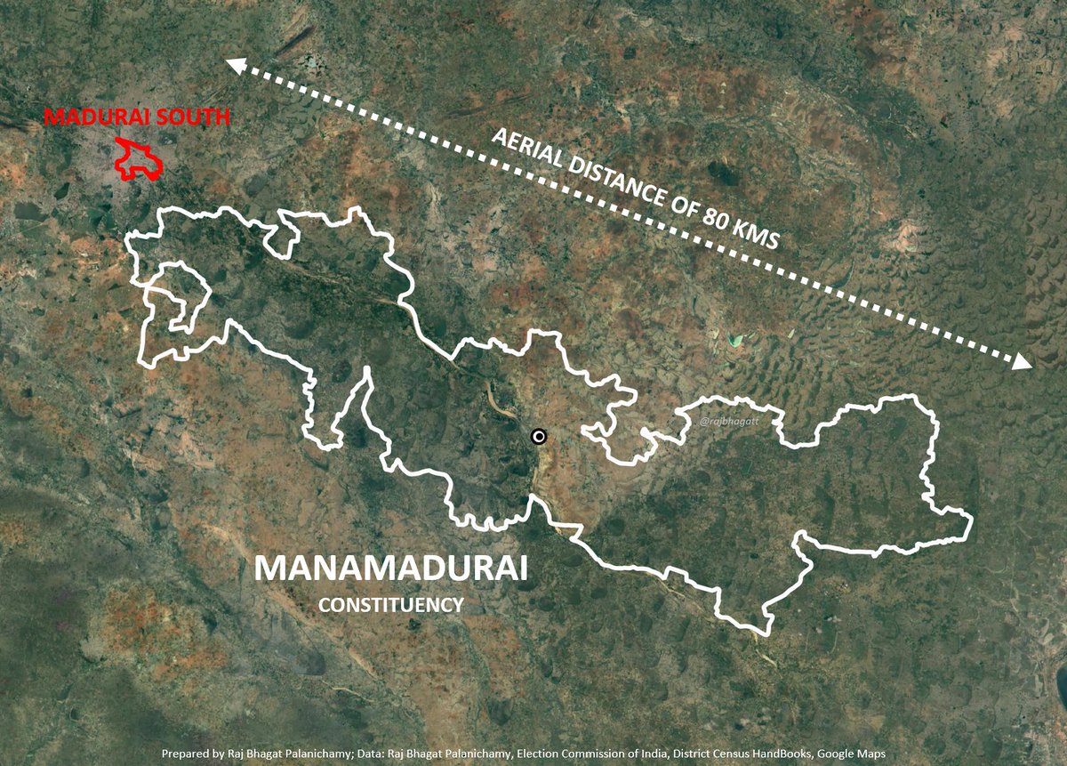
It means two villages which are a hundred kilometers apart geographically, socially, and economically unrelated to each other are expected to elect the same common representative.
8/n
8/n
In the case of Tengumarahada, a village in #nilgiris district, Citizens have to travel through two other constituencies -BhavaniSagar and Mettupalayam (and their HQs) for a minimum of 4 hours inorder to reach it's own constituency HQ (Coonoor)
Refer Map below
9/n
Refer Map below
9/n

Many such cases exist for example Elandaikuttapatty and few villages around it have been added to Harur constituency instead of #Pappireddipatti a geographically closer &easily accessible town.
10/n
10/n

The problem with such selections is that smaller communities which dont have same problems as the larger constituencies get isolated, forgotten & they dont get represented in the mainstream politics while framing legislations which affect them
Map: Bodhamalai in #Rasipuram
11/n
Map: Bodhamalai in #Rasipuram
11/n
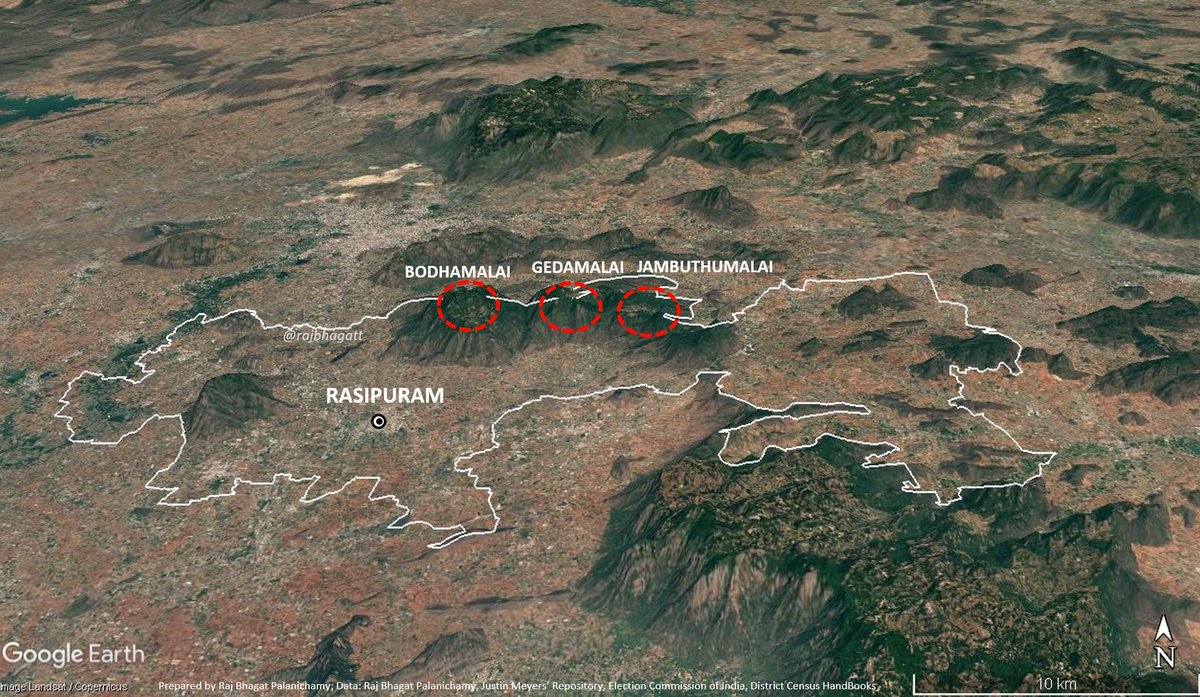
The only time you would hear about Bodhamalai is when news breaks that EVMs have to be carried through the forest etc.
12/n
deccanchronicle.com/nation/current…
12/n
deccanchronicle.com/nation/current…
Take case of #Manjolai &neighbouring villages - part of Bombay Burma Trading Corporation's (BBTC) tea estate. BBTC's lease is about to expire in 2028 (99 year lease). Tea estate workers dont own any land which means post lease expiry, people would lose livelihood & homes
13/n
13/n

These villages have been added into #Manimuthar Town P & Ambasamudram constituency. Since their population is low they dont get represented as the rest of the constituency need not worry about this & currently there is no law or guideline to help Manjolai with transition
14/n
14/n

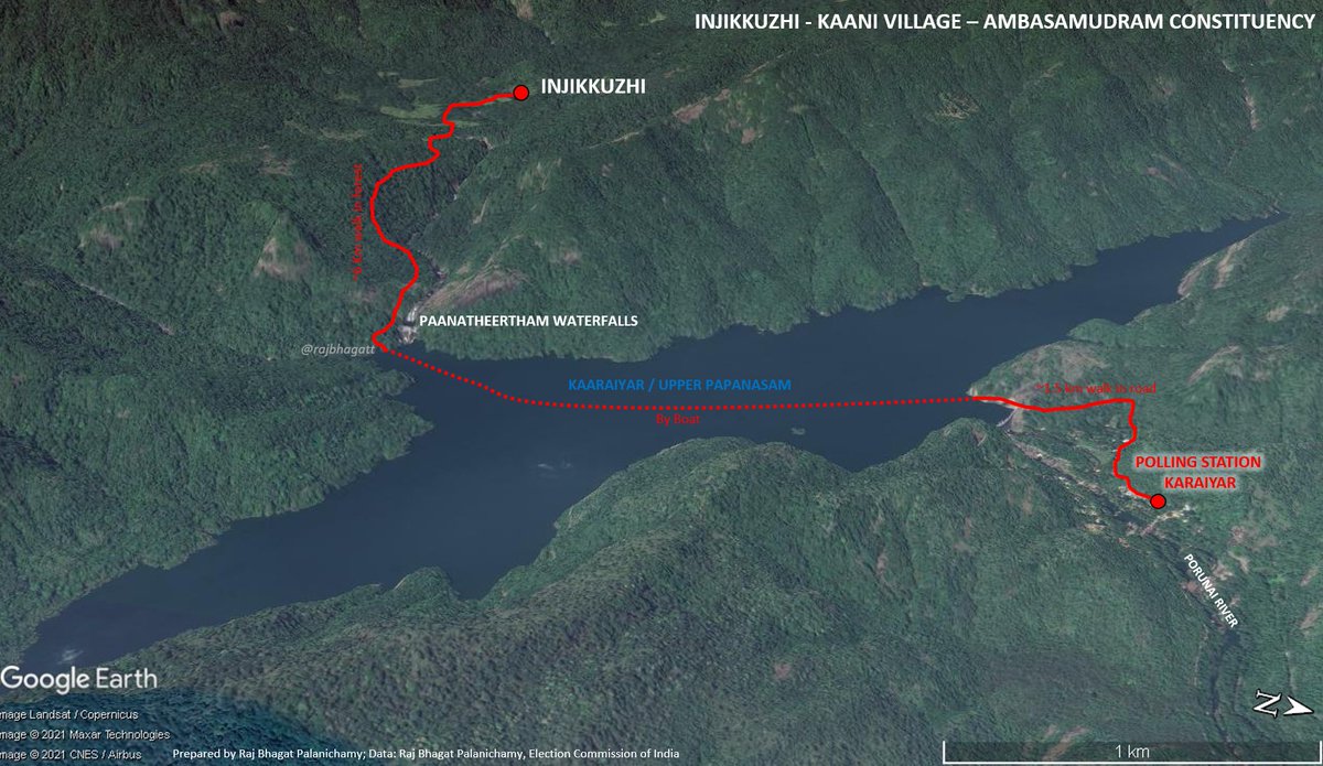
Similar is the case of Injikkuzhi a tribal village within same constituency. The native Kaanis are still fighting for getting land rights to their own ancestral land for years even after passing Forest Regulation Act. Such is the isolation caused by our electoral process
15/n
15/n
These are not cases about isolated villages, there are multiple geographical blocks within same constituencies & are expected to elect same person
Map: BhavaniSagar constituency has 3 blocks which are completely different from each other & these affect election results
16/n
Map: BhavaniSagar constituency has 3 blocks which are completely different from each other & these affect election results
16/n
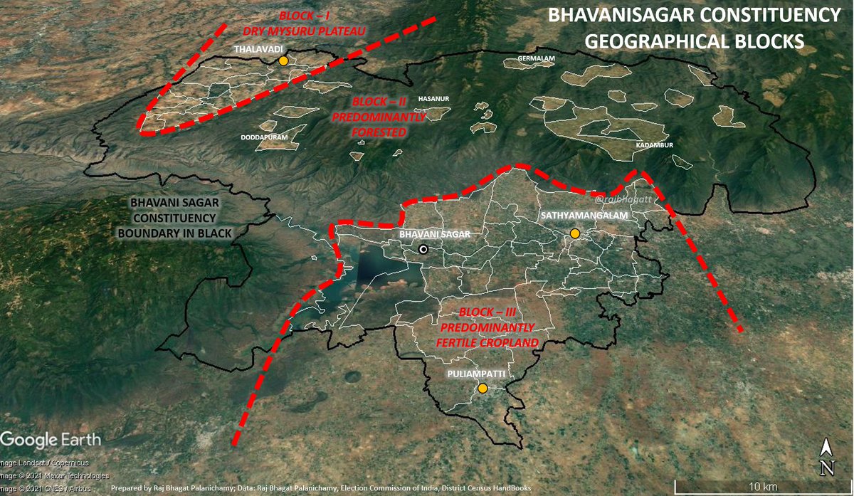
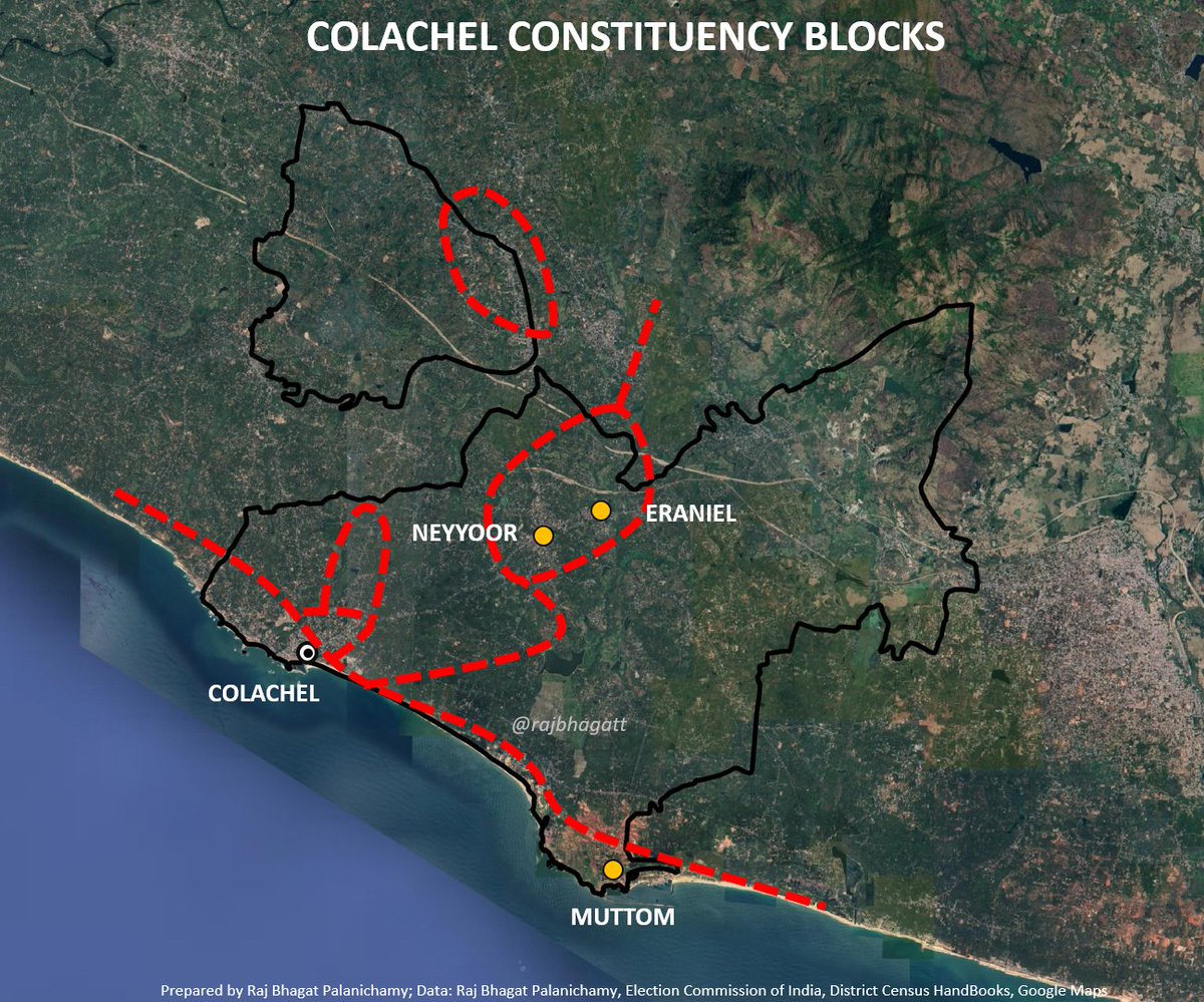
The blocks are formed because of variety of reasons: historical, geographical, social, economic reasons.
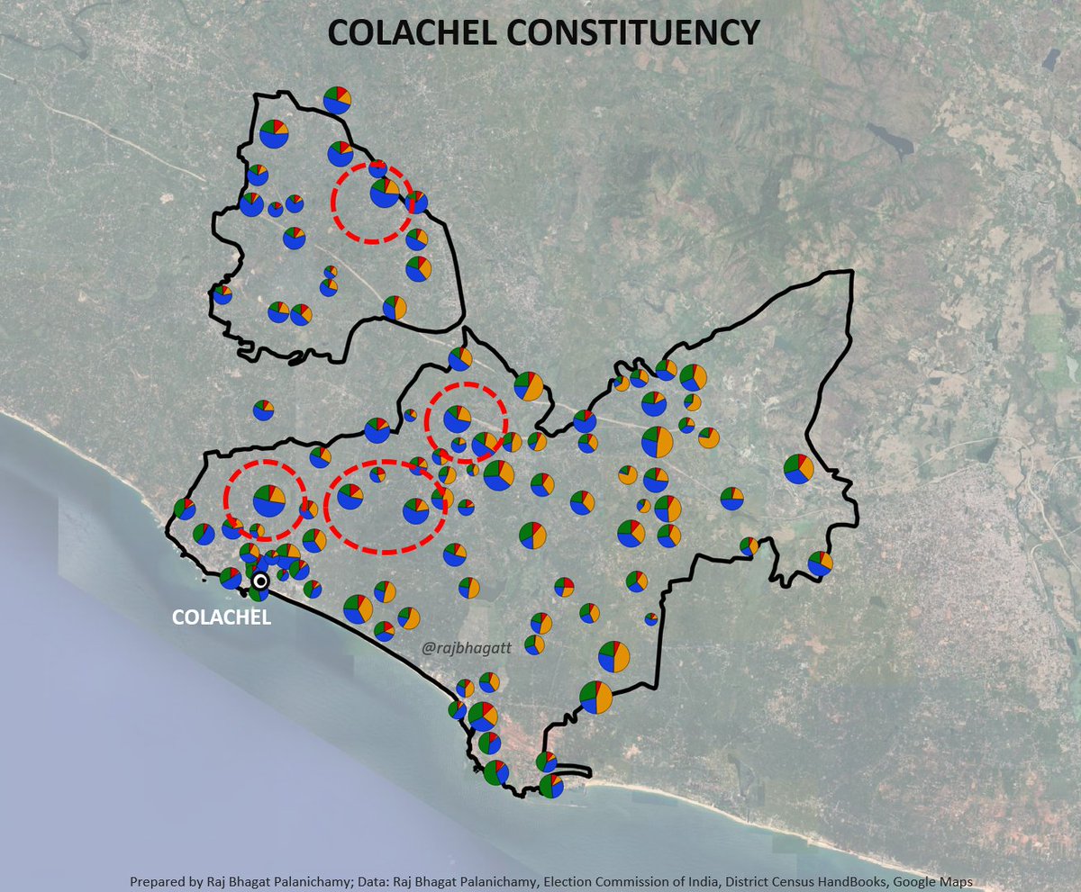
#Map shows Colachel constituency
Land - owning upper castes like Vellalas & trade oriented ElurChetties dominated flood plains & Eraniel where paddy is predominant crop
17/n
#Map shows Colachel constituency
Land - owning upper castes like Vellalas & trade oriented ElurChetties dominated flood plains & Eraniel where paddy is predominant crop
17/n
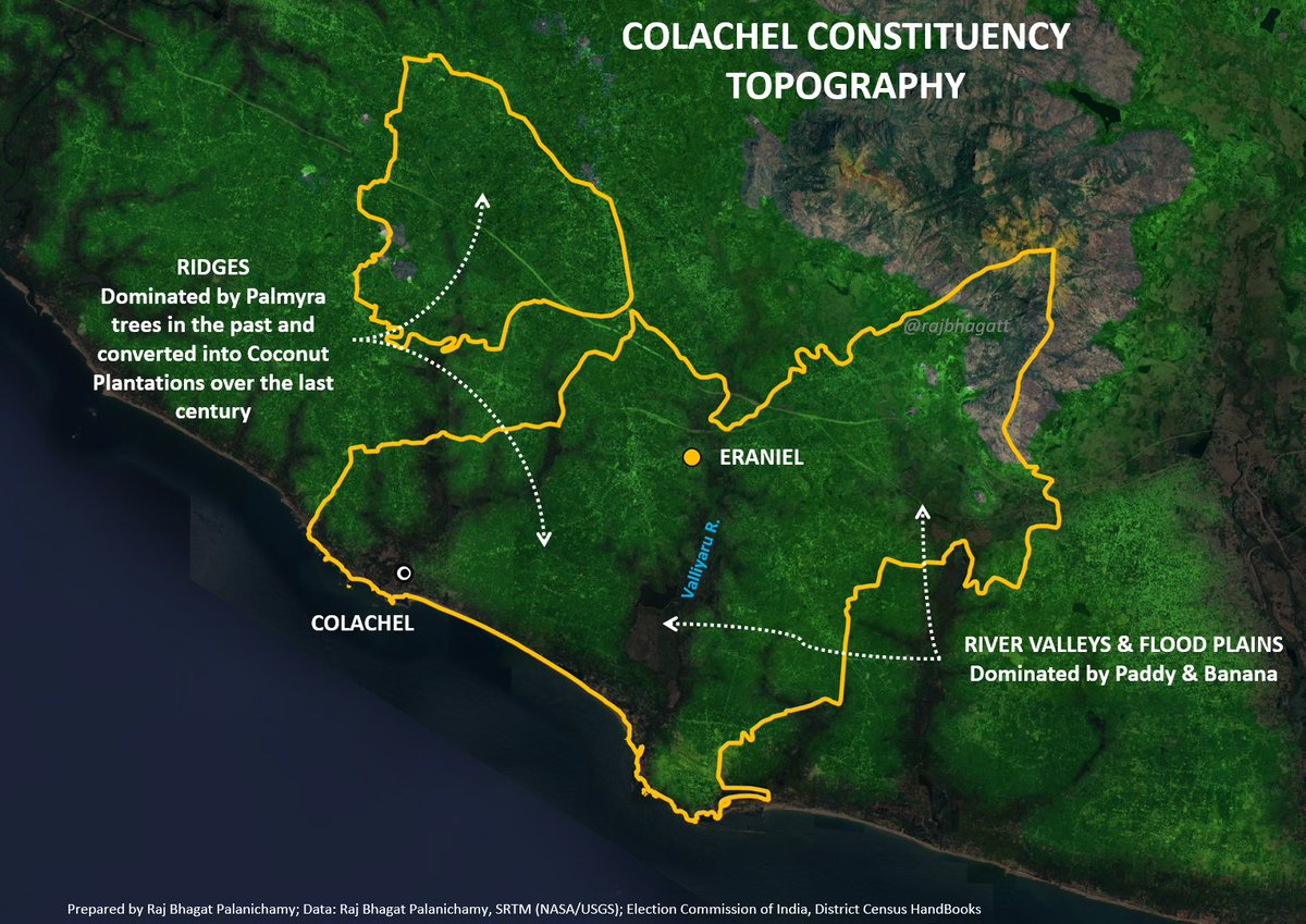
The Nadars who migrated later settled in the less fertile ridges and had converted them into Palmyra forests. Over the last century the Nadar community changed these into Coconut plantations
Coastline is dominated by Paravas (fisherfolk)
18/n
Coastline is dominated by Paravas (fisherfolk)
18/n

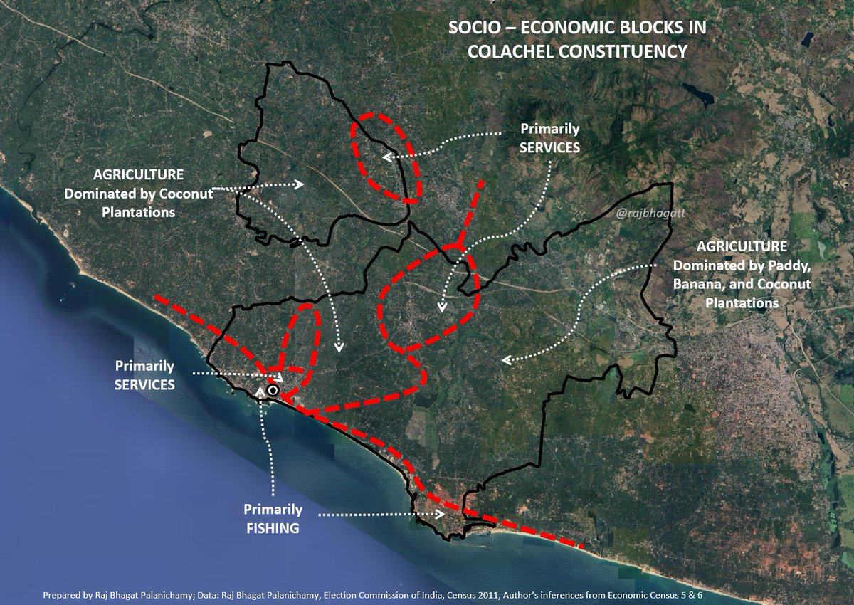
Along with the castes, religious beliefs & based on economic activity, they form complex geographical blocks
Our elections are in such a way that if a particular block is succesfully polarized, then the candidate can win & he/she need not look at the needs of other blocks
19/n
Our elections are in such a way that if a particular block is succesfully polarized, then the candidate can win & he/she need not look at the needs of other blocks
19/n
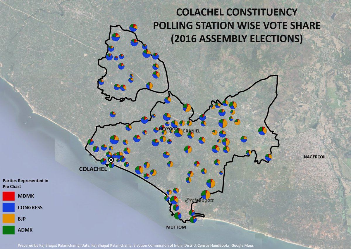
Map shows the voting pattern between 4 parties that contested in Colachel & one can notice how they correlate above mentioned blocks
So a candidate's victory/loss is purely dependent on the success of polarization by that candidate as only a small portion votes rationally
20/n
So a candidate's victory/loss is purely dependent on the success of polarization by that candidate as only a small portion votes rationally
20/n
This communal polarization has been severely affecting our election process as it leaves out a majority of voters from getting represented
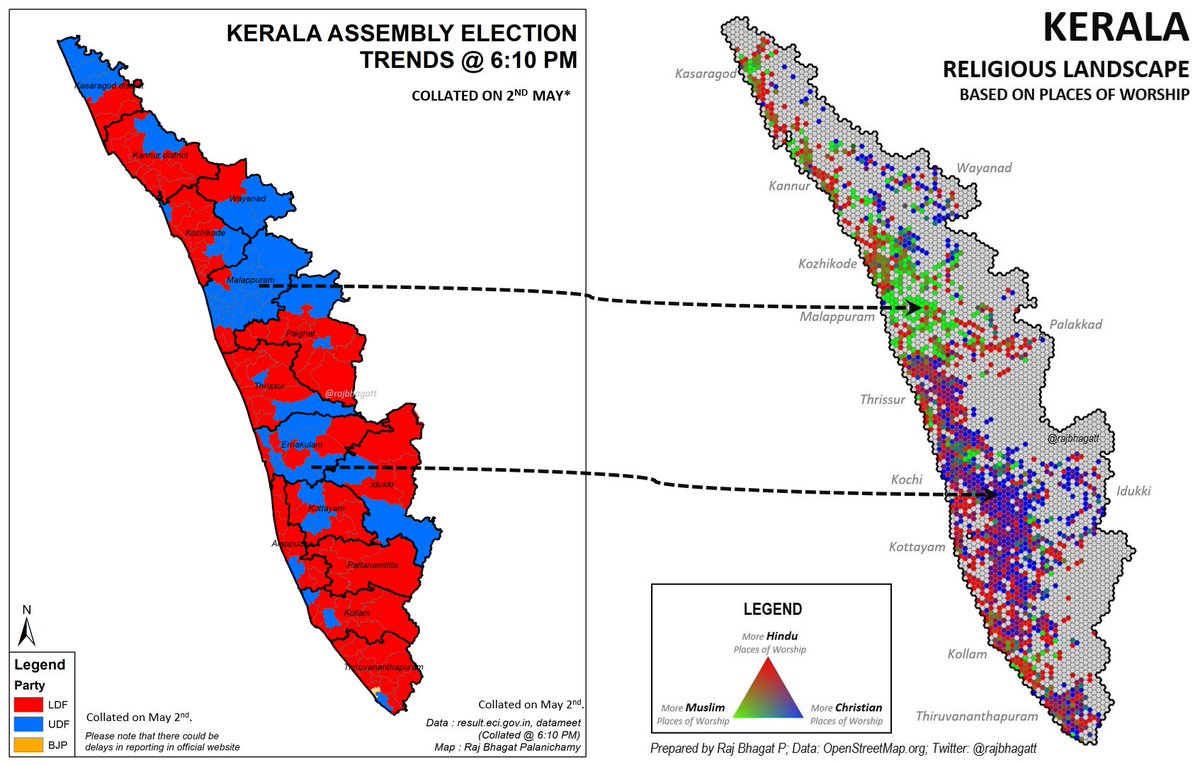
Even in a victory in #Kerala, LDF still had to fight against communal polarization done by UDF
Map: UDF was leading in 2021 & religion
21/n
Even in a victory in #Kerala, LDF still had to fight against communal polarization done by UDF
Map: UDF was leading in 2021 & religion
21/n
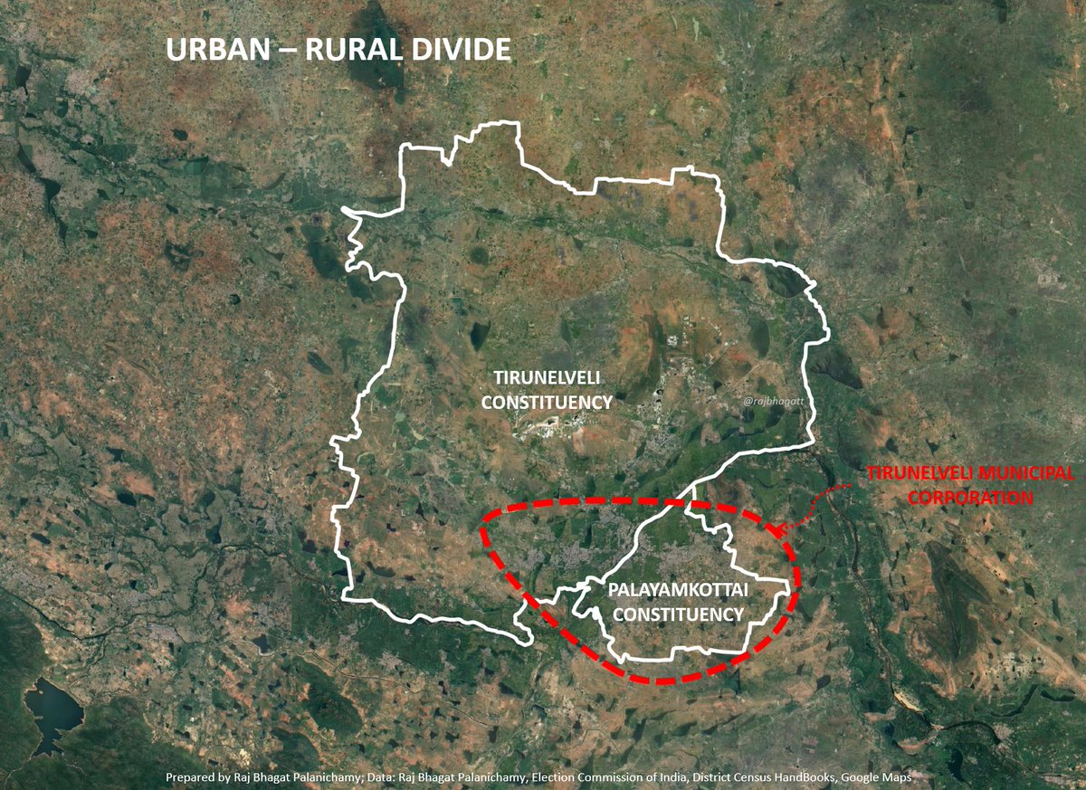
Apart from communal polarization, the constituency results are affected by Urban-Rural divide also.
Tirunelveli&Palayamkottai both belong to #Tirunelveli City but when 2 constituencies were to be created, Villages were added to tirunelveli creating another polarizing divide
22/n
Tirunelveli&Palayamkottai both belong to #Tirunelveli City but when 2 constituencies were to be created, Villages were added to tirunelveli creating another polarizing divide
22/n
Larger constituencies are more heterogeneous w.r.t caste, religion, economic activity, geography, service provisioning, development when compared to smaller urban constituencies
This makes them more vulnerable to polarization as a lot of villages get disconnected from MLAs
23/n
This makes them more vulnerable to polarization as a lot of villages get disconnected from MLAs
23/n
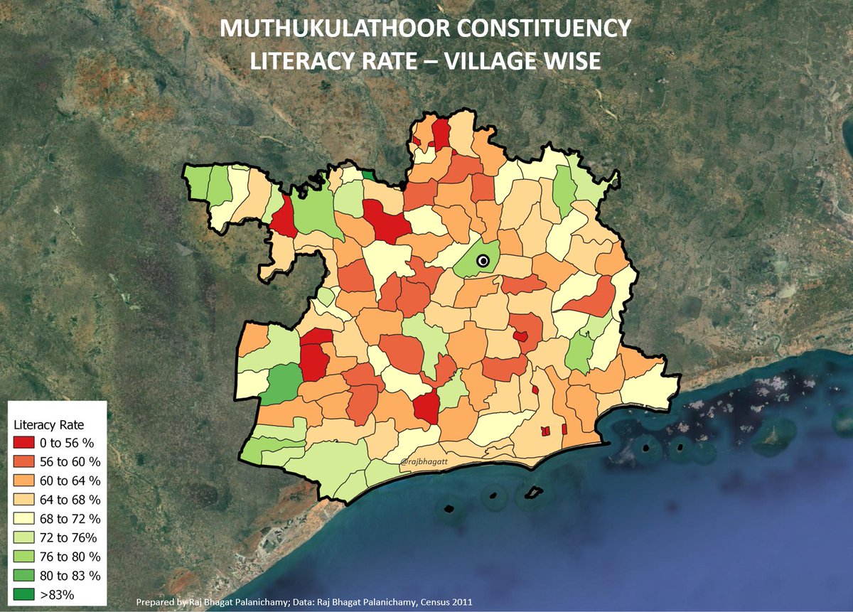
#Muthukulathoor constituency- literacy rate shows the variation between different villages (54 to 84%) whereas a smaller constituency like Harbour in Chennai's wards vary between 74 to 84% with 81% avg)
Due to larger disconnects, Polarized Large constituencies become weak
24/n
Due to larger disconnects, Polarized Large constituencies become weak
24/n
This has reduced economic development in larger constituencies and have aggravated the existing movement towards urban centers
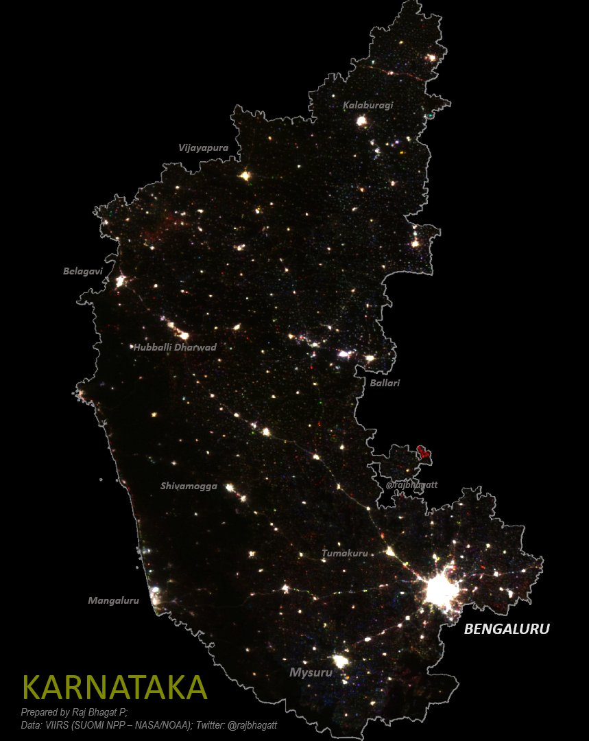
Map shows #TamilNadu's shift in population & night lights centroid indicating this migration
25/n
Map shows #TamilNadu's shift in population & night lights centroid indicating this migration
25/n

This is a vicious cycle:
Migration increases population in urban centers& in next delineation, they increase urban constituencies, further weakening mofussil districts, resulting in more developmnt in urban& ppl migrating further creating large unsustainable primate cities
26/n
Migration increases population in urban centers& in next delineation, they increase urban constituencies, further weakening mofussil districts, resulting in more developmnt in urban& ppl migrating further creating large unsustainable primate cities
26/n
Since these delineations are done purely based on population counts, non-urban mofussil districts get weakened a lot. Map shows the change in number of constituencies in TamilNadu after last delineation & the pattern can be clearly seen
27/n
27/n

The deicision of which village goes into which constituency can the existing voting blocks in the constituency & affects the results
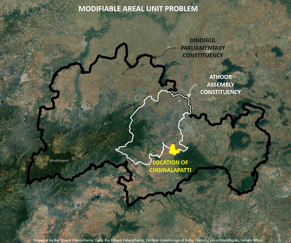
In Tech this called as "Modifiable Areal Unit Problem" i.e when aggregation area is changed, the statistics become different
28/n
In Tech this called as "Modifiable Areal Unit Problem" i.e when aggregation area is changed, the statistics become different
28/n
If the aggregation boundaries are changed, the result or share of the seats change significantly
When aggregated at an individual level
DMK:ADMK vote share is ~45 : 39
At assembly constituency level it becomes 64:36
At parliamentary const level it becomes 82:18
29/n
When aggregated at an individual level
DMK:ADMK vote share is ~45 : 39
At assembly constituency level it becomes 64:36
At parliamentary const level it becomes 82:18
29/n
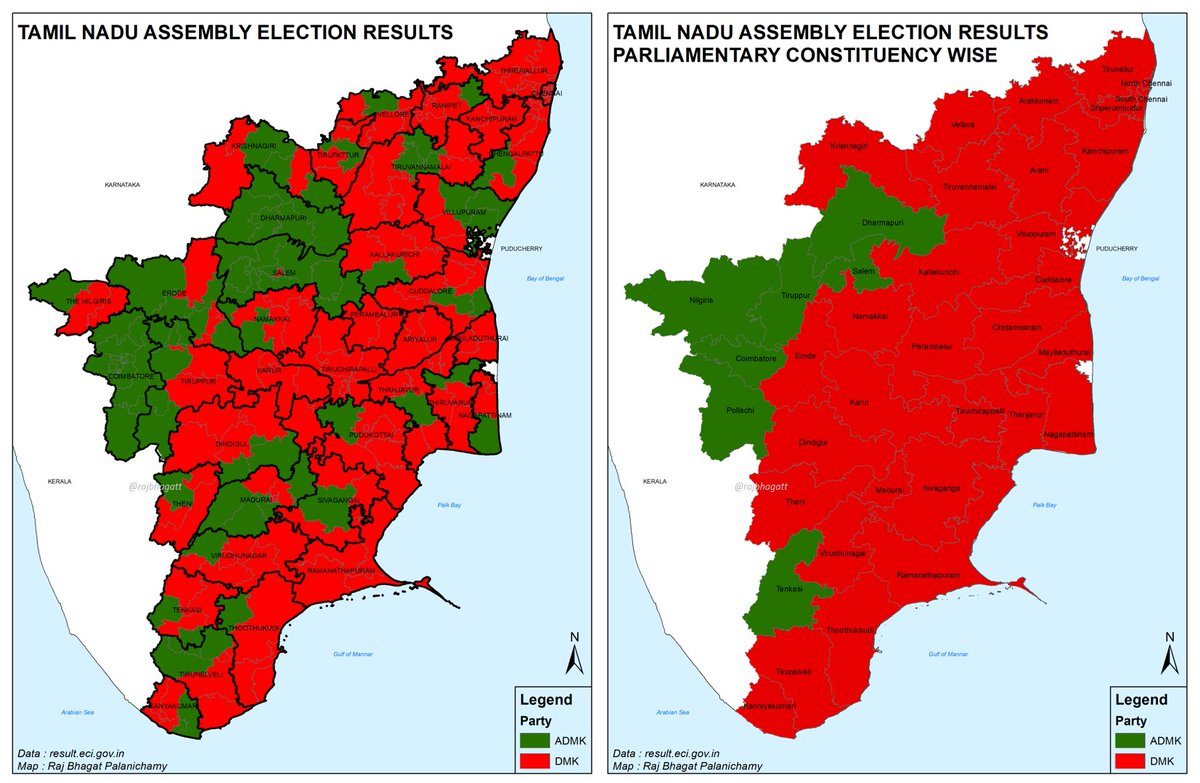
When aggregated at Assembly constituency level, DMK wins 4 and ADMK wins 2 in #Tenkasi Parliamentary constituency but when aggregated at parliamentary constituency level, ADMK wins #Tenkasi.
This is because ADMK has polarized two constituencies at a higher level
30/n
This is because ADMK has polarized two constituencies at a higher level
30/n

Many people widely believe that EVM tampering has to be done at wide scale but when we look at localized polarization pattern, it is clear that a handful of malfunctioning machines that reverse the count of top two is sufficient to change the results
31/n
31/n
IMO current model of choosing the representative based on highest number of votes in such complex constituencies should be done away with
Instead,a hybrid method of electing representatives based on proportional representation & minimum vote from blocks should be practiced
32/n
Instead,a hybrid method of electing representatives based on proportional representation & minimum vote from blocks should be practiced
32/n
The next delineation happening in 2026 & new parliament building designed to hold 800+ members
The current political system wants to maintain communal polarization friendly electoral process which leads to a form of autocracy that will benefit few places &few people alone
33/n
The current political system wants to maintain communal polarization friendly electoral process which leads to a form of autocracy that will benefit few places &few people alone
33/n
People arguing this would cause paralysis dont understand differences between legislative & executive branches of govt
Legislative process should be inclusive process with representations from diff communities, engagement, argument, debate & of course it is time consuming
34/n
Legislative process should be inclusive process with representations from diff communities, engagement, argument, debate & of course it is time consuming
34/n
It is similar to a school Parents-Teachers-Student body election where there are more students but less teachers. Election would always favour students and it wont be a healthy process
For good democracy - population count should not be the only criteria for representation!
n/n
For good democracy - population count should not be the only criteria for representation!
n/n
• • •
Missing some Tweet in this thread? You can try to
force a refresh