The eyes of the world are turned towards the Holy Land on the 10th day of a horrific conflict between the Govt. of Benjamin Netanyahu and the Hamas Govt. in Gaza.
Today's rainfall forecasts for the #MiddleEast and #HornOfAfrica follow.
Today's rainfall forecasts for the #MiddleEast and #HornOfAfrica follow.

This image shows a larger picture of the region, from Cairo to Kampala the full Nile Basin. Source: @NASA Modis. 

The 10-day forecasts for North Africa are showing increasing amounts of rain over the Western end of the Sahara Desert. The exception being the @ECMWF model which maintains its disbelief in the concept of #DesertRain. 


Here is an animation today from the area where the significant rainfall is forecast.
The Horn of Africa this morning...
And this afternoon as the sun went down.
Today's 3-Day rainfall forecasts for #Ethiopia #GERD and the Horn of Africa more broadly till midnight Saturday. There is much higher divergence between the models now than we have seen in over the last two and a half months. 


In terms of #ArabianStorms it looks as if there was only one today, north of Medina. The impact of the stream of water vapour on central Saudi Arabia is obvious. Wind direction over Oman has reversed, and clouds over the coastal mountains in the East did not produce rain.
Meanwhile today's 10-Day rainfall forecasts for the Middle East are intimating the possibility of light rains over Israel Palestine in the next 10 days. The @ECMWF is the most definite about this showing rain over Lebanon and northern Israel Palestine. 


3 Day forecasts for #MiddleEast rainfall. 


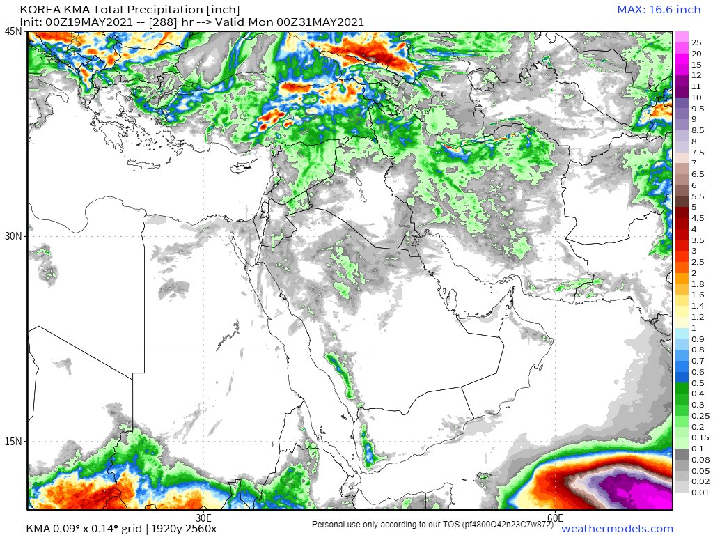
And finally in the rainfall forecast section ultra long range forecasts from three models, GFS, GEFS (16 days) and KMA (12 Days) 


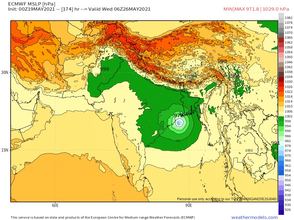
In relation to our Bay of Bengal Cyclone Watch it seems this remains a possible. The latest two GFS and ECMWF models are below.
The largely agree on timing of arrival, mid next week, but disagree on intensity. They also about the presence of a low pressure system over Tibet.


The largely agree on timing of arrival, mid next week, but disagree on intensity. They also about the presence of a low pressure system over Tibet.


On that last point. The remnants of Cyclone Tauktae seem to be streaming through the Himalayas today rather spectacularly.
Meanwhile generally speaking it seems to be expected to be wet across most of the greater Asian continent over the next 10 days. 


And a post script, another Atlantic storm is moving in over the UK and Western Europe tonight, where the rainfall continues to be widespread, occasionally intense and very determined.
@ThreadReaderApp Unroll
• • •
Missing some Tweet in this thread? You can try to
force a refresh


