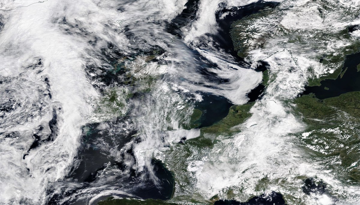
The main source of water into the European zone remains a flow of water across the Sahara north, now on a broad front bringing rain along a 1700km wide front from France to the Aegean.
Notably the unusual circulation of thunderstorms north of the Black Sea has grown to 2000kms wide and now extends all the way to the Baltic. This system appeared with the #WesternSaharaPlume and appears to be fed by it.
This animation from @Meteoblue shows an apparently connected outflow heading East across northern Russia.
Here you see the main Atlantic cloud mass has arrived in the West of Ireland. Ahead of this there is now a band of moisture running from the Pyrenees up to Norway.
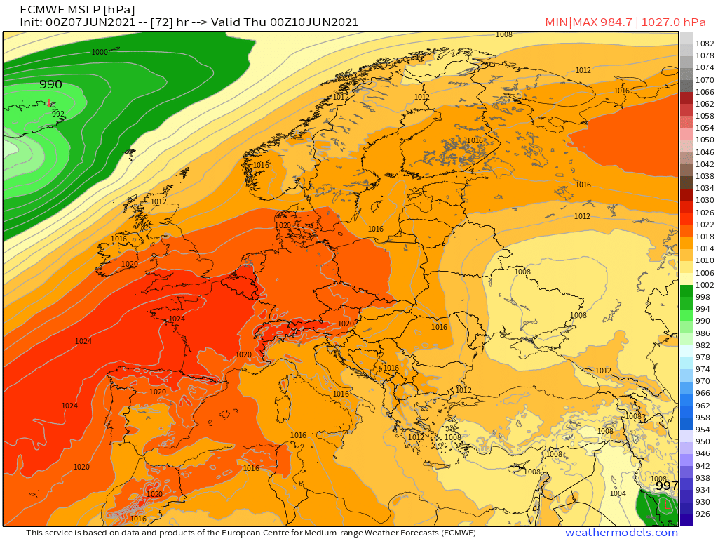
The advancing Atlantic low and the low circulation in the east are now squeezing a high centered over the UK.
Because the air is wet it has greater inertia and this I presume explains things moving so slowly. These weather maps (Midnight MLSP plots over 4 days) show the high eventually being divided and moving its center south over France (on Thursday).
These are the corresponding precipitable water maps at the same intervals. The water doesn't seem to care that much about the pressure differentials.
This animation runs from tomorrow morning (Tuesday 8th June) through to Saturday (12th June) midday. Notably the low north of the Black Sea remains in place till Friday (11th June).
Three more satellite images from this morning. The first shows the activity over over the Mediterranean. Second, the cloud action of North East Europe and finally a wide view of the full scene.
It looks as if this 2nd phase of #EuropeBigWet will end on the 12th, when the low located north of the Black Sea will finally relent and dissolve, allowing the a more active scenario to begin.
These final 6-Day rainfall forecasts show rainfall between now and Saturday midnight.
This 1st image shows the monsoon spreading westwards across the Bay of Bengal. I think it is relevant to the rains in Africa but you will need to wait till the final tweet to see how.
The strength of the West African Monsoon continues to grow as you can see in the animation above. During the current active period (See also #EuropeBigWet) the Sahara is forecast to reach a point where there is water over most of the great desert. Here are 10d rainfall forecasts.
Today's #EuropeBigWet update. Russia is getting pummelled. Italy is on fire with thunderstorms and central Europe is getting busy.
For context click on the hashtag for earlier episodes. This has been building up for a while. Thread....
It started modestly even though the warm air over Europe is increasingly saturated with moisture. And then as the day got hotter the thunderstorms got active.
This afternoon Italy in particular looks as if it is undergoing something potentially rather dangerous.
This recording stands out because:
a) its explosive nature and
b) because of its wide dissemination and the implications that come from it in relation to the fairness of the election.
c) because it was explicitly denied by the Prime Minister.
The also addresses two wider issues, the first of which relates to elections everywhere, and the second which relates to the specific conditions of this election.
In the CPJ safety handbook for journalists misinformation is directly addressed. cpj.org/2021/06/ethiop…
The @guardian has now published a ill-considered incendiary op-ed by @KjetilTronvoll containing his reckons on a subject he doesn't appear to be treating with care. He seeks resignations over a complex war the details of which remain far from clear. theguardian.com/global-develop…
Let me get this straight professor. You now acknowledge inadvertently spreading misinformation/disinformation in the lead up to this election, you continue to accuse the #Ethiopian Govt. of engaging in it.
As a professor of peace/conflict studies you would be aware that this is Ethiopia’s first shot at a real free and fair democratic election, and you would be aware of the already heightened domestic very lethal tensions, and not just in Tigray. And yet you continue to stoke these.
The Ethiopian Govt is clear they have asked Eritrean troops to leave but they have not yet left, even though undertakings to do so were provided to the U.S.
It is also clear that Tigrayan forces initiated this war and continue - with assistance unknown - to pursue it.
It is now two weeks till the first open democratic #Ethiopian election.
To open here's a high resolution satellite image of the Nile Basin from Cairo to Lake Victoria including Eastern Ethiopia where the #GERD dam is located, and where the Blue Nile - source of much of the Nile's flow - originates in Lake Tana (the heart shaped lake).
We will zoom in on the #HornOfAfrica starting with the wider picture. On the left side of this image you can see a #WesternSahara water transport event which is significantly impacting weather conditions in Europe. (See more in the attached thread