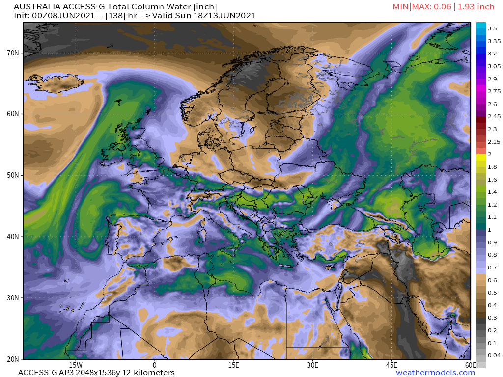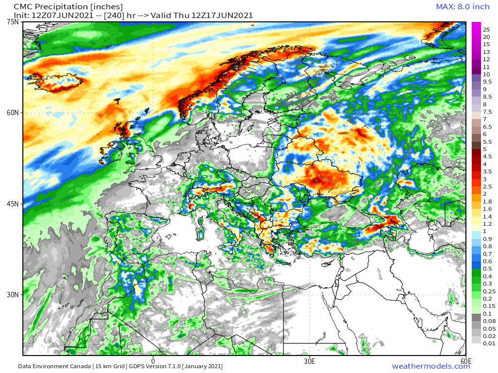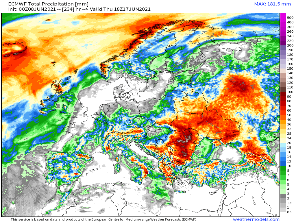
Today's #EuropeBigWet update. Russia is getting pummelled. Italy is on fire with thunderstorms and central Europe is getting busy.
For context click on the hashtag for earlier episodes. This has been building up for a while. Thread....
For context click on the hashtag for earlier episodes. This has been building up for a while. Thread....
It started modestly even though the warm air over Europe is increasingly saturated with moisture. And then as the day got hotter the thunderstorms got active. 

This afternoon Italy in particular looks as if it is undergoing something potentially rather dangerous.
To the south, Morocco & Algeria continue to receive a lot of attention from the Atlantic, and as we will see later a horizontal of stream of moisture is heading along the North African coast all the way to the Levant. Some is turning north and feeding what the Russian leviathan.
The Russian Leviathan Storm - my name - is now a week old, gradulally moving north and growing, and now dumping huge amounts of rain on Moscow. St Petersburg is still out of harm's way but for how much longer?
The models remain largely in agreement through to the weekend about the scenario before disagreeing a fair bit about what happens after the Arctic Rebound.
They agree that this will dislodge the Leviathan, but how fast and what happens next, not so much.


They agree that this will dislodge the Leviathan, but how fast and what happens next, not so much.


Here are four 48 hour rainfall forecasts, for today and tomorrow till midnight. Bare in mind that rainfall forecasts in these circumstances are devilishly difficult to compute. 


And here are four 10-day forecasts. At this range the intensity levels are impossible to predict with accuracy - but they provide a guide as to what to expect. 


Here's a 16 day forecast from the king of the supercomputer modelling systems, the United States @NOAA GFS (global forecast system), the only one that dares. 

Finally. Here are a series of images (spaced three days apart) that show the cause of all of this. I.E. the Atlantic.
And here is an academic paper which addresses the issue of how it is happening >> pnas.org/content/118/23…
Images:
1. Today
2. Saturday
3. Next Tues.
4. Next Fri.


And here is an academic paper which addresses the issue of how it is happening >> pnas.org/content/118/23…
Images:
1. Today
2. Saturday
3. Next Tues.
4. Next Fri.


/ENDS
Continuing story follow #EuropeBigWet
@ThreadreaderApp unroll
Continuing story follow #EuropeBigWet
@ThreadreaderApp unroll
• • •
Missing some Tweet in this thread? You can try to
force a refresh


