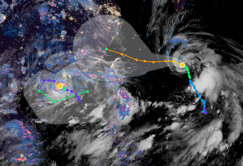
Absolute scenes in South China Sea.Track forecast for Typhoon #Cempaka shows how weird set up of 2 typhoons in the same space is expected to resolve itself. Once #FabianPH / #INFA gets close it will going to drag Cempaka back out, with #Taiwan caught in between.
Dear Ethiopian Twitter followers, and those from the wider region I have been covering with rainfall forecasts for the past few months.
I will no longer be doing these daily. But that does not mean they will stop altogether, as I am hooked on the changing weather in your region.
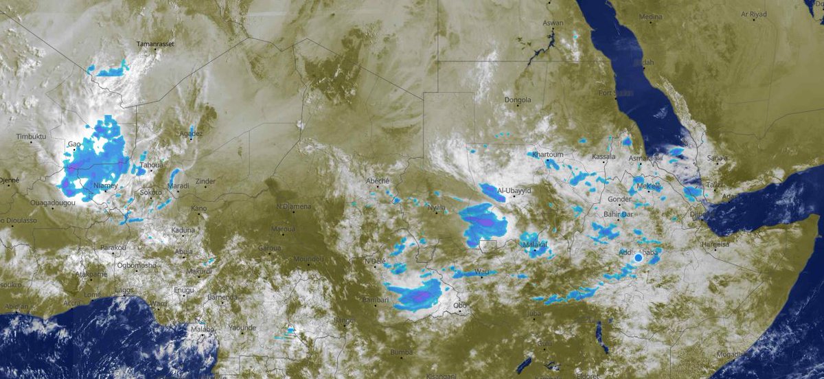
The image above is this from this morning's satellite pass. And it was the only bit visible through he cloud near the Ethiopian highlands which have been the focus of this effort. I suspect all of Ethiopia was covered but we can't see the bit in the black strip, not certain.
The reason for stopping the daily forecasts is, of course, the filling of the #GERD, that was why they started. But they led to so much more.
Today one of the things I originally started looking for happened in a spectacular way. This is a live rainfall image from 8.15 am today.
Two typhoons getting closer and closer to each other. #INFA on the right is sucking the much smaller #Cempaka into its orbit. Sucking up all its outflow and chucking it out east.
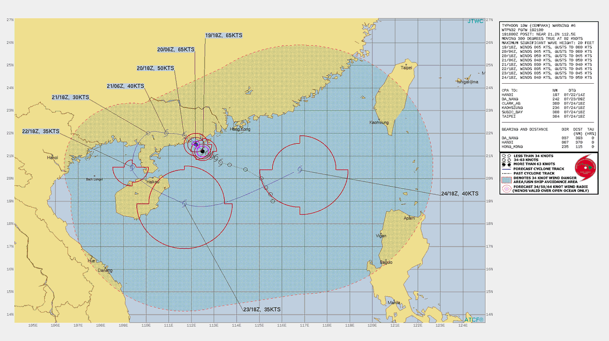
The pair of typhoons current winds are fixed by JTWC at 70 and 65 knots at 06Z.
Here are the current warning graphics from the JTWC.
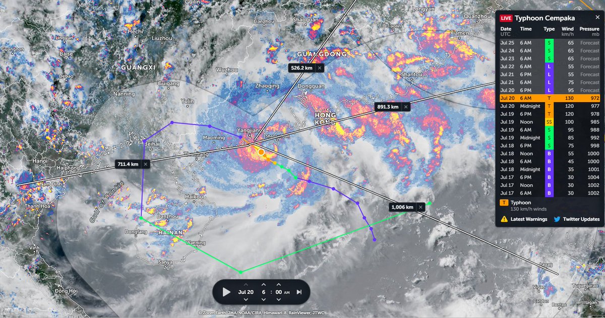
#Cempaka is a midget Typhoon (1). Spinning like a top south west of Hong Kong.
Disregarding its size, #Cempaka is directing rain from Hanoi to Taiwan (2). The forecast (3 & previous tweet) shows Cempaka moving west in a loop, but this hasn't started yet.
Congratulations to Ethiopia and Ethiopians everywhere on today's completion of the 2nd filling of the #GERD. It has been a great honour to follow along during this moment.
In honour of the #GERD we will change up the order of today's bulletin and get right to the most important issue, rain over the #Abbay basin, which due to its great quantity and consistency made this possible over such a short time period.
But first a brief explanation, as when it comes to the GERD not all rainfall counts. The first image here shows the path of the #BlueNile / #Abbay from Lake Tana to Khartoum where it meets the White Nile and becomes "The Nile".
Here's a view of the two storms, #FabianPH / #INFA whose interaction is forecast to produce a 3rd storm in 4 days time which was forecast yesterday to arrive in Tokyo two days after the Olympics opening.
In the latest GFS 1hourly simulation model the solution remains the same as of today. A large typhoon like low (in terms of water content) will make landfall in Japan and stay over the country for some time bringing torrential rains during #Olympics2021
This attached thread from this morn looks at Typhoon #INFA ("In-fa" TS09W) which is poised to be extraordinarily disruptive to the 2021 Olympics in Japan.
It has since come clearer what we can expect from a dangerous and unusual weather system developing over the West Pacific.
And here it is today. It still has a clearly defined circulation over the Adriatic Sea.
This shows the jet stream forecast for today which pretty perfectly matches what we are seeing here from the satellite imagery.
But while the circulation is gone the jet remains. This jet looks like it is going to move into the business of delivering moisture to the Middle East.