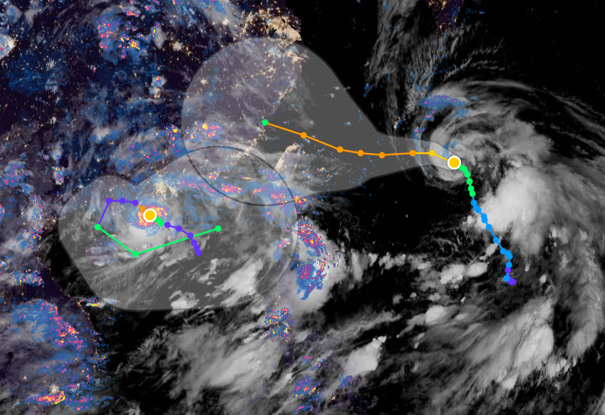
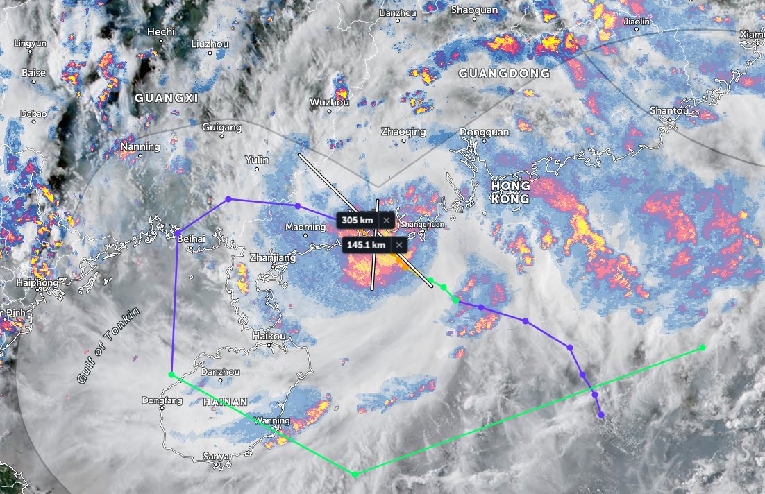
Two typhoons getting closer and closer to each other. #INFA on the right is sucking the much smaller #Cempaka into its orbit. Sucking up all its outflow and chucking it out east.
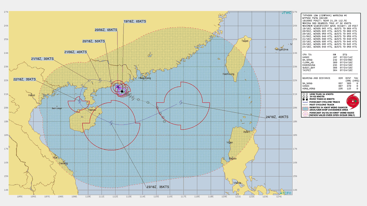
The pair of typhoons current winds are fixed by JTWC at 70 and 65 knots at 06Z.
The pair of typhoons current winds are fixed by JTWC at 70 and 65 knots at 06Z.
Here are the current warning graphics from the JTWC. 


#Cempaka is a midget Typhoon (1). Spinning like a top south west of Hong Kong.
Disregarding its size, #Cempaka is directing rain from Hanoi to Taiwan (2). The forecast (3 & previous tweet) shows Cempaka moving west in a loop, but this hasn't started yet.
Disregarding its size, #Cempaka is directing rain from Hanoi to Taiwan (2). The forecast (3 & previous tweet) shows Cempaka moving west in a loop, but this hasn't started yet.


These two images are trying to capture the relative scale but do not really do so effectively.

So what's about to happen. This is the 20 06 GFS PWAT run for 180 hours. Landfall in Japan for the third storm is forecast overnight on the 24th-25th with high winds possibly arriving in time for the Olympics Opening Ceremony on the 23rd.
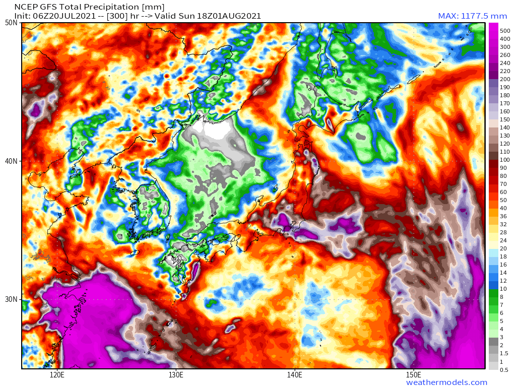
In this forecast the second phase of super moisture over Japan continues till August 1st.
Then in the final 4 days of the forecast things remain relatively benign. Over Japan.
1. Tokyo forecast rainfall before the storm 24th July
2. Tokyo forecast rainfall after the storm 29th July
2. Tokyo forecast rainfall after the storm 29th July
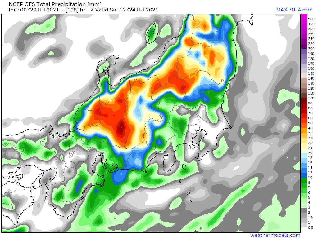

1. Japan forecast rainfall before storm 24th July (108hrs)
2. Japan forecast rainfall after storm 29th July (240hrs)
3. Japan forecast rainfall after atmospheric moisture has cleared. 1 August (300 hrs)
[Note: Forecasts beyond 120 hours are subject to significant error.]
2. Japan forecast rainfall after storm 29th July (240hrs)
3. Japan forecast rainfall after atmospheric moisture has cleared. 1 August (300 hrs)
[Note: Forecasts beyond 120 hours are subject to significant error.]


Disclaimer: This is not an official forecast and I am not a meteorologist. See the Joint Typhoon Warning Center for official advisories and warnings >> metoc.navy.mil/jtwc/jtwc.html
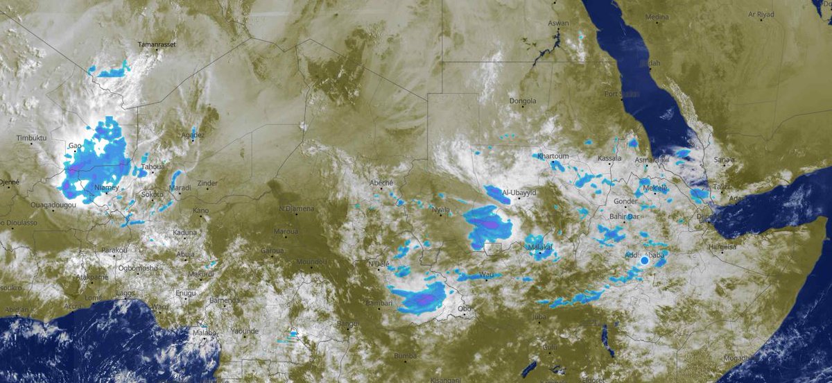
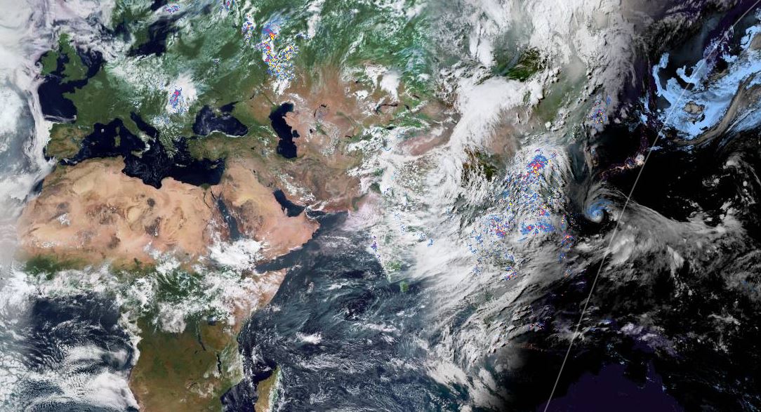
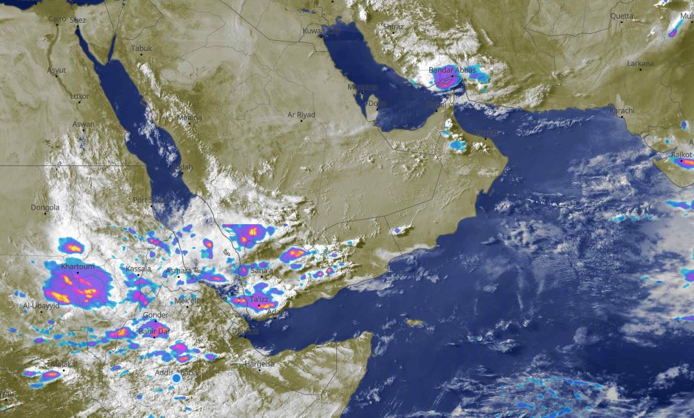
Once again today we had the peculiar site of a large storm at sunrise over the Arabian Peninsula and Horn of Africa.
And here's a view of the Indian Monsoon this evening India time.
In this image, also from @NASA, we can see the entire Nile. The GERD can be seen in there if you know where to look. With this mass of cloud it was a minor miracle that the dam was partially visible.

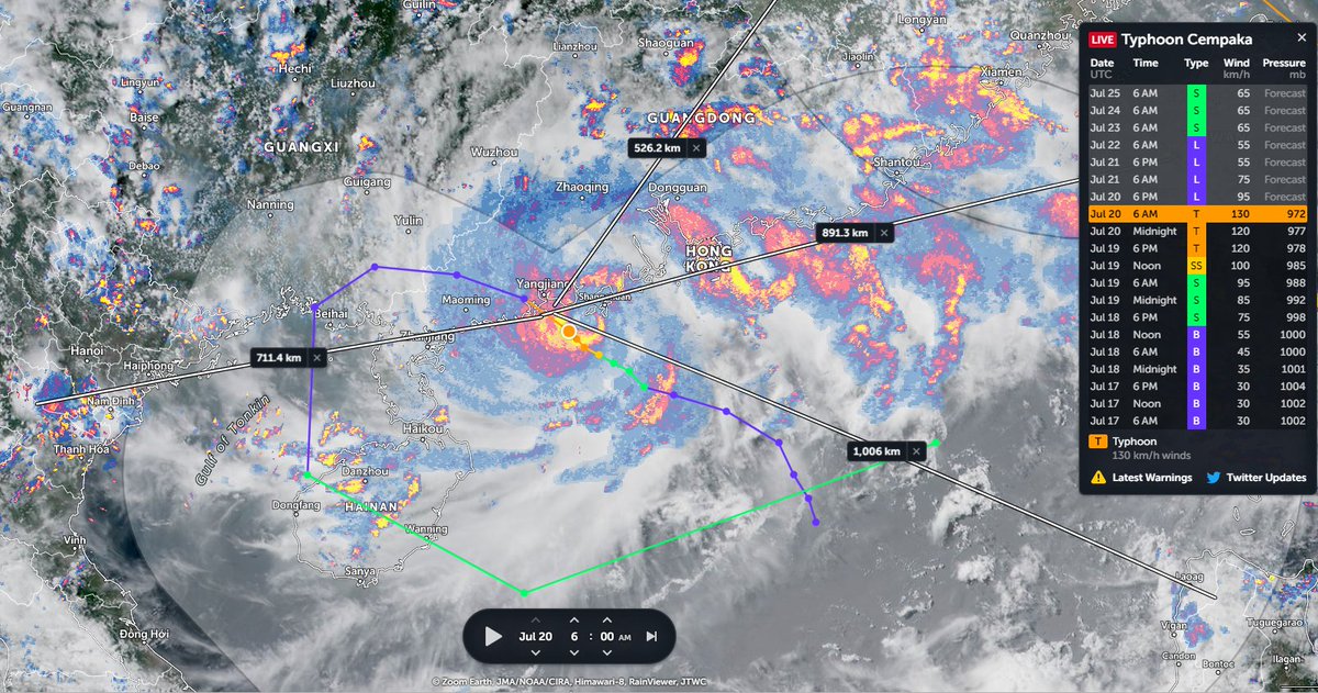
Today's big pictureshows a view across all of Asia and Africa in which the Indian & East Asian Monsoon are peaking. on the right there are two typhoons, #Cembaka and #INHA which are about to become one after they collide over Taiwan in a couple of days.
Today's 10-Day Rainfall forecasts for North Africa from July 20th through July 31st. The #ArabianMonsoonBurst is ongoing and can be seen on the far right of each rainfall forecast.

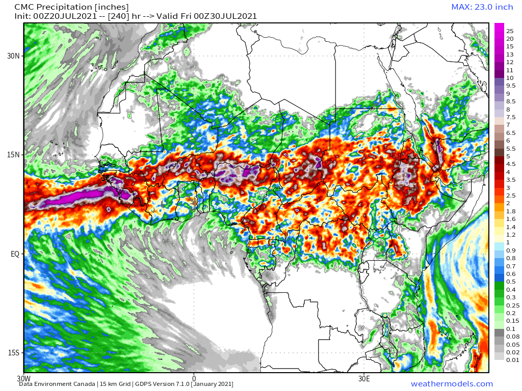

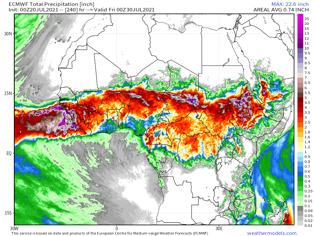
48-hour rainfall forecasts (today and tomorrow from our standard four models: the European @ECMWF, @NOAA's GFS, Canada's CMC and the Korean KMA models.


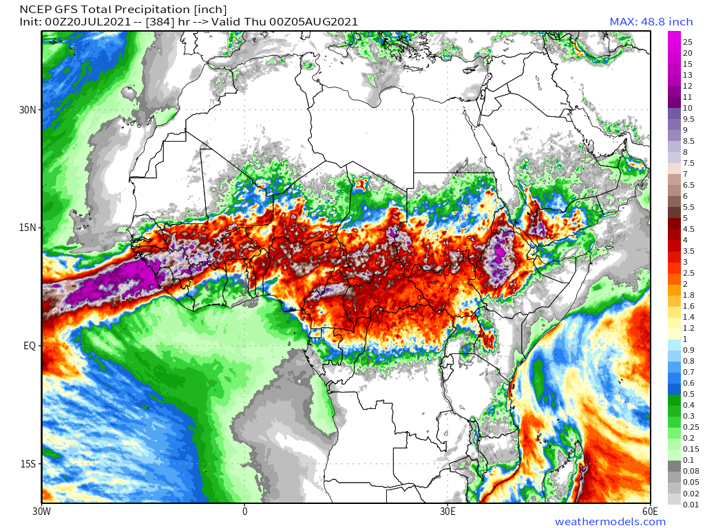
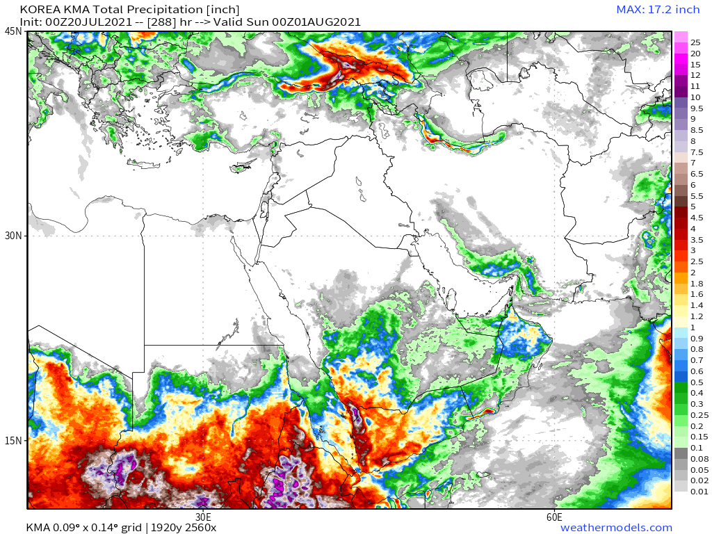
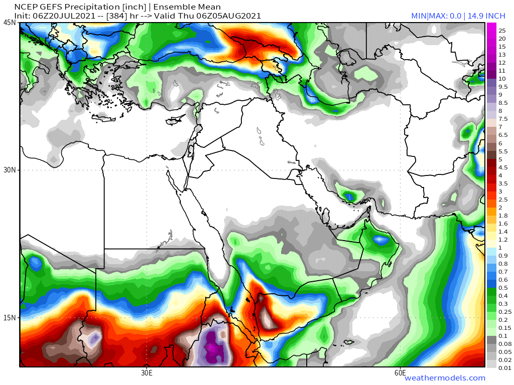
Finally for #NorthAfrica we have the long-range 16-day (GFS) and 12-day (KMA) forecasts which continue to show significant #DesertRain in the central Sahara.

Here we see a wider angle view of today's cloud movements over the Arabian Peninsula and the Horn of Africa from early this afternoon.
And this corresponding image shows us where the rain was this afternoon. There was a very big storm directly over Khartoum, and a lot of rain over Sudan. For a time there were also clouds covering most of the Aswan Dam.
And here's a closeup view of live rainstorms in this storm, which contained - as you can see - a lot of rain today.

Today's July 20th 10-day rainfall forecasts for #Ethiopia (+1 12-day from KMA) and the #HornOfAfrica: #Somalia, #Somaliland, east #SouthSudan, south east parts of Sudan, #Djbouti and #Eritrea.
Purple heaviest rain covers #Tigray, & #Abbay (#GERD) & #TekezeAtbara basins.
Purple heaviest rain covers #Tigray, & #Abbay (#GERD) & #TekezeAtbara basins.


Before the #MiddleEast forecasts here are a couple of #ArabSotrms observation tweets from today. In this first one I am not entirely sure what I am looking at. But it definitely looks dangerous. Its in #SaudiArabia today.
https://twitter.com/Arab_Storms/status/1417426617513791489?s=20
This one appears to show view from a car which looks a lot like a view from a boat, at Narjan #SaudiArabia.
https://twitter.com/Arab_Storms/status/1417386445208182785?s=20
Check out @ArabStorms for more extreme weather observations.
July 20th 10-Day accumulated rain forecasts for the #MiddleEast from the GFS, CMC, KMA & ACG weather models.
#ArabianStorms
#KSA #Yemen #Oman #Jordan #Sudan #Iran #Syria #GERD #Sudan #DesertRain #UAE
الله أعلم
#ArabianStorms
#KSA #Yemen #Oman #Jordan #Sudan #Iran #Syria #GERD #Sudan #DesertRain #UAE
الله أعلم


48 Hour July 18th (today and tomorrow), accumulated rain forecasts for the #MiddleEast from the GFS, CMC, KMA and ACG weather models.
#ArabianStorms
#KSA #Yemen #Oman #Jordan #Sudan #Iran #Syria #GERD #Sudan #DesertRain
الله أعلم
#ArabianStorms
#KSA #Yemen #Oman #Jordan #Sudan #Iran #Syria #GERD #Sudan #DesertRain
الله أعلم


And finally we have today's long-range #MiddleEast July 20th rainfall forecasts.
The16-day GFS & GEFS models, the 12 day KMA and the 15 day EPS (Euro ensemble) model forecasts.
الله أعلم
The16-day GFS & GEFS models, the 12 day KMA and the 15 day EPS (Euro ensemble) model forecasts.
الله أعلم


And to conclude the regular elements, a big picture view. North Western Hemisphere zero hour simulation data (i.e. now).
1. Precipitable water PWAT anomaly
2. PWAT (potential rain + energy)
3. MLSP (Mean Sea Level Pressure)
4. 250Hpa (jet stream winds approx 11-15 kms high)
1. Precipitable water PWAT anomaly
2. PWAT (potential rain + energy)
3. MLSP (Mean Sea Level Pressure)
4. 250Hpa (jet stream winds approx 11-15 kms high)


• • •
Missing some Tweet in this thread? You can try to
force a refresh