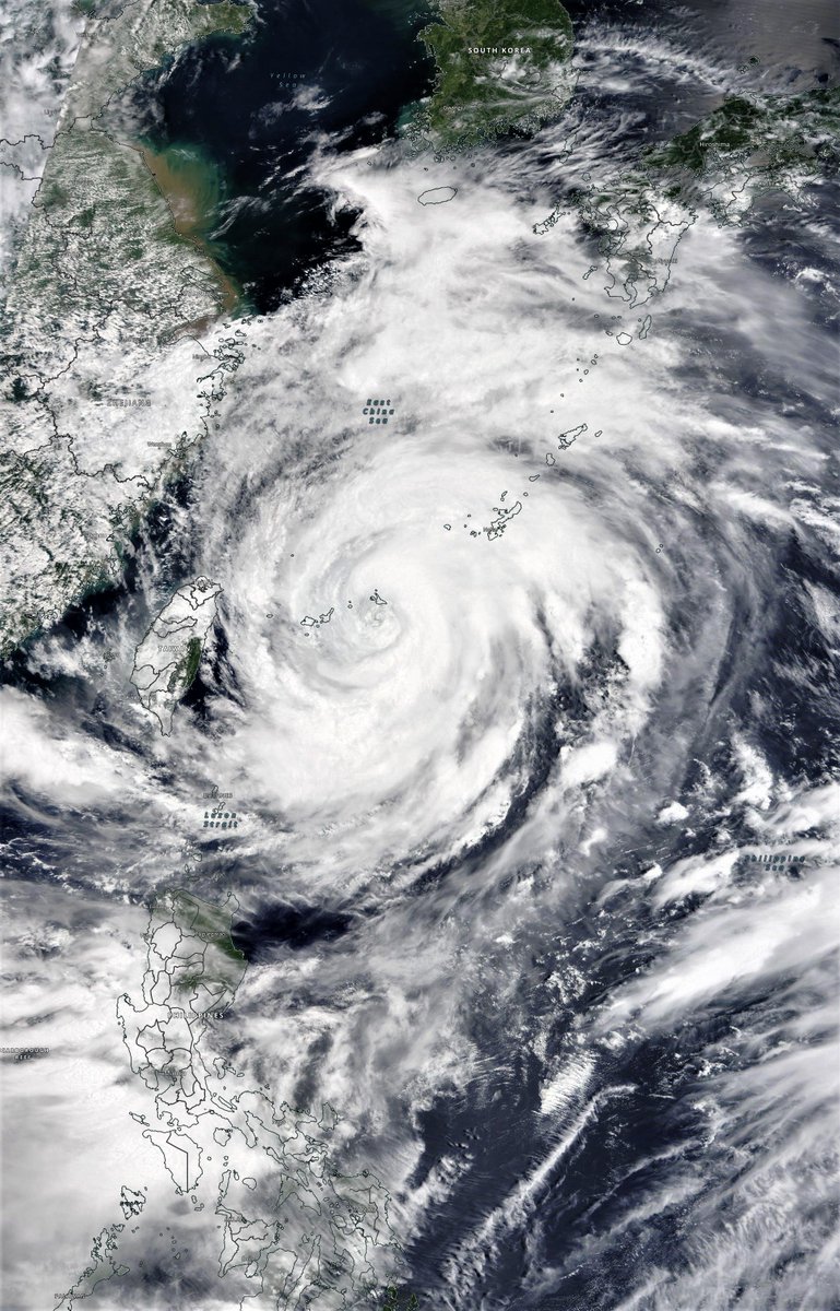
A brief pictorial thread of parts of the northern hemisphere where extreme or unusual weather phenomena are underway.
Starting with #eastasia #infa & #3rdStorm which seems to have initiated formation. This is the storm which will crash #Olympics2021, shortly after the opening.
Starting with #eastasia #infa & #3rdStorm which seems to have initiated formation. This is the storm which will crash #Olympics2021, shortly after the opening.
The 1st animation is 120 hours. This version goes for 11 days longer. As on #infa’s path beyond 120 hours, what happens beyond July 26th is pretty uncertain. #infa is also continuously not behaving as expected, totes normal for a heat engine of this magnitude.
Heading west a few thousand miles the lingering impact of the #ArabianMomsoonBurst is set to continue for some time bringing thunderstorms to the Arabian peninsula on a daily basis. See @Arab_Storms for video reports.
Next we go north west to Europe where a brief spell of hot weather and cloudless skies in the West is about to end, reverting to the #europebigwet conditions of the first half of the year. Lower than normal temperatures and endless thunderstorms, some of which have taken lives.
This version of the same map highlights areas of unusually high atmospheric moisture. Europe returns to an elevated state but the impact of the #arabianmonsoonburst on the Sahara is the most interesting phenomena here. Lots of #desertrain.
A third view shows us the next 5 days of rainfall accumulation. I am in the direct path of the incoming rain in Europe which arrives tomorrow and which will be a pleasant change for me at least. As I like rain. And rain hereabouts is generally very gentle.
Another unusual aspect of these North Atlantic forecasts is the continued absence of cyclones. While there have been several named storms this year, there had been only one hurricane, #Elsa which brought a lot of rain to the Eastern seaboard.
And finally a view of the #westafricanmonsoon which is having a very active year, in line with the East Asian and Indian Monsoons. These are the engines which are producing both predicted and some unpredicted changes to weather systems (e.g. the quiet Atlantic hurricane season.
Rivers are fixed in place, predictable, but at times hugely destructive. There are also fluid atmospheric rivers in the sky fed by convective thunderstorms which can tower to 18kms high and transport water thousands of Kms at high speed.
These two animations show forecasts for those rivers.
This one over the Western Pacific where typhoon #infa is sitting in the middle of a huge mass of meandering very wet atmosphere, and orchestrating what is happening around it.
This one over the Western Pacific where typhoon #infa is sitting in the middle of a huge mass of meandering very wet atmosphere, and orchestrating what is happening around it.
These two animations only show the winds at 250hpa pressure, between 11-15kms high typically. But there are rivers at many different altitudes and they go in different directions.
And the physics of this gets more complicated the more water/energy there is.
And the physics of this gets more complicated the more water/energy there is.
This is why hurricanes are so hard to compute.
It is a scientific miracle that these models enable us to see into the future. They are a much needed early warning system for the globe which will help us to navigate the difficult times ahead.
It is a scientific miracle that these models enable us to see into the future. They are a much needed early warning system for the globe which will help us to navigate the difficult times ahead.
But a massive investment and collaboration may well be needed to provide global coverage of the kind that currently exists in the US with meso-scale very accurate, rapid update short time scale models capable of identify local catastrophes yet to come, in time to prepare.
We live in interesting times, and it seems they are about to get much more interesting on the weather front.
/ends
@threadreaderapp unroll
/ends
@threadreaderapp unroll
• • •
Missing some Tweet in this thread? You can try to
force a refresh


