
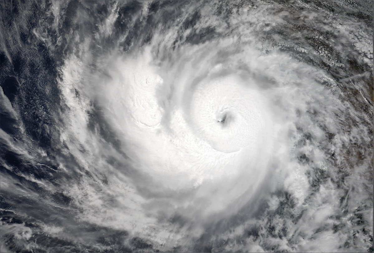
Tonight Extremely Severe Cyclonic Storm Tauktae is already a Cat 3 Hurricane equivalent Cyclone, 24 hours ahead of schedule and tearing up the West Indian coastline on its way north.
Today's #ME and #HOA rainfall forecasts follow.
Today's #ME and #HOA rainfall forecasts follow.
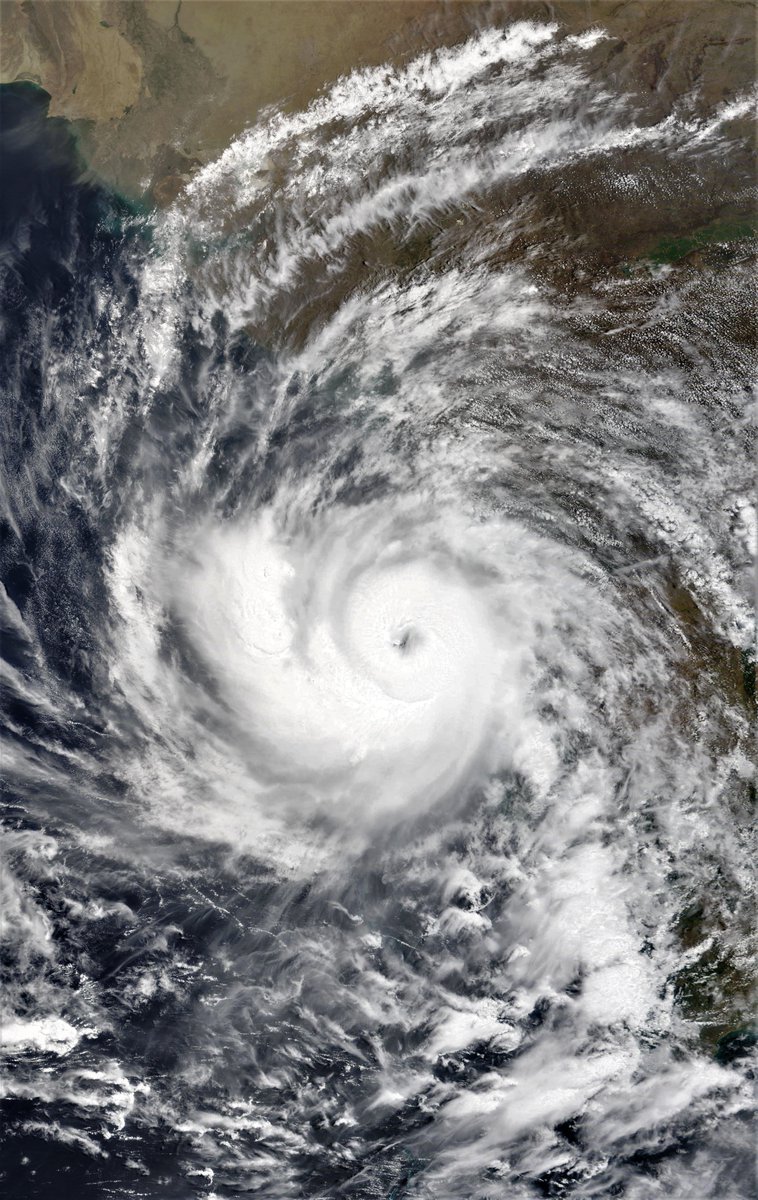
Three more views from the image.
The first shows the positioning of this morning's @NASA Modis picture of Tauktae in relation to the coast. Nearly half the central convection area is over India.
The 2nd shows a wider perspective. & the 3rd provides borders for orientation.
The first shows the positioning of this morning's @NASA Modis picture of Tauktae in relation to the coast. Nearly half the central convection area is over India.
The 2nd shows a wider perspective. & the 3rd provides borders for orientation.


Further west here are four images from today of the #HornOfAfrica, the #NileDelta, the #Levant and #UAE + #Oman.
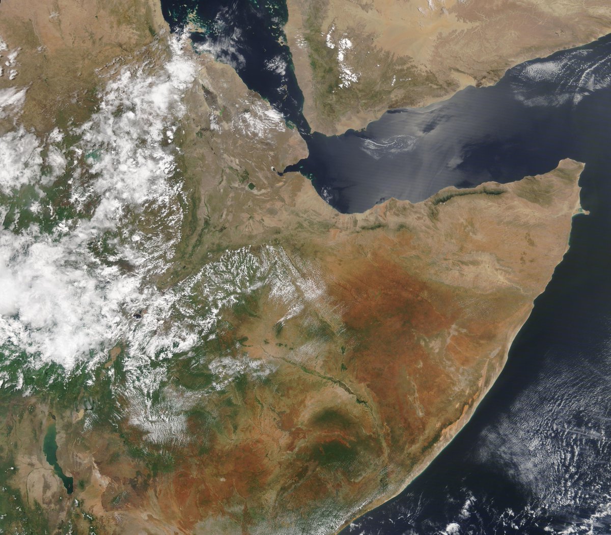


By comparison to what's happening on the other side of the #ArabianSea today's weather in the #ME and #HOA was benign with modest and orderly cloud formation and from the look of things very little wind.
Here are today's forecasts, beginning with #Ethiopia #HOA 10-day rainfall ECMWF, GFS and KMA 16th May model runs. They are very much in agreement. Rainfall is expected to resume in #Somalia and #Somaliland


+ 3-day forecasts till Thursday at midnight. On the basis of what we are seeing today. The KMA model which has rain resuming in #Somaliland resuming soon looks the most plausible.


WRT to the sufficiency of rains to enable filling of the Grand Renaissance Ethiopia Dam, #GERD, we also have an encouraging report Data Guru of the Nile, Dr. @TirusewAsefa pointing to 200%-600% over normal rainfalls in the #HOA catchments.
https://twitter.com/TirusewAsefa/status/1394002308506296323?s=20
If only a bit of extra rainfall could also help resolve the conflict in Israel-Palestine? In this satellite animation we can see an injection of water vapour into the Levant coming in rapidly as the sun sets over Greece.
In the latest ECMWF run the impact of this can be seen in a forecast increase in water vapour over nearly all of Israel at midday tomorrow.


May 16th, 10 day accumulated rain forecasts for the #MiddleEast from the GFS, ECMWF, CMC & KMA weather models.
@Arab_Storms
#ArabianStorms
#KSA #Yemen #Oman #Jordan #Sudan #Iran #Syria #GERD #Sudan #DesertRain
الله أعلم
@Arab_Storms
#ArabianStorms
#KSA #Yemen #Oman #Jordan #Sudan #Iran #Syria #GERD #Sudan #DesertRain
الله أعلم


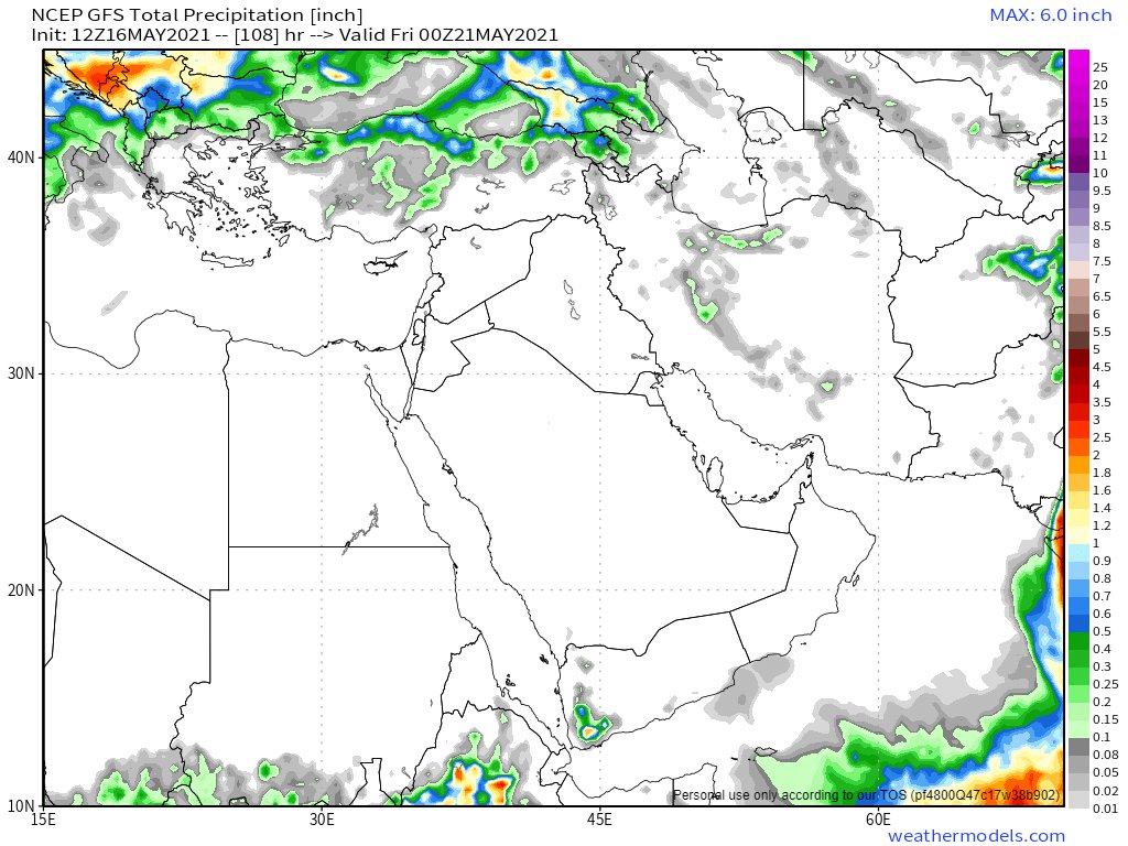
Today's 3-day accumulated rainfall forecasts for the #MiddleEast to midnight Thursday.


The final forecasts for today, ultra-long range GFS (16-days) and KMA (12-days). Here are the last two GFS and KMA model runs.


Today's final tweets return to #Tauktae, looking at what happens next in the apparently cyclone curious North Indian Ocean.
While today's GFS model runs have not shown cyclone formation in the #ArabianSea in the next 16 days, yesterday's did. Here's the latest 16:12 run.
While today's GFS model runs have not shown cyclone formation in the #ArabianSea in the next 16 days, yesterday's did. Here's the latest 16:12 run.
The other model with a great track record for early warnings on cyclone formation is the European @ECMWF. While it does not see an #ArabianSea cyclone now in the next 10 days. It continues to foresee formation of a tropical depression in the Bay of Bengal.
The reason for the disagreement is very obvious when you look at the corresponding précipitable water forecasts. The GFS is now forecasting a dry air mass arriving via Iran resulting in a massive reduction in North Indian Ocean water vapour.
The ECMWF largely agrees with this general phenomena but continues to see a Bay of Bengal event anyway. Here we can compare 240 hour predictive scenarios from the two models.


Here are comparison 10 day accumulated rainfall forecasts from all four models.


And finally. While it appears the #ArabianSea may be returning to something resembling normal following #Tauktae, further north the rain event modeled for central Asia remains on track. Unfortunately there are not a lot of people there to send us reports though.

• • •
Missing some Tweet in this thread? You can try to
force a refresh


