Hurricane #Elsa this morning shortly before daybreak. The track of this increasingly dangerous looking cyclone has moved east and north with a projected path over Cuba now.
Here is the latest official warnings and advice. Elsa is moving very fast and is currently forecast to exit the U.S. after making landfall in 5 days time. However these events are inherently unpredictable. See .... nhc.noaa.gov
This animation shows water vapour over the Caribbean over the next five days. The center of Elsa can be seen in purple.
This animation shows the forecast rain pattern from the same model run. the rains are heavy over a narrow band presumably due to the speed with which #Elsa is moving.
Here is a recent satellite animation from @zoom_earth, at this point it hasn't yet developed an eye indicating a lack of organisation, and consequently not as powerful winds. That said it is already a massive storm.
• • •
Missing some Tweet in this thread? You can try to
force a refresh
2 recent #pictures on day 5 of the 2021 Grand Ethiopian Renaissance Dam #GERD filling.
1. Satellite image this morning.
2 Date unknown, posted on Twitter today.
Meanwhile it looks as if the #HOA rain is about to get heavier. Today's forecasts follow.
Today's big picture hasn't changed much.
TS #Elsa can still be seen bottom left, she will be crossing Cuba later today.
Bottom right we see storms over #Ethiopia and #Yemen.
In Europe the #EuropeBigWet continues with North Atlantic weather moving in from West.
This @NASA Modis satellite image series zooms in from...
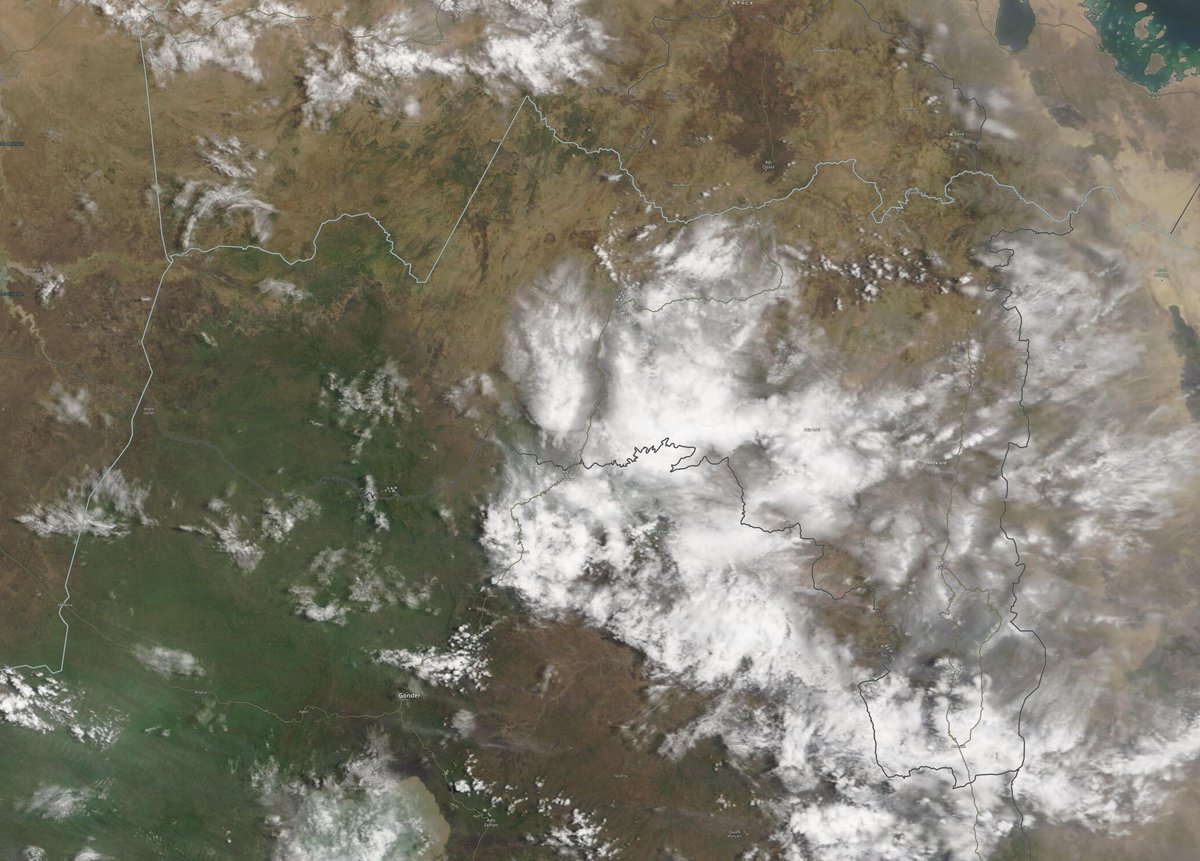
1. The entire Nile 2. Ethiopia 3. #Abbay basin. Can you spot the #GERD? 4. Tigray.
The convective storms over Ethiopia and Sudanese Nile Basins tonight is remarkably intense. Bringing massive amounts of rain across a huge area, including the #Abbay /#BlueNile basin, on the 4th day of #GERD filling.
In this wider view you can see the full size of today's rain areas which extended deep into Sudan later in the afternoon.
These two images are at sunset the sizes of the two large convective areas, the eastern one extends well north into Eritrea and covers Tigray and the entire #Abbay Basin. The first image provides an idea of size. Each storm area is larger than the UK and Ireland.
Here we zoom out a little, the source of the #Abbay/#BlueNile Lake Tana takes pride of place. You can see the #GERD lake in the bottom left hand corner.
These images are from the @NASA Modis Worldview service. Also below a picture of the #GERD from back in January.
Here's today's big picture as ever of the great Sahara Desert. You can see today's #ArabianStorms starting up bottom right, and top left a new rain front coming into Western Europe where the 2021 #EuropeBigWet continues to bring rain and unseasonably mild temperatures.
Somewhat unsually for @Monbiot this article is both harsh shallow and foolish. The story of the Tigray War, its origins, and potential consequences is not comprehensively covered in his usual manner, as a Monbiot fan I am disappointed. theguardian.com/commentisfree/…
This companion piece of reporting also from yesterday is better. But it too fails to understand the complexity of a nation which was under seige from Trump, who was in league with Egypt in the lead up to the war in its dispute over the #GERD as well as dealing with Covid.
The coverage from pontificating western media over the this Ethiopian catastrophe rages as an echo chamber of ill-informed reckons.
There are reasons this is happening. More complex and more interesting than the collective ill-informed group-think currently being reported.
And then around midday. In Levi (@TropicalTidbits) commentary he mentions several times how fast the storm is moving. And this becomes apparent in these animations.
And this is also pertinent in relation to the hazard's #Elsa#TSElsa potentially poses as she strengthens.
Levi also talks about the GFS (U.S. @NOAA) and European (@ECMWF) models disagreeing on track/guidance. Here's the latest GFS model forecast for the Caribbean. In it the storm does not strengthen a great deal. But it does reach the Gulf of Mexico by Tuesday. I.E. Elsa is moving.
This animation shows a PWAT (Precipitable water) simulation for the same period, through to a potential landfall on Wednesday/Thursday. I was curious to see how much #Elsa would gather together and influence the PWAT distribution. And it appears she will do so.
The big-rains season in Ethiopia is now underway, and today is the second day of #GERD filling. As it was yesterday, today's rains were strong over the #Abbay Catchment.
This animation shows the storms as they began today, fueled by water baring winds from the Indian Monsoon.
Attached thread show's yesterday's forecast report.
In the big picture today we can see yet another day of #ArabianStorms continuing the trend which began in April.
In Europe another big front is bearing down in the North Atlantic as two large storm systems continue to bring significant rains to West, Central & Eastern Europe.