Thread #Haldwani case:
After extreme rainfall in #Uttarakhand, a bridge failed across Gaula river near Haldwani

Rain wasn't sole cause, it just brought d collapse a bit earlier

Himalayan rivers exit mountains & enter plains with great intensity & it is a critical zone
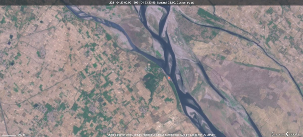
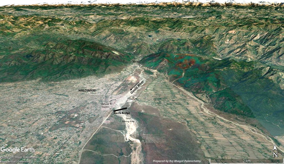
It is in this critical section is Haldwani where the Gaula river exits the himalayas and enters plains. Rivers bring huge amount of sediments with them to settle as well as they have high intensity flows during monsoon to erode

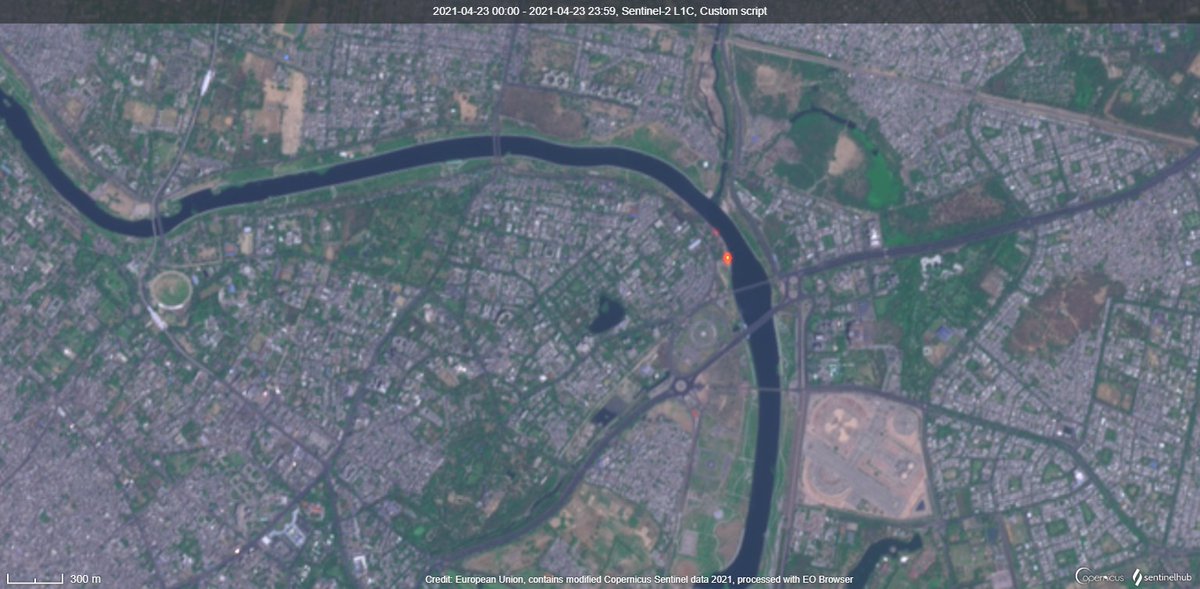
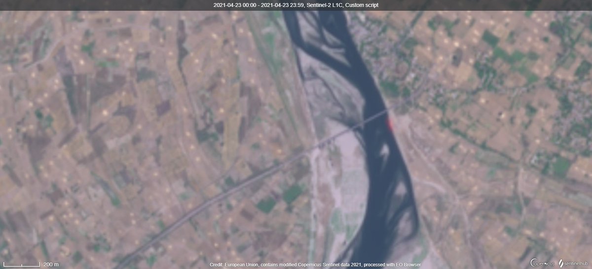
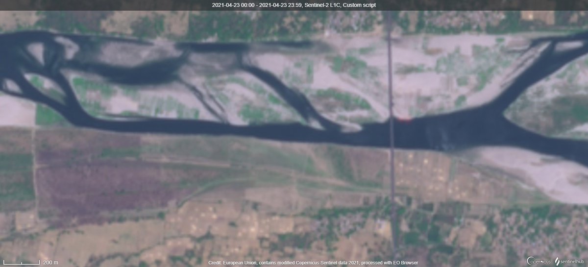
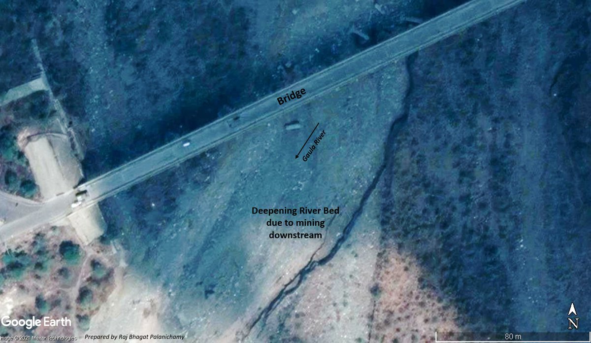
Visual shows the location of the bridge that failed
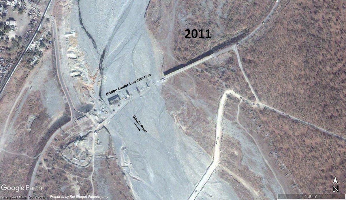
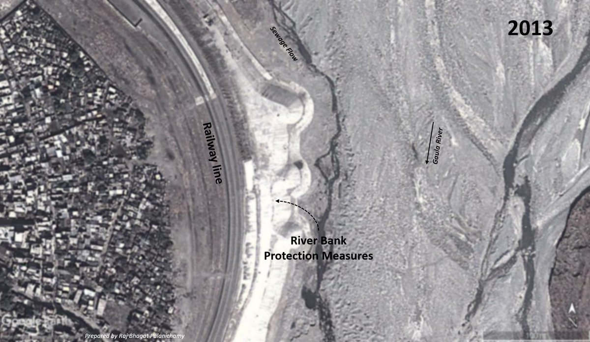
Failure of a bridge is nothing new in the region. The previous bridge across the Gaula river (shown with old satellite image below) had collapsed in 2008 after floods
A new one which was meant to be a stronger one was constructed and by 2011 it was open for traffic. Satellite image shows the bridge under construction
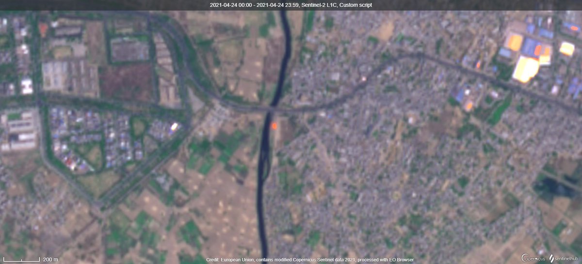
The bridge designers didnt anticipate a lot of things. There were other activities that were going on as well. Just 500 meters downstream of bridge, intense sand mining activity was happening which resulted in deepening of river bed. All those looking like ants are lorries!
As downstream river bed deepened, the river bed upstream closer to the bridge was also deepening along with it as water began flowing. This deepening of the river bed began undermining the bridge structure
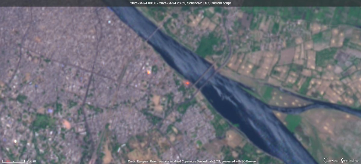
In 2011, there was erosion in the upstream of the bridge as well close to the railway line. This is just 500m above the bridge.
In order to protect the bank, protection measures were taken up and the river began moving slightly to the east because of these.
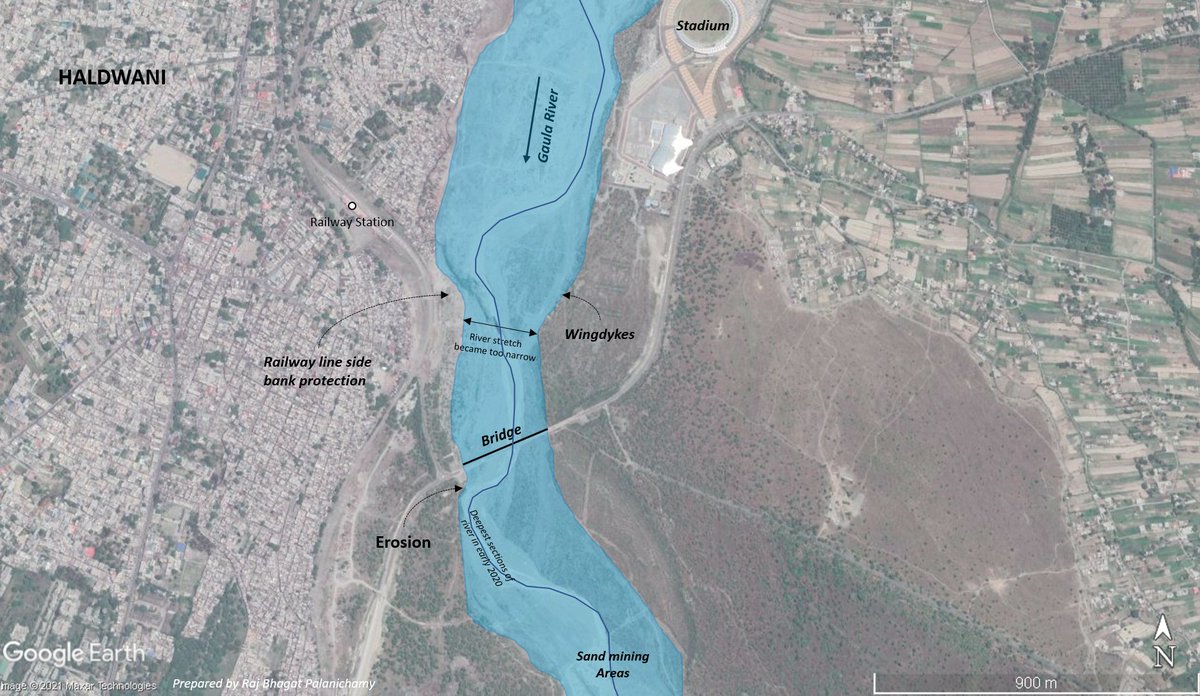
And on the other side of the river, a massive stadium and sports complex was built on the flood plain. The buffer that the river had with respect to carrying flood water was becoming limited
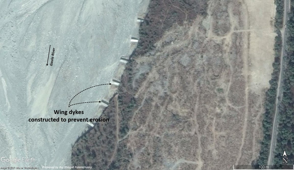
More over to protect the banks, wing dikes were constructed along the river banks. This prevented the river to move to the west as well.
With both sides of the river "protected", the river now had no place to move and it became narrower with smaller flood buffer
So the river became narrow upstream intensifying flow towards the bridge, the river bed deepened due to activities downstream, the river meander was also closer to the haldwani side of the bridge which started eroding. These began exposing the bridge structure
This video shot by Prakash provided by @Indian_Rivers shows the condition of the bridge a month before the collapse. The bridge was just waiting for demise.
And after heavy rainfall last week in uttarakhand, water levels rose and the bridge failed exactly on the haldwani side where the erosion and exposure was happening. Video Credits: @Indian_Rivers
There are many such infrastructure in such critical areas that are waiting to fail. I am not going to say what should be done but one can think in two lines
1. Responsible development
2. Financial costs (how long & how many times are tax payers going to fund such doomed projects)
The event is not sudden and as mentioned earlier was waiting to happen. @Indian_Rivers had talked about this location long time ago. Check their handle!
Side note: Notice how untreated sewage is entering the river.

• • •

Missing some Tweet in this thread? You can try to force a refresh
 

Keep Current with Raj Bhagat P #Mapper4Life

Raj Bhagat P #Mapper4Life Profile picture

Stay in touch and get notified when new unrolls are available from this author!

Read all threads

This Thread may be Removed Anytime!

PDF

Twitter may remove this content at anytime! Save it as PDF for later use!

Try unrolling a thread yourself!

how to unroll video
  1. Follow @ThreadReaderApp to mention us!

  2. From a Twitter thread mention us with a keyword "unroll"
@threadreaderapp unroll

Practice here first or read more on our help page!

More from @rajbhagatt

16 Oct
#Thread - #Bengaluru Airport:
What exactly happened in Bengaluru airport that led to the flooding/stagnation a few days before?
My version:

Before the airport, area (marked in white) was in a ridge between 2 valleys, had cropland, quarries, a minor valey, open scrubland
1/n
Even after the completion of phase I which was the runway in the northern side and the terminal, the minor valley was not affected significantly as it was all limited to the northern side. One quarry site also remained holding stagnant water.
2/n
This map gives you the terrain of the airport area and one can easily notice the ridge on which it was built. Water was supposed to drain into the main valleys through the minor valley.
Approximate water flow directions are marked for better understanding of terrain
3/n
Read 8 tweets
18 Aug
Viz: #Kaveri river watershed 😍

I would be posting some #maps about the river with finer details in this thread in coming days! Bookmark.. Image
FAQ
Data: SRTM
Software: QGIS
One of the biggest engineering works in Kaveri river is the Kallanai / Grand Anicut system. It was not constructed in 1 step & most of the structure that we see were erected during British era

Annotated drone image from @vikatan. The subsequent tweets deal with history of dam Image
Read 14 tweets
26 Jun
#Story of Lakkasandra lake in #Bengaluru

The thread shows the recent history and transformations it went through over time.

#Map shows the location of lake with an approximate boundary of the plot.
The waterbody in Lakkasandra might have lost its original applications many decades ago and hence revenue maps (given on the left) shows it as a government land but not specifically as a waterbody. Google Maps however shows the waterbody as it was detected in the early 2000s
But the lake seems to have water in many satellite images from 1970s, 1980s, and 1990s. It has attributes similar to any seasonal rainfed waterbody in the region
Read 15 tweets
10 May
#Thread
#Elections are supposed to be about electing representations for framing legislations

However the geography behind delimitation which doesnt consider complex socio-economic conditions promote communal polarization leading to deterioration of Democractic values

1/n
Understanding Delmitation:

The constituency delimitation is based on population. and for last delineation exercise, 2001 population was used. Average population was calculated to be 270000 people per constituency

#Map shows Population spread in Tamil Nadu
2/n
To delineate which village/town comes under which constituency, some rules are followed

To achieve the avg population, officials start with headquarters for the constituencies in district & add villages/towns within same or neighbouring taluks(subdistricts) in same district

3/n
Read 35 tweets
27 Apr
We talk about #DigitalIndia & every other meeting someone would claim that data is the new gold etc. But when it comes to critical data& good quality data, India is far far behind..

Eg: India's open data platform- data.gov.in provides the locations of hospitals
Location quality of many of these hospitals are not very accurate and 250 of them are mark outside the country!
The reason being is that they have automated geocoding using Google Maps
Why this happens: When done at a global scale, Google Maps API tries to read the address and gives the most "relevant" result. So D C Bank road (probably district cooperative bank) is marked in Washington DC
and Oxford Public School is marked in Oxford, England
Read 6 tweets
25 Apr
Thread:

I had earlier posted that I am not confident about Covid Nos & few asked explanation

Attaching satellite images where SWIR bands have picked up fire signals in crematoriums(orange colour). In most cases, this is 1st time detected or ten times intensity detected in past
Images from NOIDA, Vrindavan, Mathura, Lucknow (Clockwise from left top)

Orangish -red colour is the place of the ghats where these cremations take place
DhoriGhat, Baksar, Bhitoura, Fatehpur Ganga (These are Mild Signals)
Read 17 tweets

Did Thread Reader help you today?

Support us! We are indie developers!


This site is made by just two indie developers on a laptop doing marketing, support and development! Read more about the story.

Become a Premium Member ($3/month or $30/year) and get exclusive features!

Become Premium

Too expensive? Make a small donation by buying us coffee ($5) or help with server cost ($10)

Donate via Paypal Become our Patreon

Thank you for your support!

Follow Us on Twitter!

:(