
So I'm cleaning up a glorious 1905 tram map of Sydney and I just want to share a few random things that I've noticed as I work. Um... thread, I guess.
In 1905, Garden Island was actually an island, and Potts Point was an actual, physical, geographically defined point instead of just a ritzy suburb. 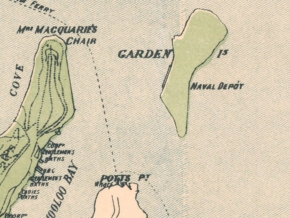
The current Central station was still a year from opening, so the mapmakers have defined the area very hazily, with "New Station" written in the general area. 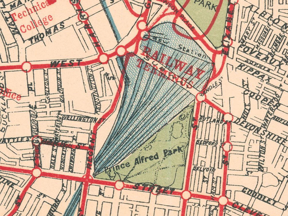
The current Dulwich Hill railway station was then known as "Wardell Road". 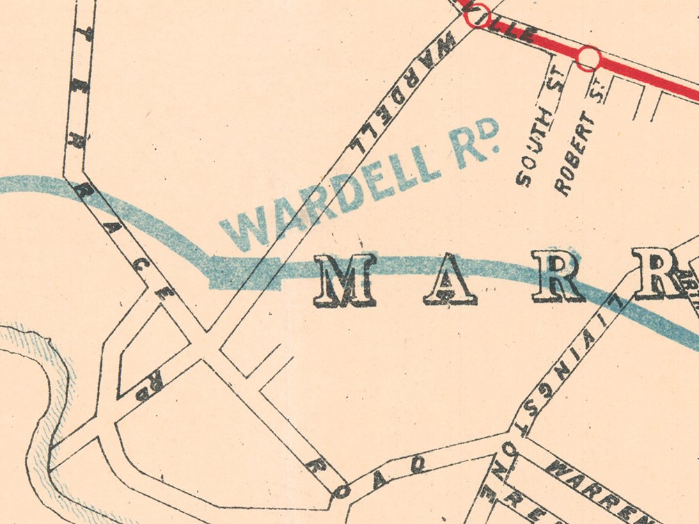
Holy moly, look at all the ferries leaving from Darling Harbour! 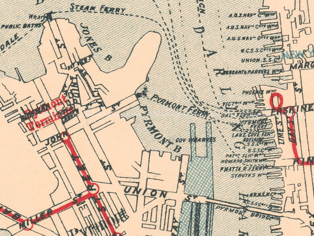
The Sydney Cricket Ground was served ridiculously well by trams. That's the Members' Stand at the top (11 o'clock position) - built in 1878 and still there to this day. 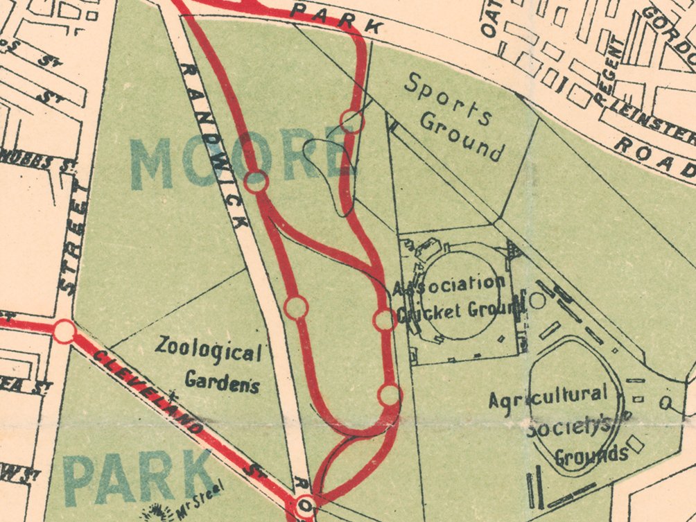
They don't make ornate map titles like this any more. 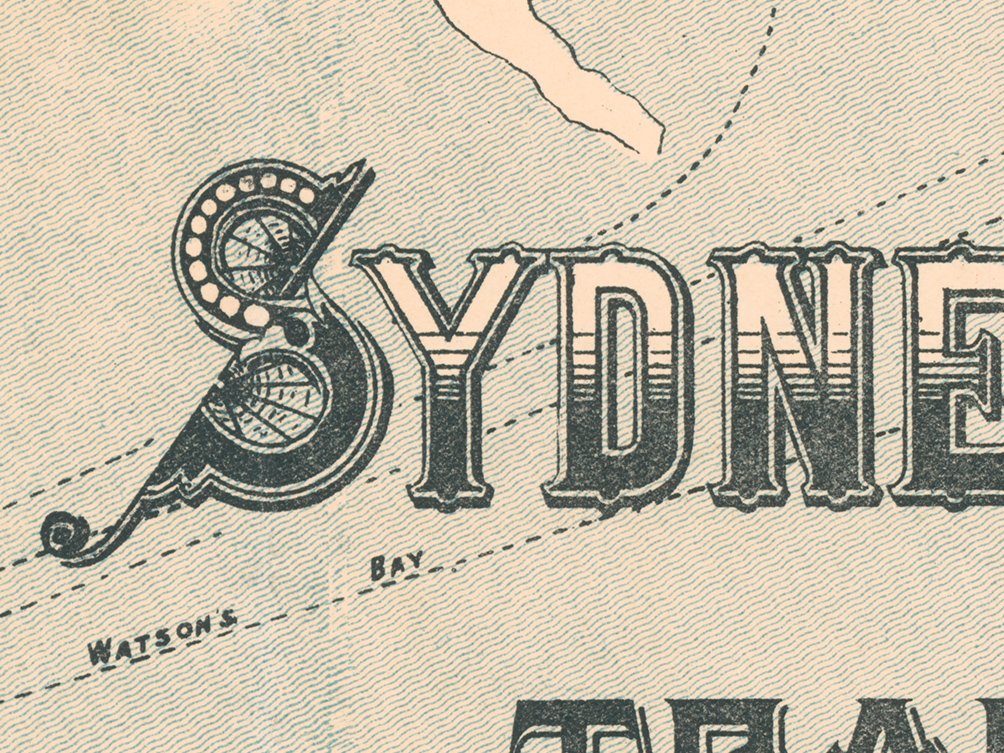
No Opera House on Bennelong Point, just a tram depot built on the site of an colonial fort. Which was built to look like the old fort, but wasn't a fort at all. 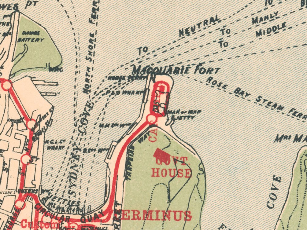
The cartographers seem entirely unsure where the shoreline west of Glebe Point actually lies. I think I see three different interpretations here. Also, I would not call the area where the car barn is "Rozelle". 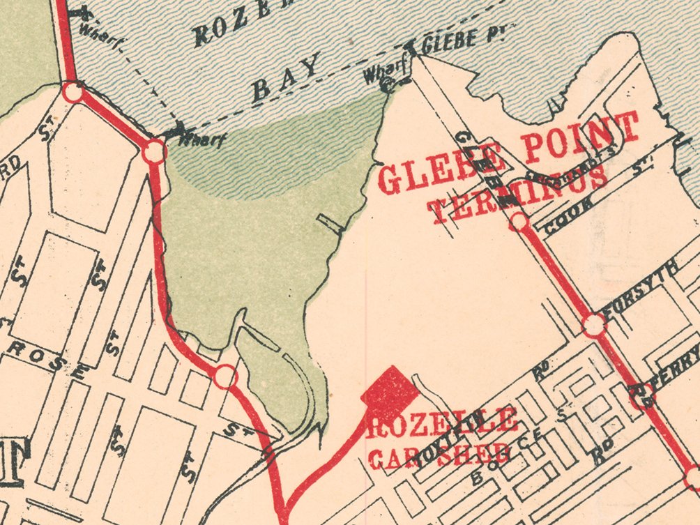
The tram line ran right *into* Bronte Park, using a private right-of-way (now Calga Place, by the look of it). 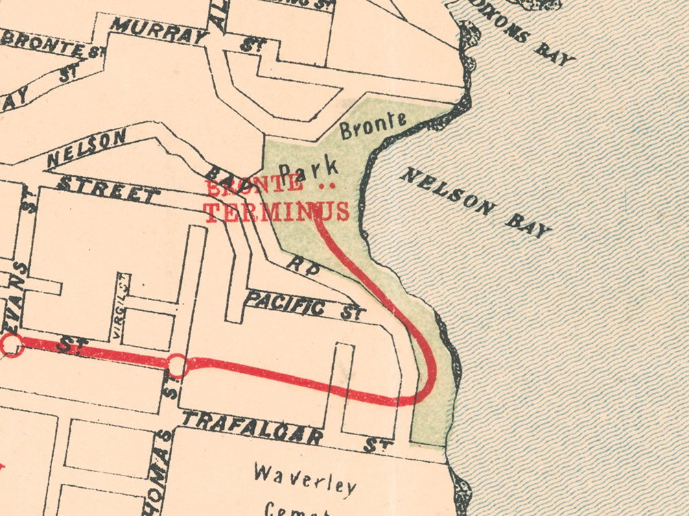
Sydney Airport's international terminal is now here. The aptly named Swamp Road is now Marsh Street, which is somehow an improvement? 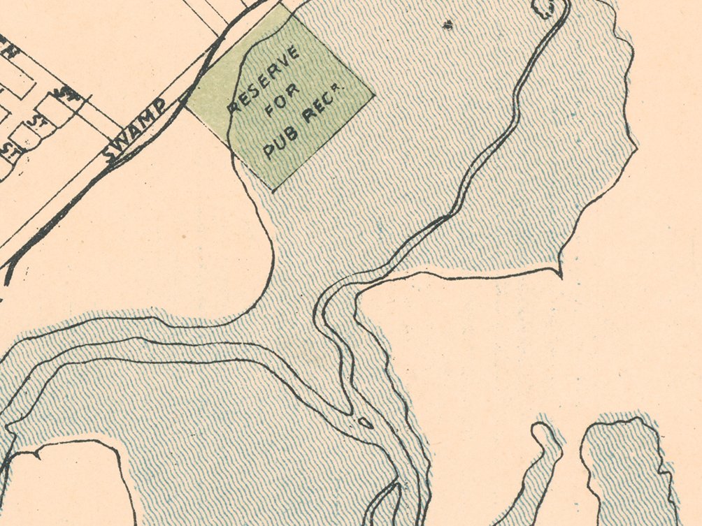
Here's the tram system's electrical powerhouse on Harris Street (built 1902), now the museum of the same name. 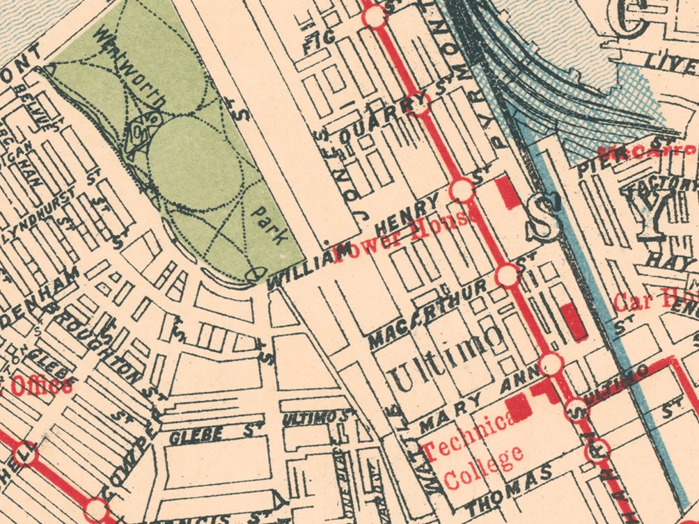
The Newtown tram shed (built 1900) is still extant today, though largely derelict. 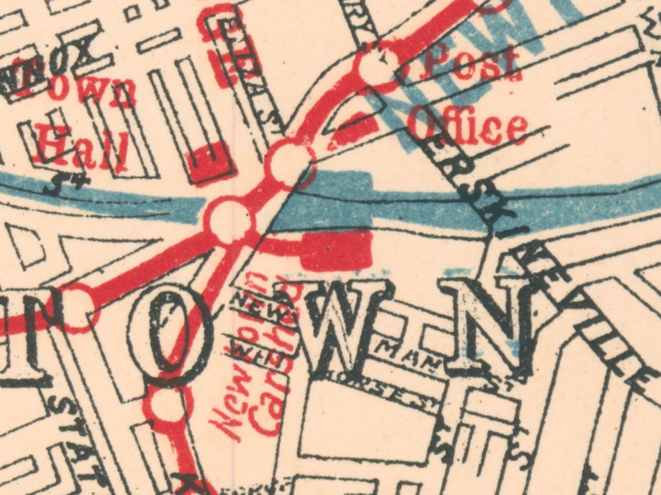
Note also the zoo here, before it was relocated to Mosman as Taronga Zoo. The site is now the location of Sydney Boys and Sydney Girls High Schools.
Interesting: the Devonshire Street tunnel (here marked as "SUBWAY") only opened in 1906, so maybe the dating of this map is a little out.


