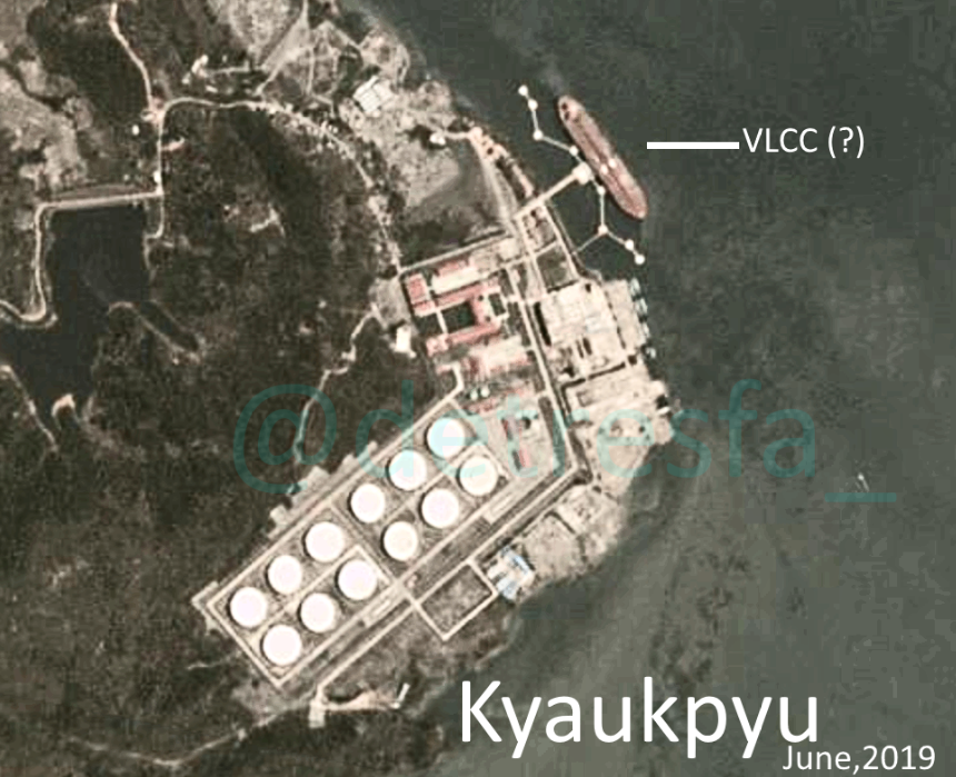
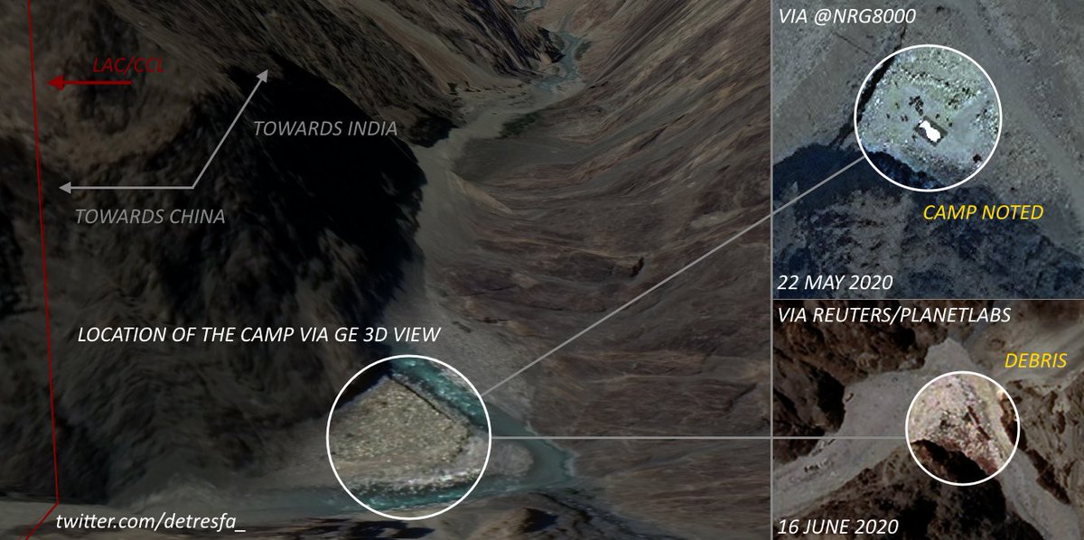
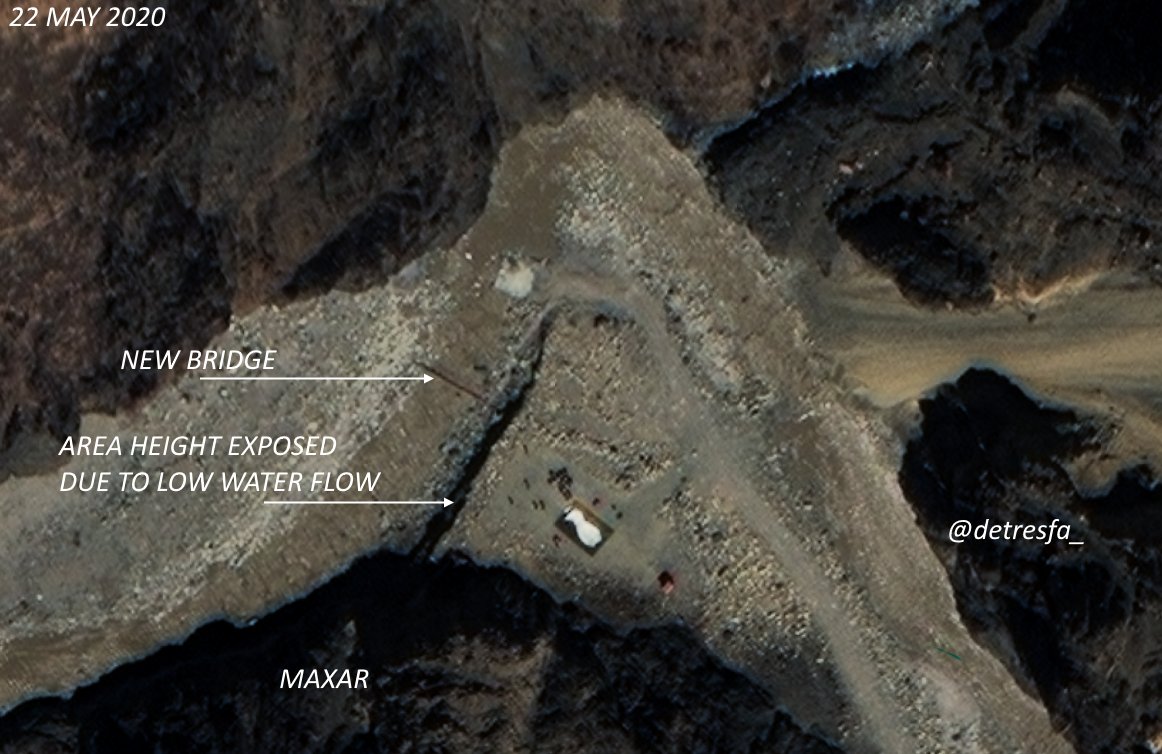
-Images by @Nrg8000 spotted a camp at #GalwanValleyFaceOff on 22.05.2020
-Images by @Reuters spot debris in the area on 16.06.2020
-#India said #China set up a temp structure that led to the clash, media said the #IndianArmy Col burnt it down
Composite image below
-Images by @Reuters spot debris in the area on 16.06.2020
-#India said #China set up a temp structure that led to the clash, media said the #IndianArmy Col burnt it down
Composite image below
Adding this comparison between the 9-16 of June as well that shows the camp did indeed leave some time between may & june but debris arrived instead at the same spot --- via @reuters
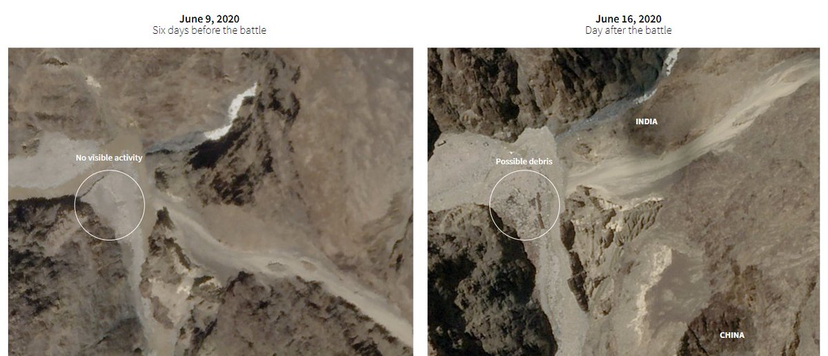
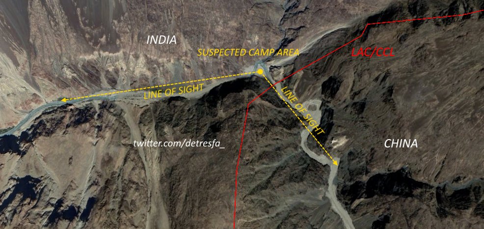
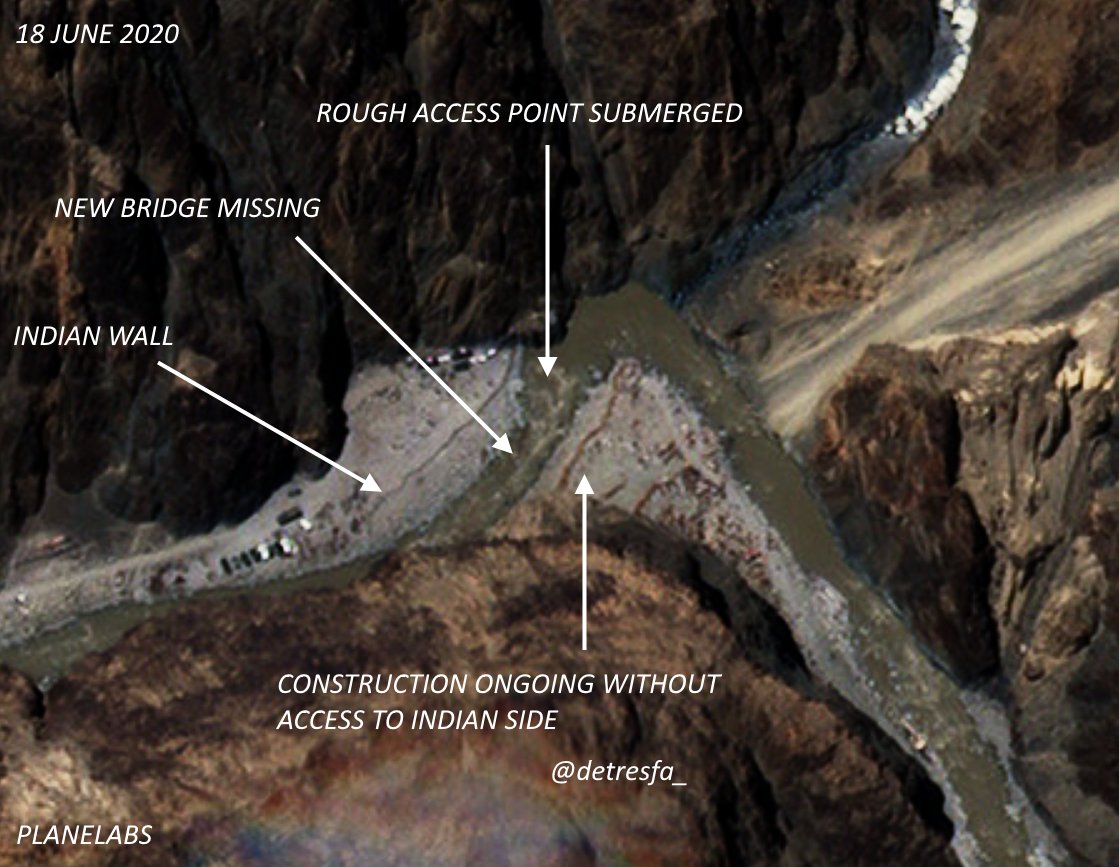
Image dated 18 June 2020 shows what the onground situation at the #GalwanValleyFaceOff point was 48 hours ago #IndiaChinaBorder
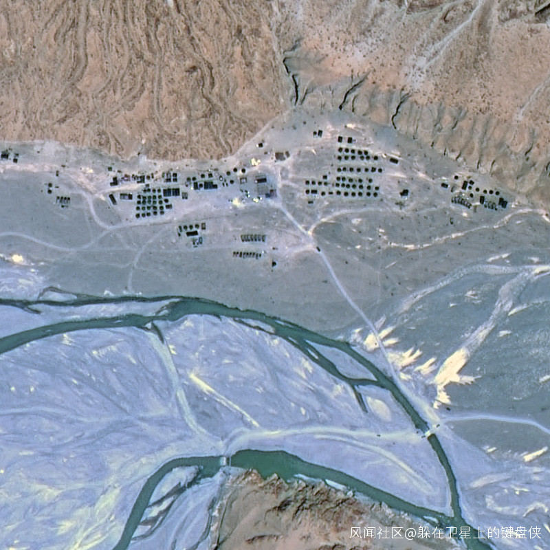
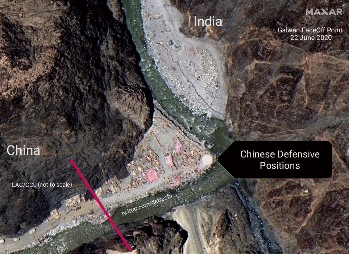
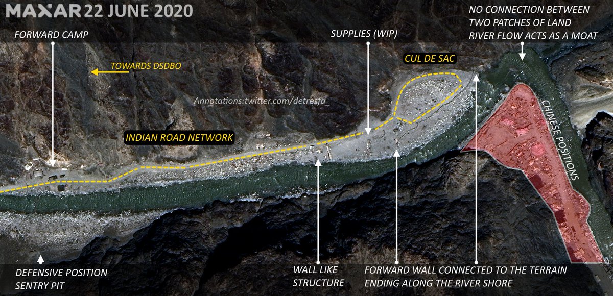
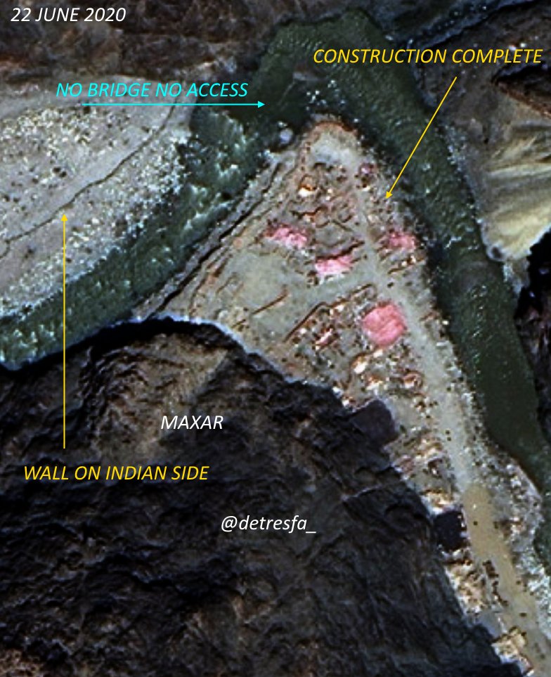
Images via @Maxar of the #GalwanValley face-off point on 22 June 2020 show possible defensive positions being set up by #China, small walls, trench type areas have now appeared on site #IndiaChinaFaceOff
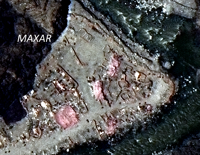
Here is a contrast enhanced zoom in to help further examine the area, offered without comments
Pinging @Nrg8000
1 Any resemblance to #PangongTso you see ?
2 Any thoughts youd like to drop ?
3 with Regards to the LAC/CCL line being used off google earth/google .. could you drop the LAC you have been referring to ? (GOI)
1 Any resemblance to #PangongTso you see ?
2 Any thoughts youd like to drop ?
3 with Regards to the LAC/CCL line being used off google earth/google .. could you drop the LAC you have been referring to ? (GOI)
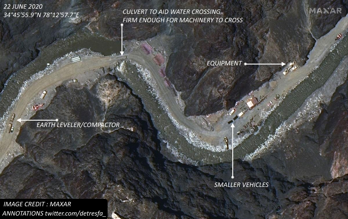
Adding another one dated 22 June 2020 from the @Maxar images that are widely circulating the internet now, that shows road & earthworks near the #galwanvalleyclash point #indiachinastandoff
Location -
maps.app.goo.gl/d9yhRoXF3T78Md…
Location -
maps.app.goo.gl/d9yhRoXF3T78Md…
A brief look at positions set up by #India (marked in white) helps understand the area dynamics & further visualizes how both sides have dug in across the flow of the #Galwan
as the #indiachinastandoff continues
📷@Maxar
as the #indiachinastandoff continues
📷@Maxar
This trifecta image moving from the 16-18-22 June (left to right) explains how #China & #India dug in instantly with their forward lines/defenses post the #GalwanValleyFaceOff
Water here is the natural barrier ...
Water here is the natural barrier ...
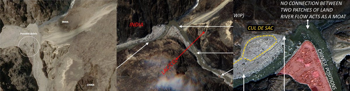
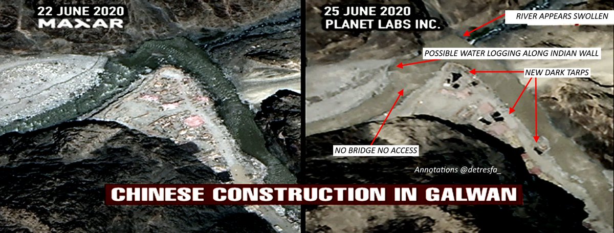
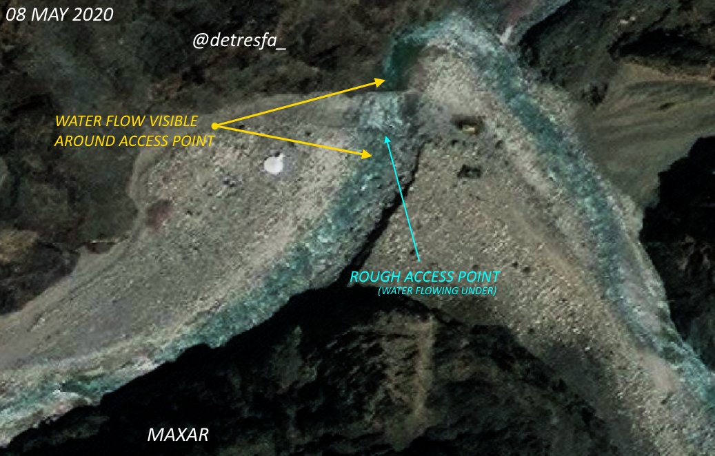
Time series at #Galwan shows how two patches of land, connected by multiple structures in May, had been disconnected by June with defensive walls on either side; raising questions on how structures across the river were supposedly built by India without physical access
Images via @ndtv @planetlabs & @VishnuNDTV dated 25 June of the #Galwan river bend now show possible water level rise in the river along with new tarps on CHINESE side
A video report on #China PLA camps extending upto 9KMs from here
A video report on #China PLA camps extending upto 9KMs from here