This jet-stream wind forecast simulation from @NOAA's GFS Hourly model on July 13 captured this disastrous European Storm event almost perfectly.

#EuropeBigWet
@RyanMaue @weathermodels_
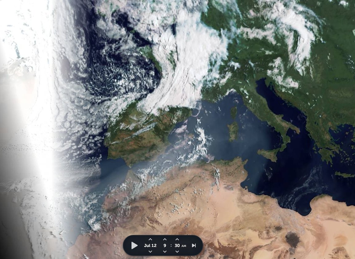
13th July... morning
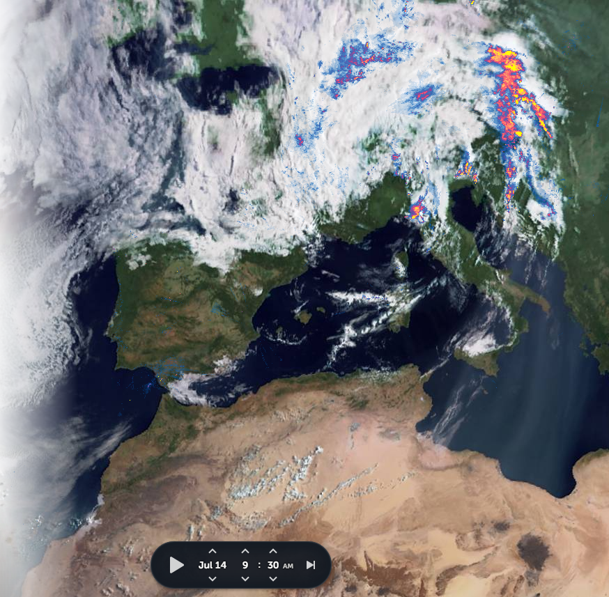
14th July.. morning
15th July.. morning
15th July to 5.30pm
15th July to 9.45pm
And another two days to go.

/Ends

@Threadreaderapp unroll

• • •

Missing some Tweet in this thread? You can try to force a refresh
 

Keep Current with Alastair Thompson

Alastair Thompson Profile picture

Stay in touch and get notified when new unrolls are available from this author!

Read all threads

This Thread may be Removed Anytime!

PDF

Twitter may remove this content at anytime! Save it as PDF for later use!

Try unrolling a thread yourself!

how to unroll video
  1. Follow @ThreadReaderApp to mention us!

  2. From a Twitter thread mention us with a keyword "unroll"
@threadreaderapp unroll

Practice here first or read more on our help page!

More from @althecat

17 Jul
Today is possibly the apex of this #ArabianMonsoonBurst which began several days ago now. It's hard to imagine it getting bigger than this.

Today's #NorthAfrican #HornOfAfrica and #MiddleEast rainfall forecasts follow.
The animation above is for 12 hours hence the arriving and departing light effect. As always the engine behind this is the Indian Monsoon which you can see here this morning gathering strength.
A close up from the end of today shows how the big storms over #SaudiArabia are generating new atmospheric rivers of moisture, or plumes, over the Sahara, you can see these top right.

[Note: Atmospheric rivers are often invisible, this one becomes visible as night falls.]
Read 39 tweets
17 Jul
This is a long statement, probably a bit too long, but interesting and important. My reading is that Ethiopia has not yet decided to abandon the unilateral ceasefire, but that frustration is going, both with the TPLF and their ongoing offensive....
... and with ongoing one-sided diplomatic/media understanding of the Tigray conflict.
The @nytimes story from @declanwalsh (see below) has become a lightning rod for public and government concerns that Ethiopia is not being listened to or being given due respect internationally.
Read 37 tweets
17 Jul
The German storm has now, as forecasted move south east and is now centered over the Adriatic. Its presentation has the appearance of a storm which is receiving its energy from an Atmospheric River of water.
Here's a 90 hour accumulated forecast for Italy. The storm is continuing to move very slowly.
^^ this is from @NOAA's GFS

Here's the European @ECMWF model version which shows particularly highlevels of rain over the Slovenia, Croatia, & Bosnia & Herzegovina.
Read 5 tweets
16 Jul
The magnitude of #ArabianMonsoonBurst is now apparent. A major storm is about to cross the Red Sea and arrive in the #HornOfAfrica. Behind it are two enormous super-cell thunderstorms.

Today's rainfall forecasts follow.
The rain activity shown in the @zoom_earth animation preceding is only radar based, Saudi radar, and in this case is complementary to the @meteoblue satellite rainfall estimates you see below. There is likely significantly more rainfall in this than you see here. Image
Here we see India (the heart of this Monsoon), this morning to 10am East Africa Time. I.E. around seven hours ago.
Read 21 tweets
16 Jul
@jonathanwatts a couple of threads on the German Floods, and their cause.

@jonathanwatts

Make that three threads. This year we have seen some specific identifiable climate anomalies/abnormalities which are brought us these storms, and which are far from over.

This one is on German Storm causation...
@jonathanwatts And this pictorial thread from back in May was an attempt to draw attention to the strange weather Europe has experienced since the Spring. It focuses on the role of the West Africa Monsoon which is contributing to the current storm.
Read 5 tweets
15 Jul
Today's #ArabianStorms thread took a bit of a detour into looking at today's fatal floods in #Benelux and #Germany, and the causes for the weather pattern that brought them.

Turns out that a #WestAfricaWaterPlume is involved. When it comes to weather we are #AllInThisTogether.
Here we see satellite images for the three days leading up to this. And a close look at this satellite imagery [@zoom_earth] suggests that the the persistence of the storm, which is far from over, is due to it being mainlined tropical water from the West Africa Monsoon.
On @zoom_earth you can watch animations of the satellite data to check this for yourself at this link >>zoom.earth/#view=40.2,-1,…
Read 5 tweets

Did Thread Reader help you today?

Support us! We are indie developers!


This site is made by just two indie developers on a laptop doing marketing, support and development! Read more about the story.

Become a Premium Member ($3/month or $30/year) and get exclusive features!

Become Premium

Too expensive? Make a small donation by buying us coffee ($5) or help with server cost ($10)

Donate via Paypal Become our Patreon

Thank you for your support!

Follow Us on Twitter!

:(