
Military Drones| Conflict, Climate & Environment| UN Green Star Award | Contributor @bellingcat | views are my own. https://t.co/DtZgeYl5YP
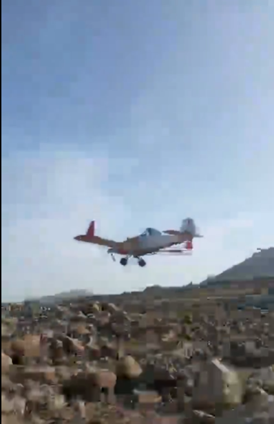
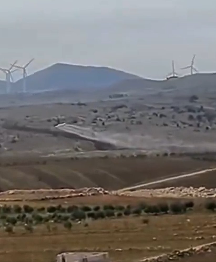
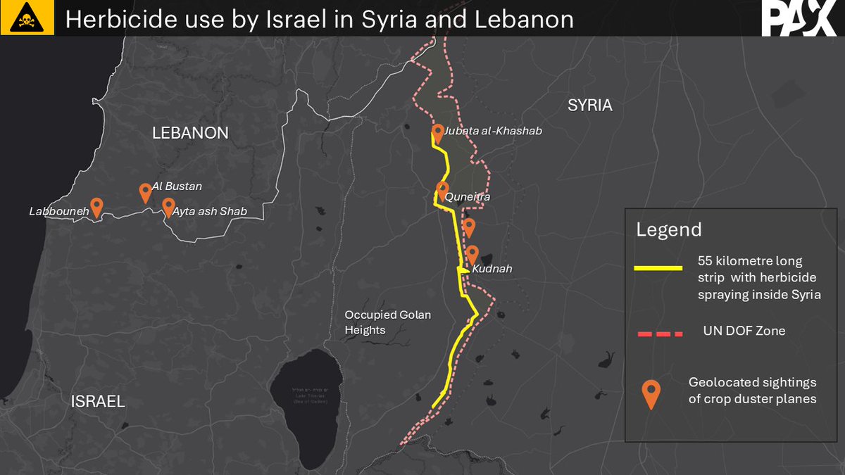 On January 25, 2026, several local Syrian social media accounts started posting images of crop duster planes flying across Syrian border areas spraying a substance on the fields there. With support of @obretix we geolocated this filming locations in and around Quneitra 2/x
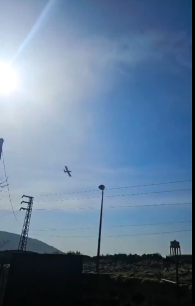
 The chemical plant is producing phenol, a flammable, highly corrosive chemical. The site itself hosted large quantities prior to the invasion, while toxic waste is stored in three nearby ponds. We flagged these risks in this 2017 @bellingcat piece 2/x
 Prior to Oct 7, the #Gaza Strip was already facing enormous problems with solid waste management, despite initiatives by the @WorldBank to construct safe landfills. Illegal waste dumps and waste fires contributed to environmental stressors for nearby communities 2/x


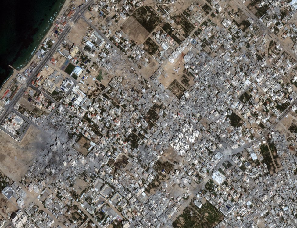 Here the damage at Beit Hanoun in northern #Gaza showing a complete neighborhood being almost completely demolished from bombardments 2/x


 Another area of concerns is the industrial area south, hosting various construction facilities that are storing different types of hazardous substances. Satellite imagery by @planet indicates there are pollutants in the water 2/x
 Morocco has been operating Israeli Harfang #drones from the Dakhla airbase in occupied Western Sahara, that are visible on Google Earth imagery in 2021 as shown by @obretix It is unclear if these drones have been armed 2/x
 Over the course of the last 10 months, we noted 213 reported incidents of strikes against thermal, hydro, nuclear and solar energy facilities in #Ukraine. We could verify 63 of those incidents with satellite images that observed damage to these facilities. 2/X
 As we shared earlier this week, the lack of water coming into the Tigris and Euphrates rivers that lead to the south is resulting in the drying of Iraq's Marshes, home to the Marsh Arabs and with a unique ecosystem, threatening the lives and livelihoods of its population 2/x
 After entering the gate through the administrative building of the NPP, as seen on the first image , we see military truck here moving near the first of the 6 nuclear reactors. 2/x google.com/maps/place/Pro…
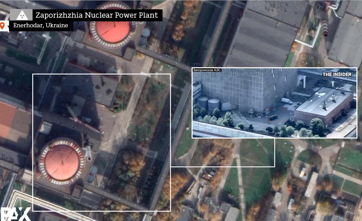
 First, one of the shots shows a wide-area view of this area where in the last years new Turkish/KRG military bases were set-up in the fight against the PKK, also featured in @SimonaFoltyn excellent piece for @NewsHour pbs.org/newshour/show/… h/t @obretix 2/ for geolocation


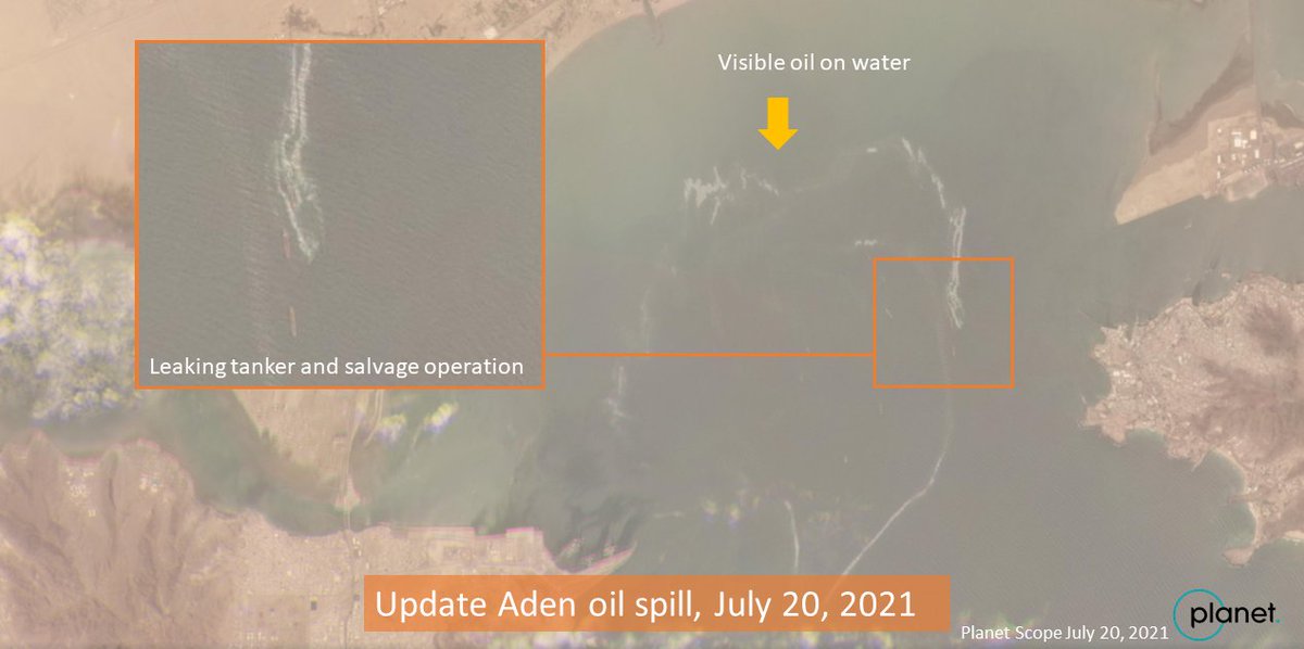 #PT And here's radar image of the port of #Aden using @sentinel_hub Sentinel-1 SAR with an Oil Slick Custom script and Planet to show the spill. Note the image shows both water surface roughness and the spill itself, so it's not all oil in yellow..

 The main focus was on the Hasakah and to a smaller extend the Raqqa governorate, due to presence of our partners and own access. More analysis on environmental issues in the SDF controlled Deir ez Zor is in the making 2/x
 More oil waste pits here south of the US air strip at Rmeilan in NE #Syria
 #PT An oil spoil is already visible on this @sentinel_hub image from early July 2021 at the Aden oil terminal, near two smaller vessels cc @TankerTrackers #OOTT
 First of all, lack of transparency by the US in DU use in 1991 and 2003 in #Iraq hindered identifying contaminated areas, clean-up operations and health monitoring of exposed populations. In 2014, we got the first set through and Dutch FOIA 2/x theguardian.com/world/2014/jun…

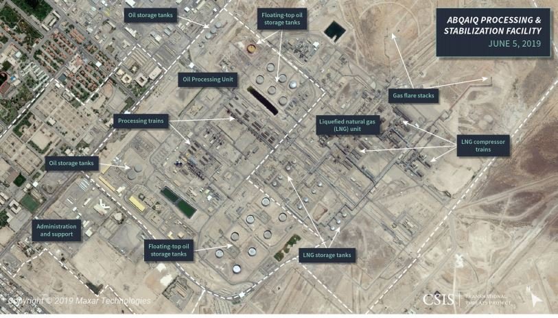 #PT at the #Abqaiq processing facility, 6.8 million barrels of crude oil are processed on a daily basis. Saudis claim the fire is now under control. The base is at least 1000km away from Houthi controlled area, so their likely #drone of choice is the UAV-X

