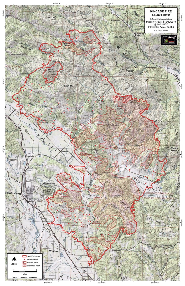
The fire is at 76,825 acres and at **30%** containment. Kincade was first reported at 9:24 PM near the Geysers at a power plant on 10/23.
(1/
(2/
(3/
(4/
Right now firefighters are running around mitigating structure threats (protecting buildings from spot fires from the isolated heat that still dots the landscape) and constructing more control lines.
(5/
Red Flag warning will end at 4 PM today. According to NOAA meteorologist working the fire, NE winds will shift southerly this afternoon. Winds will be way lower than yesterday. Tonight will be cold! 20s and 30s!!!! Ping me if you want details.
(6/
206 destroyed, including 94 residential & 7 commercial
40 damaged, including 27 residential & 1 commercial
90,015 remain threatened including 80,435 homes
INJURIES
2 first responders
(7/
You can find a map of all three counties and evacuation zones here: sonomacounty.maps.arcgis.com/apps/webappvie…
(8/
-Alexander Valley (all the way up to Asti)
-All areas north of the City of Santa Rosa north of Hwy 12 W and Hwy 101
-Calistoga Rd/Petrified Forest Rd to Sonoma/Napa Co line
-Charles Schulz Airport
-Coffey Park
-Fountaingrove
-Fulton
(9/
-Geyserville
-Healdsburg
-Knights Valley
-Larkfield-Wikiup
-Mark West
(10/
-Santa Rosa, including all areas East of the Western City limit, North of Guerneville Road, Steele Lane, Lewis Road, & Chanate Road to Montecito, north to the City limit.
-South of Westside Rd to Mill Creek Rd
-Windsor
(11/
SONOMA COUNTY (repopulate at your own risk)
-Bodega
-Bodega Bay
-Cazadero
-Duncans Mills
-Forestville
-Freestone
-Graton (west of Highway 116 only)
-Guerneville
-Jenner
-Monte Rio
-North of Westside Rd to Mill Creek Rd.
(12/
SONOMA COUNTY (repopulate at your own risk)
-Occidental
-Rio Nido
-Sebastopol
-Twin Hills
-Western unincorporated Santa Rosa
(13/
LAKE COUNTY
-Adams Springs
-Hobergs
-Cobb
-Whispering Pines
-Gifford Springs
-Anderson Springs
-Ford Flat Rd
-Socrates Mine Rd
-Hwy 29 from Butts Canyon Rd S to the County Line
-Butts Canyon Rd between Hwy 29 & Napa Co Line
(15/
LAKE COUNTY
-Hwy 175 between Hwy 29 Middleton North to McKinley Dr
-Middletown
-Twin Pine Casino
-Middletown Rancheria
-Dry Creek area
-all roads off of Hwy 175 between Middletown & McKinley Dr
-Butts Canyon Rd including all side streets.
(16/
-Pine Flat Rd @ Red Winery Rd
-Geysers Rd @ Red Winery Rd
-Geysers Rd @ River Rd
-SR 128 @ Moody Ln
-SR 128 @ Geysers Rd
-SR 128 @ Geyserville Ave
-SR 128 @ Alexander Valley Rd
-SR 128 @ Pine Flat Rd
(17/
-SR 128 @ Railroad Ave
-Lytton Station Rd @ Lytton Springs Rd
-Healdsburg Ave @ Alexander Valley Rd
-All roads east of Hwy 101 in Geyserville area
Avoid Hwy 101 if you can to allow resources. Only be on 101 near the fire area if you *must.*
(18/
SANTA ROSA
Santa Rosa Veterans Memorial Building, 1351 Maple Ave
Sonoma County Fairgrounds, 1350 Bennett Valley Rd
(19/
PETALUMA
Cavalry Chapel Church, 1955 South McDowell Blvd
New Life Church Petaluma, 1315 Rand St.
Petaluma Community Center, 320 N McDowell Blvd
(20/
CrossWalk Community Church Napa, 2590 1st St Napa
Napa Valley Expo, 575 3rd St, Napa
(21/
SAN FRANCISCO
St. Mary’s Cathedral, 1111 Gough St, San Francisco
(22/
SAN RAFAEL
Marin County Fairgrounds, 10 Ave of the Flags, San Rafael
(23/
Alameda County Fairgrounds
4501 Pleasanton Ave, Pleasanton
Sonoma-Marin Fairgrounds in Petaluma
100 Fairgrounds Dr, Petaluma
(24/
Go here: socoemergency.org/home/emergency…
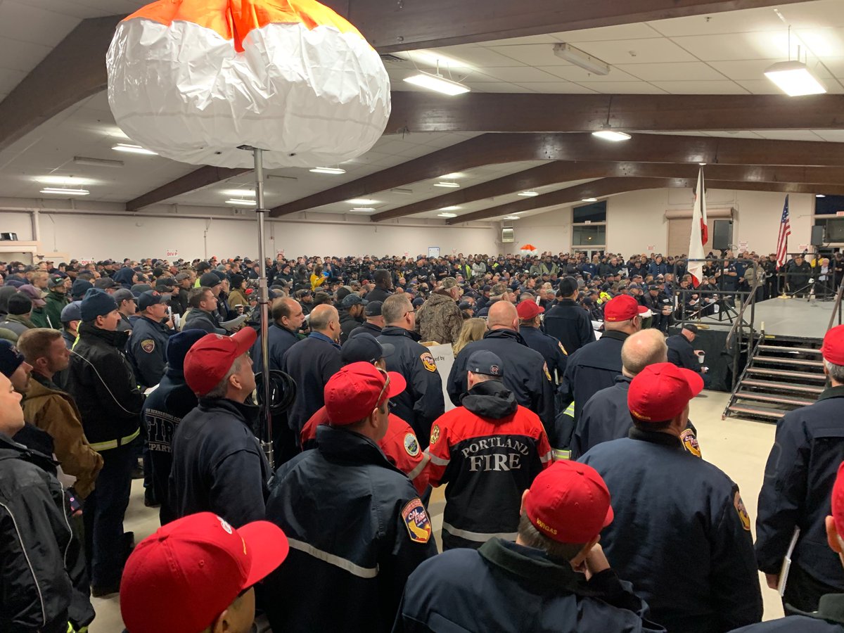
PICTURE: Crews getting brief this morning. Photo: CAL FIRE (Public domain) & Fire footprint as of this morning.


