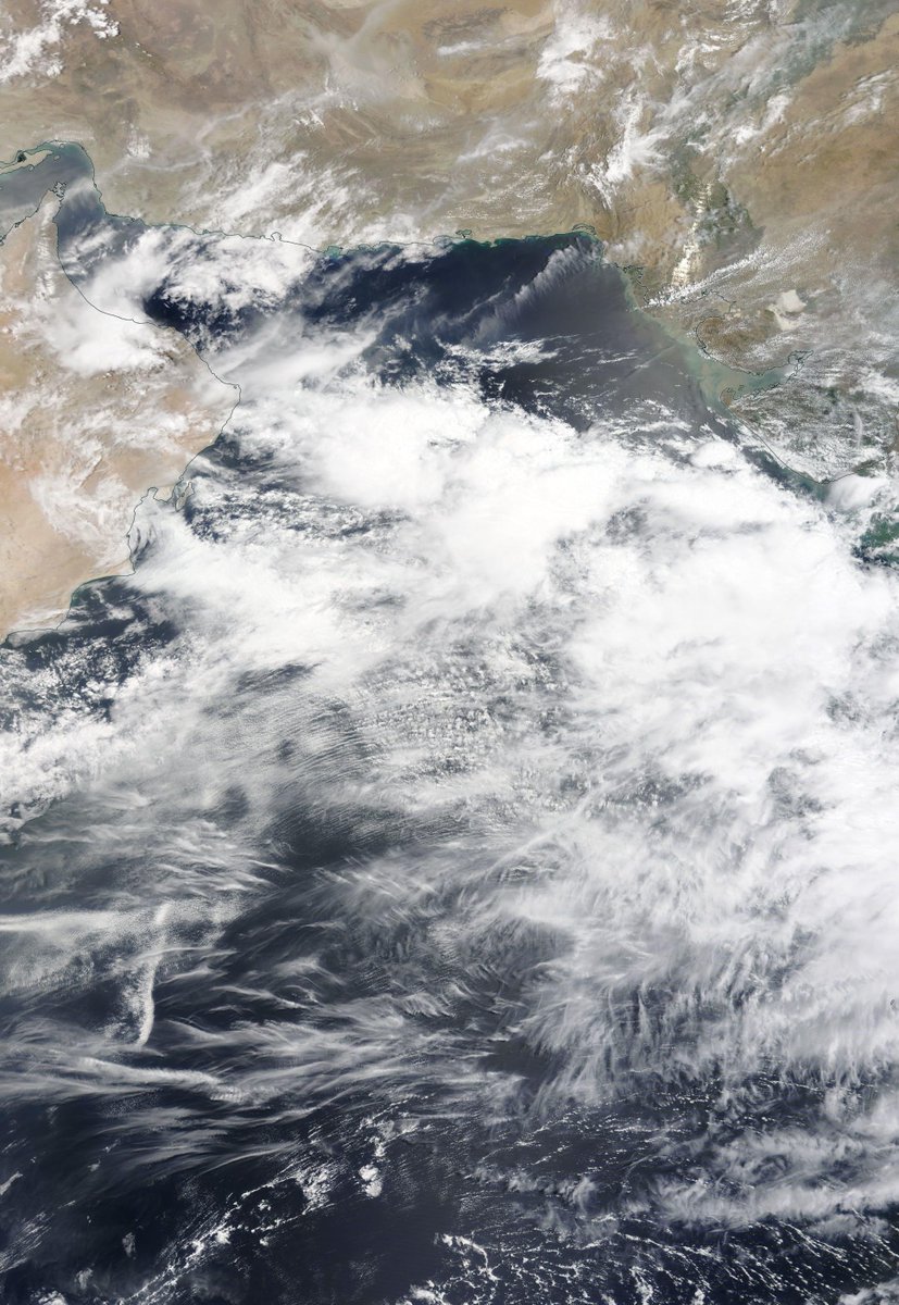
Ongoing coverage of Invest 98w, currently south east of the Phillipines and forecast by the GFS to make landfall in China, after formation and swift strengthening over the next few days. Here is a picture as the Sun came up over the west Pacific ocean.
Yesterday's thread linked above.

This cyclone candidate is interesting for two reasons: 1. intrinsically as a potentially dangerous storm and 2. because of the wider set up around it which is detailed in yesterday's thread.

This animation is from this afternoon.
Meanwhile we have a new cyclone candidate in the Atlantic also, #Invest99L which is also stationary and presents visually in a similar manner to #Invest98w. It is developing in a similar spot to the first Tropical Storm of the 2021 Hurricane Season, Ana.
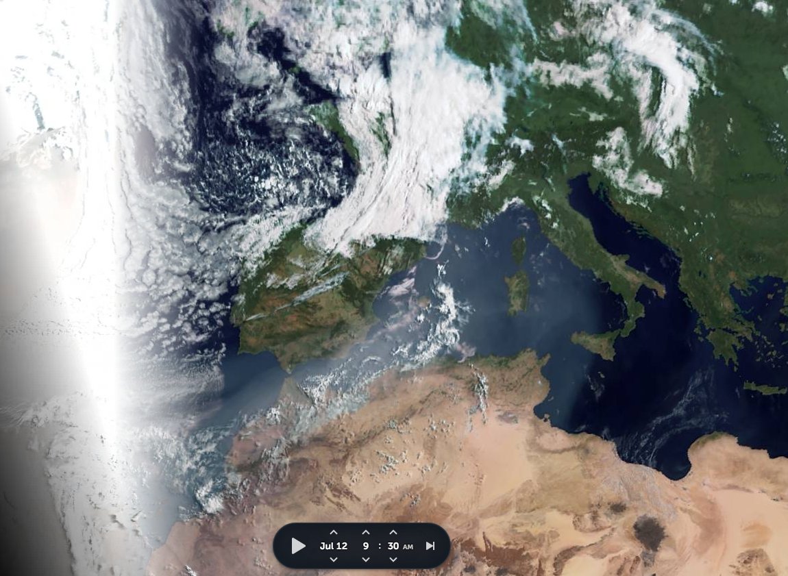
#Invest99L has a similar presentation to #Invest98w, but will not threaten the U.S. Seaboard. It could however impact weather in Europe, albeit not as a tropical storm.
The latest GFS model run now has two Typhoons in it (the second is not yet designated. The first makes landfall in China 21st July and the second in Japan on July 25th.
The previous GFS model run 15:00 is almost identical, albeit with a signifcantly closer Japanese Landfall to Tokyo.
As for the comparatively completely harmless #Invest99L at this stage neither @ECMWF nor @NOAA GFS are expecting any development.
/ENDS

@Threadreaderapp unroll

• • •

Missing some Tweet in this thread? You can try to force a refresh
 

Keep Current with Alastair Thompson

Alastair Thompson Profile picture

Stay in touch and get notified when new unrolls are available from this author!

Read all threads

This Thread may be Removed Anytime!

PDF

Twitter may remove this content at anytime! Save it as PDF for later use!

Try unrolling a thread yourself!

how to unroll video
  1. Follow @ThreadReaderApp to mention us!

  2. From a Twitter thread mention us with a keyword "unroll"
@threadreaderapp unroll

Practice here first or read more on our help page!

More from @althecat

16 Jul
The magnitude of #ArabianMonsoonBurst is now apparent. A major storm is about to cross the Red Sea and arrive in the #HornOfAfrica. Behind it are two enormous super-cell thunderstorms.

Today's rainfall forecasts follow.
The rain activity shown in the @zoom_earth animation preceding is only radar based, Saudi radar, and in this case is complementary to the @meteoblue satellite rainfall estimates you see below. There is likely significantly more rainfall in this than you see here. Image
Here we see India (the heart of this Monsoon), this morning to 10am East Africa Time. I.E. around seven hours ago.
Read 21 tweets
16 Jul
@jonathanwatts a couple of threads on the German Floods, and their cause.

@jonathanwatts

Make that three threads. This year we have seen some specific identifiable climate anomalies/abnormalities which are brought us these storms, and which are far from over.

This one is on German Storm causation...
@jonathanwatts And this pictorial thread from back in May was an attempt to draw attention to the strange weather Europe has experienced since the Spring. It focuses on the role of the West Africa Monsoon which is contributing to the current storm.
Read 5 tweets
15 Jul
This jet-stream wind forecast simulation from @NOAA's GFS Hourly model on July 13 captured this disastrous European Storm event almost perfectly.

#EuropeBigWet
@RyanMaue @weathermodels_
13th July... morning
14th July.. morning
Read 7 tweets
15 Jul
Today's #ArabianStorms thread took a bit of a detour into looking at today's fatal floods in #Benelux and #Germany, and the causes for the weather pattern that brought them.

Turns out that a #WestAfricaWaterPlume is involved. When it comes to weather we are #AllInThisTogether.
Here we see satellite images for the three days leading up to this. And a close look at this satellite imagery [@zoom_earth] suggests that the the persistence of the storm, which is far from over, is due to it being mainlined tropical water from the West Africa Monsoon. ImageImageImageImage
On @zoom_earth you can watch animations of the satellite data to check this for yourself at this link >>zoom.earth/#view=40.2,-1,…
Read 5 tweets
15 Jul
It's raining cats and dogs in the highlands northern Ethiopia tonight. Across all of Tigray and south into the #Abbay basin which is busy filling the GERD. The #ArabianMonsoonBlast is getting into gear now but it is far from over.

Today's Rainfall forecasts follow.
The Bay of Bengal and Arabian Sea are ultimately responsible for all of this and so we begin with a couple of satellite images of them today. I will post another picture of the #GERD as soon as it reveals itself from under the clouds.
Here's a rainfall map from @Meteoblue which can be followed live at >> meteoblue.com/fr/meteo/curre….

Mekele isn't right under the rain but Aksum and Shire are. Hopefully this will slow down the warriors.
Read 38 tweets
14 Jul
On day 3 of #ArabianMonsoonBlast here's the view over the region tonight. This is definitely bringing rain, and lots of it to both Tigray and #GERD.

Today's rainfall forecasts follow.
Today's Big Pictures provide a view of the entire planet today in three images.

1. The Atlantic
2. The Pacific
3. Asia

Sometimes its helpful to take a broad view and remember that we are all on this planet together. And that we share the one amazing life giving biosphere.
I found another #MonsoonBurst in the pipeline, this time over the Western Pacific. One which shows very clearly that weird weather is now a universal phenomena in the Northern Hemisphere. And it all started with another Typhoon...

Thread attached...
Read 31 tweets

Did Thread Reader help you today?

Support us! We are indie developers!


This site is made by just two indie developers on a laptop doing marketing, support and development! Read more about the story.

Become a Premium Member ($3/month or $30/year) and get exclusive features!

Become Premium

Too expensive? Make a small donation by buying us coffee ($5) or help with server cost ($10)

Donate via Paypal Become our Patreon

Thank you for your support!

Follow Us on Twitter!

:(