On day 3 of #ArabianMonsoonBlast here's the view over the region tonight. This is definitely bringing rain, and lots of it to both Tigray and #GERD.
Today's rainfall forecasts follow.
Today's rainfall forecasts follow.
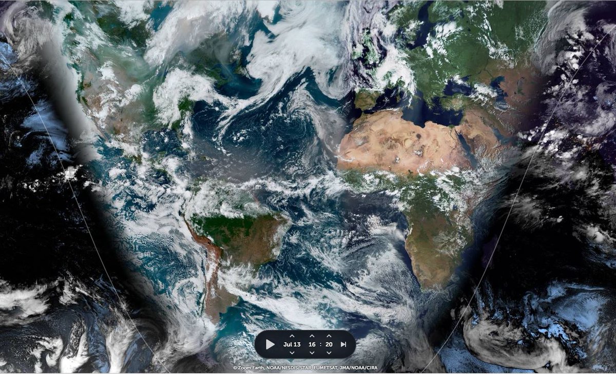
Today's Big Pictures provide a view of the entire planet today in three images.
1. The Atlantic
2. The Pacific
3. Asia
Sometimes its helpful to take a broad view and remember that we are all on this planet together. And that we share the one amazing life giving biosphere.
1. The Atlantic
2. The Pacific
3. Asia
Sometimes its helpful to take a broad view and remember that we are all on this planet together. And that we share the one amazing life giving biosphere.


I found another #MonsoonBurst in the pipeline, this time over the Western Pacific. One which shows very clearly that weird weather is now a universal phenomena in the Northern Hemisphere. And it all started with another Typhoon...
Thread attached...
Thread attached...
https://twitter.com/althecat/status/1415223024073248775?s=20
The forecasts for the area which is primarily addressed in this bulletin continue to be volatile in their detail. This seems to be a characteristic of extreme weather events, as the weather models learn from observation.
Here's a rainfall anomaly simulation for the next 16 days
Here's a rainfall anomaly simulation for the next 16 days
It usefully highlights the aspects of this that are unusual. Rain in the #HornOfAfrica is not. #DesertRain in the Sahara and the rain over the Arabian Peninsula is, when compared with the 1981-2010 climate data set.
Here is another rainfall anomaly simulation, but this time over 46 days. Its from the European @ECMWF simulation (EPS ensemble model). The Euro model is noticeably the most conservative model in forecasting #DesertRain.
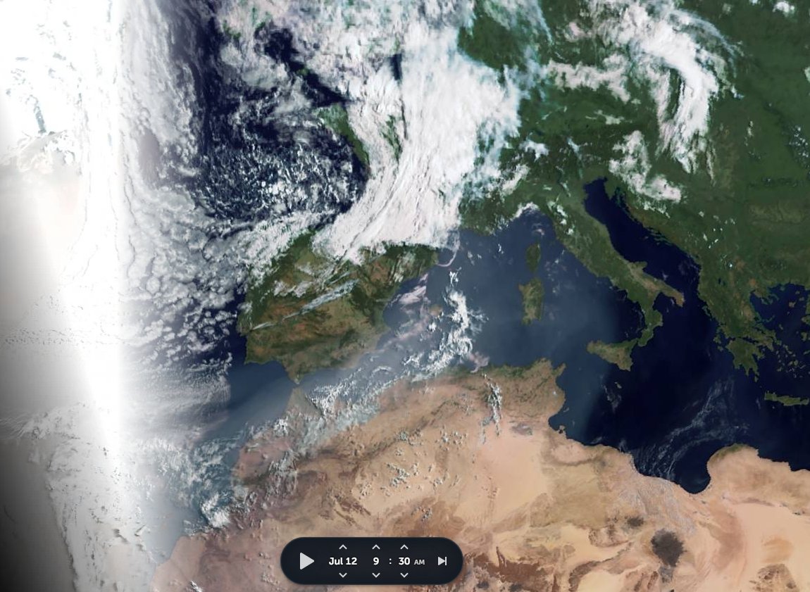
The view tonight over the Great Sahara Desert. If you look in the darkened area you can see the pipeline of moisture is moving over the #MiddleEast, the #HornOfAfrica and bringing its water deep into the Sahel already.

Today's 10-Day Rainfall forecasts for North Africa from July 14th through July 25th.
[All four models forecasts for #ArabianStorms have increased, so much show so that the Arabian Peninsula looks like an extension to the monsoon!]
[All four models forecasts for #ArabianStorms have increased, so much show so that the Arabian Peninsula looks like an extension to the monsoon!]


48-hour rainfall forecasts (today and tomorrow from our standard four models: the European @ECMWF, U.S. @NOAA's GFS, Canada's CMC and the Korean KMA models. The last, skinniest, one is the ECMWF.


And finally for #NorthAfrica we have the long-range 16-day (GFS) and 12-day (KMA) forecasts - which remain remarkably well aligned.
We will have a better view of forecast rain over the southern Arabian Peninsula later in the bulletin.
We will have a better view of forecast rain over the southern Arabian Peninsula later in the bulletin.


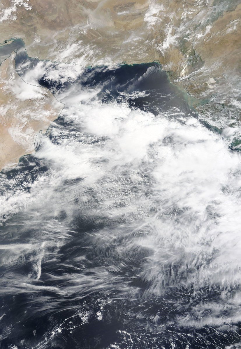
The next three animations show the path of the #ArabianMonsoonBlast from India to the Sahara this morning. First leg across the Arabian Sea, and down through Pakistan.
.. oops not quite the right order. The starting point is here over India.
Here's the Arabian Peninsula leg, also from this morning.
And finally, the view as the stream of storm clouds arrived this morning in the Ethiopian Highlands.
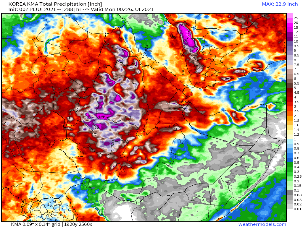
Today's July 14th 10-day rainfall forecasts for #Ethiopia (+1 12-day from KMA) and the #HornOfAfrica including #Somalia, #Somaliland, eastern parts of #SouthSudan, south eastern parts of Sudan, #Djbouti and #Eritrea.
Purple areas cover Tigray & the #Abbay #TekezeAtbara basins.
Purple areas cover Tigray & the #Abbay #TekezeAtbara basins.


48 Hour forecasts (today and tomorrow) from the same three models. Rains are now forecast in west and coastal #Somaliland in the KMA model, which seems plausible.
[@Somaalilanders if you have reports you can point to it would be interesting to see what is actually happening.]
[@Somaalilanders if you have reports you can point to it would be interesting to see what is actually happening.]


This animation shows us an even wider view from this morning of the entire #WestAfricanMonsoon
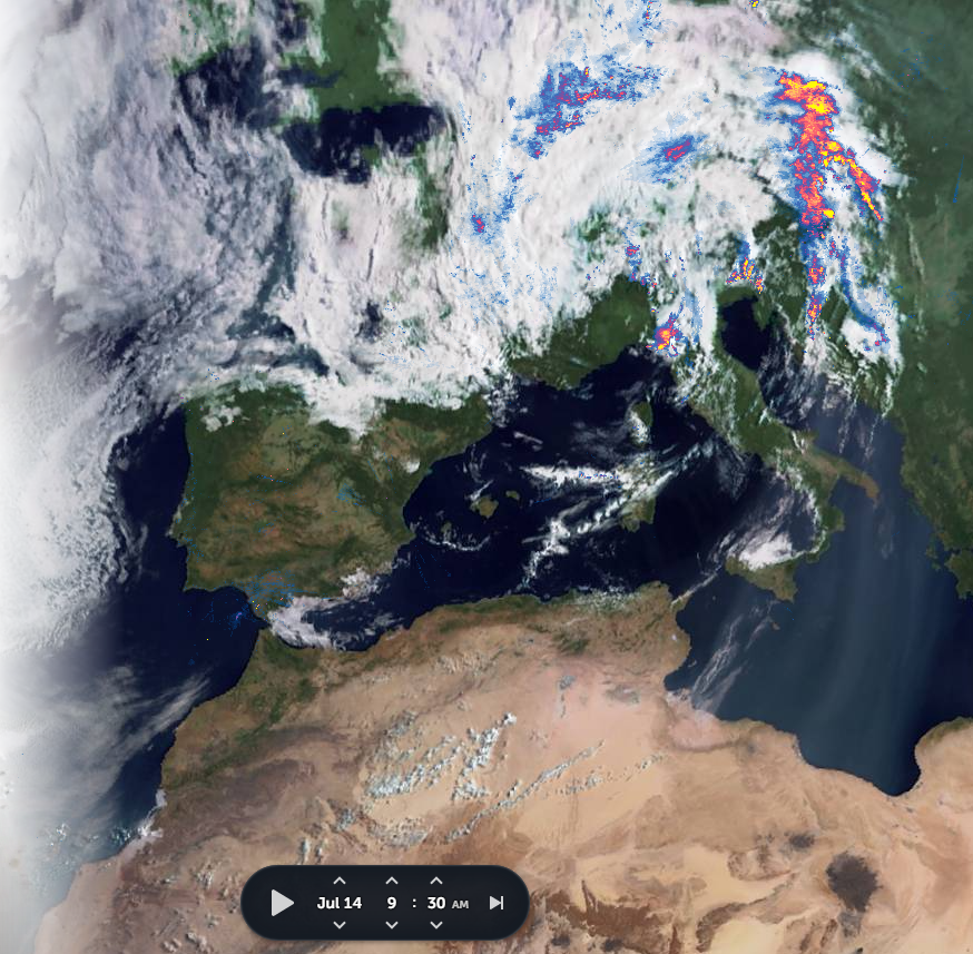
Here's a closeup higher resolution view of today's #ArabianStorms. Its a complex phenomena operating in several layers over a very large area.
& more @Arab_Storms live reports of flooding and storms today. We will focus on the Arabian end of this bonkers weather, but the account is well worth a follow, it has extraordinary footage from all over the world.
We begin today in the #UAE.
We begin today in the #UAE.
https://twitter.com/Arab_Storms/status/1415350481413672974?s=20
And the aftermath of a relatively nice looking hail storm in the Kingdom of Saudi Arabia [Courtesy of @Arab_Storms]
https://twitter.com/Arab_Storms/status/1415363621421559811?s=20
Here we see some flooding in India. [Courtesy of @Arab_Storms]
https://twitter.com/Arab_Storms/status/1415379456005443590?s=20
And Turkey... [Courtesy of @Arab_Storms]
https://twitter.com/Arab_Storms/status/1415374914153029635?s=20
And finally here we see Pakistan. [Courtesy of @Arab_Storms]
https://twitter.com/Arab_Storms/status/1415256442576248834?s=20
July 14th 10-Day accumulated rain forecasts for the #MiddleEast from the GFS, CMC, KMA & ACG weather models.
#ArabianStorms
#KSA #Yemen #Oman #Jordan #Sudan #Iran #Syria #GERD #Sudan #DesertRain #UAE
الله أعلم
#ArabianStorms
#KSA #Yemen #Oman #Jordan #Sudan #Iran #Syria #GERD #Sudan #DesertRain #UAE
الله أعلم


[Note: These forecasts are now showing increasing levels of rain in south east Iran.]
48 Hour July 14th (today and tomorrow), accumulated rain forecasts for the #MiddleEast from the GFS, CMC, KMA and ECMWF weather models.
#ArabianStorms
#KSA #Yemen #Oman #Jordan #Sudan #Iran #Syria #GERD #Sudan #DesertRain
الله أعلم
#ArabianStorms
#KSA #Yemen #Oman #Jordan #Sudan #Iran #Syria #GERD #Sudan #DesertRain
الله أعلم


And finally we have today's long-range #MiddleEast July 14th rainfall forecasts.
The16-day GFS & GEFS models, the 12 day KMA and the 15 day EPS (Euro ensemble) model forecasts.
UAE rainfall is in the frame in all models & as we saw earlier it is already getting it.
الله أعلم
The16-day GFS & GEFS models, the 12 day KMA and the 15 day EPS (Euro ensemble) model forecasts.
UAE rainfall is in the frame in all models & as we saw earlier it is already getting it.
الله أعلم


To conclude here is today's North Western Hemisphere zero hour simulation data (i.e. now) from the GFS.
1. Precipitable water PWAT anomaly
2. PWAT (potential rain + energy)
3. MLSP (Mean Sea Level Pressure)
4. 250Hpa (jet stream winds approx 11kms high)
1. Precipitable water PWAT anomaly
2. PWAT (potential rain + energy)
3. MLSP (Mean Sea Level Pressure)
4. 250Hpa (jet stream winds approx 11kms high)


A couple of bonus animations returning to the global eye perspective. Here we see 120 hours (5 days) of PWAT anomaly. So this is definitely lasting at least that long.
And my favourite plot of all the GFS North Atlantic PWAT simulation which corresponds to the previous one.
Its going to be very interesting to see whether that burst of PWAT heading north over Egypt brings rain to ever dry Egypt and Israel.
Its going to be very interesting to see whether that burst of PWAT heading north over Egypt brings rain to ever dry Egypt and Israel.
/ENDS
@Threadreaderapp unroll
@Threadreaderapp unroll
• • •
Missing some Tweet in this thread? You can try to
force a refresh