(1) A quick guide on following river level gauges: A key indicator of Hurricane #Lane effects in real time.
Go to this link: water.weather.gov/ahps/region.ph…
Notice the color of the river level gauges. These two orange ones are "in flood."
Go to this link: water.weather.gov/ahps/region.ph…
Notice the color of the river level gauges. These two orange ones are "in flood."
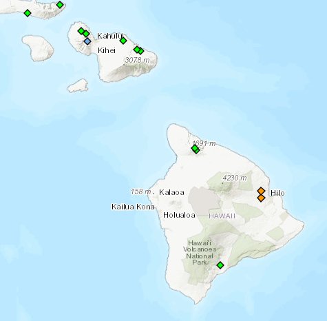
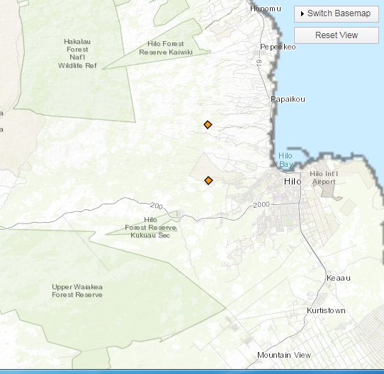
(2) Zooming in, you see a creek and a river near the town of #Hilo.
Hover over an orange diamond, and the river level chart should come into view. Don't click on the diamond.
Hover over an orange diamond, and the river level chart should come into view. Don't click on the diamond.
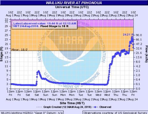
(3) Depending on the available data, the chart will show current & recent river levels, and the feet above sea level where it enters the "minor flood" and then "major flood" stages.
This flooding is only the start of the multi-day #Lane related flooding.
This flooding is only the start of the multi-day #Lane related flooding.
(4) Some of the rivers and creeks in the state are downstream of reservoirs, which can lead to some interesting effects as a dam is opened or closed to manage changing conditions.
Also, as a river nears the coast, a high tide can compound the flooding.
Also, as a river nears the coast, a high tide can compound the flooding.