A follow-up to last week's Yandex story: Israel's official map has painted over several of its nuclear and military facilities with fake farms and deserts! 🤫
Check out some very weird (and sometimes hilarious) examples in my new piece for @FAScientists
fas.org/blogs/security…
Check out some very weird (and sometimes hilarious) examples in my new piece for @FAScientists
fas.org/blogs/security…
Here is Tel-Nof Air Base (one of the Israeli Air Force's most important bases). Just southeast is a suspected storage site for Jericho missiles. They are visible on both Google Earth and Yandex (although Yandex has blurred them). 
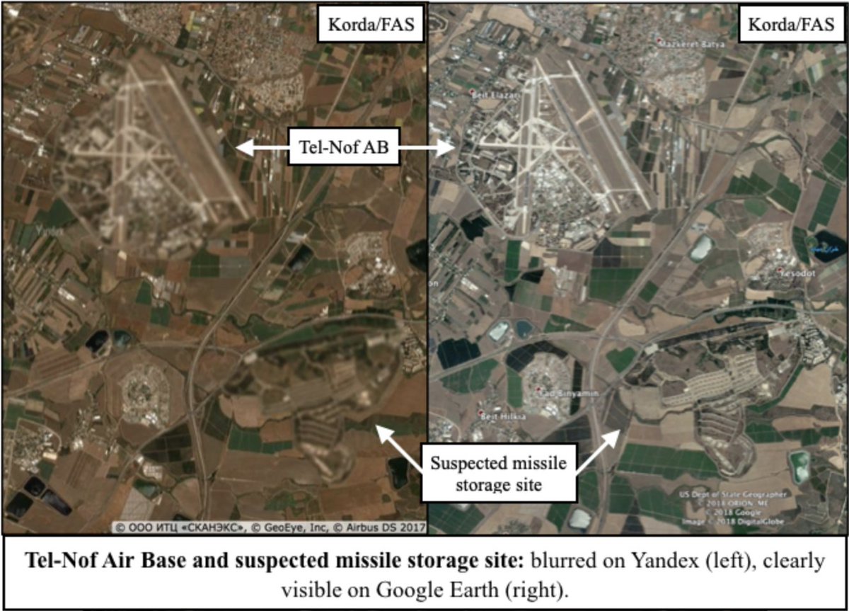
HERE is Tel-Nof and the missile storage site again, but this time taken from the Israeli government's official map. Interestingly, both sites have been replaced by very conveniently-located and identical farms!

Palmachim Air Base doubles as a launch site for Jericho missiles and is collocated with the Soreq Nuclear Research Center (responsible for nuclear weapons research and design). The entire area has been replaced with a fake desert on the Israeli government's official map.


Haifa's sub base houses Israel's Dolphin-class subs (which are rumoured to be nuclear-capable). Although totally visible on Google Earth, it's completely blacked out on Israel's official map.


Here is the Dimona nuclear weapons complex that we all know and love.
And here it is again on the Israeli government's official map -- but painted over with a white splotch.
And here it is again on the Israeli government's official map -- but painted over with a white splotch.


Slight correction needed: I meant to say *test* launch site! (the report includes the correct language).
Finally, my personal favourite: Hatzerim Air Base. On Google Earth/Yandex it's clearly visible, but the on the Israeli government's official map, it's been replaced by a very distinctive (and differently-coloured!) piece of desert located only 5km away.


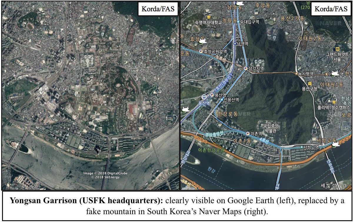
It may seem like I'm picking on Israel, but that is 100% not my intention. Israel is a great example of over-secrecy gone wrong, but many other countries are guilty of this as well. As @ArmsControlWonk has pointed out many times, South Korea uses digital trees to hide its sites.
In a story that absolutely hasn't gotten enough attention, the Belgian MoD is actually *suing* Google for not blurring its own military facilities.
reuters.com/article/belgiu…
reuters.com/article/belgiu…
The main takeaway is this: now that anyone can freely access satellite imagery, it simply makes no sense for states to persist with unnecessary censorship––especially since these methods can often backfire and draw attention to the exact sites that they're supposed to be hiding.