,
16 tweets,
7 min read
Read on Twitter
THREAD. Here’s a fun game for a rainy day based on the proposition: where 1 line in the landscape is crossed by another, then the one being crossed is the older of the 2. Eg the M11 in Cambs. built 1975-80 cuts rectangular fields of Parliamentary enclosure c1803 into triangles+ 

2. Train journeys are always interesting - so many fields cut into triangles can be seen along the way, like these on either side of the R Ouse near Huntingdon transected by the main line from London to York which opened in 1840+

3. Oops, domestic interruption - back in a while. Excited about it, though
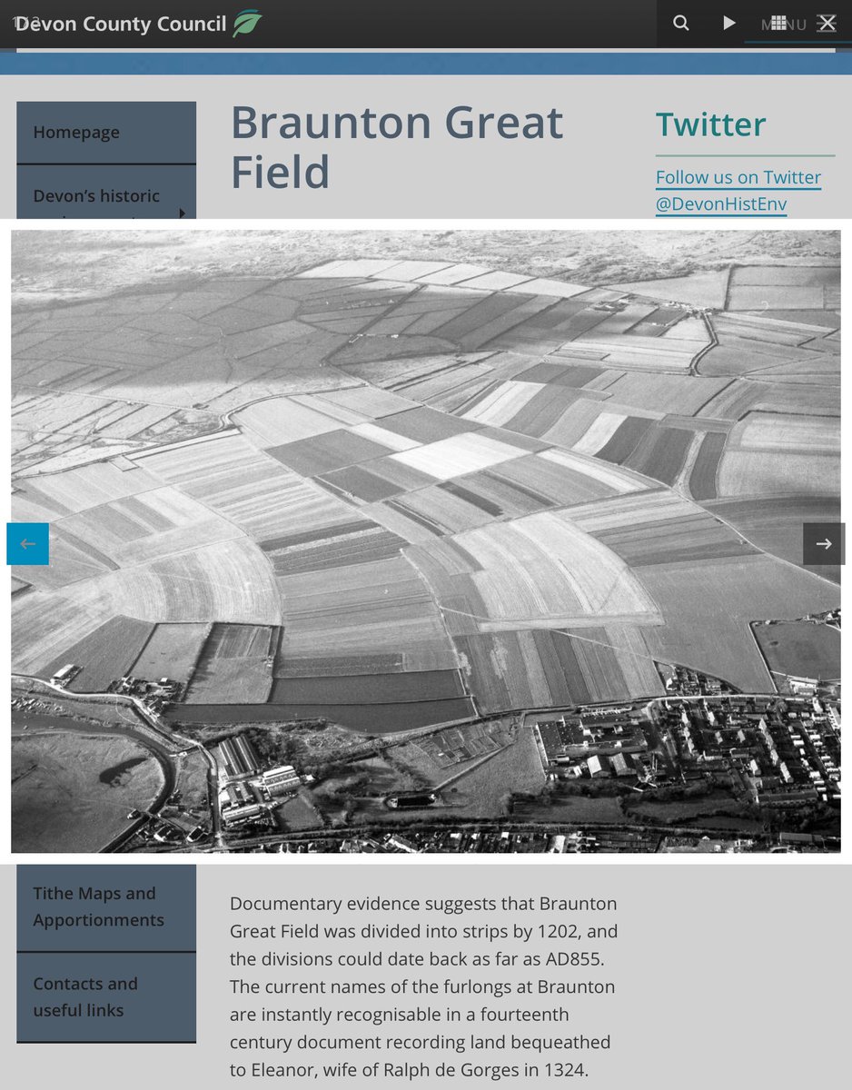
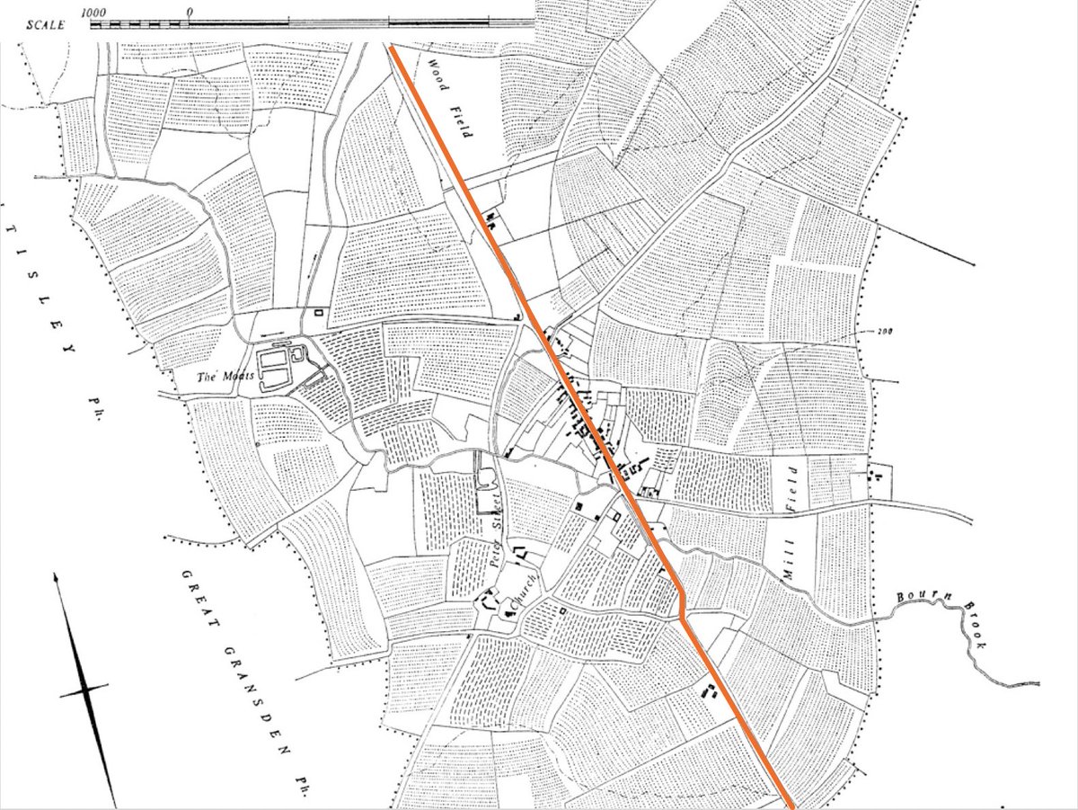
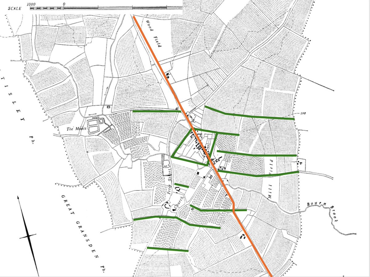
4. Back again! So, here is an air photo, looking roughly N, of Ermine Street, the first major Roman road built in Britain, in the middle of the 1stC AD, crossing the image from bottom R towards top L as it passes through the later village of Caxton, Cambs.

5. Taking the Roman road as the longer side of a triangle, the other 2 sides are formed by a lane leading from the R rd towards the bottom L of the photo, and the hedge that forms the back boundary of properties lining the LH side of the R rd. Is this significant?

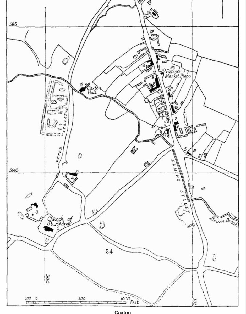
6. Here’s a modern map of Caxton showing the Roman rd (orange), the village, fields & lanes, and the surviving ridges of medieval cultivation (from british-history.ac.uk/rchme/cambs/vo…). The rd certainly seems to divide the settlement into two triangles.
7. The RCHM (link on previous tweet) suggested that the two triangles now occupied by the village were, in the medieval period, part of the open fields. That’s why the property boundaries within them are curved : when 13thC villagers moved to the new site ..


8. .. they used the furrows of the open field strips to define the boundaries of their new properties. If you visit Caxton, you’ll see that same of the walls of the buildings follow the same curves. At any rate, before the 13thC these were fields. But
9. .. is the rectangle field transected by the Roman road a sign that the road is later than the field or just one of those things? If that field is the only field on that alignment then it would b3 difficult (I think) to read much into it. But

10. If the boundaries of the field are part of a larger landscape in which roughly west-east AND roughly north-south boundaries are generally parallel to each other, then the proposition is more likely that the #Roman road is later than the underlying layout of the fields.
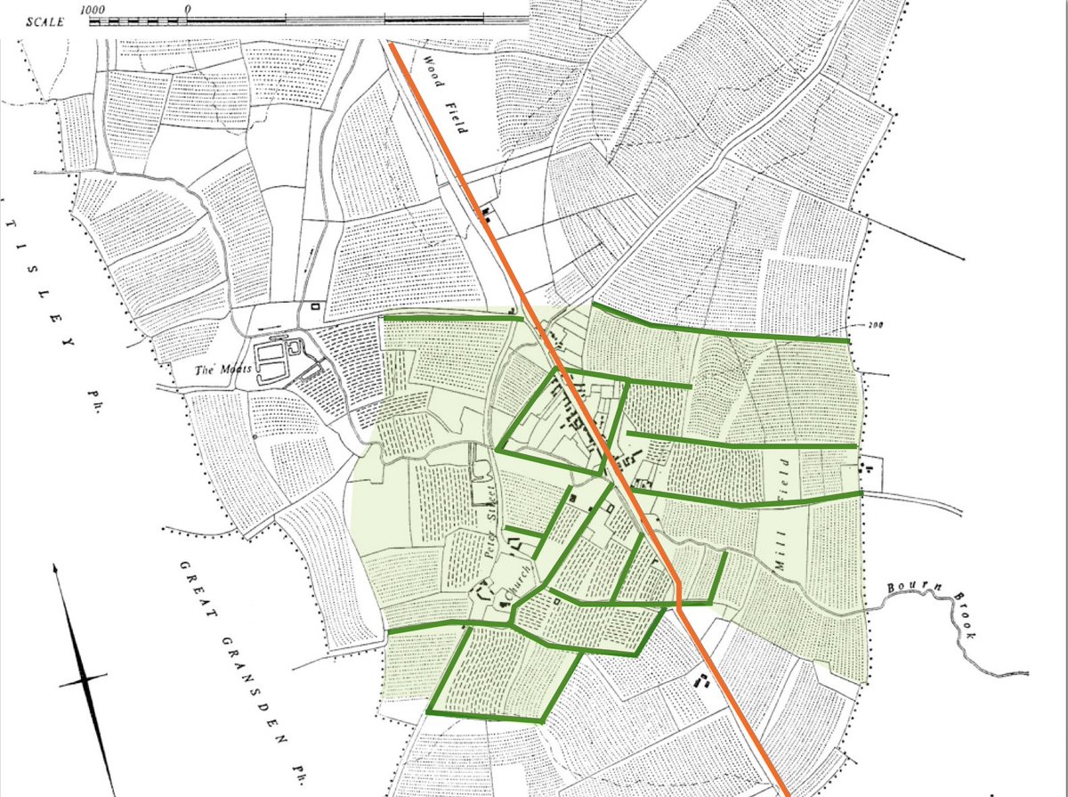
11. (Oops - interrupted again). The possibility that the field pattern around the village (coloured green) predates the Roman occupation of a Britain gets some support from the orientation of the medieval open field strips on the slopes beyond the village - they lie ...

12. (Another, hopefully the last, interruption) ... parallel to th e Roman road, so it’s feasible that their alignment may have been influenced by the road. In their case, that is, the road was their first. So far, the evidence suggests a 3-phase overall development:

13. .. prehistoric land divisions (green), the Roman road (orange), the medieval extension of arable beyond the prehistoric fields (the blue arrows); all suggesting the possibility that the green-shaded area has been continuously exploited since the Irin Age at least.

14. That possibility is supported by the odd angles between the ridge and furrow inside the green-shaded area and that beyond, eg on either side of the green line in the red circle. They’re on quite different alignments, suggesting quite different periods of origin.

15. I can’t promise you that this conclusion is ‘true’. Few of us can be certain about what happened in the past. All I can say is that it’s the best-fit explanation for the currently-available evidence. END
PS Forgot to say that the evidence & argument are laid out in more detail in archaeologydataservice.ac.uk/archiveDS/arch….